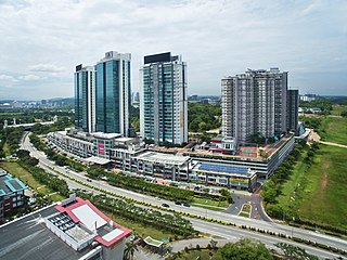
Cyberjaya is a city with a science park as its core that forms a key part of the Kuala Lumpur in Malaysia. It is located in Sepang District, Selangor. Cyberjaya is adjacent to and developed along with Putrajaya, Malaysia's government seat. This city aspires to be known as the Silicon Valley of Malaysia.

The Penang Bridge is a 13.5-kilometre (8.4-mile) dual carriageway toll bridge and controlled-access highway in the state of Penang, Malaysia. The bridge connects Perai on the mainland side of the state with Gelugor on the island, crossing the Penang Strait. The bridge was the first and, until 2014, the only road connection between the peninsula and the island. The bridge is the second-longest bridge over water in Malaysia, with a length over water of 8.4 kilometres.

Hulu Perak District is a district in Perak, Malaysia. It is the largest district in Perak. In the east of the district it borders the districts of Jeli and Gua Musang in Kelantan, to the west it borders Baling and Kulim Districts of Kedah, to the south it borders the district of Kuala Kangsar while to the south-west it borders the district of Larut, Matang and Selama. Hulu Perak also shares a border with Yala province's Betong district on the border with Thailand. The seat of the district is Gerik, which is also the largest town of the district.

Pulau Ketam is an island located off the coast of Port Klang, Selangor, Malaysia. The island is in the intertidal zone and the chief vegetation is mangrove.
East–West Highway or also known as Gerik–Jeli Highway, Kulim–Baling Highway and Titi Karangan–Gerik Highway, Federal Route 4, Asian Highway Route 140 is the 215 kilometres (134 mi) federal highway constructed by the Malaysian Public Works Department (JKR) to shorten the journey from Kota Bharu, Kelantan to northwestern towns and cities of Malaysia such as Alor Star, Kedah and Penang. The highway connects Gerik, Perak in the west to Jeli, Kelantan in the east, before being extended further to Lunas, Kedah.
Federal Route 4 is a federal road in the north of Peninsula Malaysia. The 307 kilometres (191 mi) road connects Butterworth, Penang to Pasir Puteh in Kelantan. The highway also goes close to the border with Thailand and meets Jalan Kompleks CIQ Bukit Bunga at Bukit Bunga.

Gerik is a mukim and the district capital of Hulu Perak District, Perak, Malaysia. The town is also known as Rest Town due to its strategic location next to East-West Highway Federal Route 4, the main route linking Kedah, Penang and Kelantan.

Westports Malaysia Sdn Bhd is a multi-cargo terminal located on Pulau Indah, Port Klang, Malaysia which is accessible by road via Pulau Indah Expressway, connecting to the KESAS Highway. On 1 October 2013, Pulau Indah was directly connected to the Malaysian Administrative Capital, Putrajaya via the South Klang Valley Expressway.
The Temenggor Dam or Temenggor Hydro-Electric Project or Temenggor Power Station is a dam in Gerik, Perak, Malaysia. It is located on Perak River about 200 km northeast of Ipoh. Construction of the dam impounded Temenggor Lake.

Pulau Indah is an island in Klang District, Selangor, Malaysia with a population of around 20,000 people overall. Malaysia's largest port, West Port, Port Klang, is on the island.

Kuang is a town in Gombak District, Selangor, Malaysia. Its main importance in older times was the starting of the railway branch to Batu Arang from the mainline of Malayan Railways. Today, Kuang's main industry is cement distribution for the CIMA Company. There is a successful HS Nada cow farm at Kampung Gombak.

Belum-Temengor is the largest continuous forest complex in Peninsular Malaysia. Specifically, it is located in the Malaysian state of Perak and crosses into Southern Thailand. Belum-Temenggor is divided into two sections. Belum is located up north, right by the Malaysia-Thailand border, while Temenggor is south of Belum. The Royal Belum State Park is entirely contained within the forest complex. Bang Lang National Park is on the Thailand side of the border.

Temenggor Lake is a lake in Hulu Perak District, Perak, Malaysia. It is the second largest lake in Peninsular Malaysia after Kenyir Lake in Hulu Terengganu District, Terengganu. This man-made lake is located south of the 1,533 m high Ulu Titi Basah peak. The lake was created by the construction of Temenggor Dam to generate electric power. The lake is located about 45 km from the Hulu Perak district capital, Gerik. There is a bridge on the East-West Highway, which crosses the lake and passing through a man-made island called Banding Island.
Temenggor Lake Bridge is the longest highway bridge on the East-West Highway,. Opened on 1 July 1982, the bridge crosses Temenggor Lake, which was created after the construction of Temenggor hydroelectric dam in Perak, Malaysia. There are two sections of the bridge, in west side and east side.

Eye on Malaysia was a transportable Ferris wheel installation in Malaysia. It began operating in Kuala Lumpur in 2007, and was then moved to Malacca in 2008, where it operated until 2010.
The Seremban railway station is a Malaysian railway station located in the heart of Seremban, the capital of the state of Negeri Sembilan. The station is named after the city.
Pulau Meranti is a village in Sepang District, Selangor, Malaysia.

Management & Science University is a private university in Malaysia located in Shah Alam, Selangor. The university was founded in 2001 as University College of Technology & Management Malaysia before officially becoming a full fledge university in October 2007 as Management & Science University.

The 16 Sierra MRT station is a mass rapid transit (MRT) station that serves the suburbs of 16 Sierra and Pulau Meranti in Puchong, Selangor, Malaysia. It is one of the stations built as part of the Klang Valley Mass Rapid Transit (KVMRT) project on the Sungai Buloh-Serdang-Putrajaya Line PYL . It is probably the only station to have a name that starts with numbers.
Konet Island is an islet located 100 metres off the shores of Telok Gong in Kuala Sungai Baru, Malacca, Malaysia. It is rich with corals and colourful ornamental fishes, connected to the mainland by a tombolo and is accessible by foot at low tide. Similar to Besar Island and according to local legends, the island is also believed to be the home of the elves known as Orang bunian. Another islet with similar feature, Keramat Island, is located 50 metres west of this islet.
