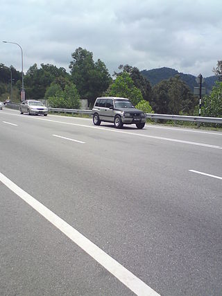
Malaysian State Roads System are the secondary roads in Malaysia with a total length of 247,027.61 km. The construction and maintenance works of state roads in Malaysia is managed by Malaysian Public Works Department (JKR) of each state and funded by state governments. The standard of the state roads is similar with the federal roads except for the coding system, where the codes for state roads begin with state codes followed by route number, for example Johor State Route J32 is labeled as J32. If a state road crosses the state border, the state code will change, for example route B20 in Salak Tinggi, Selangor will change to N20 after crossing the border of Negeri Sembilan to Nilai.
The Federal Route 1 is the first federal road in Malaysia, the oldest federal road in Malaysia, and among the nation's earliest public roadways ever constructed. The Federal Route 1 was the backbone of the road system in the western states of Peninsular Malaysia before being supplanted by the North–South Expressway.
The Federal Route 2 is a major east–west oriented federal highway in Malaysia. The 276.9 kilometres (172 mi) road connects Port Klang in Selangor to Kuantan Port in Pahang. The Federal Route 2 became the backbone of the road system linking the east and west coasts of Peninsula Malaysia before being surpassed by the East Coast Expressway E8.
Federal Route 5 is one of the three north–south oriented backbone federal road running along the west coast of Peninsular Malaysia, Malaysia. The 655.85 kilometres (408 mi) federal highway runs from Jelapang, Perak in the north to Skudai, Johor in the south.
Federal Route 4 is a federal road in the north of Peninsula Malaysia. The 307 kilometres (191 mi) road connects Butterworth, Penang to Pasir Puteh in Kelantan. The highway also goes close to the border with Thailand and meets Jalan Kompleks CIQ Bukit Bunga at Bukit Bunga.

Jalan Seremban-Kuala Pilah or Federal Route 51 is the main federal road in Negeri Sembilan, Malaysia, connecting Seremban to Kuala Pilah. It is a relatively busy road in Negeri Sembilan.
Federal Route 6 is a federal road around Penang Island, Malaysia.
Federal Route 150, or Jalan Paaboi, is a federal road in Penang, Malaysia.
Jalan Permatang Pauh, Federal Route 3111, is an industrial federal road in Penang, Malaysia. It is also a main route to North–South Expressway Northern Route via Permatang Pauh Interchange.
Federal Route 220, consisting of Jalan Paya Terubong and Jalan Dato Ismail Hashim, is a federal road in Penang, Malaysia.
Federal Route 221, consisting of Jalan Thean Teik(Thean Teik Road) and Lebuhraya Thean Teik(Thean Teik Avenue) (formerly Penang State Route P212), is a federal road in Penang, Malaysia.
Lebuhraya Kampung Jawa, or Kampong Java Avenue, Federal Route 3114, is an industrial federal road in Penang, Malaysia.

Tun Dr Lim Chong Eu Expressway or Federal Route 3113, is an expressway in Penang, Malaysia, that connects the city of George Town to Batu Maung. This 17.84 km (11.09 mi) expressway stretches along the eastern coast of Penang Island. It was erected on 7 December 2010 in honour of the former Penang's second chief minister and also the 'Architect of Modern Penang', Tun Dr Lim Chong Eu who died on 24 November that year. There are two sections of the expressway, the Jelutong Expressway and Bayan Lepas Expressway.

The Malaysian Expressway System is a network of national controlled-access expressways in Malaysia that forms the primary backbone network of Malaysian national highways. The network begins with the Tanjung Malim–Slim River tolled road which was opened to traffic on 16 March 1966, later North–South Expressway (NSE), and is being substantially developed. Malaysian expressways are built by private companies under the supervision of the government highway authority, Malaysian Highway Authority.
Federal Route 149, or Jalan Bukit Tambun, is a federal road in Penang, Malaysia.
Federal Route 254 is a federal road in Penang and Kedah state, Malaysia. The Kilometre Zero is at Kulim, Kedah.
The Ipoh North–Ipoh South Local Express Lane, or Jalan Jelapang–Ampang, Federal Route 239 (northbound) and 240 (southbounds), are toll-free local-express lanes in the North–South Expressway Northern Route E1 in Ipoh, Perak, Malaysia.
Jalan Transkrian, Federal Route 283, is a dual-carriageway federal road in Penang and Perak state, Malaysia, connecting Nibong Tebal in Penang to Parit Buntar in Perak. It is also a main route to Universiti Sains Malaysia (USM) Engineering Campus in Transkrian. The Kilometre Zero is located at Nibong Tebal, Penang.
Federal Route 282 is a dual-carriageway federal road in Penang state, Malaysia. Connecting Transkrian in the southwest to Bukit Panchor in the northeast. It is also a main route to Universiti Sains Malaysia (USM) Engineering Campus in Transkrian. The Kilometre Zero is located at Transkrian.

Komtar is a state constituency in Penang, Malaysia, that has been represented in the Penang State Legislative Assembly since 2004. It covers George Town's city centre, including the eponymous Komtar, which houses Penang's administrative centre.


