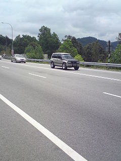
Federal Highway is a Malaysian controlled-access highway connecting the capital city of Kuala Lumpur, and Klang, Selangor. The highway starts from Seputeh in Kuala Lumpur to Klang, Selangor. It is the busiest highway in Klang Valley during rush hour from/to Kuala Lumpur. The Federal Highway is coded as Federal Route 2.

Malaysian Federal Roads System, is the main national road network in Malaysia. All Federal Roads in Malaysia are under the purview of the Ministry of Works (MOW). According to the Ministerial Functions Act 1969, the MOW is responsible to plan, build and maintain all Federal Roads gazetted under the Federal Roads Act 1959. However, most of the Federal roads' projects were built and maintained by the Malaysian Public Works Department (JKR), which is also one of the implementing agencies under the MOW.

Malaysian State Roads System are the secondary roads in Malaysia with a total length of 227,647 km. The construction of state roads in Malaysia is funded by Malaysian Public Works Department (JKR) of each state. The standard of the state roads is similar with the federal roads except for the coding system, where the codes for state roads begin with state codes followed by route number, for example Johor State Route J32 is labeled as J32. If a state road crosses the state border, the state code will change, for example route B20 in Salak Tinggi, Selangor will change to N20 after crossing the border of Negeri Sembilan to Nilai.
The Federal Route 2 is a major east–west oriented federal highway in Malaysia. The 276.9 kilometres (172 mi) road connects Port Klang in Selangor to Kuantan Port in Pahang. The Federal Route 2 became the backbone of the road system linking the east and west coasts of Peninsula Malaysia before being surpassed by the East Coast Expressway E8.
Federal Route 5 is one of the three north–south oriented backbone federal road running along the west coast of Peninsular Malaysia, Malaysia. The 655.85 kilometres (408 mi) federal highway runs from Jelapang, Perak in the north to Skudai, Johor in the south.
Jalan Seremban-Kuala Pilah or Federal Route 51 is the main federal road in Negeri Sembilan, Malaysia, connecting Seremban to Kuala Pilah.
Jalan Ampang or Ampang Road is a major road in Klang Valley region, Selangor and Federal Territory of Kuala Lumpur, Malaysia. Built in the 1880s, it is one of the oldest roads in the Klang Valley. It is a main road to Ampang Jaya and is easily accessible from Jalan Tun Razak or Jalan Ulu Klang from the Hulu Kelang or Setapak direction. It is also accessible from Cheras through Jalan Shamelin, from Jalan Tun Razak through Jalan Kampung Pandan via Taman Cempaka, from Kampung Pandan through Jalan Kampung Pandan Dalam via Taman Nirwana, from the Kuala Lumpur Middle Ring Road 2 via Pandan Indah & Taman Kencana and from Hulu Langat town through the mountain pass. Wangsa Maju, Setapak, central Kuala Lumpur, Ampang Park and Salak South surround Ampang. Jalan Ampang became the backbone of the road system linking Ampang to Kuala Lumpur before being surpassed by the Ampang–Kuala Lumpur Elevated Highway (AKLEH) , in 2001.
Jalan Sabak Bernam–Hulu Selangor or Jalan Sungai Panjang on Sabak Bernam side is a major road in Selangor, Malaysia. It is the longest state road in Selangor with a total distance of 77.6 km (48.2 mi) The roads connects Sungai Besar at Sabak Bernam in the west to Ulu Bernam at Hulu Selangor in the east.
Jalan Seri Kembangan, or Jalan Putra Permai and Jalan Besar, Federal Route 3215, is a major highway in Klang Valley region, Selangor, Malaysia. This 9.4 km toll-free highway connects Serdang interchange of the Damansara–Puchong Expressway in the southwest to Seri Kembangan interchange of the Besraya Expressway in the northeast. Jalan Seri Kembangan connects with three major tolled expressways: Damansara–Puchong Expressway, Maju Expressway and Besraya Expressway.
Jalan Kim Chuan, or Jalan Batu Unjur, Federal Route 3218, is an industrial federal road in the Klang Valley region of Selangor, Malaysia.
Selayang is a town in Gombak District, Selangor, Malaysia. A new township, Bandar Baru Selayang is sited just 2 km away and was named after the town, where Majlis Perbandaran Selayang is located.
Jalan Batu Tiga Lama, which consists of Jalan Sungai Rasau and Persiaran Selangor, also called Federal Route 3216, is an industrial federal road in Klang Valley regions, Selangor, Malaysia. It is a toll free road.
Jalan Balakong, Federal Route 3211, is an industrial federal road in Selangor, Malaysia.
Jalan Perindustrian Kapar–Meru, Federal Route 3217, is an industrial federal road in Selangor, Malaysia.

The Sungai Besi–Ulu Klang Elevated Expressway (SUKE) is a 31.8-kilometre (19.8-mile) three-laned, dual carriageway, controlled-access highway that is being constructed in Kuala Lumpur and Selangor, Malaysia. The expressway will run on top of the existing Kuala Lumpur Middle Ring Road 2 between Sungai Besi and Ulu Klang, with the intent of reducing traffic along the road.
Labohan Dagang–Nilai Route, also known as Nilai–KLIA Highway, Federal Route 32, is a major highway in the Multimedia Super Corridor area in Selangor and Negeri Sembilan states, Malaysia. The 26.0 km (16.2 mi) federal highway connects Tanjung Dua Belas, Selangor in the west to Nilai, Negeri Sembilan in the east.
Persiaran Mokhtar Dahari, or Shah Alam–Batu Arang Highway or Puncak Alam Highway and Jalan Batu Arang, is a major highway in Selangor, Malaysia.
Kuala Kubu Baharu is a state constituency in Selangor, Malaysia, that has been represented in the Selangor State Legislative Assembly since 1974.
The following is an alphabetical list of articles related to Selangor.
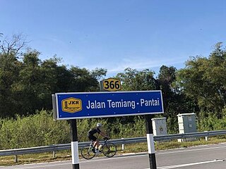
Temiang–Pantai Highway or Malaysia Federal Route 366 is a federal route in Seremban, Negeri Sembilan, Malaysia. It is built to shorten amount of time for users from Kajang–Seremban Highway to Malaysia Federal Route 86 which connects Seremban to Kuala Klawang and Simpang Pertang.