Roxas Boulevard

Last updated

AH26 (N120) sign.svg N61 (Philippines).svg
R-1
Roxas Boulevard sign.svg
Roxas Boulevard
Roxas Boulevard route map.svg
The route of Roxas Boulevard within Metro Manila. Roxas Boulevard is highlighted in red.
Roxas Boulevard, Pedro Gil (Manila; 02-06-2021).jpg
The boulevard in 2021
Route information
Maintained by the Department of Public Works and Highways [1] [2]
Length7.6 km (4.7 mi)
Existed1910s–present
Component
highways
Major junctions
North endAH26 (N120) sign.svgN150 (Philippines).svg AH 26 (N120) (Bonifacio Drive) / N150 (Padre Burgos Avenue) / Katigbak Parkway in Ermita, Manila [3] [4]
Major intersections
South endE3 (Philippines).svgN63 (Philippines).svg E3 (Manila–Cavite Expressway) / N63 (MIA Road) / Seaside Drive in Parañaque
Location
Country Philippines
Major cities Manila, Pasay, and Parañaque
Highway system
  • Roads in the Philippines

Roxas Boulevard is a popular waterfront promenade in Metro Manila in the Philippines. The boulevard, which runs along the shores of Manila Bay, is well known for its sunsets and stretch of coconut trees. The divided roadway has become a trademark of Philippine tourism, famed for its yacht club, hotels, restaurants, commercial buildings and parks.

Contents

The boulevard was completed in the 1910s. Originally called Cavite Boulevard, [5] [6] it was renamed Dewey Boulevard in honor of the American admiral George Dewey, whose forces defeated the Spanish navy in the Battle of Manila Bay in 1898, Heiwa Boulevard in late 1941 during the Japanese occupation, [7] and finally Roxas Boulevard in the 1960s in honor of Manuel Roxas, the fifth president of the Philippines. It was also designated as a new alignment of the Manila South Road that connects Manila to the southern provinces of Luzon. [8]

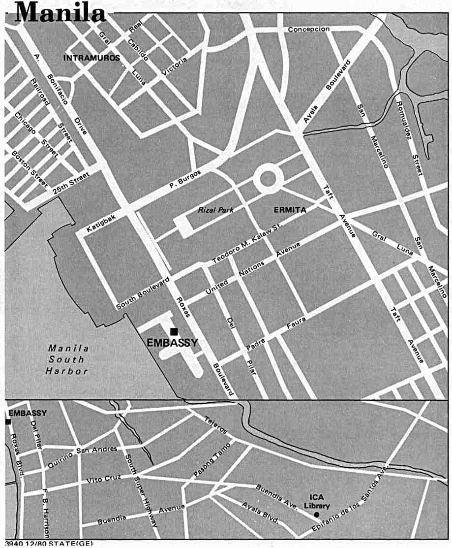
The boulevard is also an eight-lane major arterial road in Metro Manila designated as Radial Road 1 (R-1) of Manila's arterial road network, National Route 61 (N61), the shortest primary route in the Philippines, National Route 120 (N120) of the Philippine highway network and a spur of Asian Highway 26 (AH26). The arcing road runs in a north–south direction from Luneta in Manila and ends in Parañaque at the intersection of MIA Road and Seaside Drive, beneath the elevated NAIA Expressway. [9] Beyond its southern terminus, starts the Manila–Cavite Expressway (E3), also known as the Coastal Road, or more recently, CAVITEX.

History

Daniel Burnham's plan of the sea boulevard from Manila to Cavite Cavite Boulevard sketch by Burnham.jpg
Daniel Burnham's plan of the sea boulevard from Manila to Cavite

City Beautiful movement

The Cavite Boulevard was part of Architect Daniel Burnham's plan for beautifying the city of Manila. [10] At the request of Commissioner William Cameron Forbes, Burnham visited the country in 1905 at the height of the City Beautiful movement, a trend in the early 1900s in America for making cities beautiful along scientific lines, for the future urban development of Manila and Baguio. [11]

Original concept

Construction of Cavite Boulevard, 1912 Construction of Cavite Boulevard, 1912.jpg
Construction of Cavite Boulevard, 1912
Aerial view of Dewey Boulevard, 1931 Philippine Island - Manila - NARA - 68156719.jpg
Aerial view of Dewey Boulevard, 1931

According to Burnham's original concept of the Cavite Boulevard, the bayfront from the Luneta southward should be a continuous parkway, extending in the course of time all the way to the Cavite Navy Yard about 20 miles (32 km) away. This boulevard, about 250 ft (76 m) in width, with roadways, tramways, bridle path, rich plantations, and broad sidewalks, should be available for all classes of people in all sorts of conveyances, and so well shaded with coconut palms, bamboo, and mangoes as to furnish protection from the elements at all times.

"In order to make the boulevard presentable and useful as soon as possible, a quick-growing tree like the acacia might be planted, alternating with the trees of slower growth, and be replaced after the latter attain their growth. The boulevard's seaward side should be planted so as to interrupt occasionally the view of the sea and, by thus adding somewhat of mystery, enhance the value of the stretch of ocean and sky. The boulevard would be on reclaimed land to about as far south as the old Fort San Antonio Abad in Malate, beyond which it strikes the beach and follows the shoreline to Cavite. The possible extension of the ocean boulevard along the north shore would naturally depend upon the development of the town in that direction and upon the question of additional harbor works north of the Pasig River." [11]

During the 1945 Battle of Manila, however, the Japanese forces cut down palm trees along the boulevard to convert it to an improvised runway.

Route description

Roxas Boulevard starts at Rizal Park in Manila as a physical continuation of Bonifacio Drive. The road passes through many tall buildings, restaurants, banks, monuments, and other establishments as it curves along Manila Bay. The United States Embassy is located in the vicinity of Rizal Park; a kilometer south, the headquarters of Bangko Sentral ng Pilipinas (BSP) and Philippine Navy are located within the Malate district of Manila. After the BSP building, the boulevard enters Pasay, passing through the Cultural Center of the Philippines (CCP Complex) and Star City. It then intersects with Gil Puyat Avenue and Jose W. Diokno Boulevard, where it ascends through the Gil Puyat Flyover. It then parallels Macapagal Boulevard. It ascends again to intersect Epifanio delos Santos Avenue (EDSA) through the flyover of the same name; there, the route number transitions from N120/AH26, a secondary road, to N61, a primary road. A few meters after passing EDSA, it enters Parañaque, continues into a straight route until it ends on an intersection with MIA Road and Seaside Drive, where the road continues south as Manila–Cavite Expressway (CAVITEX/E3), which is also known as Coastal Road.

Landmarks

The historic Rizal Park marks the northern end of the boulevard RizalParkjf8445 06.JPG
The historic Rizal Park marks the northern end of the boulevard
The Malate section of Roxas Boulevard is famous for Baywalk and Plaza Rajah Sulayman Roxas Boulevard (Manila; 01-30-2021).jpg
The Malate section of Roxas Boulevard is famous for Baywalk and Plaza Rajah Sulayman
Manila's Baywalk along Roxas Boulevard WTMP Team Waka Waka A-29.JPG
Manila's Baywalk along Roxas Boulevard

Churches

Urban parks

Entertainment parks


Plazas

CCP Complex

Government buildings

Foreign embassies

Museums

Hospitals

Hotels

Yacht club

Educational Institutions

Intersections

Roxas Boulevard facing south, showing the Manila Yacht Club and the Cultural Center of the Philippines Complex. Roxas Boulevard Aerial.jpg
Roxas Boulevard facing south, showing the Manila Yacht Club and the Cultural Center of the Philippines Complex.
Roxas Boulevard facing north from Baclaran area, Pasay. Pasay-roxas-baclaran-2012-01.JPG
Roxas Boulevard facing north from Baclaran area, Pasay.

Intersections are numbered by kilometer post, with Rizal Park in Manila designated as kilometer 0. The kilometer count is discontinuous. 

ProvinceCity/Municipalitykm [1] [2] miDestinationsNotes
Parañaque 7.4444.625N194 (Philippines).svgAirport Sign.svg N194 (NAIA Road) / Seaside Drive Airport Southern terminus; continues south as E3 (Philippines).svg E3 (CAVITEx)
6.5464.067Asean Avenue (Aseana Avenue)Southbound access only; northbound access via U-turn slot under EDSA Flyover
6.3483.944N192 (Philippines).svg N192 (Airport Road)No left turn allowed from southbound
6.0993.790Bradco AvenueSouthbound access only; northbound access via U-turn slot under EDSA Flyover
5.8113.611Redemptorist RoadNorthbound access only
Pasay South end of EDSA Flyover
5.2563.266AH26 (N1) sign.svg AH 26 (N1) (EDSA)End of AH26 overlap; route number change from N61 to N120
North end of EDSA Flyover
4.1912.604 Arnaiz Avenue Northbound access only; southbound access via U-turn slot under Buendia/Gil Puyat Flyover
South end of Gil Puyat Flyover
4.4692.777N190 (Philippines).svg N190 (Gil Puyat Avenue)
North end of Gil Puyat Flyover
Manila 2.5811.604 Pablo Ocampo Street / Pedro Bukaneg StreetNo left turn allowed from northbound and southbound
2.1211.318N140 (Philippines).svg N140 (Quirino Avenue)
2.3491.460 San Andres Street Northbound access only
Remedios StreetNorthbound access only
1.0620.660 Pedro Gil Street
Padre Faura Street Northbound access only
N156 (Philippines).svg N156 (United Nations Avenue)
N155 (Philippines).svg N155 (Kalaw Avenue) / South Drive
0.0000.000 Kilometer zero (Kilometer count reverses)
0.2050.127N150 (Philippines).svg N150 (Padre Burgos Avenue) / Katigbak ParkwayNorthern terminus; continues north as AH26 (N120) sign.svg AH 26 (N120) (Bonifacio Drive)
1.000 mi = 1.609 km; 1.000 km = 0.621 mi

See also

Related Research Articles

<span class="mw-page-title-main">Ermita</span> District of Manila, Metro Manila, Philippines

Ermita is a district in Manila, Philippines. Located at the central part of the city, the district is a significant center of finance, education, culture, and commerce. Ermita serves as the civic center of the city, bearing the seat of city government and a large portion of the area's employment, business, and entertainment activities.

<span class="mw-page-title-main">Macapagal Boulevard</span>

Macapagal Boulevard, also known as President Diosdado Macapagal Boulevard and Macapagal Avenue, is an eight-lane road in Metro Manila, Philippines, running parallel to Roxas Boulevard from the Cultural Center of the Philippines Complex in Pasay to Asia World City in Parañaque. It was named after former Philippine President Diosdado Macapagal. This road has three major bridges, crossing the 'channels', of which the largest is the Libertad Channel, where the Libertad Water Pumping Station is situated. Thanks to intersection reconfiguring around EDSA to relieve traffic, Macapagal Boulevard is now often used to access the SM Mall of Asia to the north and Cavite to the south. It is also the main major road in Metro Manila's reclamation area called Bay City.

<span class="mw-page-title-main">Malate, Manila</span> District of Manila, Metro Manila, Philippines

Malate is a district of Manila, Philippines. Together with the district of Ermita, it serves as Manila's center for commerce and tourism.

<span class="mw-page-title-main">Manila–Cavite Expressway</span> Expressway in the Philippines

The Manila–Cavite Expressway, signed as E3 of the Philippine expressway network and R-1 of Metro Manila's arterial road network, is a 14-kilometer-long (8.7 mi) controlled-access highway linking Manila to the southern province of Cavite in the Philippines. At its north end, it feeds into and from Roxas Boulevard in the city of Parañaque in Metro Manila, also part of R-1. At the south end, it splits into two termini, both along the north coast in Kawit, Cavite. The first feeds into the intersection of Tirona Highway and Antero Soriano Highway. The second southern terminus is on the intersection of Tirona Highway, Antero Soriano Highway and Covelandia Road in Kawit, Cavite.

<span class="mw-page-title-main">Pan-Philippine Highway</span> Highway in the Philippines traversing most of the country

The Pan-Philippine Highway, also known as the Maharlika Highway, is a network of roads, expressways, bridges, and ferry services that connect the islands of Luzon, Samar, Leyte, and Mindanao in the Philippines, serving as the country's principal transport backbone. Measuring 3,379.73 kilometers (2,100.07 mi) long excluding sea routes not counted by highway milestones, it is the longest road in the Philippines that forms the country's north–south backbone component of National Route 1 (N1) of the Philippine highway network. The entire highway is designated as Asian Highway 26 (AH26) of the Asian Highway Network.

<span class="mw-page-title-main">Radial Road 1</span> Route in Metro Manila

Radial Road 1 (R-1), informally known as the R-1 Road, is a network of roads and bridges that all together form the first arterial road of Metro Manila in the Philippines. Spanning some 42.67 kilometers (26.51 mi), it connects the cities and municipalities of Bacoor, General Trias, Imus, Kawit, Las Piñas, Manila, Naic, Noveleta, Parañaque, Pasay, and Tanza in Cavite and Metro Manila.

<span class="mw-page-title-main">Taft Avenue</span> Major street in Metro Manila, Philippines

Taft Avenue is a major road in the south of Metro Manila. It passes through three cities in the metropolis: Manila, Pasay, and Parañaque. The road was named after the former Governor-General of the Philippines and U.S. President, William Howard Taft; the Philippines was a former commonwealth territory of the United States in the first half of the 20th century. The avenue is a component of National Route 170 (N170), a secondary road in the Philippine highway network and the entirety R-2 of the Manila arterial road network.

<span class="mw-page-title-main">Quezon Boulevard</span>

Quezon Boulevard is a short stretch of highway in Manila, Philippines running north–south through the district of Quiapo. It is a six- to ten-lane 1.1-kilometer-long (0.68 mi) divided boulevard designated as a component of National Route 170 (N170) of the Philippine highway network, except for its service roads, and Radial Road 8 (R-8) of Manila's arterial road network which links the center of Manila to North Luzon Expressway in Quezon City in the north. The boulevard is the main access to the popular Quiapo Church and is one of the main thoroughfares of the University Belt area.

<span class="mw-page-title-main">Cavite–Laguna Expressway</span> Expressway in the Philippines

The Cavite–Laguna Expressway, signed as E3 of the Philippine expressway network, is a partially operational controlled-access toll expressway in the provinces of Cavite and Laguna, Philippines. The construction of the 44.63-kilometer-long (27.73 mi) expressway, which began in July 2019, costs an estimated ₱35.43 billion. Once completed, it will connect the Manila–Cavite Expressway in Kawit to the South Luzon Expressway in Biñan and is expected to ease the traffic congestion in the Cavite–Laguna area, particularly along the Aguinaldo Highway, Governor's Drive, and the Santa Rosa–Tagaytay Road.

<span class="mw-page-title-main">Gil Puyat Avenue</span> Road in the Philippines

Senator Gil J. Puyat Avenue, also known simply as Gil Puyat Avenue and by its former official name Buendia Avenue, is a major arterial thoroughfare which travels east–west through the cities of Makati and Pasay in western Metro Manila, Philippines. It is one of the busiest avenues in Metro Manila linking the Makati Central Business District with the rest of the metropolis.

<span class="mw-page-title-main">Pablo Ocampo Street</span> Street in Metro Manila, Philippines

Pablo Ocampo Street, also known simply as Ocampo Street and formerly and still referred to as Vito Cruz Street, is an inner city main road in Manila, Philippines. It runs west–east for about 3.448 kilometers (2.142 mi) connecting the southern districts of Malate and San Andres southeast to the adjacent city of Makati.

<span class="mw-page-title-main">Pedro Gil Street</span> Street in Manila, Philippines

Pedro Gil Street is an east-west inner city street and a tertiary national road in south-central Manila, Philippines. It is 3.65 kilometers (2.27 mi) long and spans the entire length of Ermita, Malate, Paco, and Santa Ana. The street is served by the Pedro Gil LRT Station along Taft Avenue and the Paco railway station along Quirino Avenue. It also continues towards the central Metro Manila cities of Mandaluyong and San Juan across the Pasig River as New Panaderos and General Kalentong Streets.

<span class="mw-page-title-main">Kalaw Avenue</span> Street in Manila, Philippines

Kalaw Avenue is a short stretch of road in the Ermita district of Manila, Philippines. It forms the southern boundary of Rizal Park running east–west from San Marcelino Street to Roxas Boulevard near the center of the city. It begins as a four-lane road at the intersection with San Marcelino widening to an eight-lane divided roadway along the stretch of Rizal Park from Taft Avenue west to Roxas Boulevard. It has a short extension into the reclaimed area of Luneta and Quirino Grandstand as South Drive. The avenue's main section between Taft Avenue and Roxas Boulevard is assigned as National Route 155 (N155) of the Philippine highway network.

<span class="mw-page-title-main">Quirino Avenue</span> Major street in Manila, Philippines

President Elpidio Quirino Avenue, more commonly known as Quirino Avenue, is a 6-10 lane divided highway in Manila, Philippines. It runs for 3.6 kilometers (2.2 mi) in a northeast–southwest direction from Nagtahan Bridge across from Santa Mesa in the north to Roxas Boulevard in Malate in the south. It passes through Paco and Pandacan districts where it also serves as a truck route between Port Area and South Luzon Expressway. North of Nagtahan Bridge, the road continues as Nagtahan Street. It is designated as part of Circumferential Road 2. It is named after Elpidio Quirino, the sixth President of the Philippines.

<span class="mw-page-title-main">Bonifacio Drive</span> Major road in Manila, Philippines

Bonifacio Drive is a road running for approximately 1 kilometer (0.62 mi) in a north-south direction between Intramuros and Port Area in Manila, Philippines. The boulevard is also designated as Radial Road 1 (R-1) of Manila's arterial road network, National Route 120 (N120) of the Philippine highway network and an auxiliary route of Asian Highway 26 (AH26).

<span class="mw-page-title-main">Del Pilar Street</span>

Marcelo H. del Pilar Street, also known as M.H. del Pilar Street or simply Del Pilar Street, is a north–south road running for 1.895 kilometers (1.177 mi) connecting Ermita and Malate districts in Manila, Philippines. It is a two-lane street which carries traffic one-way southbound from Kalaw Avenue in Rizal Park to Quirino Avenue just across from the Ospital ng Maynila. It was formerly called Calle Real.

<span class="mw-page-title-main">Index of Metro Manila–related articles</span>

The following is an alphabetical list of articles related to the Philippine capital region of Metro Manila.

National Route 62 (N62) forms part of the Philippine highway network. It runs south from Metro Manila to northeastern Cavite.

<span class="mw-page-title-main">Davao–Cotabato Road</span> Road in the Philippines

The Davao–Cotabato Road is a 205.7-kilometer (127.8 mi), two-to-six lane major national primary road, connecting the provinces of Davao del Sur, Maguindanao del Sur, Cotabato, and Maguindanao del Norte. It runs from Davao City to Sultan Kudarat, Maguindanao del Norte.

<span class="mw-page-title-main">Tambo, Parañaque</span> Barangay in Parañaque City, Metro Manila, Philippines

Tambo is an administrative division in southern Metro Manila, the Philippines. It is a coastal barangay in the city of Parañaque situated just south of Baclaran adjoining Ninoy Aquino International Airport complex to the east.

References

  1. 1 2 "South Manila". DPWH Road Atlas. Department of Public Works and Highways. Archived from the original on December 22, 2015. Retrieved December 12, 2015.
  2. 1 2 "Metro Manila 2nd". DPWH Road Atlas. Department of Public Works and Highways.
  3. "Manila map". University of Texas at Austin Library. Retrieved on June 5, 2011.
  4. "Rizal Park-Manila Map". Google Maps. Retrieved on June 5, 2011.
  5. "United States Congressional serial set, Issue 5280 - Act no. 1745, Section 2a", pg. 417. Government Printing Office, Washington.
  6. Map of city of Manila and vicinity (Map). 1:10560. Manila?: Office of Dept. Engineer, Phil. Dept. 1919. Retrieved October 10, 2021.
  7. Executive Order No. 41, s. 1942 (1942), Changing the name of Dewey Boulevard to Heiwa Boulevard; Taft Avenue to Daitoa Avenue; Harrison Boulevard to Koa Boulevard; Jones Bridge to Banzai Bridge; Harrison Park to Rizal Park; and Wallace Field and Burnham Green to Plaza Bagong Filipinas , retrieved April 26, 2021
  8. Executive Order No. 483 (November 6, 1951), Establishing the Classification of Roads , retrieved September 23, 2021
  9. "Intersection of Roxas Blvd. and NAIA Rd". Google Maps. Retrieved on June 5, 2011.
  10. (1910). "Report of the Philippine Commission to the Secretary of War", pg.68. Government Printing Office, Washington.
  11. 1 2 (1907-03). "Far Eastern Review - Details and Description of the Burnham Plans for the Reconstruction of Manila", pg.322. Google Books. Retrieved on April 13, 2012.

14°34′05″N120°59′00″E / 14.56806°N 120.98333°E / 14.56806; 120.98333