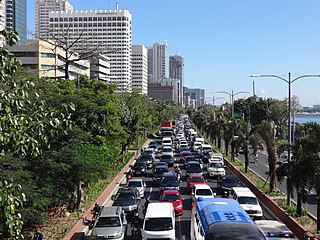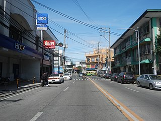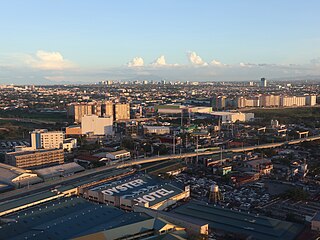
Parañaque, officially the City ofParañaque, is a highly urbanized city in the National Capital Region of the Philippines. According to the 2020 census, it has a population of 6 people.

Francis Burton Harrison was an American statesman who served in the United States House of Representatives and was appointed governor-general of the Philippines by President of the United States Woodrow Wilson. Harrison was a prominent adviser to the president of the Philippine Commonwealth, as well as the next four presidents of the Republic of the Philippines. He is the only former governor-general of the Philippines to be awarded Philippine citizenship.

Roxas Boulevard is a popular waterfront promenade in Metro Manila in the Philippines. The boulevard, which runs along the shores of Manila Bay, is well known for its sunsets and stretch of coconut trees. The divided roadway has become a trademark of Philippine tourism, famed for its yacht club, hotels, restaurants, commercial buildings and parks.

Radial Road 3 (R-3), informally known as the R-3 Road, is a network of roads and bridges which comprise the third arterial road of Metro Manila in the Philippines. It connects the cities of Manila, Makati, Pasay, Taguig, Parañaque, and Muntinlupa.

Taft Avenue is a major road in southern Metro Manila. It passes through three cities in the metropolis: Manila, Pasay, and Parañaque. The road was named after the former Governor-General of the Philippines and U.S. President William Howard Taft; the Philippines was a former commonwealth territory of the United States in the first half of the 20th century. The avenue is a component of National Route 170 (N170), a secondary road in the Philippine highway network and Radial Road 2 (R-2) of the Manila arterial road network.

Padre Burgos Avenue, also known as Padre Burgos Street, is a 14-lane thoroughfare in Manila, Philippines.

Senator Gil J. Puyat Avenue, also known simply as Gil Puyat Avenue and by its former official name Buendia Avenue, is a major arterial thoroughfare which runs east–west through Makati and Pasay in western Metro Manila, Philippines. It is one of the busiest avenues in Metro Manila, linking the Makati Central Business District with the rest of the metropolis.

Pablo Ocampo Street, also known simply as Ocampo Street and formerly and still referred to as Vito Cruz Street, is an inner-city main road in Manila, Philippines. It runs west–east for about 3.448 kilometers (2.142 mi), connecting the southern districts of Malate and San Andres southeast to the adjacent city of Makati.

Pedro Gil Street is an east-west inner city street and a tertiary national road in south-central Manila, Philippines. It is 3.65 kilometers (2.27 mi) long and spans the entire length of Ermita, Malate, Paco, and Santa Ana. The street is served by the Pedro Gil LRT Station along Taft Avenue and the Paco railway station along Quirino Avenue. It also continues towards the central Metro Manila cities of Mandaluyong and San Juan across the Pasig River as New Panaderos and General Kalentong Streets.

President Elpidio Quirino Avenue, more commonly known as Quirino Avenue, is a 6-10 lane divided highway in Manila, Philippines. It runs for 3.6 kilometers (2.2 mi) in a northeast–southwest direction from Nagtahan Bridge across Santa Mesa in the north to Roxas Boulevard in Malate in the south. It passes through the Paco and Pandacan districts and serves as a truck route between the Port Area and the South Luzon Expressway. North of Nagtahan Bridge, the road continues as Nagtahan Street. It is designated as part of Circumferential Road 2. It is named after Elpidio Quirino, the sixth President of the Philippines.

Antonio Arnáiz Avenue, also known simply as Avenida Arnáiz and by its former official name Pásay Road, is a major east–west collector road linking Makati and Pasay in the Philippines. It stretches across western Metro Manila from Roxas Boulevard in Pasay to Epifanio de los Santos Avenue (EDSA/C-4) in Makati.

Alabang–Zapote Road is a four-lane national road which travels east–west through the southern limits of Metro Manila, Philippines. It runs parallel to Dr. Santos Avenue in the north and is named after the two barangays it links: Alabang, Muntinlupa and Zapote in Bacoor and Las Piñas.

Ninoy Aquino Avenue is a north–south collector road that links Pasay and Parañaque in southern Metro Manila, Philippines. It serves as an extension to Dr. Santos Avenue and a feeder road to Ninoy Aquino International Airport (NAIA) from the south and the east. Like the airport it passes through, it is named after Senator Benigno "Ninoy" Aquino Jr., who was assassinated at the airport in 1983.

Tramo Street is a major local road in Pasay, Metro Manila, Philippines. It runs north-south from Ocampo Street, which is on the border with Malate, Manila, to Andrews Avenue in Maricaban. It is interrupted by Epifanio de los Santos Avenue (EDSA) and the MRT Line 3, which divides the road into two sections. The southern section from EDSA to Andrews Avenue has been renamed Aurora Boulevard.

Marcelo H. del Pilar Street, also known as M.H. del Pilar Street or simply Del Pilar Street, is a north–south road running for 1.895 kilometers (1.177 mi) connecting Ermita and Malate districts in Manila, Philippines. It is a two-lane street carrying one-way southbound traffic from Kalaw Avenue in Rizal Park to Quirino Avenue across from the Ospital ng Maynila. It was formerly called Calle Real.

Elpidio Quirino Avenue, also known simply as Quirino Avenue, is a major north-south collector road in Parañaque, southern Metro Manila, Philippines. It is a four-lane undivided arterial running parallel to Roxas Boulevard and its extension, the Manila–Cavite Expressway, to the west from Baclaran at Parañaque's border with Pasay in the north to San Dionisio right by the border with Las Piñas in the south. It is a continuation of F.B. Harrison Street from Pasay and was originally a segment of the coastal highway called Calle Real. The entire road is a component of Radial Road 2 (R-2) of Manila's arterial road network, while its segment south of NAIA Road is a component of National Route 62 (N62) of the Philippine highway network. It was named after President Elpidio Quirino. The road's name is also applied alternatively to Diego Cera Avenue in Las Piñas.

Padre Diego Cera Avenue, or simply Diego Cera Avenue, is a major north-south collector road in Las Piñas, Metro Manila, Philippines. It is a four-lane undivided arterial running parallel to the Manila–Cavite Expressway to the west from Manuyo Uno at Las Piñas' border with Parañaque in the north to Zapote near the border with Bacoor in the south. It is a continuation of Elpidio Quirino Avenue from Parañaque and was originally a segment of Calle Real in Las Piñas. The road is a component of the National Route 62 (N62) of the Philippine highway network and Radial Road 2 (R-2) of Manila's arterial road network.

Jose W. Diokno Boulevard, officially J. W. Diokno Boulevard, is a 4.38-kilometer (2.72 mi) long major collector road that runs north–south along the eastern perimeter of the SM Mall of Asia complex and parallel to Macapagal Boulevard in Bay City, Metro Manila, Philippines. It provides access from the Cultural Center of the Philippines Complex and Roxas Boulevard north to the shopping and lifestyle hub by Manila Bay in Pasay. Motorists use the highway as the less congested alternative route from Manila to the Bay City vis-à-vis its parallel partner road on Macapagal Boulevard. It also connects to Entertainment City further south in Parañaque, and unlike Macapagal Boulevard, it is situated along the coastline overlooking Manila Bay.

The following is an alphabetical list of articles related to the Philippine capital region of Metro Manila.

San Dionisio is an administrative division in southern Metro Manila, Philippines. It is a barangay at the southwestern edge of Parañaque and north of its border with Manuyo, Las Piñas. The barangay is centered on the westernmost section of Dr. Santos Avenue where it veers north and parallels Elpidio Quirino Avenue with De Leon Street and Aldana Avenue forming its boundaries with La Huerta and Manuyo Uno respectively. It extends to the east along the San Dionisio River-Villanueva Creek by barangay Moonwalk to the north and along Balong Creek by Manuyo Dos, Las Piñas to the south towards its border with San Isidro. San Dionisio includes a large swath of the C-5 Road South Extension properties in Parañaque including the Amvel Business Park, Avida Sucat and SM City Sucat sites, the Irasan Complex logistics hub, and as well as the area surrounding the Evacom Plaza. It also covers a significant portion of the reclaimed Freedom and Long Islands in the Las Piñas–Parañaque Critical Habitat and Ecotourism Area.


