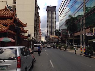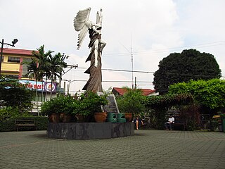
Ermita is a district in central Manila, Philippines. It is a significant center of finance, education, culture, and commerce. Ermita serves as the civic center of Manila, bearing the seat of city government and a large portion of the area's employment, business, and entertainment activities.

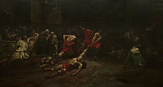
The Spoliarium is a painting by Filipino painter Juan Luna. Luna, working on canvas, spent eight months completing the painting which depicts dying gladiators. The painting was submitted by Luna to the Exposición Nacional de Bellas Artes in 1884 in Madrid, where it garnered the first gold medal. The picture recreates a despoiling scene in a Roman circus where dead gladiators are stripped of weapons and garments. Together with other works of the Spanish Academy, the Spoliarium was on exhibit in Rome in April 1884.

Malate is a district of Manila, Philippines. Together with the district of Ermita, it serves as Manila's center for commerce and tourism.
Lorenzo "Larry" J. Cruz was a Filipino restaurateur who founded the LJC Restaurant Group, which operates several restaurants in the Philippines. Among the restaurants in the said group include Café Adriatico, Cafe Havana, Bistro Remedios, and Abe, which was named after his father, the writer E. Aguilar Cruz. Cruz was also a journalist and magazine publisher.

Commonwealth Avenue, formerly known as Don Mariano Marcos Avenue, is a 12.4-kilometer (7.7 mi) highway located in Quezon City, Philippines. It spans six to eighteen lanes, making it the widest road in the country. The avenue is one of the major roads in Metro Manila and is designated as part of Radial Road 7 (R-7) of the older Manila arterial road system and National Route 170 (N170) of the Philippine highway network.

Our Lady of Remedies Parish, commonly known as Malate Church, is a Roman Catholic parish church in the district of Malate in the city of Manila, Philippines. It is under the jurisdiction of the Archdiocese of Manila. This Mexican Baroque-style church is overlooking Plaza Rajah Sulayman and, ultimately, Manila Bay. The church is dedicated to Nuestra Señora de los Remedios, the patroness of childbirth. A revered statue of the Virgin Mary in her role as Our Lady of Remedies was brought from Spain in 1624 and stands at the altar.

Harrison Plaza (HP) was a shopping mall situated along Adriatico Street corner Ocampo Street in the district of Malate in Manila, Philippines. Opened in 1976 and closed at the end of 2019, it was the first modern and major shopping mall located in the area. The shopping mall building has been demolished to give way for a redevelopment of the site into residential building complex with a shopping center called SM City Harrison by SM Prime Holdings.

Taft Avenue is a major road in southern Metro Manila. It passes through three cities in the metropolis: Manila, Pasay, and Parañaque. The road was named after the former Governor-General of the Philippines and U.S. President William Howard Taft; the Philippines was a former commonwealth territory of the United States in the first half of the 20th century. The avenue is a component of National Route 170 (N170), a secondary road in the Philippine highway network and Radial Road 2 (R-2) of the Manila arterial road network.

In Metro Manila, Philippines, tourism is a significant industry. In 2012, the city and the region welcomed 974,379 overnight visitors. Serving as the main gateway to the Philippines' numerous destinations, the city attracts mainly international tourists, with a total of 3,139,756 visitors in 2012. Global Blue ranks Manila as the eleventh 'Best Shopping Destination' in Asia. The city holds the tenth position in MasterCard's global top 20 fastest-growing cities for international visitors from 2009 to 2013.

Plaza Rajah Sulayman, also known as Rajah Sulayman Park, is a public square in Malate, Manila. It is bounded by Roxas Boulevard to the west, San Andres Street to the south, and Remedios Street to the north. The plaza is considered the center of Malate as it fronts the Malate Church, the main church of the district.

In the Philippines, a freedom park is a centrally located public space where political gatherings, rallies and demonstrations may be held without the need of prior permission from government authorities. Similar to free speech zones in the United States, the existence of freedom parks are based on the premise that the government may regulate the time, place and manner of assemblies, without prejudice to the nature of expression being expressed in those assemblies.

Pedro Gil Street is an east-west inner city street and a tertiary national road in south-central Manila, Philippines. It is 3.65 kilometers (2.27 mi) long and spans the entire length of Ermita, Malate, Paco, and Santa Ana. The street is served by the Pedro Gil LRT Station along Taft Avenue and the Paco railway station along Quirino Avenue. It also continues towards the central Metro Manila cities of Mandaluyong and San Juan across the Pasig River as New Panaderos and General Kalentong Streets.

Adriatico Street is a north–south road connecting the Ermita and Malate districts in Manila, Philippines. Its northern terminus is at Padre Faura Street in Ermita, carrying southbound traffic all the way to Quirino Avenue in Malate. South of Quirino, the street becomes two-way, with a wide median running down the center from just past the Manila Zoo up to its southern terminus at Ocampo Street.

President Elpidio Quirino Avenue, more commonly known as Quirino Avenue, is a 6-10 lane divided highway in Manila, Philippines. It runs for 3.6 kilometers (2.2 mi) in a northeast–southwest direction from Nagtahan Bridge across Santa Mesa in the north to Roxas Boulevard in Malate in the south. It passes through the Paco and Pandacan districts and serves as a truck route between the Port Area and the South Luzon Expressway. North of Nagtahan Bridge, the road continues as Nagtahan Street. It is designated as part of Circumferential Road 2. It is named after Elpidio Quirino, the sixth President of the Philippines.

The Welcome Rotonda, officially the Mabuhay Rotonda, is a roundabout in Quezon City, Philippines. It is located a few meters from the city's border with Manila, at the intersection of E. Rodriguez, Sr. Boulevard, Mayon Street, Quezon Avenue, Nicanor Ramirez Street, and España Boulevard. The name may also refer to the monument situated on its central island.

The Philippines–Thailand Friendship Circle is a traffic circle in Santa Ana, Manila, Philippines. It is located at the intersection of Jose Syquia, M. Roxas, Revellin, and Zamora Streets, near the Santa Ana Public Market.

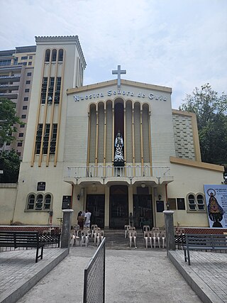
The Archdiocesan Shrine of Nuestra Señora de Guia, commonly known as Ermita Shrine or Ermita Church, is a Roman Catholic church and shrine located in the district of Ermita in the city of Manila, Philippines. The church is home to the Marian image of the Immaculate Concepcion known as Nuestra Señora de Guía, which is considered to be oldest in the Philippines, and in whose honor the church is officially named after and dedicated to.

Marcelo H. del Pilar Street, also known as M.H. del Pilar Street or simply Del Pilar Street, is a north–south road running for 1.895 kilometers (1.177 mi) connecting Ermita and Malate districts in Manila, Philippines. It is a two-lane street carrying one-way southbound traffic from Kalaw Avenue in Rizal Park to Quirino Avenue across from the Ospital ng Maynila. It was formerly called Calle Real.


