
The Pasig River is a water body in the Philippines that connects Laguna de Bay to Manila Bay. Stretching for 25.2 kilometers (15.7 mi), it bisects the Philippine capital of Manila and its surrounding urban area into northern and southern halves. Its major tributaries are the Marikina River and San Juan River. The total drainage basin of the Pasig River, including the basin of Laguna de Bay, covers 4,678 square kilometers (1,806 sq mi).
Sampaloc is a district of Manila, Philippines. It is referred to as the University Belt or simply called "U-Belt" for numerous colleges and universities are found within the district such as the University of Santo Tomas, the oldest extant university in Asia; the National University, the first private nonsectarian and coeducational institution in the Philippines; the Far Eastern University, known for its Art Deco campus and cultural heritage site of the Philippines; and the University of the East, once dubbed as the largest university in Asia in terms of enrollment. The district is bordered by the districts of Quiapo and San Miguel in the south, Santa Mesa district in the south and east, Santa Cruz district in the west and north, and Quezon City in the northeast.

Pandacan is a district in Manila, Philippines, which is known in recent history for its former Pandacan oil depot which supplies the majority of oil exports in the country.

The Metro Manila Skyway, officially the Metro Manila Skyway System (MMSS) or simply the Skyway, is an elevated highway serving as the main expressway of Metro Manila, Philippines. It connects the North and South Luzon Expressways with access to Ninoy Aquino International Airport via the NAIA Expressway (NAIAX). It is the first fully grade-separated highway in the Philippines and one of the longest elevated highways in the world, with a total length of approximately 39.2 kilometers (24.4 mi).

Paco station is a railway station located on the South Main Line in the city of Manila, Philippines. It was originally opened by the Manila Railroad Company in 1908 as a major hub in the southern half of Manila, where trains toward Cavite province once operated. The old train station building was designed by William E. Parsons and was completed in 1915. Prior to the electrification plan in the late 1970s, Paco was the southernmost double-track station on the line.

Circumferential Road 3 (C-3), informally known as the C-3 Road, is a network of roads and bridges which comprise the third beltway of Metro Manila in the Philippines. Spanning some 10.8 kilometers (6.7 mi), it connects the cities of Caloocan, Navotas, Quezon City, and San Juan.
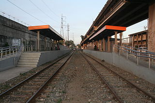
Pandacan station is a railway station located on the South Main Line in the city of Manila, Philippines.

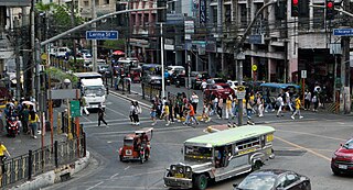
Circumferential Road 2 (C-2), informally known as the C-2 Road, is a network of roads and bridges which comprise the second beltway of Metro Manila in the Philippines. Spanning some 10.18 kilometers (6.33 mi), it connects the districts of Tondo, Santa Cruz, Sampaloc, San Miguel, Santa Mesa, Paco, Pandacan, and Malate in Manila.

President Elpidio Quirino Avenue, more commonly known as Quirino Avenue, is a 6-10 lane divided highway in Manila, Philippines. It runs for 3.6 kilometers (2.2 mi) in a northeast–southwest direction from Nagtahan Bridge across from Santa Mesa in the north to Roxas Boulevard in Malate in the south. It passes through Paco and Pandacan districts where it also serves as a truck route between Port Area and South Luzon Expressway. North of Nagtahan Bridge, the road continues as Nagtahan Street. It is designated as part of Circumferential Road 2. It is named after Elpidio Quirino, the sixth President of the Philippines.
Ramon Magsaysay Boulevard, also known simply as Magsaysay Boulevard and formerly as Santa Mesa Boulevard, is the principal artery of Santa Mesa in Manila, Philippines. It is a six-lane divided roadway that travels east–west from Gregorio Araneta Avenue near the city's border with Quezon City and San Juan to Lacson Avenue and the Nagtahan Interchange, close to the district of San Miguel. The entire length of the boulevard serves as the district boundary between Sampaloc in the north and Santa Mesa in the south with the LRTA's Line 2 running along its median. East of Gregorio Araneta, the road continues as Aurora Boulevard while west of Lacson, it extends as Legarda Street via Legarda Flyover into San Miguel and Quiapo.

Lacson Avenue is the principal northwest–southeast artery located in Sampaloc district in northern Manila, Philippines. It is a 6-8 lane median divided avenue that runs approximately 2.9 kilometers (1.8 mi) from Tayuman Street in Santa Cruz to Nagtahan Interchange. It is a component of Circumferential Road 2 of the Manila arterial road network and N140 of the Philippine highway network.
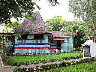
The Apolinario Mabini Shrine is a historic site in Santa Mesa, Manila, Philippines. It is noted for being the residence of Filipino military leader Apolinario Mabini who figured in the Philippine Revolution. Originally situated along the Nagtahan River, the structure was moved to the Polytechnic University of the Philippines main campus in Santa Mesa, Manila in the mid-2000s.

Mabini Bridge, formerly and still referred to as Nagtahan Bridge, is a road bridge crossing the Pasig River between Nagtahan Street in Santa Mesa and Quirino Avenue in Paco to the west and Pandacan to the east. It was constructed between January and February 1945. It initially served as a pontoon bridge transporting U.S. Army jeeps and evacuating citizens caught in the crossfire during the Liberation of Manila.

The following is an alphabetical list of articles related to the Philippine capital region of Metro Manila.

The President Sergio Osmeña Sr. Highway, also known as the South Superhighway, is a 4.595-kilometer (2.855 mi) major highway that links Quirino Avenue in Paco, Manila to Epifanio de los Santos Avenue (EDSA) and South Luzon Expressway (SLEX) at the Magallanes Interchange in Makati.

The Nagtahan Interchange, also known as the Nagtahan Flyover and the Mabini Flyover, is a three-level set of three intersecting flyovers in Manila, the Philippines which serves as the junction between Lacson Avenue, Nagtahan Street, Legarda Street, Magsaysay Boulevard, and Jose P. Laurel Street, as well as the nearby Mabini Bridge. The interchange includes the Legarda Flyover, between Legarda Street and Magsaysay Boulevard, and the Nagtahan Flyover, between Nagtahan Street and Lacson Avenue.

The Sucat–Paco–Araneta–Balintawak Transmission Line also known as Muntinlupa–Manila–Doña Imelda–Quezon Transmission Line, and formerly known as Sucat–Araneta–Balintawak Transmission Line from July 2000 to October 2012, is a 230,000 volt, single-circuit, three-part transmission line in Metro Manila, Philippines that connects Sucat and Balintawak substations of National Grid Corporation of the Philippines (NGCP), with line segment termination at NGCP Araneta substation in Quezon City and Manila Electric Company (Meralco) Paco substation in Paco, Manila.
National Route 180 (N180) is a secondary national route that forms part of the Philippine highway network, running from Cubao, Quezon City to Ermita, Manila.

NLEX Connector, also known as the NLEX–SLEX Connector Road, NLEX Connector Road, and NLEX Segment 11 during the planning stages, is a 7.7-kilometer (4.8 mi), four-lane elevated expressway in Metro Manila, Philippines. It connects the NLEX Harbor Link to the Metro Manila Skyway, which in turn connect to the North and South Luzon Expressways, respectively, while traversing parallel to the PNR Metro Commuter Line. The highway has five interchanges, four of which is currently operational. Alongside NLEX Harbor Link, trucks are allowed to use it.

