Pandacan

Last updated

Pandacan
District of Manila
Pandacan, Santa Ana, Skyway Stage 3 (Manila; 02-23-2022).jpg
Aerial view of Pandacan in 2022
Ph fil manila pandacan.png
Pandacan
Country Philippines
Region National Capital Region
City Manila
Congressional districtsPart of the 6th district of Manila
Barangays 38
Area
  Total1.66 km2 (0.64 sq mi)
Population
 (2020) [1]
  Total84,769
  Density51,000/km2 (130,000/sq mi)

Pandacan is a district in Manila, Philippines which is known in recent history for its former Pandacan oil depot which supplies the majority of oil exports in the country.

Contents

Etymology

Pandacan is a corrupted term derived from its older designation, Pandanan. The name is rooted in the word pandan (Pandanus amaryllifolius), referencing a tree that was once abundant in the area. [2]

Profile

In 2020, Pandacan has a total population of 84,769. [1] The original residents of the district are Tagalog migrants from the province of Bulacan. When the district grew and progressed as a manufacturing center for Manila, several ethnic groups from other parts of the country migrated into the district after the Second World War.

The district is bounded to the north and northeast by the Pasig River, the Estero de Pandacan to the west and south and the district of Santa Ana to the southeast.

Socioeconomically, the majority of the residents of Pandacan range from lower- to upper-middle class. Original residents are gainfully employed as blue-collar workers in the nearby factories and oil depots, while those in the service sector are generally employed in nearby Makati, the country's central business district.

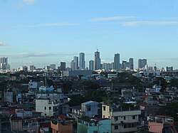
Pandacan was originally established as the industrial center for the city of Manila during the turn of the 20th century. Oil depots which service more than half of the fuel requirement of the country were established along the banks of the Pasig River in the district.

Barangays

Zones
Barangays
Zone/BarangayLand area (km²)Population (2020 census)
Zone 91
Barangay 8330.06385 km²1,504
Barangay 8340.2786 km²1,733
Barangay 8350.09306 km²2,706
Barangay 8360.04999 km²5,317
Barangay 8370.06437 km²3,039
Barangay 8380.04986 km²2,969
Barangay 8390.09567 km²2,007
Barangay 8400.02656 km²2,541
Zone 92
Barangay 8410.04135 km²2,250
Barangay 8420.03160 km²2,812
Barangay 8430.02849 km²8,744
Barangay 8440.03332 km²3,500
Barangay 8450.01743 km²1,309
Barangay 8460.01389 km²1,848
Barangay 8470.04071 km²2,883
Barangay 8480.04114 km²1,586
Zone 93
Barangay 8490.01205 km²1,849
Barangay 8500.01176 km²2,456
Barangay 8510.02360 km²1,052
Barangay 8520.008810 km²1,118
Barangay 8530.007320 km²505
Barangay 8550.04422 km²2,142
Barangay 8560.03971 km²1,611
Barangay 8570.01500 km²1,894
Barangay 8580.01477 km²665
Barangay 8590.03437 km²1,355
Zone 94
Barangay 8600.01857 km²3,214
Barangay 8610.2062 km²1,072
Barangay 8620.04347 km²2,419
Barangay 8630.03479 km²1,481
Barangay 8640.01977 km²813
Barangay 8650.1867 km²79
Zone 95
Barangay 8670.03001 km²2,116
Barangay 8680.01848 km²2,850
Barangay 8690.02494 km²2,010
Barangay 8700.02373 km²3,049
Barangay 8710.01273 km²2,407
Barangay 8720.02407 km²1,864

Landmarks

Romualdez Ancestral House Romualdez House.jpg
Romualdez Ancestral House

The district is home to a few well-known historical figures, including Apolinario Mabini, one of the key figures in the Philippine fight for independence during the late 19th century against Spanish rule. The National Historical Commission of the Philippines has declared Mabini's former residence as a national historical shrine.

Former First Lady Imelda Romualdez Marcos claims Pandacan as her ancestral home in Manila. Since marrying former President Ferdinand Marcos in the 1960s, caretakers have been constantly maintaining her home. The house is Marcos' tie as a resident of Manila, despite her family's roots in Leyte province in the Visayas.

Schools

Public elementary schools serving the district includes Jacinto Zamora Elementary School, Bagong Diwa Elementary School, Beata Elementary School and Bagong Barangay Elementary School; the district has one public high school, the Carlos P. Garcia High School.

Private education is provided by a Catholic school called St. Joseph's School – Pandacan, located beside the Santo Niño Parish along Jesus Street.

In 1994, the ERDA Technical And Vocational Secondary School was built by Fr. Pierre Tritz, a Jesuit from France for the disadvantaged Filipino youth.

Churches

Four of the leading Christian religious dominations in the Philippines established their presence in the district. For Roman Catholics, there is the Santo Niño Parish along Jesus Street. The Iglesia ni Cristo and the United Methodist Church both have a church along Quirino Avenue, and the Philippine Independent Church has a church (Parish of Sto. Niño) at the corner of Central and Labores Streets.

History

Aerial view of the Pandacan oil depot, 1940 Philippine Island - Manila - NARA - 68156599.jpg
Aerial view of the Pandacan oil depot, 1940

Officially, Pandacan was established as a community in 1574 when Franciscan priests of the Roman Catholic Church established the first mission in the district. Pandacan was originally part of the parish of Sampaloc; it was later established as a separate parish in 1712.

Pandacan was a farming community, producing small quantities of rice and sugar that were sold to the Spanish enclave in Intramuros. Aside from a few vegetable plots, the old Pandacan produced bricks and tiles, colored cotton laces but in limited quantities. The district also produced shoes and small boats.

In the 19th century, Pandacan was described as a "Little Venice" or "Little Italy" for its numerous canals or estuaries leading to the Pasig River. Many would leisurely row through the estuaries in the late afternoons as described by Francisco Balagtas in his early writings. Pandacan was home to balladeers and a source of musicians in the early times.

Late in the Spanish era and into the American regime, Pandacan was developed into becoming the first industrial estate in the Philippines. The first modern manufacturing company was built in Pandacan and was called the Compañia General de Tabacos de Filipinas in 1882, a modern cigar-making plant.

The Santo Nino de Pandacan Parish Church (prior to the 2020 fire) Pandacan Church, Manila City (2019).jpg
The Santo Niño de Pandacan Parish Church (prior to the 2020 fire)

The first stone church in Pandacan was built in 1732 by Father Francisco del Rosario. It was completed in 1760 but was destroyed twice by earthquakes. A modern church stood on the ruins including a parish school which stands on what was the Catholic cemetery of the district. The church was destroyed by fire on July 10, 2020. [3]

Pandacan was home to prominent Filipino artists of the 19th century, including Francisco Baltazar (also known as Balagtas) who authored Florante at Laura ; musician Ladislao Bonus; Tagalog language theorist Lope K. Santos; and playwrights Miguel Masilungan and Pantaleon Lopez.

By the turn of the 19th century, the American colonial government decreed Pandacan as the center for industrial activity and had oil companies build their storage and distribution facilities in the district.

With the presence of several manufacturing facilities in the district, a modern housing facility was built to house the workers at the nearby oil depots. The housing project was called "Kapitan Tikong" (Captain Tikong) subdivision, named after a popular local leader. The housing facility was built on the southeastern banks of the Estero de Beata. In honor of Francisco Baltazar, the streets in the subdivision were named after the characters of Florante at Laura .

Modernization

From industrial to commercial

The former Pandacan Oil Depot Oil depot cylinders (pandacan, Manila)(2014-10-25).jpg
The former Pandacan Oil Depot

The manufacturing facilities in Pandacan have long transferred to other locations outside of Manila. Only the major "Big Three" oil companies operate oil distribution depots in Pandacan: Royal Dutch Shell, Chevron's Caltex and San Miguel Energy Corp. majority-owned Petron Philippines.

During his second term, Manila Mayor Lito Atienza led an effort to convert Pandacan from an industrial classification into commercial, in an effort to have the oil depot removed from the district. Atienza and several city councilors were concerned that the oil depot served as a security, environment, and safety hazard to the densely populated Pandacan. Several fires have been attributed to the presence of the oil depot and terrorist attacks were a major concern.

Difficulty in finding a reasonable relocation site for the depots, without disturbing the national distribution process of fuel, resulted in a compromise in place of the eviction. However, a gradual phase out of large oil tanks that lined residential areas has been completed and a Pandacan Linear Park was built along the oil depot and residential units up to the banks of the Pasig River.

Beautification programs

Plaza Balagtas Liwasang Balagtas, Pandacan, Manila, June 2023.jpg
Plaza Balagtas

Atienza spearheaded a beautification program and spruced up parks and recreational facilities. This included the Plaza Balagtas that sits atop the Estero de Beata in 2003 and the Ladislao Bonus Park in 2006.

In September 2006, as part of Atienza's sidewalk redevelopment and street lighting program, the main highway from the corner of Jesus Street and Quirino Avenue at the foot of Nagtahan Bridge southwards into Palumpong Street and the whole of Laura Street up to the foot of the Padre Zamora Bridge was renovated, linking the walkways into the Pandacan Linear Park, a buffer zone made into a park separating the oil distribution facilities from the residential-commercial areas. The Pandacan Linear Park, developed under the support of the big three oil companies and the city government of Manila, allows for a leisure walk and recreational activities along the Pasig River.

Modern housing

Sections of the district are seeing improvements with a low-cost housing development in the site of the compound of the Manila City Engineer's Office beside the Nagtahan Bridge called "Residencias de Manila".

Tourism and events

Manila boasts its rich cultural history every year in Pandacan with the traditional "Buling Buling" Dance Festival. Because many of the country's literary and musical geniuses of the 19th century came from Pandacan, an annual traditional dancing in the streets of Pandacan is featured every Saturday before the main celebrations for the feast of the Santo Niño every third week of January.

See also

Related Research Articles

<span class="mw-page-title-main">Pasig</span> Highly urbanized city in Metro Manila, Philippines

Pasig, officially the City of Pasig, is a highly urbanized city in the National Capital Region of the Philippines. According to the 2020 census, it has a population of 803,159 people.

<span class="mw-page-title-main">Tondo, Manila</span> District in Metro Manila, Philippines

Tondo is a district located in Manila, Philippines. It is the largest, in terms of area and population, of Manila's sixteen districts, with a census-estimated 654,220 people in 2020. It consists of two congressional districts. It is also the second most densely populated district in the city.

<span class="mw-page-title-main">Sampaloc, Manila</span> District of Metro Manila, Philippines

Sampaloc is a district of Manila, Philippines. It is referred to as the University Belt or simply called "U-Belt" for numerous colleges and universities are found within the district such as the University of Santo Tomas, the oldest extant university in Asia; the National University, the first private nonsectarian and coeducational institution in the Philippines; the Far Eastern University, known for its Art Deco campus and cultural heritage site of the Philippines; and the University of the East, once dubbed as the largest university in Asia in terms of enrollment. The district is bordered by the districts of Quiapo and San Miguel in the south, Santa Mesa district in the south and east, Santa Cruz district in the west and north, and Quezon City in the northeast.

<span class="mw-page-title-main">Santa Mesa</span> District of Manila, Metro Manila, Philippines

Santa Mesa is a district in Manila, Philippines. It is surrounded by the Pasig River on the southwestern side, and by the San Juan River on its southern and eastern side. Land borders include the districts of San Miguel to the west and Sampaloc to the north; and to the northeast is Quezon City.

<span class="mw-page-title-main">Balagtas, Bulacan</span> Municipality in Bulacan, Philippines

Balagtas, officially the Municipality of Balagtas, is a 1st class municipality in the province of Bulacan, Philippines. According to the 2020 census, it has a population of 77,018 people.

<span class="mw-page-title-main">Hagonoy, Bulacan</span> Municipality in Bulacan, Philippines

Hagonoy, officially the Municipality of Hagonoy, is a 1st class municipality in the province of Bulacan, Philippines. According to the 2020 census, it has a population of 133,448 people.

<span class="mw-page-title-main">Santa Ana, Manila</span> District of Manila, Metro Manila, Philippines

Santa Ana is a district in the City of Manila, Philippines. It is located on the city's southeast, bordering the cities of Mandaluyong and Makati in the east, the city districts of Paco and Pandacan in the west, and Santa Mesa in the north. It is part of the 6th congressional district of Manila, with thirty-five barangays. Based on the 2020 national census, the Philippine Statistics Authority reports that the district has a population of 203,598.

<span class="mw-page-title-main">San Nicolas, Manila</span> District of Manila, Metro Manila, Philippines

San Nicolas is one of the sixteen districts in the city of Manila in the Philippines. It is located at the west central part of the city, on the northern bank of the Pasig River bounded by the districts of Binondo to the east by Estero de Binondo, and Tondo to the north and west, and by the Pasig River to the south. Considered as a heritage district of Manila, this community has kept its 19th-century ancestral houses, which symbolizes the wealthy lives of the people who used to live there, similar to the ancestral houses of Silay and Vigan.

<span class="mw-page-title-main">Namayan</span>

Namayan, also called Sapa, Maysapan, and sometimes Lamayan, was an independent indigenous polity on the banks of the Pasig River in the Philippines. It is believed to have achieved its peak in 1175, and to have gone into decline sometime in the 13th century, although it continued to be inhabited until the arrival of European colonizers in the 1570s.

<span class="mw-page-title-main">Circumferential Road 2</span> Road in the Philippines

Circumferential Road 2 (C-2), informally known as the C-2 Road, is a network of roads and bridges that all together form the second beltway of Metro Manila in the Philippines. Spanning some 10.18 kilometers (6.33 mi), it connects the districts of Tondo, Santa Cruz, Sampaloc, San Miguel, Santa Mesa, Paco, Pandacan, and Malate in Manila.

<span class="mw-page-title-main">Manila City Council</span> Legislative body of the city of Manila, Philippines

The Manila City Council or the city's legislature is composed of 38 councilors, with 36 councilors elected from Manila's six councilor districts and two councilors elected from the ranks of barangay (neighborhood) chairmen and the Sangguniang Kabataan. The presiding officer of the council is the Vice Mayor, who is elected citywide.

<span class="mw-page-title-main">Quirino Avenue</span> Major street in Manila, Philippines

President Elpidio Quirino Avenue, more commonly known as Quirino Avenue, is a 6-10 lane divided highway in Manila, Philippines. It runs for 3.6 kilometers (2.2 mi) in a northeast–southwest direction from Nagtahan Bridge across from Santa Mesa in the north to Roxas Boulevard in Malate in the south. It passes through Paco and Pandacan districts where it also serves as a truck route between Port Area and South Luzon Expressway. North of Nagtahan Bridge, the road continues as Nagtahan Street. It is designated as part of Circumferential Road 2.

<span class="mw-page-title-main">Lacson Avenue</span> Major thoroughfare in Manila, Philippines

Lacson Avenue is the principal northwest–southeast artery located in Sampaloc district in northern Manila, Philippines. It is a 6-8 lane median divided avenue that runs approximately 2.9 kilometers (1.8 mi) from Tayuman Street in Santa Cruz to Nagtahan Interchange. It is a component of Circumferential Road 2 of the Manila arterial road network and N140 of the Philippine highway network.

<span class="mw-page-title-main">Pandacan oil depot</span> Oil terminal in Manila, Philippines

The Pandacan Oil Depot was a 33-hectare compound in Pandacan, Manila, Philippines. It housed the storage facilities and distribution terminals of three major players in the country's petroleum industry, namely Caltex, Petron, and Shell. The oil depot took its roots from separate establishments by these oil companies.

Pandacan being established as a community in 1574 is considered as one of the oldest districts in Manila and contains several notable places rich in heritage. It is home to a few well-known historical figures, historical landmarks and hosts a number of ancestral houses.

<span class="mw-page-title-main">Buling-Buling Festival</span>

Buling-Buling Festival is a religious and cultural event celebrated annually in Pandacan, Manila in the Philippines on the third Saturday of January, in time with the town's fiesta, to honor its patron saint, Santo Niño — a wooden image of child Jesus Christ. It is a festival of street dancing where its people, Pandaqueños who are well-dressed in traditional Filipino costumes, dance along the streets of Pandacan accompanied by marching bands. In 2005, it was adopted as Manila's official cultural dance identity.

<span class="mw-page-title-main">Index of Metro Manila–related articles</span>

The following is an alphabetical list of articles related to the Philippine capital region of Metro Manila.

<span class="mw-page-title-main">Santo Niño, Parañaque</span> Barangay in Parañaque City, Metro Manila, Philippines

Santo Niño is an administrative division in southern Metro Manila, the Philippines. It is a barangay in the city of Parañaque immediately surrounding Ninoy Aquino International Airport on its west and south sides. A large portion of the village extends into the property of the airport grounds to include Terminal 1 as well as the western half of Runway 06/24. The village has a total land area of 245.97 hectares of which about 55% is occupied by the airport complex. Its population is concentrated in the areas along the Estero de Tripa de Gallina.

The Nagtahan Link Bridge is a series of road bridges crossing the Pasig River between the districts of Paco and Santa Mesa in Manila, Philippines. Constructed from 1996 to 1998, the road links and bridges pass along the Paco-Santa Mesa Road, which is also referred to as Tomas Claudio Street.

References

  1. 1 2 Census of Population (2020). "National Capital Region (NCR)". Total Population by Province, City, Municipality and Barangay. Philippine Statistics Authority . Retrieved July 8, 2021.
  2. "Pandacan: the land of arts and depots (Part 1)". The Urban Roamer. May 22, 2012. Retrieved January 21, 2024.
  3. Cator, Currie (July 10, 2020). "Fire razes Sto. Niño Church in Manila". CNN Philippines . Retrieved April 28, 2021.

14°35′38″N121°00′25″E / 14.594°N 121.007°E / 14.594; 121.007