Tunasan

Last updated • 3 min readFrom Wikipedia, The Free Encyclopedia
Tunasan
2263Barangay Center of Tunasan, Muntinlupa City 24.jpg
Barangay Hall of Tunasan
Tunasan
Map
Coordinates: 14°22′21.16″N121°2′10.96″E / 14.3725444°N 121.0363778°E / 14.3725444; 121.0363778
Country Philippines
Region National Capital Region
City Muntinlupa
District 1st Legislative district of Muntinlupa
EstablishedJune 28, 1964
Government
  Type Barangay
  Barangay CaptainJohn Dave Arcilla
  SK ChairpersonRyan Marmeto
Area
  Total9.596 km2 (3.705 sq mi)
Population
 (2020) [1]
  Total61,374
  Density6,400/km2 (17,000/sq mi)
Time zone UTC+8 (PST)
Postal Code
1773
1774 (Susana Heights)
Area code 02
Range Marikina Valley Fault Ridge

Tunasan is a barangay in Muntinlupa, Philippines. It is the southernmost barangay of Metro Manila located in the southern section of the city bordering the province of Laguna. The total land area of the barangay is 9.596 km2 (3.705 sq mi), the largest in the city. According to the 2020 census, it has a population of 61,374. [1]

Contents

Tunasan is located 27 kilometers (17 mi) south of the City of Manila. It is bounded by Poblacion, Muntinlupa on the north, Laguna de Bay on the east, the San Pedro barangays of San Antonio and Cuyab on the south; the Las Piñas barangay of Almanza Uno on the west; and Dasmariñas barangay of Salapan, province of Cavite, on the southwest.

Etymology

Tunasan got its name from a medicinal plant locally called tunas ( Nymphaea nouchali ), which was abundant on the Tunasan River and the shoreline of Laguna de Bay.

There are also three legends or myths that possibly explain the origin of Tunasan's name: [2]

History

Tunasan was called "Tunasancillo" during the Spanish colonial period and it was a barrio and also a part of the vast hacienda owned by the Augustinian Recollects in the pueblo or town of San Pedro Tunasan in the province of La Laguna. [3] San Pedro Tunasan was later annexed to the town of Biñan in 1903. [4] Eventually, the barrio became part of Muntinlupa, which was then part of Taguig in the province of Rizal when San Pedro Tunasan sold it in 1907 during the American period. [5] [6] After the separation, San Pedro Tunasan simply changed its name to San Pedro and the sold barangay of Tunasancillo was called Tunasan.

Subdivisions

Victoria Homes Elementary Homes inside Victoria Homes Subdivision 5000Victoria Homes Subdivision 48.jpg
Victoria Homes Elementary Homes inside Victoria Homes Subdivision

While barangays are the administrative divisions of the city, and are legally part of the addresses of establishments and homes, residents also include their subdivision . Listed below are subdivisions in this barangay. [7]

Brgy. Tunasan in Muntinlupa Tunasan.png
Brgy. Tunasan in Muntinlupa

Laguerta Compound

SM Development Corporation donated an 8,348-square-meter (89,860 sq ft) property in Laguerta, Barangay Tunasan for residential use . [8] Several government offices and buildings are also in this area. [9]

Tunasan Baywalk

The Tunasan Baywalk is a reclaimed area behind the Muntinlupa Science High School where the Muntinlupa Sports Complex is located.

See also

Related Research Articles

<span class="mw-page-title-main">Muntinlupa</span> Highly urbanized city in Metro Manila, Philippines

Muntinlupa, officially the City of Muntinlupa, is a 1st class highly urbanized city in the National Capital Region of the Philippines. According to the 2020 census, it has a population of 543,445 people.

<span class="mw-page-title-main">Rizal (province)</span> Province in Calabarzon, Philippines

Rizal, officially the Province of Rizal, is a province in the Philippines located in the Calabarzon region in Luzon. Its capital is the city of Antipolo. It is about 16 kilometers (9.9 mi) east of Manila. The province is named after José Rizal, one of the main national heroes of the Philippines. It is bordered by Metro Manila to the west, Bulacan to the north, Quezon to the east and Laguna to the southeast. The province also lies on the northern shores of Laguna de Bay, the largest lake in the country. Rizal is a mountainous province perched on the western slopes of the southern portion of the Sierra Madre mountain range.

<span class="mw-page-title-main">Taguig</span> Highly urbanized city in Metro Manila, Philippines

Taguig, officially the City of Taguig, is a highly urbanized city located alongside the northwestern shores of Laguna de Bay in Metro Manila, Philippines. With a population of 1,223,595 people, it is the 5th most populous city in the Philippines. The city is known for Bonifacio Global City, one of the leading financial centers of the Philippines. Originally a fishing village during the Spanish and American colonial periods, it experienced rapid growth when former military reservations were converted by the Bases Conversion and Development Authority (BCDA) into financial centers and mixed-use planned communities. Taguig became a highly urbanized city with the passage of Republic Act No. 8487 in 2004, which was ratified by a plebiscite.

<span class="mw-page-title-main">San Pedro, Laguna</span> Component city in Calabarzon

San Pedro, officially the City of San Pedro, is a 3rd class component city in the province of Laguna, Philippines. According to the 2020 census, it has a population of 326,001 people.

<span class="mw-page-title-main">Batangas City</span> Capital of Batangas, Philippines

Batangas City, officially the City of Batangas, is a 1st class component city and capital of the province of Batangas, Philippines. According to the 2020 census, it has a population of 351,437 people.

<span class="mw-page-title-main">Pagsanjan</span> Municipality in Laguna, Philippines

Pagsanjan, officially the Municipality of Pagsanjan, is a 3rd class municipality in the province of Laguna, Philippines. According to the 2020 census, it has a population of 44,327 people.

<span class="mw-page-title-main">Bay, Laguna</span> Municipality in Laguna, Philippines

Bay, officially the Municipality of Bay, and colloquially known as Bae, is a 2nd class municipality in the province of Laguna, Philippines. According to the 2020 census, it has a population of 67,182 people.

<span class="mw-page-title-main">Biñan</span> Component city in Laguna, Philippines

Biñan, officially the City of Biñan, is a 1st class component city in the province of Laguna, Philippines. According to the 2020 census, it has a population of 407,437 people.

<span class="mw-page-title-main">Pila, Laguna</span> Municipality in Laguna, Philippines

Pila, officially the Municipality of Pila, is a 3rd class municipality in the province of Laguna, Philippines. According to the 2020 census, it has a population of 54,613 people.

<span class="mw-page-title-main">Santa Cruz, Laguna</span> Capital of Laguna, Philippines

Santa Cruz, officially the Municipality of Santa Cruz, is a 1st class municipality and capital of the province of Laguna, Philippines. According to the 2020 census, it has a population of 123,574 people.

<span class="mw-page-title-main">Malvar</span> Municipality in Batangas, Philippines

Malvar, officially the Municipality of Malvar, is a 2nd class municipality in the province of Batangas, Philippines.

<span class="mw-page-title-main">Santo Tomas, Batangas</span> Component city in Batangas, Philippines

Santo Tomas, officially the City of Santo Tomas, is a 1st class component city in the province of Batangas, Philippines. According to the 2020 census, it has a population of 218,500 people.

<span class="mw-page-title-main">Tunasan River</span> River in National Capital Region, Philippines

The Tunasan River, also referred to as the Tunasan–Cuyab River, is a river system in the Philippines. This river begins in Dasmariñas, Cavite, and ends 9 kilometres (5.6 mi) at the border of Muntinlupa, and San Pedro, Laguna. It is one of 21 major tributaries of Laguna de Bay.

<span class="mw-page-title-main">Precolonial barangay</span> Complex sociopolitical units in precolonial Philippines

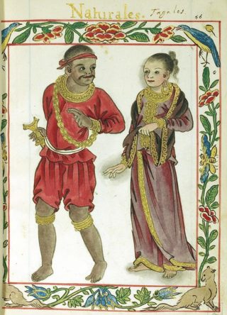
In early Philippine history, barangay is the term historically used by scholars to describe the complex sociopolitical units that were the dominant organizational pattern among the various peoples of the Philippine archipelago in the period immediately before the arrival of European colonizers. Academics refer to these settlements using the technical term "polity", but they are usually simply called "barangays".

<span class="mw-page-title-main">Daang Hari</span> Road in the Philippines

Daang Hari, also known as the Las Piñas–Muntinlupa–Laguna–Cavite Link Road, is a collector road that links southern Metro Manila to the province of Cavite in the Philippines. It begins as a north–south road from Commerce Avenue, just south of the Alabang–Zapote Road running for 5.9 kilometers (3.7 mi) on the boundary of Las Piñas and Muntinlupa. It then runs east–west for about 9.2 kilometers (5.7 mi) from its junction with Daang Reyna, winding through the cities of Bacoor, Imus, Dasmariñas, and General Trias.

Metro Manila, the capital region of the Philippines, is a large metropolitan area that has several levels of subdivisions. Administratively, the region is divided into seventeen primary local government units with their own separate elected mayors and councils who are coordinated by the Metropolitan Manila Development Authority, a national government agency headed by a chairperson directly appointed by the Philippine president. The cities and municipality that form the region's local government units are further divided into several barangays or villages which are headed by an elected barangay captain and barangay council.

<span class="mw-page-title-main">Poblacion, Muntinlupa</span> Barangay in Muntinlupa City, Metro Manila, Philippines

Poblacion is one of the nine barangays of Muntinlupa, Metro Manila, Philippines. It is also the center of the city, hence the name which translates to center in Spanish.

<span class="mw-page-title-main">Putatan, Muntinlupa</span> Barangay in Muntinlupa City, Metro Manila, Philippines

Putatan is a barangay in Muntinlupa, Metro Manila, Philippines. The total land area of the barangay is 6.746 km2. According to the 2020 census, it has a population of 99,725.

<span class="mw-page-title-main">Sucat, Muntinlupa</span> Barangay in Muntinlupa City, Metro Manila, Philippines

Sucat is an administrative division in southern Metro Manila, the Philippines. It is an urban barangay in Muntinlupa City with many high-rise condominiums and commercial establishments in the area. The area is also well known for the Sucat exit of the South Luzon Expressway and Metro Manila Skyway.

<span class="mw-page-title-main">Cupang, Muntinlupa</span> Barangay in Muntinlupa City, Metro Manila, Philippines

Cupang is a barangay in the Muntinlupa, Metro Manila, Philippines. The total land area of the barangay is 5.370 km2 (2.073 sq mi). It has a population of 57,196 as of the 2020 census. It is located in the northern section of the city.

References

  1. 1 2 "Philippine Standard Geographic Code (PSGC)". Philippine Statistics Authority. Retrieved May 29, 2022.
  2. "Brgy. Tunasan". City Government of Muntinlupa. Retrieved June 7, 2022.
  3. Buzeta, Manuel (1831). Diccionario geografico, estadistico, historico de las islas Filipinas. p. 464.
  4. Act No. 939 (12 October 1903), An Act reducing the thirty municipalities of the Province of La Laguna to nineteen , retrieved June 15, 2023
  5. Cruz-Araneta, Gemma (October 20, 2008). "Part of History". With One's Past. Retrieved February 28, 2016.[ self-published source ]
  6. "History". City Government of Muntinlupa. Retrieved June 19, 2023.
  7. "LIST OF SUBDIVISION IN THE CITY OF MUNTINLUPA". Archived from the original on January 14, 2016.
  8. Gamil, Jaymee. "Low-cost homes set for Muntinlupa gov't workers, squatters". Inquirer.net.
  9. Hicap, Jonathan. "Earthquake-proof, self sustaining city government building rises in Muntinlupa". Manila Bulletin. Retrieved August 24, 2015.