Mariana, Quezon City

Last updated
Mariana
New Manila
Barangay
09719jfAurora Boulevard Landmarks Hemady Saint Paul Mariana Quezon Cityfvf 19.jpg
Barangay Mariana Seal.png
Mariana, Quezon City
Metro Manila location map.svg
Red pog.svg
Mariana
Coordinates: 14°37′10″N121°02′05″E / 14.61944°N 121.03472°E / 14.61944; 121.03472
CountryPhilippines
Region National Capital Region
City Quezon City
District4th District
EstablishedAugust 21, 1961 [1]
Government
  Type Barangay
   Barangay captain Regine C. San Miguel [2]
Area
[1]
  Total1.66 km2 (0.64 sq mi)
Population
 (2020) [3]
  Total11,967
  Density7,209/km2 (18,670/sq mi)
Time zone UTC+8 (PST)
Postal Code
1112 [4]
Area code 2
PSGC 137404060
Website Facebook

Mariana, is an administrative division in eastern Metro Manila, the Philippines. It is an urban barangay in Quezon City in a middle class residential and commercial area known as New Manila, which includes Barangay Mariana and the adjacent Barangay Damayang Lagi. [5]

Contents

Originally a hinterland along the San Juan River at the outskirts of Manila, the area was purchased from friar lands and other estates by Doña Hemady and Kemal H. Hemady in the 1920s, developing it into the first gated community outside of Manila.

Following World War II, the area experienced significant changes with the development of schools, churches, and the commercialization of adjacent areas. New Manila eventually ceased to become a gated community, with only some roads remaining gated at certain hours of the day, spurring the decline of low-density suburbia in favor of mixed-use and higher-density developments.

History

Prior to the 1920s, the area that would become known as New Manila was once a hilly, underdeveloped hinterland along the shoreline of the San Juan River, at the outskirts of Manila. Eventually, as Manila became crowded, noisy, and polluted, new developments in the nearby San Juan became popular among middle-class families for a much more quiet and peaceful place to live. [6] Thus, the reason it was named New Manila as the place's original settlers moved from Manila.

New Manila subdivision

In the 1920s, Lebanese immigrant Doña Magdalena Hemady purchased 1,000 ha (10 km2) of land from friar lands bought by the Taft Commission as a result of Act No. 1120, also known as the Friar Lands Act of 1904. These lands acquired by Doña Hemady became known as the Magdalena Estate, [6] with among these friar lands was land owned by the Ortigas family, which in turn was previously owned by the Augustinian Order as the Hacienda de Mandaluyon. [7] [8] [9]

Around 1922 to 1923, Doña Hemady and her second husband Kemal H. Hemady developed the land into the New Manila Subdivisions as a residential enclave for the elite, [10] becoming the first real estate developer in the country, and establishing what would be the first gated community outside of Manila. [7] The lots along the subdivision's main roads, namely Victoria Avenue, Broadway Avenue, Gilmore Avenue, and Pacific Avenue (now Doña Hemady Avenue) were cut at no less than 2,000 m2 (0.20 ha) per corner. On the other hand, lots along the side streets, numbered 1st to 13th after the numbered streets in New York City, measured at approximately 1,000 m2 (0.10 ha) each. [6]

In 1937, the New Manila area gained recognition as the "Hollywood of the Philippines", being home to Sampaguita Pictures (along Granada Street, now located in Barangay Valencia), as well as its rival, LVN Pictures, [10] being one of the first companies that produced original Filipino films. [6]

Post-war developments

The Mount Carmel Shrine minor basilica in Barangay Mariana Mount Carmel Shrine facade 2023-05-07.jpg
The Mount Carmel Shrine minor basilica in Barangay Mariana

Throughout the 1940s, being far from Manila, the area was able to survive with minimal ruin during World War II. [6] This has led to increased development throughout the 1950s and 1960s around the area, as schools, churches, hospitals, and other institutions were set up in New Manila. [6]

In 1946, the St. Paul University System set up a Quezon City branch in New Manila, which would be known as St. Paul College Quezon City (now St. Paul University Quezon City). [11] This was followed by the evangelist Jubilee Christian Elementary School (now Jubilee Christian Academy) moving into a new elementary campus across St. Paul in 1980 and a high school and preschool campus just outside New Manila along E. Rodriguez Sr. Avenue in 2002 and 2003. [12]

In 1954, the Carmelites purchased a 17,155 m2 (1.7 ha) property along Broadway Avenue to construct the Chapel of Our Lady of Mount Carmel (now known as Mount Carmel Shrine). It was inaugurated on July 16, 1964, on the feast day of Our Lady of Mount Carmel, and was declared a parish in 1975. [13]

In 1961, the Dispensary of St. Luke the Beloved Physician (now St. Lukes Medical Center) moved from its original 52-bed hospital in Tondo, Manila to a new property along E. Rodriguez Sr. Avenue, within reach of New Manila. [14] That same year, the New Manila area was included in the barrio of Mariana in through Quezon City Ordinance No. 4816, which was later converted into a barangay in the 1970s. It was named after Mariana Wilson, one of the original residents of the New Manila area who was known among its residents for spearheading many of social activities within the community. [7]

Present day

A gated area within Barangay Mariana, located along 9th Street. 9th St. seen from Balete Drivefvf.jpg
A gated area within Barangay Mariana, located along 9th Street.

The continuing migration of middle-class families towards new suburban developments outside of Manila resulted in available housing in the New Manila area to reach its peak in 1961. [15] At some point as well, the New Manila area ceased to exist as a gated community and was completely opened to outside traffic, with only some roads remaining gated at certain hours of the day. [16] :51–52 As a result, throughout the 1980s, many of the original, large suburban houses were replaced by higher density developments such as townhouses, condominiums, and mixed-use complexes. [15]

In 2012, the Quezon City government allocated a budget of ₱9.94 million to move the Quezon Heritage House, a 3,678 square metres (0.3678 ha) two-storey house owned by former Philippine president and city namesake Manuel L. Quezon from its original location along Gilmore Avenue to a dedicated area within the Quezon Memorial Shrine. [17] The reconstructed house was opened to the public on October 21, 2013 by Quezon City mayor Herbert Bautista and vice mayor Joy Belmonte. [18]

Geography

Mariana and Damayang Lagi are among 19 barangays in Quezon City that are considered to be prone to liquefaction. [16] :24 Both barangays are located on an adobe clay loam soil referred to as the Novaliches Clay Loam, which is the predominant type of soil in Quezon City. [19] :9 The slope of the area also ranges from a slope gradient of 5 to 15 percent. [16] :8

Both Mariana and Damayang Lagi are classified to be at medium-low risk in the event of a 7.2 magnitude earthquake due to its proximity to the Marikina Valley Fault System. [16] :23 In terms of flood hazards and vulnerability, Damayang Lagi is classified to be at high risk, among the highest of all barangays in the city, while Mariana, on the other hand, is classified to be at low risk. [16] :21

Boundaries

The political borders of Mariana are defined on land by the España Boulevard Extension (now E. Rodriguez Sr. Avenue), Ilang-ilang Street, Rosario Drive, Victoria Avenue, and Aurora Boulevard, while its water boundaries are defined by the Salapan Creek (also known as the Ermitaño Creek). [7]

It is bordered by Barangay Damayang Lagi to the west, Barangays Kalusugan, and Kristong Hari to the north, Barangay Immaculate Concepcion to the east, Barangays Kaunlaran and Valencia to the south, and San Juan's Barangay Ermitaño to the southwest.

Education

St. Paul University Quezon City 09657jfAurora Boulevard Landmarks Saint Paul Mariana Quezon Cityfvf 13.jpg
St. Paul University Quezon City

Health

Landmarks

Wisdom Park, a Buddhist park and religious resource center located along Broadway Avenue. 0375jfWisdom Park Namo Amitabha Buddha New Manila Quezon Cityfvf 08.jpg
Wisdom Park, a Buddhist park and religious resource center located along Broadway Avenue.

Transport

Roads and streets

Rows of mango trees planted along Gilmore Avenue, the area's main southbound thoroughfare. Gilmore Avenue New Manilajwilz.jpg
Rows of mango trees planted along Gilmore Avenue, the area's main southbound thoroughfare.

Mariana has a grid road layout, with its latitudinal roads named numerically from 1st to 13th, and its longitudinal roads serving as main thoroughfares. Victoria Avenue (named after Doña Hemady's daughter-in-law, Victoria Cortes Ysmael), Broadway Avenue, Gilmore Avenue, Doña Hemady Avenue (formerly named Pacific Avenue), and Balete Drive serve as north–south thoroughfares within the area, while Eulogio Rodriguez Sr. Avenue and Aurora Boulevard serves as outlying east–west thoroughfares. [6]

All roads in the barangay are two-lane roads. Victoria Avenue, Broadway Avenue, and Balete Drive run in a two-way direction while Gilmore Avenue runs in a one-way direction going south, and Doña Hemady Avenue runs in a one-way direction going north.

Bus routes

Bus Route 3 (Antipolo - Quiapo via Aurora Boulevard) serves the southern perimeter of the barangay along Aurora Boulevard, with stops at Betty Go-Belmonte Street, Robinsons Magnolia, Gilmore Avenue, and Madison Street. Jeepneys run along E. Rodriguez Sr. Avenue with routes going to and from Manila, Araneta City, and the Project 2 & 3 area.

The area is also served by two routes of the Quezon City Bus Service. Route 3 passes through E. Rodriguez Sr. Avenue with stops at the St. Lukes Medical Center and Gilmore Avenue, while Route 6 passes through Gilmore Avenue with stops at E. Rodriguez Sr. Avenue, 1st Street, and Robinsons Magnolia along Doña Hemady Avenue. [20]

Jeepney routes

Jeepneys pass through Aurora Boulevard to and from the Cubao district and Stop & Shop (a name for the area of Old Santa Mesa Road in Santa Mesa, Manila). [21]

Tricycle terminals

Tricycles ply the New Manila area directly through New Manila Tricycle Operators and Drivers' Association (TODA) terminals located at Madison Street, 3rd Street corner Gilmore Avenue, and Victoria Avenue corner E. Rodriguez Sr. Avenue.

Railways

Mariana is served by Gilmore Station and Betty Go-Belmonte Station of the LRT Line 2.

Government

The exterior of the barangay hall. 09644jf Barangay Mariana fvf 14.jpg
The exterior of the barangay hall.

The seat of government of Mariana is located at 4th Street corner New Jersey Street, a compound which also includes the barangay's multi-purpose facilities and materials recovery facility. [1] [23]

Demographics

Barangay Mariana is the 56th most-populated barangay in Quezon City, with a population of 11,967 people according to the 2020 census, [3] up from a population of 11,227 people in the 2015 census. [24]

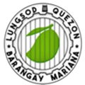
The insignia of the barangay seal is a green mango, owing to the prominence of mango trees planted along Gilmore Avenue and Broadway Avenue that were originally planted by Doña Hemady and her laborers. [7] [6]

Related Research Articles

<span class="mw-page-title-main">Quezon City</span> Highly urbanized city in Metro Manila, Philippines

Quezon City, also known as the City of Quezon and Q.C., is the most populous city in the Philippines. According to the 2020 census, it has a population of 2,960,048 people. It was founded on October 12, 1939, and was named after Manuel L. Quezon, the second president of the Philippines.

<span class="mw-page-title-main">EDSA</span> Limited-access circumferential highway around Metro Manila

Epifanio de los Santos Avenue, commonly referred to by its acronym EDSA, is a limited-access circumferential highway around Manila, the capital city of the Philippines. It passes through 6 of Metro Manila's 17 local government units or cities, namely, from north to south, Caloocan, Quezon City, San Juan, Mandaluyong, Makati, and Pasay.

<span class="mw-page-title-main">Pan-Philippine Highway</span> Highway in the Philippines traversing most of the country

The Pan-Philippine Highway, also known as the Maharlika Highway, is a network of roads, expressways, bridges, and ferry services that connect the islands of Luzon, Samar, Leyte, and Mindanao in the Philippines, serving as the country's principal transport backbone. Measuring 3,379.73 kilometers (2,100.07 mi) long excluding sea routes not counted by highway milestones, it is the longest road in the Philippines that forms the country's north–south backbone component of National Route 1 (N1) of the Philippine highway network. The entire highway is designated as Asian Highway 26 (AH26) of the Asian Highway Network.

<span class="mw-page-title-main">Balete Drive</span> Street in Quezon City, Philippines

Balete Drive is an undivided, two-lane street and the main thoroughfare of New Manila, Quezon City, Philippines. The road is a major route for jeepneys and cabs, serving the New Manila area and connecting Eulogio Rodriguez Sr. Avenue and Nicanor Domingo Street in Quezon City.

<span class="mw-page-title-main">St. Paul University Quezon City</span> Private coeducational university

St. Paul University Quezon City, also referred to as SPUQC or SPU Quezon City, is a private, sectarian and coeducational university located in New Manila, Quezon City. It was previously an all-girls' school and turned co-ed beginning school year 2006-2007.

<span class="mw-page-title-main">Gilmore station (LRT)</span> LRT Line 2 station in Quezon City

Gilmore station is an elevated Manila Light Rail Transit (LRT) station situated on Line 2. It is located near Gilmore Avenue, Quezon City in Mariana, Quezon City. It is named after the nearby Gilmore Avenue, which in turn is named for Eugene Allen Gilmore, Vice Governor-General of the Philippines from 1922 to 1929 who twice served as acting Governor-General of the Philippines.

Burger Machine is a Filipino chain of fast-food restaurants owned by the Burger Machine Holdings Corporation, a sub-company of the Philippine-based Gilmore Food Corporation.

<span class="mw-page-title-main">Gilmore Avenue (Quezon City)</span>

Gilmore Avenue, formerly known as Gilmore Street, is a two-lane, one-way road in Quezon City, Metro Manila, the Philippines. It runs one-way from Eulogio Rodriguez Sr. Avenue in New Manila and terminates at Nicanor Domingo Street in Valencia, continuing on as the two-way Granada Street until it reaches the city border with San Juan, where it becomes Ortigas Avenue.

<span class="mw-page-title-main">Katipunan Avenue</span>

Katipunan Avenue is a major avenue in Quezon City, Metro Manila, Philippines. It runs in a north–south direction from the University of the Philippines Diliman, intersecting with Tandang Sora Avenue at its northernmost point, down to the Manila Philippines Temple of the Church of Jesus Christ of Latter-day Saints, intersecting with White Plains Avenue at its southernmost point.

<span class="mw-page-title-main">San Juan River (Metro Manila)</span> Major tributary of the Pasig River

The San Juan River is one of the main river systems in Metro Manila, Philippines, and is a major tributary of the Pasig River. It begins near La Mesa Dam as the San Francisco del Monte River, which officially takes the name San Juan River when it meets with Mariblo Creek in Quezon City. As the San Juan River, it passes through Quezon City, San Juan, the Manila district of Santa Mesa and Santa Ana, and Mandaluyong.

<span class="mw-page-title-main">Aurora Boulevard</span> Road in the Philippines

Aurora Boulevard is a four-to-ten lane major thoroughfare in Quezon City and San Juan in Metro Manila, Philippines. It was named after Doña Aurora Quezon, the consort of Commonwealth President Manuel Luis Quezon. It is one of the major roads in the commercial district of Araneta City in Cubao. Line 2 follows the alignment of the boulevard.

<span class="mw-page-title-main">Gregorio Araneta Avenue</span>

Gregorio Araneta Avenue is a suburban arterial road in the Santa Mesa Heights area of Quezon City, northeastern Metro Manila, Philippines. Built in 1985, it is a 6- to 8-lane divided avenue designated as part of Circumferential Road 3 (C-3) and a physical continuation of Sergeant Rivera Street which travels from Santo Domingo Avenue at its north end near Balintawak in Quezon City, and meets N. Domingo Street in the south in San Juan near the border with Santa Mesa, Manila. En route, it intersects with Del Monte Avenue, Quezon Avenue, Eulogio Rodriguez Sr. Avenue and Magsaysay-Aurora Boulevard passing through barangays Balingasa, Manresa, Masambong, Sienna, Santo Domingo, Talayan, Tatalon, Santol, and Doña Imelda in Quezon City and Progreso in San Juan.

<span class="mw-page-title-main">Betty Go-Belmonte Street</span>

Betty Go-Belmonte Street is a street running through the New Manila district of Quezon City, Philippines. It is a notable road in a generally northwest-southeast orientation between the junction with E. Rodriguez Sr. Avenue in New Manila and the junction with N. Domingo Street also in New Manila. It is served by Betty Go-Belmonte station of the Manila Line 2.

<span class="mw-page-title-main">Tomas Morato Avenue</span>

Tomas Morato Avenue is a street located in Quezon City within the Diliman and New Manila areas of northeastern Metro Manila, Philippines. The street links Eulogio Rodriguez Sr. Avenue in the village of Mariana in the south with Eugenio Lopez Drive in South Triangle in the north, and passes through Barangays Sacred Heart, Laging Handa, Kamuning, Obrero, and Kristong Hari. It was named after the first mayor of Quezon City.

<span class="mw-page-title-main">Index of Metro Manila–related articles</span>

The following is an alphabetical list of articles related to the Philippine capital region of Metro Manila.

<span class="mw-page-title-main">Bungad</span> Barangay in Quezon City, Metro Manila, Philippines

Bungad is an administrative division in eastern Metro Manila, the Philippines.

<span class="mw-page-title-main">Balingasa</span> Barangay in Quezon City, Metro Manila, Philippines

Balingasa, commonly known as Balintawak and Cloverleaf, is an administrative division in eastern Metro Manila, the Philippines. It is an urban barangay located in Quezon City, at the city's western boundary with Caloocan.

<span class="mw-page-title-main">Mount Carmel Shrine (Quezon City)</span> Roman Catholic church in Quezon City, Philippines

Mount Carmel Shrine, formally the Minor Basilica of the National Shrine of Our Lady of Mount Carmel, is a Roman Catholic minor basilica and national shrine located in Barangay Mariana, Quezon City, Metro Manila in the Philippines. Dedicated to Our Lady of Mount Carmel, the church opened in 1964 after a decade of construction. It was declared a parish church in 1975 and a national shrine in 2015. In 2019, it was declared a minor basilica, making it the fifteenth minor basilica in the country.

References

  1. 1 2 3 "QC : Barangay Profiles". Quezon City Public Library. Archived from the original on 2013-03-14. Retrieved 2021-11-06.
  2. "Quezon City Barangay Officials". Quezon City Government. Retrieved 2021-11-06.
  3. 1 2 "2020 Census of Population and Housing (2020 CPH) Population Counts Declared Official by the President". Philippine Statistics Authority . July 7, 2021. Retrieved November 6, 2021.
  4. "Quezon City Postal Code Metro Manila". 2019-09-12. Retrieved 2021-11-06.
  5. Comprehensive Land Use Plan 2011-2025 (PDF). Quezon City Government. 2011. pp. Annex 5.1 pages 6–7.
  6. 1 2 3 4 5 6 7 8 "Generations of Prestige: Unraveling the Heritage of New Manila". One Balete. 2016-07-19. Retrieved 2022-06-29.
  7. 1 2 3 4 5 History of QC Barangays: Journey to Early Beginnings of Quezon City Barangays. Vol. 1. Quezon City: Quezon City Public Library. 2019.
  8. "The Developer". Ortigas Properties. Retrieved 2021-09-21.
  9. Flores, Wilson (2005-12-19). "The Ortigas clan stages a business comeback". The Philippine Star. Retrieved 2021-09-21.
  10. 1 2 Ysmael, Rosary (December 19, 2020). "Doña Hemady—my great grand 'lola', not the street" . Retrieved October 18, 2022.
  11. "Why SPUQC is a Recognized LEADER in Education". St. Paul University Quezon City. Retrieved 2022-06-29.
  12. "History". Jubilee Christian Academy. Retrieved 2022-06-29.
  13. Francisco, Butch (2015-12-13). "QC's Mt. Carmel church now a national shrine". INQUIRER.net. Retrieved 2022-06-29.
  14. "ST. LUKE'S THROUGH THE YEARS: A TRADITION OF EXCELLENCE". www.stlukes.com.ph. Retrieved 2022-06-29.
  15. 1 2 Alcazaren, Paulo. "The suburbs of Quezon City". Philstar.com. Retrieved 2021-11-28.
  16. 1 2 3 4 5 2011-2025 Quezon City Comprehensive Land Use Plan (PDF). Quezon City: Quezon City Government. 2011.
  17. Andrade, Jeannette (November 16, 2012). "Quezon City gov't to destroy, rebuild Quezon house". Philippine Daily Inquirer . Retrieved August 22, 2022.
  18. Mateo, Janvic (October 23, 2013). "QC officials inaugurate Quezon heritage house". The Philippine Star . Retrieved August 22, 2022.
  19. Quezon City 2018 Ecological Profile (PDF). Quezon City: Quezon City Government. 2018.
  20. "Quezon City QCity Bus Service". Quezon City Government. May 31, 2021. Retrieved September 28, 2022.
  21. "The story behind Sta. Mesa, Manila's 'Stop & Shop'". InqPOP!. 2021-02-08. Retrieved 2021-12-20.
  22. "Parang - Cubao — Sakay Route Explorer". explore.sakay.ph. Retrieved 2021-12-20.
  23. "Materials Recovery Facility MRF" . Retrieved 2021-11-06.
  24. "Population of the National Capital Region (Based on the 2015 Census of Population)". Philippine Statistics Authority . May 31, 2016. Retrieved November 6, 2021.