Santa Cruz | |
|---|---|
District of Manila | |
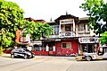
 Plaza Santa Cruz with Carriedo Fountain and Santa Cruz Church | |
 Map of Manila showing the location of Santa Cruz | |
 | |
| Coordinates: 14°35′59″N120°58′49″E / 14.5998366°N 120.9801955°E | |
| Country | Philippines |
| Region | National Capital Region |
| City | Manila |
| District | Part of the 3rd district of Manila |
| Barangays | 82 |
| Area | |
• Total | 3.0901 km2 (1.1931 sq mi) |
| Population (2020) [1] | |
• Total | 126,735 |
| • Density | 41,000/km2 (110,000/sq mi) |
| Time zone | UTC+08:00 (Philippine Standard Time) |
| Zip codes | 1003 (Santa Cruz South) 1014 (Santa Cruz North) |
| Area codes | 02 |
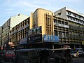
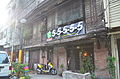
Santa Cruz is a district in the northern part of the City of Manila, Philippines, located on the right bank of the Pasig River near its mouth, bordered by the districts of Tondo, Binondo, Quiapo, and Sampaloc, as well as the areas of Grace Park and Barrio San Jose in Caloocan and the district of La Loma in Quezon City. The district belongs to the 3rd congressional district of Manila.