
Pateros, officially the Municipality of Pateros, is the lone municipality of Metro Manila, Philippines. According to the 2020 census, it has a population of 65,227 people.

Taguig, officially the City of Taguig, is the fifth-most populous city in the Philippines situated in eastern shores of Metro Manila, the national capital region. It is a center for culture, finance, technology, entertainment and media, academics, and the arts and fashion. The city hosts several embassies, making it an important center for the country's international diplomacy. As the home of Bonifacio Global City, major multinational corporations have their headquarters in the city, and it has the fourth largest skyline in the Philippines, with 289 high-rises, 80 of which exceed 100 m (328 ft).

Teresa, officially the Municipality of Teresa, is a municipality in the province of Rizal, Philippines. According to the 2020 census, it has a population of 64,072 people.

Mabalacat, officially City of Mabalacat, is a component city in the province of Pampanga, Philippines. According to the 2020 census, it has a population of 293,244 people.

Padre Garcia, officially the Municipality of Padre Garcia, is a municipality in the province of Batangas, Philippines. According to the 2020 census, it has a population of 51,853 people.

Rizal, officially the Municipality of Rizal, is a municipality in the province of Zamboanga del Norte, Philippines. According to the 2020 census, it has a population of 15,052 people.

Rizal, officially the Municipality of Rizal, is a municipality in the province of Occidental Mindoro, Philippines. According to the 2020 census, it has a population of 40,429 people.

Guiguinto, officially the Municipality of Guiguinto, is a municipality in the province of Bulacan, Philippines. According to the 2020 census, it has a population of 113,415 people.

Bamban, officially the Municipality of Bamban, is a municipality in the province of Tarlac, Philippines. According to the 2020 census, it has a population of 78,260 people.

Lucban, officially the Municipality of Lucban, is a municipality in the province of Quezon, Philippines. According to the 2020 census, it has a population of 53,091 people.
Roxas, officially the Municipality of Roxas, is a municipality in the province of Palawan, Philippines. According to the 2020 census, it has a population of 69,624 people.

Tabontabon, officially the Municipality of Tabontabon, is a municipality in the province of Leyte, Philippines. According to the 2020 census, it has a population of 11,902 people.
Llanera, officially the Municipality of Llanera, is a municipality in the province of Nueva Ecija, Philippines. According to the 2020 census, it has a population of 42,281 people.

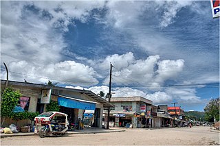
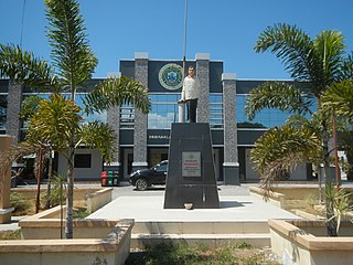
Rizal, officially the Municipality of Rizal is a municipality in the province of Nueva Ecija, Philippines. According to the 2020 census, it has a population of 70,196 people.

Central Signal Village, officially Barangay Central Signal Village and simply known as Central Signal, is one of the 38 barangays of Taguig, Philippines. As of the 2020 census, the population was 44,126. The barangay was previously known as EM's Signal Barrio on January 25, 1965, and was created as Signal Village in 1972, before it was renamed on December 28, 2008.

Tuktukan is one of the 38 barangays of Taguig, Philippines. Since 1958, it is the center of the city (poblacion) as it is the location of the Taguig City Hall.

Napindan, officially Barangay Napindan, is one of the 38 barangays of Taguig, Metro Manila, Philippines. As of the 2020 census, the population was 24,437. It was one of the earlier barrios that was added to Taguig during the Spanish colonial period.

Taguig–Pateros's 1st congressional district is one of the two congressional districts of the Philippines in the combined independent local government units of Pateros and Taguig. It has been represented in the House of Representatives of the Philippines since 2007. The district was created in 2004 following a plebiscite to ratify Republic Act No. 8487 or the 1998 Taguig City Charter. It consists of the entire municipality of Pateros and the eastern Taguig barangays of Bagumbayan, Bambang, Calzada, Comembo, Hagonoy, Ibayo-Tipas, Ligid-Tipas, Lower Bicutan, New Lower Bicutan, Napindan, Palingon, Pembo, Rizal, San Miguel, Santa Ana, Tuktukan, Ususan and Wawa. The district is currently represented in the 19th Congress by Ricardo S. Cruz Jr. of the Nacionalista Party (NP).

Ususan is one of the 38 barangays of Taguig, Philippines. As of 2020, it has a population of 53,956 people.

Hagonoy, officially Barangay Hagonoy, is one of the 38 barangays of Taguig, Metro Manila, Philippines. As of the 2020 census, the population was 21,693. It had since existed before the arrival of Spaniards to the country and was originally one of the nine barrios that formed Taguig after the latter was established on April 25, 1587.


