Port Area, Manila

Last updated

Port Area
Port District
South Port District
District of Manila
Manila Port Area, Customs (Manila; 06-13-2019).jpg
Aerial view of Port Area with Customs House
Ph fil manila port area.png
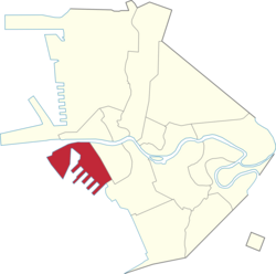
Map of Manila showing the location of Port Area
Port Area, Manila
Coordinates: 14°35′19″N120°58′07″E / 14.588726°N 120.968597°E / 14.588726; 120.968597
Country Philippines
Region National Capital Region
City Manila
DistrictPart of the 5th district of Manila
Barangays 5
Area
  Total3.1528 km2 (1.2173 sq mi)
Population
 (2020) [1]
  Total72,605
  Density23,000/km2 (60,000/sq mi)
Time zone UTC+08:00 (Philippine Standard Time)
ZIP code
1018 (Port Area South)
Area code 2

The Port Area, also known as Port District and South Port District, [2] [3] is a district of the city of Manila, Philippines. It is entirely a reclaimed land occupied by Manila South Harbor and Baseco Compound. It is bounded on the north by the Pasig River, facing the districts of Tondo and San Nicolas, on the west by Manila Bay, on the east by Intramuros, separated by Radial Road 1, and on the south by Ermita. Post-war developments at the Manila South Harbor eventually paved the way for the migration of people from the different provinces, making it one of the largest urban poor community in the Philippines.

Contents

History

Port Area in May 1958 Aerial view of Manila, Philippines, in May 1958.jpg
Port Area in May 1958

Port Area, historically known as Port District, [4] was built on reclaimed land in the 1890s, toward the end of the Spanish rule, as an expansion of the Port of Manila. [5] [6] [7] In 1914, administrative oversight of the district was transferred to the Insular Collector of Customs (now Bureau of Customs). [8] Subsequently, in 1949, revisions to the Manila city charter resulted in the formal and explicit inclusion of Port Area as part of the newly established 4th district. [9] It was later transferred to the 5th district in 1987, following the restoration of the bicameral Congress.

In the late 1970s, the urban poor were resettled to Baseco Compound, originally a dockyard of the National Shipyard and Steel Corporation (NASSCO) that was acquired by the Romualdez family in 1966, to make space for a potential international seaport. Baseco was declared a barangay in the 1980s. Following the 1986 People Power Revolution, the property was sequestered, leading to further resettlement and its proclamation as a residential site in 2002. [10]

Barangays

The district of Port Area is made up of 5 barangays, numbered 649 to 653. Barangay 649 contains the Engineer's Island, now informally known as the Baseco Compound. The Island is regarded as one of the biggest urban poor communities in the Philippines. All barangays of Port Area belong to Zone 68 of the City of Manila.

Zone/BarangayLand areaPopulation (2020)
Barangay 649 1.102 km264,750
Barangay 6500.1059 km25,202
Barangay 6510.1738 km22,556
Barangay 6520.09513 km239
Barangay 6530.2958 km258

Related Research Articles

<span class="mw-page-title-main">San Jose del Monte</span> Component city in Bulacan, Philippines

San Jose del Monte, officially the City of San Jose del Monte, is a 1st class component city in the province of Bulacan, Philippines. According to the 2020 census, it has a population of 651,813 people, making it the largest local government unit within the province of Bulacan and Central Luzon, and the 18th most populated city in the Philippines.

<span class="mw-page-title-main">Ermita</span> District of Manila, Metro Manila, Philippines

Ermita is a district in Manila, Philippines. Located at the central part of the city, the district is a significant center of finance, education, culture, and commerce. Ermita serves as the civic center of the city, bearing the seat of city government and a large portion of the area's employment, business, and entertainment activities.

<span class="mw-page-title-main">Cavite City</span> Component city in Cavite, Philippines

Cavite City, officially the City of Cavite, is a 2nd class component city in the Philippines. According to the 2020 census, it has a population of 100,674 people.

<span class="mw-page-title-main">Rizal Park</span> Historic urban park in Manila, Philippines

Rizal Park, also known as Luneta Park or simply Luneta, is a historic urban park located in Ermita, Manila. It is considered one of the largest urban parks in the Philippines, covering an area of 58 hectares. The site on where the park is situated was originally known as Bagumbayan during the Spanish colonial period. It is adjacent to the historic Walled City of Intramuros.

<span class="mw-page-title-main">San Carlos, Negros Occidental</span> Component city in the Philippines

San Carlos, officially the City of San Carlos, is a second-class component city in the province of Negros Occidental in the Philippines. According to the 2020 census, it has a population of 132,650 people.

<span class="mw-page-title-main">Jose Panganiban, Camarines Norte</span> Municipality in Camarines Norte, Philippines

Jose Panganiban, officially the Municipality of Jose Panganiban, is a 2nd class municipality in the province of Camarines Norte, Philippines. According to the 2020 census, it has a population of 63,662 people.

<span class="mw-page-title-main">Ubay, Bohol</span> Municipality in Bohol, Philippines

Ubay, officially the Municipality of Ubay, is a fast growing 1st class municipality in the province of Bohol, Philippines. Based on the 2020 Philippine Statistics Authority census, it has a population of 81,799 people which is projected to grow to 100,000 in 2030.

<span class="mw-page-title-main">San Andres, Manila</span> District of Manila, Metro Manila, Philippines

San Andres is a district of Manila, Philippines. San Andres shares the Estero Tripa de Gallina as its western and northern border with the districts of Malate and Paco, respectively and Pedro Gil and Tejeron streets to the east with the district of Santa Ana. It borders the cities of Pasay and Makati in the south. The area is under the jurisdiction of the Fifth Congressional District of Manila, and includes the Manila South Cemetery, an exclave of the city surrounded by land administered by Makati.

<span class="mw-page-title-main">Quezon Boulevard</span>

Quezon Boulevard is a short stretch of highway in Manila, Philippines running north–south through the district of Quiapo. It is a six- to ten-lane 1.1-kilometer-long (0.68 mi) divided boulevard designated as a component of National Route 170 (N170) of the Philippine highway network, except for its service roads, and Radial Road 8 (R-8) of Manila's arterial road network which links the center of Manila to North Luzon Expressway in Quezon City in the north. The boulevard is the main access to the popular Quiapo Church and is one of the main thoroughfares of the University Belt area.

<span class="mw-page-title-main">United Nations Avenue</span> Avenue in Manila, Philippines

United Nations Avenue is a major thoroughfare in Manila, Philippines. A commercial, residential and industrial artery, the avenue runs east–west through the near-center of the city linking Ermita and Rizal Park with the eastern districts. It is home to the World Health Organization Western Pacific headquarters.

<span class="mw-page-title-main">Pedro Gil Street</span> Street in Manila, Philippines

Pedro Gil Street is an east-west inner city street and a tertiary national road in south-central Manila, Philippines. It is 3.65 kilometers (2.27 mi) long and spans the entire length of Ermita, Malate, Paco, and Santa Ana. The street is served by the Pedro Gil LRT Station along Taft Avenue and the Paco railway station along Quirino Avenue. It also continues towards the central Metro Manila cities of Mandaluyong and San Juan across the Pasig River as New Panaderos and General Kalentong Streets.

<span class="mw-page-title-main">Bonifacio Drive</span> Major road in Manila, Philippines

Bonifacio Drive is a road running for approximately 1 kilometer (0.62 mi) in a north-south direction between Intramuros and Port Area in Manila, Philippines. The boulevard is also designated as Radial Road 1 (R-1) of Manila's arterial road network, National Route 120 (N120) of the Philippine highway network and an auxiliary route of Asian Highway 26 (AH26).

<span class="mw-page-title-main">Mel Lopez Boulevard</span> Major street in Metro Manila, Philippines

Mel Lopez Boulevard, formerly known as President Ferdinand E. Marcos Highway or simply as Marcos Road, is a 6.2-kilometer (3.9 mi), six-to-ten lane divided highway in northern Manila, Philippines, connecting Bonifacio Drive in Port Area and Intramuros in the south with Radial Road 10 (R-10) in Navotas in the north. The highway is the main component of the R-10 network, which runs north of the Pasig River until Anda Circle, and is an extension of Bonifacio Drive, running north–south through the Manila North Port area serving the coastal districts of Tondo and Port Area, as well as San Nicolas and Intramuros.

<span class="mw-page-title-main">North Bay Boulevard</span>

North Bay Boulevard is a 2.34-kilometer-long (1.45 mi) two- to four-lane access road in the Navotas Fish Port Complex of northern Metro Manila, Philippines. It is one of the main roads in Navotas which travels north-south through the southern parts of the city running parallel to Radial Road 10 (R-10) to the west. The road links the Balut area of Tondo in Manila and San Rafael Village in the south to the central Navotas barangay of Bagumbayan South in the north. It was named after its location in Manila Bay north of the Manila North Harbor complex.

<span class="mw-page-title-main">Bureau of Customs</span> Agency of the Philippine government

The Bureau of Customs is a Filipino government agency that is responsible for the collecting of customs duties, excise duties, and other indirect taxes in the Philippines. It is part of the Philippines Department of Finance.

<span class="mw-page-title-main">Tambo, Parañaque</span> Barangay in Parañaque, Metro Manila, Philippines

Tambo is an administrative division in southern Metro Manila, the Philippines. It is a coastal barangay in the city of Parañaque situated just south of Baclaran adjoining Ninoy Aquino International Airport complex to the east.

<span class="mw-page-title-main">Baseco Compound</span> Barangay in National Capital Region, Philippines

Baseco, also known as the Baseco Compound or Barangay 649, Zone 68, is a barangay in Port Area, Manila. It largely consists of Engineer's Island.

<span class="mw-page-title-main">Baseco Beach</span> Beach in the Philippines

Baseco Beach is an urban beach located at Baseco Compound in Port Area, Manila, Philippines. A part of the beach was redeveloped by the city as the Baseco Park, using rehashed materials such as rehabilitated old lamp posts from other parts of the city.

<span class="mw-page-title-main">Land reclamation in Metro Manila</span>

The reclamation of land from the surrounding waters of Metro Manila is used to expand the region's limited area of usable and natural land. There are about 25 projects that aims to reclaim more than 10,000 hectares (100 km2) of land in Manila Bay from the city of Navotas to the province of Cavite. Reclamation projects have been met with opposition and criticism, especially from environmental groups.

References

  1. "2020 Census of Population and Housing Results" (PDF). Philippine Statistics Authority. August 16, 2021. Retrieved May 31, 2023.
  2. Bach, John (1920). City of Manila, Philippine Islands (Map). 1:11,000. Bureau of Commerce and Industry. Retrieved May 31, 2023.
  3. De Jesus, Domingo (1958). Table and Pocket Map Guide City of Manila Republic of the Philippines (Map). 1:24,268. Retrieved May 31, 2023.
  4. Beautiful Philippines: A Handbook of General Information. Manila Bureau of Printing. 1923. Retrieved June 3, 2024.
  5. Plano de Manila y sus arrabales 1894 [Map of Manila and its suburbs 1894] (Map). 1:5,000 (in Spanish). Manila: Lit De Chofre y Co. 1894.
  6. de Gamoneda, Francisco J. (1898). Plano de Manila y sus Arrables [Map of Manila and its suburbs] (Map). 1:10,000 (in Spanish).
  7. Gonzales, Iris (July 6, 2023). "Reclamation: the good, the bad and the ugly". The Philippine Star. Retrieved June 3, 2024.
  8. Executive Order No. 26 (April 15, 1914), Placing the new port district, city of Manila, under the supervision and control of the Insular Collector of Customs
  9. Republic Act No. 409 (June 18, 1949), An act to revise the charter of the City of Manila, and for other purposes, Official Gazette of the Republic of the Philippines , retrieved February 3, 2024
  10. Murphy, Dennis. "Baseco and Its Proclamation" (PDF). Ombudsman of the Philippines. Retrieved August 7, 2019.