Payatas

Last updated
Payatas
Barangay 8
Barangay
860Roads Payatas Bagong Silangan Quezon City Landmarks 45.jpg
Street of the barangay
Payatas logo.png
Ph quezon city payatas.png
Map of Quezon City showing Payatas
Metro Manila location map.svg
Red pog.svg
Payatas
Location of Payatas within Metro Manila Payatas
Coordinates: 14°42′35.6″N121°5′58.8″E / 14.709889°N 121.099667°E / 14.709889; 121.099667
Country Philippines
Region National Capital Region
City Quezon City
District 2nd District of Quezon City
Established1976
Government
  Type Barangay
  Barangay CaptainManny N. Guarin [1]
Area
  Total7.74 km2 (2.98 sq mi)
Population
  Total139,740 (as of 2,020)
Time zone UTC+8 (PST)
Postal Code
1119
Area code 2
Website Facebook

Payatas is an administrative division in eastern Metro Manila, the Philippines. It is an urban barangay located in the 2nd district of Quezon City [2] adjacent to the barangays of Commonwealth, Batasan Hills and Bagong Silangan.

Contents

Etymology

The name Payatas derived from the word payat sa taas (lit.'thin at the top'), which describes the soil located in the upper part of Tullahan River, unsuitable for planting rice. [3]

History

Payatas was part of San Mateo, Rizal until it was ceded to Quezon City in 1949. [4]

On July 4, 1974, pursuant to Presidential Decree No. 86 [5] as amended Presidential Decree No. 86-A, [6] portion of the community known as ZONE 108 – Commonwealth in Quezon City, which is not a barrio but, having sufficient population and definite jurisdiction, organized itself into a barangay known as Barangay No. 8 and elected an official who took their oath before Hon. Eduardo Soliman Jr.

On September 21, 1974, Presidential Decree No. 557 [7] was promulgated, declaring among other things that in the case of Manila and other chartered cities with no barrios, all existing barangay therein created under Presidential Decree No. 86 as amended by Presidential Decree No. 86-A shall continue as barangays and adopt Republic Act No. 3590.

On June 22, 1975, Resolution No. 75-12 was passed by Barangay Zone 108 consolidating or merging all barangays within the Commonwealth area, including that of Barangay No. 8 (Payatas), resulting in the abolition of the corporate existence and personality of the latter.

In 1976, Barangay Captain Inocencio Deyro of the Barangay Commonwealth, constituted under Resolution No. 75-12 which was already null and void, called a meeting to take place on June 6, 1976. Among the items on the agenda is the appointment of Purok Leaders in Barangay No. 8 (Payatas), seeking to perform an act affecting Barangay No. 8 (Payatas) that is a defiance of the clarification order of the Hon. Judge Augusto L. Valencia. On October 14, Judge Jaime R. Agloro rendered his decision in Special Civil Case No. Q-21577, prohibiting that the respondents, Barangay Captain Inocencio Deyro and the Barangay Commonwealth, interfere with the powers, duties and functions of Barangay No. 8 (Payatas). Barangay No. 8, now called Payatas, was created with definite territorial jurisdiction as confirmed by Judge Augusto L. Valencia in his order dated March 5, 1976. Payatas is the only barangay to date that was created through judicial process.

Demography

As of 2015, children aged 5 to 9 years are the largest age group, making up 11.0 percent of the population. This is followed by those in the age groups 15 to 19 years (10.7 percent), 0 to 4 years and 10 to 14 years (each 10.6 percent).

Males outnumber females in the age group 0 to 54 years and females outnumber males in the age group 55 years old and over. [8]

Community

The population of Barangay Payatas was almost 130,333 in 2015. [8] Most of the residents fall below the poverty level, living under harsh conditions in depressed areas. Payatas has the fastest-growing population in the city. Residents comprise various ethnic groups, the majority from the Northern Luzon. They include Ilokanos, Pangasinan, Novo Ecijanos, Tagalogs, Kapampangan and a small percentage of Ibanags, Itawis and members of Igorot tribes. There are also migrants from Southern-Tagalog parts: Bicolanos, Visayas, Mindanao Region and a small percentage of Muslims.

The main language is Tagalog. English is widely spoken. Waray, Ilonggo, Visaya, Bicol, Ilokano, Pangasinense and Kapampangan are secondary languages commonly used.

Christianity is dominant; most of the Christians are Roman Catholics. There are also a small number of Muslims, Iglesia ni Cristo, Protestants (El Shaddai, Shalom, Born Again, Mormons, Seventh Day Adventists, etc.) and Aglipays.

Most residents lives in semi-concrete homes, with those living near the dumpsite augmenting their houses or shanties with scavenged materials.

While a portion of the area has been developed into residential subdivisions (Don Carlos Heights, Manila Remnants, Doña Nicasia, Empire Subdivision, Capitol Homes II, Amlac Ville Subd., Violago Homes Parkwood Subd., Madrigal Subd., Manahan Subd., Fil-Invest II Mountain View, Villa Gracia Homes, etc.), vast stretches of land remain either underdeveloped or undeveloped because of poor access and lack of services. Many of those areas have evolved into squatter colonies. Areas may contain a mixture of housing sites, commercial and business centers, light industries, civic centers, educational areas and recreational parks.

Transportation

Public utility vehicles

Jeepneys serve as public transport in the northern areas via Gravel Pit Road plying either Lupang Pangako or Montalban. Approximately 60 units ply these routes. Fare varies depending on distance. There is only one existing jeepney Operators and Drivers Association, which is the Lupang Pangako JODA office.

Tricycles service all other parts of Payatas. There are four registered Tricycle Operators and Drivers Associations, with almost 1,000 units operating from Area A, Area B and Urban Lupang Pangako:

Some residents use their own vehicles.

Roads

Payatas Road is basically the service road for the NGC area but also serves as the main access road to properties situated in the central areas, such as Ilang-Ilang Street to Campsite, Sampaguita Street to Brgy. Bagong Silangan and Everlasting Street to Lower Hasmin.

Gravel Pit Road, originally part of the peripheral road of La Mesa Reservoir, now serves as the sole public road of Northern Payatas Area.

Proposed C-6 is a metro toll way facility that is expected to traverse the area. It is still under study as to its alignment by the PNCC as BOT Project of the DOTC.

Collector roads branch out from the primary roads extending the network into the inner areas. These are mostly Barangay main roads like the following:

  1. Ilang-Ilang Streets linking to San Juan Bautista Street and Spiritual road at Campsite Area
  2. Sampaguita Street going to Springfield area and part of San Vicente Street also at Campsite
  3. Everlasting Street to Hasmin Street, Lower Hasmin Street going to gravel Pit Road, Payatas B
  4. Molave street connecting at Litex Road, going to Lower Molave, Tahanan Rehabilitation, Atis Roads going to Spiritual and San Juan Bautista Street at Campsite
  5. Madja-as Avenue going into inner Group 2 composing of Mayon, Banahaw Campo Verde Street etc.
  6. Amlac Ville Subdivision private road, the main road going to Urban Lupang Pangako, including Phase 1, II, III and Phase IV, Payatas B

The provision of utility services such as electricity, water, public transport and communication relies on the improvement and repairs of access roads.

Drainage and sewage

Payatas is drained principally by the Marikina River Basin, with the Marikina River as the main drainage out fall.

Developed areas such as residential subdivisions have their own drainage network or man-made canals or pipe grids discharging into rivers and creeks.

Toilet facilities and individual septic tanks are mostly found in developed housing areas. In Area A, Payatas residents mostly employ water-scaled types of toilet facilities. In Lupang Pangako, and some in Area B, Payatas, 80% of the residents use open dumping for waste.

There is no area-wide sewer system for Payatas. Wastewater coming from squatter colonies is usually directly discharged on the ground.

Solid waste disposal

The Payatas Dumpsite is situated in the north, three kilometers from the Commonwealth via Litex Road. It occupies more than 13 hectares of entirely private properties. An estimated 2,000 cubic meters (924 tons) of garbage is dumped in Payatas daily . Municipalities dumping in the area are Quezon City and San Juan.

There are approximately 2,000 scavengers and 50 junk shop owners who profit from the dump site.

Residents dispose their waste through the Xerox waste management program of the Barangay Government (Garbage Collection).

Payatas dumpsite

The Payatas dumpsite in 2017, at the time of its permanent closure. Payatas Dumpsite (Quezon City)(2017-12-04).jpg
The Payatas dumpsite in 2017, at the time of its permanent closure.

Payatas is known for its former dumpsite, which closed in 2010. A landslide in the area led to the national legislation that banned open-ground dump sites in the Philippines. A more regulated dumping ground was established adjacent to the old landfill in 2011; the site closed in 2017.

In 2023 the dumpsite was converted into an urban park for cycling. [9]

Water supply

Approximately 95% of the area is served by MWSI or (Maynilad). This consists primarily of the residential areas near the IBP Road, Ilang-Ilang St., Payatas A. MWSI are laying the main line (pipes) for the area of Payatas and it is expected that the entire area will be serviced by MWSI by the end of 2000. The other 10% of residents are serviced by both public and private artesian wells, open-pit wells, spring creeks and water peddlers.

The City rations the water daily in the areas of Lupang Pangako (Phase I, II, III and IV), where most of urban poor (approximately 5,000 families) reside. This is done under SMILE Project “OPLAN Paglilingap sa Payatas”.

Other sources of drinking water include private artesian wells and water peddlers.

Manila Water owns the East La Mesa treatment plant in the Payatas. The plant provides water to the Rizal province. [10]

Sports

Payatas is a very poor area, and many foundations operate to help improve the opportunities of residents. This includes the Fairplay For All Foundation, which runs an alternative learning center, a sports center, and a cafe. Programs are run in part by locals. Several Payatas football players have represented the country in the National Youth Team and on Team Philippines in the Street Child World Cup. In total, the Payatas Football Club has won more than 40 trophies. [11]

Government

The seat of government of Payatas is located on Bulacan Street.

See also

Further reading

Related Research Articles

<span class="mw-page-title-main">Quezon City</span> Highly urbanized city in Metro Manila, Philippines

Quezon City, also known as the City of Quezon and Q.C., is the most populous city in the Philippines. According to the 2020 census, it has a population of 2,960,048 people. It was founded on October 12, 1939, and was named after Manuel L. Quezon, the second president of the Philippines.

<span class="mw-page-title-main">Rodriguez, Rizal</span> Municipality in Rizal, Philippines

Rodriguez, officially the Municipality of Rodriguez, is a 1st class urban municipality in the province of Rizal, Philippines. According to the 2020 census, it has a population of 443,954 people making it the most populous municipality in the country. Pending an affirmation through plebiscite, Republic Act No. 11812 repealed Batas Pambansa Blg. 275 and intend to revert to its original municipal name Montalban.

<span class="mw-page-title-main">Caloocan</span> Highly urbanized city in Metro Manila, Philippines

Caloocan, officially the City of Caloocan, is a 1st class highly urbanized city in Metro Manila, Philippines. According to the 2020 census, it has a population of 1,661,584 people making it the fourth-most populous city in the Philippines.

<span class="mw-page-title-main">Malabon</span> Highly urbanized city in Metro Manila, Philippines

Malabon, officially the City of Malabon, is a 1st class highly urbanized city in the National Capital Region of the Philippines. According to the 2020 census, it has a population of 380,522 people.

<span class="mw-page-title-main">San Mateo, Rizal</span> Municipality in Rizal, Philippines

San Mateo, officially the Municipality of San Mateo, is a 1st class urban municipality in the province of Rizal, Philippines. According to the 2020 census, it has a population of 273,306.

<span class="mw-page-title-main">Bagong Silangan</span> Barangay in Quezon City, Metro Manila, Philippines

Bagong Silangan is a barangay located in the 2nd district of Quezon City, Philippines. Nearby barangays are Commonwealth, Batasan Hills and Payatas. Separated by a river in the east, the barangay leads to the Municipality of San Mateo in the province of Rizal.

<span class="mw-page-title-main">Batasan Hills</span> Barangay in Quezon City, Metro Manila, Philippines

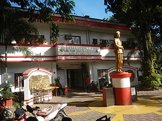
Batasan Hills is a barangay of Quezon City, Philippines. The barangay was originally planned as the National Government Center of the Philippines. The Batasang Pambansa Complex, which sits atop the Constitution Hill, is the legislative session hall of the House of Representatives of the Philippines. The Sandiganbayan, a special appellate court, is also located here.

<span class="mw-page-title-main">Batasan Road</span>

Batasan Road, is a six-to-ten lane circumferential highway located in the barangays of Batasan Hills, Bagong Silangan, Payatas, and Commonwealth, which are located all in Quezon City, Philippines. The road serves as a route towards the Batasang Pambansa Complex, where the House of Representatives of the Philippines is located.

<span class="mw-page-title-main">Greenhills, San Juan</span> Barangay in San Juan, Metro Manila, Philippines

Greenhills is an administrative division in eastern Metro Manila, the Philippines. It is an urban barangay in San Juan and is the largest barangay in the city, covering a total area of 2.09 square kilometers (209 ha) that spans over a third of San Juan's total land area.

<span class="mw-page-title-main">Katipunan Avenue</span>

Katipunan Avenue is a major avenue in Quezon City, Metro Manila, Philippines. It runs in a north–south direction from the University of the Philippines Diliman, intersecting with Tandang Sora Avenue at its northernmost point, down to the Manila Philippines Temple of the Church of Jesus Christ of Latter-day Saints, intersecting with White Plains Avenue at its southernmost point.

The Fairplay For All Foundation (FFA) is a non-stock, non-profit, non-government organization working in the community of Payatas in the Philippines. Payatas is known as the home of the country's largest open dump site. Residents are very poor and overall the area scores 0.4179 on the Human Development Index, similar to the scores of the poorest countries in the world, while the Philippines overall scores 0.74.

Slums are traditionally described as dense urban settlements, usually displaying characteristics such as crowded and compact housing units, informal delivery of utilities, and unofficial recognition by local government. In the Philippines, residents of slum areas are commonly referred to as "squatters" and have historically been subject to relocation or forced demolition. With a steadily growing metropolitan area, Metro Manila is subject to a densifying population of slum dwellers—a 2014 article states that Manila has an estimated 4 million people living in slums, out of a total population of 21.3 million.

<span class="mw-page-title-main">Bonny Serrano Avenue</span> Road in Manila, Philippines

Colonel Bonny Serrano Avenue, formerly named and still referred to as Santolan Road, is a major east–west thoroughfare in the Eastern Manila District of Metro Manila, Philippines, running between San Juan and Quezon City. It forms the northern limit of San Juan and the southern limit of Quezon City's New Manila and Cubao districts and links the Philippine National Police headquarters in Camp Crame with the Armed Forces of the Philippines headquarters in Camp Aguinaldo. The avenue runs from the border of barangays Corazón de Jesús, St. Joseph (Halo-Halo), Pasadena, and Little Baguio in San Juan in the west to barangays Libís and Blue Ridge B near Quezon City's border with Marikina in the east. It was named after the decorated Korean War hero, Venancio "Bonny" Serrano.

<span class="mw-page-title-main">West Avenue (Quezon City)</span>

West Avenue is a major road located in Quezon City within the Diliman area of northeastern Metro Manila, Philippines. It runs north–south through the western edge of the barangay of West Triangle. The street is located in Quezon City's commercial-residential area, known for its restaurants, car shops, schools, and villages. It is also home to the old Delta theater located on the avenue's junction with Quezon Avenue. The avenue is a component of National Route 171 (N171) of the Philippine highway network.

<span class="mw-page-title-main">Balingasa</span> Barangay in Quezon City, Metro Manila, Philippines

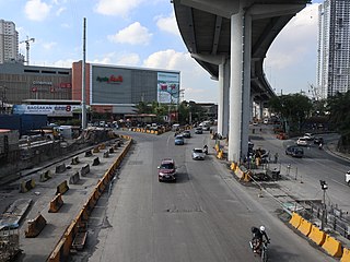
Balingasa, commonly known as Balintawak and Cloverleaf, is an administrative division in eastern Metro Manila, the Philippines. It is an urban barangay located in Quezon City, at the city's western boundary with Caloocan.

<span class="mw-page-title-main">Bagong Pag-asa</span> Barangay in Quezon City, Metro Manila, Philippines

Bagong Pag-asa, also known as the Magsaysay District, is an administrative division in eastern Metro Manila. It is an urban barangay of Quezon City with low-density housing and is known for its shopping malls, transport hubs and office buildings.

<span class="mw-page-title-main">San Martin de Porres, Parañaque</span> Barangay in Parañaque City, Metro Manila, Philippines

San Martin de Porres is an administrative division in southern Metro Manila, the Philippines. It is an elongated barangay located in the northeast corner of Parañaque adjoining the areas of Bicutan in Taguig and northern Muntinlupa. It is unique in that it is connected to the rest of Parañaque by only two bridges, one of which is a footbridge. Its western border follows the South Luzon Expressway, thus separating it from Merville, Sun Valley, Don Bosco and Marcelo Green. It neighbors Western Bicutan to the north, particularly the redevelopment area of the former Food Terminal Inc. (FTI) known as Arca South. To the east, it adjoins Taguig's barangays of Upper Bicutan, Central Bicutan, North Daang Hari and Tanyag. It neighbors South Daang Hari and Sucat, Muntinlupa to the south.

<span class="mw-page-title-main">Payatas dumpsite</span> Former open dumpsite in Quezon City, the Philippines

<span class="mw-page-title-main">Squatting in the Philippines</span> Occupation of derelict land or abandoned buildings

Urban areas in the Philippines such as Metro Manila, Metro Cebu, and Metro Davao have large informal settlements. The Philippine Statistics Authority defines a squatter, or alternatively "informal dwellers", as "One who settles on the land of another without title or right or without the owner's consent whether in urban or rural areas". Squatting is criminalized by the Urban Development and Housing Act of 1992, also known as the Lina Law. There have been various attempts to regularize squatter settlements, such as the Zonal Improvement Program and the Community Mortgage Program. In 2018, the Philippine Statistics Authority estimated that out of the country's population of about 106 million, 4.5 million were homeless.

<span class="mw-page-title-main">Mariana, Quezon City</span> Barangay in Quezon City, Metro Manila, Philippines

Mariana, is an administrative division in eastern Metro Manila, the Philippines. It is an urban barangay in Quezon City in a middle class residential and commercial area known as New Manila, which includes Barangay Mariana and the adjacent Barangay Damayang Lagi.

References

  1. "Quezon City Barangay Officials". Quezon City Government . Retrieved March 20, 2023.
  2. "Quezon City Barangays". The Local Government of Quezon City. Retrieved 22 May 2013.
  3. "Tabada: Into the Light". SunStar . March 18, 2017. Retrieved March 20, 2023.
  4. Republic Act No. 392 (18 June 1949). An Act to Amend Section Three of Commonwealth Act Numbered Five Hundred and Two, as Amended, Redefining the Boundaries of Quezon City . Retrieved June 28, 2023.{{cite book}}: |website= ignored (help)CS1 maint: numeric names: authors list (link)
  5. Presidential Decree No. 86, s. 1972 (31 December 1972). Creating Barangays (Citizens Assemblies) . Retrieved May 23, 2022.{{cite book}}: |website= ignored (help)CS1 maint: numeric names: authors list (link)
  6. Presidential Decree No. 86-A, s. 1973 (5 January 1973). Strengthening and Defining the Role of Barangays (Citizens Assemblies) . Retrieved May 23, 2022.{{cite book}}: |website= ignored (help)CS1 maint: numeric names: authors list (link)
  7. Presidential Decree No. 557 (21 September 1974). Declaring All Barrios in the Philippines as Barangays, and for Other Purposes. Government of the Philippines. Retrieved October 5, 2021.{{cite book}}: |website= ignored (help)CS1 maint: numeric names: authors list (link)
  8. 1 2 "2015 Population of Barangay Payatas, Quezon City | Philippine Statistics Authority National Capital Region". rssoncr.psa.gov.ph. Philippine Statistics Authority. Retrieved 5 October 2021.
  9. Argosino, Faith (March 3, 2023). "LOOK: QC gov't converts Payatas dumpsite into bike park". Philippine Daily Inquirer . Retrieved March 19, 2023.
  10. "Water and Used Water Facilities". Manila Water Company, Inc. Archived from the original on 5 October 2021. Retrieved 5 October 2021.
  11. "Fairplay For All Foundation". Fairplay For All Foundation. Retrieved 5 October 2021.