Santa Mesa

Last updated
Santa Mesa
District of Manila
Santa Mesa and Pandacan area, PUP campus (from Mezza 2) (Manila)(2018-05-12).jpg
Aerial view of Santa Mesa
Ph fil manila santa mesa.png
Santa Mesa
Country Philippines
Region National Capital Region
City Manila
Congressional District 6th District
Barangays 51
Area
  Total2.6101 km2 (1.0078 sq mi)
Population
 (2020) [1]
  Total111,292
  Density43,000/km2 (110,000/sq mi)
Time zone UTC+08:00 (Philippine Standard Time)
Zip codes
1016
Area codes 2

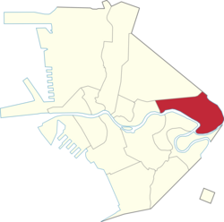
Santa Mesa is a district in Manila, Philippines. It is surrounded by the Pasig River on the southwestern side, and by the San Juan River on its southern and eastern side. Land borders include the districts of San Miguel to the west and Sampaloc to the north; and to the northeast is Quezon City.

Contents

Santa Mesa was formerly a part of the Sampaloc district, from which it was partitioned and separated after it had its own parish in 1911. The parish is now known as Old Sta. Mesa (Poblacion), which extends from Victorino Mapa Street (Calle Santa Mesa) to Magsaysay Boulevard (Santa Mesa Boulevard). [2] [3]

Etymology

The district's name comes from the Jesuits, who christened the area Hermandad de Santa Mesa de la Misericordia (Spanish for "Brotherhood of the Holy Table of Mercy"). The local parish church had for its titular Sacred Heart of Jesus, which formed part of the phrase the "Center of the Table is the Sacred Heart which all Graces and Mercy flowed down." The Tuason family are the landlords of Santa Mesa during the Spanish colonial period offered an obra pía ("pious work"), and provided social services to the people Doña Albina Tuason also donated the Land where the Church is located even right at this modern days.

A more popular folk etymology is that the name is a corruption of the Spanish term Santa Misa ("Holy Mass").[ citation needed ]

History

Wounded soldiers during the Philippine-American War. Wounded American soldiers at Santa Mesa.jpg
Wounded soldiers during the Philippine–American War.

Santa Mesa was situated in the alluvial deposits at the confluence of Pasig and San Juan Rivers. It was owned by a Jesuits religious order during the Spanish Era, and it is in this period that Santa Mesa got its name. Santa Mesa is better known for its role in the Philippine–American War, in which the area became a battlefield during the Philippine–American War. The conflict started when Pvt. William W. Grayson shot a Filipino soldier in San Juan Bridge between Santa Mesa and San Juan. In late 2003, the National Historical Commission of the Philippines had determined that the conflict did not happen on San Juan Bridge, but at the juncture of Sociego and Silencio Streets.

Up until the early American period, Santa Mesa was just one of the barrios that comprised Sampaloc, which was a town of the defunct province of Manila before it was absorbed by the city of Manila upon its chartering in 1901. [4] In 1911, Santa Mesa became a separate religious district out of Sampaloc when the first and oldest parish in the Philippines in honor of its Titular Patron, the Sacred Heart of Jesus, was established. The created parish is now known as the Old Santa Mesa, which extended from V. Mapa to Santa Mesa Boulevard. The neighborhood was composed of wealthy and aristocrats Spanish and Filipino families who built summer houses, examples of which are the Sociego Mansion, formerly home of the Tuason Family, and the Carriedo Mansion (currently known as the Antique House in Pureza), formerly home of Governor General Francisco Carriedo y Peredo who spearheaded the clean water system of the City of Manila. Affluent families where attracted to Santa Mesa's cooler climate and the picturesque streets that were lined with ylang-ylang trees along Santa Mesa Boulevard. The abundance of these trees started a perfume industry in Santa Mesa — flowers were harvested, pressed and the oil were exported in great quantities to perfumeries in France. [2]

The small community became the location of the hospital to treat the wounded during World War II. The town experienced its growth after the war. Santa Mesa was the site of a 1950s suburban development because of its proximity to Central Manila. The Santa Mesa Market was constructed around this period. It was a big shopping complex, and became popular for the selling of Post eXchange or PX Goods from U.S. bases in the Philippines that's why it was called Stop & Shop. [2]

When the Congressional Districts of Manila were created, Sta. Mesa was separated from Sampaloc, falling to the jurisdiction of the 6th District. The national census still considers Santa Mesa as a part of Sampaloc for statistical purposes.

Geography

Santa Mesa is located in the eastern section of the City of Manila. It is bounded to the west by Lacson Avenue separating it from San Miguel; by Ramon Magsaysay Boulevard to the north bordering it from Sampaloc. The northeast boundary of Santa Mesa is west of SM City Sta. Mesa shopping mall. Although the mall has "Santa Mesa" on its name, it is located in Quezon City very near the city limits of Manila. [5]

The southwestern side of Santa Mesa is along the Pasig River while the southern and eastern sides are along the San Juan River. Across the San Juan River are the cities of San Juan to the east and a small portion of Mandaluyong to the southeast. Across the Pasig River, are the Manila areas of Santa Ana to the south and Pandacan to the southeast.

The topography of the area is relatively flat as some of the natural variations in elevations have been evened out due to urbanization.

Sites of interest

The main campus of the Polytechnic University of the Philippines, seen from the air. Ph=mm=manila=santa mesa=pup mabini campus - aerial view (philippines)(2015-0703).JPG
The main campus of the Polytechnic University of the Philippines, seen from the air.

Churches

Churches of Santa Mesa
NameImageLocation / GPS CoordinatesDenominationNotes
Baptist Bible ChurchSociego Street Baptists
Gloria Dei Lutheran Church
9600Santa Mesa, Manila Landmarks 34.jpg
Old Santa Mesa Street Lutheran
Jehovah's Witness Kingdom HallOld Santa Mesa Street Jehovah's Witnesses
Nuestra Señora de Salvacion Parish Church
0614JfSanta Mesa Altrura Church Magsaysay Boulevard Sampaloc Manilafvf 08.jpg
Anonas Street cor Hipodromo Street Roman Catholic
Our Lady of Fatima Parish Church
05537jfOur Lady of Fatima Parish Church Parochial School Bacood Santa Mesa Manilafvf 13.jpg
Lubiran Street cor. Mag. Jose Abad Santos StreetRoman Catholic
Sacred Heart of Jesus Parish Church
0804JfOld Santa Mesa Sacred Heart Church School Magsaysay Boulevard Manilafvf 03.jpg
Old Santa Mesa StreetRoman Catholic
Sambahan sa Banal na Hapag (IEMELIF Church)
0949jfSambahan sa Banal na Hapag I E M E L I F Magsaysay Boulevard Santa Mesa, Manilafvf 07.jpg
Magsaysay Boulevard Methodist
Seventh-day Adventist ChurchHippodromo Street Adventist
SM Valenzuela (IEMELIF Church)Old Santa Mesa StreetMethodist
Abundant Life Ministry Inc.Teresa Street Born Again

Parks and plazas

Parks and plazas in Santa Mesa
NameImageLocation / GPS CoordinatesNotes
Bacood ParkValenzuela Street
Paraiso ng Batang MaynilaBataan cor. Leyte Streets, Bacood
PUP Lagoon
IJVPup3.jpg
PUP Mabini Campus, Anonas Street
PUP Linear Park
PUP Pasig River Linear Park.jpg
PUP Mabini Campus, Anonas Street
PUP Nemesio E. Prudente Freedom Park (Freedom Plaza)
01834jfSanta Mesa Manila Polytechnic University of the Philippinesfvf 30.jpg
PUP Mabini Campus, Anonas Street

Barangays

Santa Mesa is made up of 51 barangays. For statistical convenience for housing and population, the data for Santa Mesa is grouped with the data of Sampaloc.

Zones
Barangays
Zone/BarangayLand area (km2)Population (2020 census)
Zone 58
Barangay 5870.07333 km22,920
Barangay 587-A0.02194 km21,277
Barangay 5880.01947 km2989
Barangay 5890.03283 km2660
Barangay 5900.03619 km23,209
Barangay 5910.06667 km22,498
Barangay 5920.03228 km22,371
Barangay 5930.04383 km21,775
Zone 59
Barangay 5940.03035 km2636
Barangay 5950.04867 km24,198
Barangay 5960.02226 km22,375
Barangay 5970.03043 km21,672
Barangay 5980.07679 km212,027
Barangay 5990.03596 km24,272
Barangay 6000.06367 km25,892
Barangay 6010.1163 km27,759
Zone 60
Barangay 6020.1353 km22,000
Barangay 6030.04759 km2712
Barangay 6040.02000 km21,477
Barangay 6050.03845 km21,751
Barangay 6060.03072 km2532
Barangay 6100.02922 km2968
Barangay 6110.03176 km2808
Barangay 6120.02191 km2703
Barangay 6130.02612 km2568
Zone 61
Barangay 6070.04699 km21,782
Barangay 6080.02579 km2756
Barangay 6090.02867 km21,046
Barangay 6140.01654 km2404
Barangay 6150.02034 km21,828
Barangay 6160.03139 km2910
Barangay 6170.03125 km2921
Barangay 6180.04016 km2740
Zone 62
Barangay 6190.2010 km21,283
Barangay 6200.02244 km2725
Barangay 6210.07931 km21,787
Barangay 6220.02481 km21,197
Barangay 6230.02529 km2954
Barangay 6240.02421 km21,429
Barangay 6250.03206 km21,027
Zone 63
Barangay 6260.03282 km21,285
Barangay 6270.04027 km21,605
Barangay 6280.1839 km215,202
Barangay 6290.03937 km21,633
Barangay 6300.2551 km24,660
Zone 64
Barangay 6310.04890 km21,254
Barangay 6320.01467 km2254
Barangay 6330.01554 km2447
Barangay 6340.05924 km2
Barangay 6350.05317 km2660
Barangay 6360.08512 km22,135

Notable

Related Research Articles

<span class="mw-page-title-main">Pasig River</span> Estuary in Metro Manila, Philippines

The Pasig River is a water body in the Philippines that connects Laguna de Bay to Manila Bay. Stretching for 25.2 kilometers (15.7 mi), it bisects the Philippine capital of Manila and its surrounding urban area into northern and southern halves. Its major tributaries are the Marikina River and San Juan River. The total drainage basin of the Pasig River, including the basin of Laguna de Bay, covers 4,678 square kilometers (1,806 sq mi).

<span class="mw-page-title-main">Sampaloc, Manila</span> District of Metro Manila, Philippines

Sampaloc is a district of Manila, Philippines. It is referred to as the University Belt or simply called "U-Belt" for numerous colleges and universities are found within the district such as the University of Santo Tomas, the oldest extant university in Asia; the National University, the first private nonsectarian and coeducational institution in the Philippines; the Far Eastern University, known for its Art Deco campus and cultural heritage site of the Philippines; and the University of the East, once dubbed as the largest university in Asia in terms of enrollment. The district is bordered by the districts of Quiapo and San Miguel in the south, Santa Mesa district in the south and east, Santa Cruz district in the west and north, and Quezon City in the northeast.

<span class="mw-page-title-main">Pandacan</span> District of Manila, Metro Manila, Philippines

Pandacan is a district in Manila, Philippines which is known in recent history for its former Pandacan oil depot which supplies the majority of oil exports in the country.

<span class="mw-page-title-main">V. Mapa station</span> LRT Line 2 station in Manila

V. Mapa station is an elevated Light Rail Transit (LRT) station located on the LRT Line 2 (LRT-2) system in Sampaloc, Manila. It is one of the four stations in the line with a reserve track nearby together with Santolan, Anonas and Araneta Center–Cubao. The station during its inception was formerly called as G. Araneta station but was renamed into the current name due to the minor realignment of some stations that has caused the change of proximity to the V. Mapa Street. The station serves the areas of Santa Mesa, Manila, Quezon City, and San Juan. The station is situated at Ramon Magsaysay Boulevard, near its intersection with Victorino Mapa Street in Santa Mesa, Manila.

<span class="mw-page-title-main">Santa Cruz, Manila</span> District of Manila, Metro Manila, Philippines

Santa Cruz is a district in the northern part of the City of Manila, Philippines, located on the right bank of the Pasig River near its mouth, bordered by the districts of Tondo, Binondo, Quiapo, and Sampaloc, as well as the areas of Grace Park and Barrio San Jose in Caloocan and the district of La Loma in Quezon City. The district belongs to the 3rd congressional district of Manila.

<span class="mw-page-title-main">San Nicolas, Manila</span> District of Manila, Metro Manila, Philippines

San Nicolas is one of the sixteen districts in the city of Manila in the Philippines. It is located at the west central part of the city, on the northern bank of the Pasig River bounded by the districts of Binondo to the east by Estero de Binondo, and Tondo to the north and west, and by the Pasig River to the south. Considered as a heritage district of Manila, this community has kept its 19th-century ancestral houses, which symbolizes the wealthy lives of the people who used to live there, similar to the ancestral houses of Silay and Vigan.

<span class="mw-page-title-main">Namayan</span>

Namayan, also called Sapa, Maysapan, and sometimes Lamayan, was an independent indigenous polity on the banks of the Pasig River in the Philippines. It is believed to have achieved its peak in 1175, and to have gone into decline sometime in the 13th century, although it continued to be inhabited until the arrival of European colonizers in the 1570s.

<span class="mw-page-title-main">San Juan River (Metro Manila)</span> Major tributary of the Pasig River

The San Juan River is one of the main river systems in Metro Manila, Philippines, and is a major tributary of the Pasig River. It begins near La Mesa Dam as the San Francisco del Monte River, which officially takes the name San Juan River when it meets with Mariblo Creek in Quezon City. As the San Juan River, it passes through Quezon City, San Juan, the Manila district of Santa Mesa and Santa Ana, and Mandaluyong.

<span class="mw-page-title-main">Circumferential Road 2</span> Road in the Philippines

Circumferential Road 2 (C-2), informally known as the C-2 Road, is a network of roads and bridges that all together form the second beltway of Metro Manila in the Philippines. Spanning some 10.18 kilometers (6.33 mi), it connects the districts of Tondo, Santa Cruz, Sampaloc, San Miguel, Santa Mesa, Paco, Pandacan, and Malate in Manila.

<span class="mw-page-title-main">Magsaysay Boulevard</span>

Ramon Magsaysay Boulevard, also known simply as Magsaysay Boulevard and formerly as Santa Mesa Boulevard, is the principal artery of Santa Mesa in Manila, Philippines. It is a six-lane divided roadway that travels east–west from Gregorio Araneta Avenue near the city's border with Quezon City and San Juan to Lacson Avenue and the Nagtahan Interchange, close to the district of San Miguel. The entire length of the boulevard serves as the district boundary between Sampaloc in the north and Santa Mesa in the south with the LRTA's Line 2 running along its median. East of Gregorio Araneta, the road continues as Aurora Boulevard while west of Lacson, it extends as Legarda Street via Legarda Flyover into San Miguel and Quiapo.

<span class="mw-page-title-main">Lacson Avenue</span> Major thoroughfare in Manila, Philippines

Lacson Avenue is the principal northwest–southeast artery located in Sampaloc district in northern Manila, Philippines. It is a 6-8 lane median divided avenue that runs approximately 2.9 kilometers (1.8 mi) from Tayuman Street in Santa Cruz to Nagtahan Interchange. It is a component of Circumferential Road 2 of the Manila arterial road network and N140 of the Philippine highway network.

<span class="mw-page-title-main">Legarda Street</span> Street in Manila, Philippines

Legarda Street is a short street located in Sampaloc district in Manila, Philippines. It crosses through the eastern section of the University Belt area in a generally east–west orientation between the Nagtahan Interchange and the intersection with Nepomuceno Street in Quiapo. It is served by Legarda station of the LRTA's Line 2 system.

<span class="mw-page-title-main">Mabini Shrine (Manila)</span>

The Apolinario Mabini Shrine is a historic site in Santa Mesa, Manila, Philippines. It is noted for being the residence of Filipino military leader Apolinario Mabini who figured in the Philippine Revolution. Originally situated along the Nagtahan River, the structure was moved to the Polytechnic University of the Philippines main campus in Santa Mesa, Manila in the mid-2000s.

<span class="mw-page-title-main">Carriedo Fountain</span> Fountain in Manila, Philippines

Carriedo Fountain is a fountain in Santa Cruz, Manila, Philippines. It was built in honor of the 18th-century Capitán General of Manila, Don Francisco Carriedo y Peredo, benefactor of Manila's pipe water system. It was moved three times before its current location at Plaza Santa Cruz, right in front of the Santa Cruz Church.

<span class="mw-page-title-main">Radial Road 5</span>

Radial Road 5, more commonly referred to as R-5, is a network of roads and bridges that all together form the fifth radial road of Manila in the Philippines. The road links the City of Manila with Mandaluyong and Pasig in the east, leading out of Metro Manila into the province of Rizal and south towards Laguna. It is the only arterial road traversing the east side of Laguna de Bay.

<span class="mw-page-title-main">Index of Metro Manila–related articles</span>

The following is an alphabetical list of articles related to the Philippine capital region of Metro Manila.

<span class="mw-page-title-main">Nagtahan Interchange</span> Street junction in Manila, Philippines

The Nagtahan Interchange, also known as the Nagtahan Flyover and the Mabini Flyover, is a three-level set of three intersecting flyovers in Manila, the Philippines which serves as the junction between Lacson Avenue, Nagtahan Street, Legarda Street, Magsaysay Boulevard, and Jose P. Laurel Street, as well as the nearby Mabini Bridge.

National Route 180 (N180) is a secondary national route that forms part of the Philippine highway network, running from Cubao, Quezon City to Ermita, Manila.

References

  1. "Highlights of the Philippine Population 2015 Census of Population". Philippine Statistics Authority . Retrieved July 11, 2017.
  2. 1 2 3 Alcazaren, Paulo (June 13, 2012). "Sta. Mesa: Manila's northeastern edge". PhilStar.com. Retrieved December 10, 2021.
  3. "City of Manila, Philippine Islands". Library of Congress. Retrieved 2021-12-10.
  4. "An act to incorporate the City of Manila". Act No. 183 of July 31, 1901 . Retrieved June 6, 2022.
  5. "Metro Manila Malls - SM City Sta. Mesa". SM Prime. Retrieved on 2014-11-23.

14°36′N121°01′E / 14.600°N 121.017°E / 14.600; 121.017