Marikina Heights

Last updated

Marikina Heights
6269Marikina Heights Metro Manila Landmarks 45.jpg
Marikina Heights Barangay Hall
Marikina Heights
Metro Manila location map.svg
Red pog.svg
Marikina Heights
Coordinates: 14°39′12.2″N121°7′7.49″E / 14.653389°N 121.1187472°E / 14.653389; 121.1187472
Country Philippines
Region National Capital Region
City Marikina
District 2nd Legislative district of Marikina
Government
  Type Barangay
  Barangay CaptainMiguel Punzalan Jr.
Population
 (2012)
  Total40,967
Time zone UTC+8 (PST)
Postal Code
1810
Area code 02
Sculpted cows are placed at the park to remind the people of the place's history as a thriving hacienda decades ago. Cows Evolution Park.JPG
Sculpted cows are placed at the park to remind the people of the place's history as a thriving hacienda decades ago.

Marikina Heights is one of the largest barangays of Marikina measuring some 206 hectares (510 acres). Once a privately owned hacienda, it is now populated by 35,416 people according to the 2010 National Census. [1]

Contents

History

Before becoming a barangay in 1978, the area were once known as Sitio Mapunso and Sitio Kasuyan of Barrio Bayan-Bayanan(Present day Concepcion) and Barrio Parang(Present day Brgy. Parang and Fortune) with Champagnat Street serving as the boundary of its two mother barrios. Marikina Heights also started out as a grazing and pasture land for carabaos, cows, goats and horses. Because it was owned by the Tuason family, the Marikina Dairy Farm was established in what was now known as C&P Mall, Palmera Homes and the Tanseco Residence. [2]

A monument is placed at the Evolution Park in Marikina Heights commemorating Filipino soldiers in the Korean War. Mari-Korea Monument.JPG
A monument is placed at the Evolution Park in Marikina Heights commemorating Filipino soldiers in the Korean War.

During the Japanese occupation, Marikina Heights became a vital military location as the Imperial soldiers dug through parts of the area leading to Paliparan, Sto. Nino and Concepcion where the airfields are situated. One of the said tunnels lies underneath a police sub-station along Bayan-Bayanan Avenue. When the combined Filipino and American troops retaken in Marikina Heights was defeat by the Japanese during the Allied liberation and ended in World War II.

Due to the land's terrain which resembles the highlands of South Korea, the area also became a training ground for Filipino soldiers prior to their deployment in the Korean War, thus earning the nickname "Mari-Korea".

The late 1950s witnessed the growth of the area as the Tuasons decided to develop their landholdings into the Marikina Heights subdivision. Finally, on April 2, 1978, President Ferdinand Marcos signed the Presidential Decree No. 1489, declaring Marikina Heights as another barangay in Marikina's growing populace. [3]

Present day

Marikina Heights is now a lush barangay with abundant trees and well-maintained pocket parks such as Marikina-Yeongdo Friendship Park, Marikina-Brampton Friendship Park, Liwasang Kalayaan, Marikina Hardin ng Bayan and Marikina Heights Creekside Park.

Marikina Heights also became a runner up in the cleanest waterways in the Metro Manila for its effort on maintaining the cleanliness of the barangay's creek. The barangay also won the cleanest and greenest barangay in the Philippines during the former President Joseph Ejercito Estrada's term around 1998 to 2001.

One of the largest vacant lot in Marikina can also be seen within Marikina Heights which serves as its memory on its hilly terrain, the foothill along Champaca Street and Tanguile and in Empress 1 Subdivision and La Milagrosa Villages. Marikina's best exclusive schools are in this barangay; St. Scholastica's Academy Marikina (exclusively for women) and Marist School (exclusively for men). Ayala Malls Marikina, opened in 2017, is located here, alongside the C&B Circle Mall Marikina.

Ayala Malls Arvo at the center of Marikina Heights Ayala Malls Marikina.jpg
Ayala Malls Arvo at the center of Marikina Heights
C&B Circle Mall in Marikina Heights C&B Circle Mall.jpg
C&B Circle Mall in Marikina Heights

Marikina Heights is also now a developing community. Numerous commercial and modern residential developments have been popping up like Michelia Residences along General Ordoñez street. Executive villages are also found within the barangay such as Empress 1 Subdivision, La Milagrosa Village, Marist Village, Mansion Hills, etc.

Related Research Articles

<span class="mw-page-title-main">Rodriguez, Rizal</span> Municipality in Rizal, Philippines

Rodriguez, officially the Municipality of Rodriguez, is a 1st class urban municipality in the province of Rizal, Philippines. According to the 2020 census, it has a population of 443,954 people making it the most populous municipality in the country. Pending an affirmation through plebiscite, Republic Act No. 11812 repealed Batas Pambansa Blg. 275 and intend to revert to its original municipal name Montalban.

<span class="mw-page-title-main">Marikina</span> Highly urbanized city in Metro Manila, Philippines

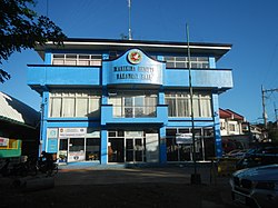
Marikina, officially the City of Marikina, is a 1st class highly urbanized city in the National Capital Region of the Philippines. According to the 2020 census, it has a population of 456,159 people.

<span class="mw-page-title-main">Caloocan</span> Highly urbanized city in Metro Manila, Philippines

Caloocan, officially the City of Caloocan, is a 1st class highly urbanized city in Metro Manila, Philippines. According to the 2020 census, it has a population of 1,661,584 people making it the fourth-most populous city in the Philippines.

<span class="mw-page-title-main">Malabon</span> Highly urbanized city in Metro Manila, Philippines

Malabon, officially the City of Malabon, is a 1st class highly urbanized city in the National Capital Region of the Philippines. According to the 2020 census, it has a population of 380,522 people.

<span class="mw-page-title-main">San Mateo, Rizal</span> Municipality in Rizal, Philippines

San Mateo, officially the Municipality of San Mateo, is a 1st class urban municipality in the province of Rizal, Philippines. According to the 2020 census, it has a population of 273,306.

<span class="mw-page-title-main">San Antonio, Nueva Ecija</span> Municipality in Nueva Ecija, Philippines

San Antonio, officially the Municipality of San Antonio, is a 1st class municipality in the province of Nueva Ecija, Philippines. According to the 2020 census, it has a population of 83,060 people.

<span class="mw-page-title-main">Puerto Princesa</span> Capital and largest highly urbanized city of Palawan, Philippines

Puerto Princesa, officially the City of Puerto Princesa, is a 1st class highly urbanized city in the Mimaropa region of the Philippines. According to the 2020 census, it has a population of 307,079 people.

<span class="mw-page-title-main">Marikina River</span> River in Calabarzon, Philippines

The Marikina River is a river in eastern Metro Manila, Philippines. It is the largest tributary of the Pasig River, with headwaters located in the Sierra Madre Mountains in Rodriguez, Rizal province.

<span class="mw-page-title-main">Bagong Silangan</span> Barangay in Quezon City, Metro Manila, Philippines

Bagong Silangan is a barangay located in the 2nd district of Quezon City, Philippines. Nearby barangays are Commonwealth, Batasan Hills and Payatas. Separated by a river in the east, the barangay leads to the Municipality of San Mateo in the province of Rizal.

<span class="mw-page-title-main">Barangka</span> Barangay in Marikina City, Metro Manila, Philippines

Barangka is an administrative division of Marikina, Metro Manila, the Philippines. It is an urban barangay part of the 1st district of Marikina and is one of the oldest barangays in Marikina.

<span class="mw-page-title-main">Batasan Hills</span> Barangay in Quezon City, Metro Manila, Philippines

Batasan Hills is a barangay of Quezon City, Philippines. The barangay was originally planned as the National Government Center of the Philippines. The Batasang Pambansa Complex, which sits atop the Constitution Hill, is the legislative session hall of the House of Representatives of the Philippines. The Sandiganbayan, a special appellate court, is also located here.

<span class="mw-page-title-main">BF Homes Parañaque</span> Barangay in Parañaque City, Metro Manila, Philippines

BF Homes Parañaque, officially Barangay BF Homes, is a gated community and administrative division in southern Metro Manila, the Philippines. It is one of the sixteen barangays that make up Parañaque and is the city's largest barangay and southernmost village. As a subdivision, the local term for gated community, its territory includes portions of neighboring cities, Las Piñas and Muntinlupa. It was formerly known as Las Piñas-Parañaque BF Homes and was developed by Banco Filipino owner Tomas Aguirre in 1968. The development was part of the BF Homes project, alongside its sister branches in Quezon City, Caloocan, and Naga, and became fully operational by early 1970. Philippine media refer to it as "the biggest subdivision in Asia". The larger portion of the development in Parañaque was carved out of the village of San Dionisio to form its own barangay in 1978.

<span class="mw-page-title-main">Upper Marikina River Basin Protected Landscape</span>

The Upper Marikina River Basin Protected Landscape is a protected area in the Province of Rizal in the Philippines, which forms the upper area of the drainage basin of the Marikina River.

<span class="mw-page-title-main">Sucat, Muntinlupa</span> Barangay in Muntinlupa City, Metro Manila, Philippines

Sucat is an administrative division in southern Metro Manila, the Philippines. It is an urban barangay in Muntinlupa City with many high-rise condominiums and commercial establishments in the area. The area is also well known for the Sucat exit of the South Luzon Expressway and Metro Manila Skyway.

<span class="mw-page-title-main">Bayanan, Muntinlupa</span> Barangay in Muntinlupa City, Metro Manila, Philippines

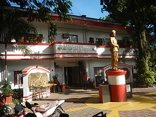
Bayanan is a barangay in the Muntinlupa, Philippines. It has a total land area of 0.784 km2 (0.303 sq mi), making it the city's second smallest barangay in terms of land area. As of 2020, it has a population of 39,150.

<span class="mw-page-title-main">Santo Niño, Parañaque</span> Barangay in Parañaque City, Metro Manila, Philippines

Santo Niño is an administrative division in southern Metro Manila, the Philippines. It is a barangay in the city of Parañaque immediately surrounding Ninoy Aquino International Airport on its west and south sides. A large portion of the village extends into the property of the airport grounds to include Terminal 1 as well as the western half of Runway 06/24. The village has a total land area of 245.97 hectares of which about 55% is occupied by the airport complex. Its population is concentrated in the areas along the Estero de Tripa de Gallina.

<span class="mw-page-title-main">San Martin de Porres, Parañaque</span> Barangay in Parañaque City, Metro Manila, Philippines

San Martin de Porres is an administrative division in southern Metro Manila, the Philippines. It is an elongated barangay located in the northeast corner of Parañaque adjoining the areas of Bicutan in Taguig and northern Muntinlupa. It is unique in that it is connected to the rest of Parañaque by only two bridges, one of which is a footbridge. Its western border follows the South Luzon Expressway, thus separating it from Merville, Sun Valley, Don Bosco and Marcelo Green. It neighbors Western Bicutan to the north, particularly the redevelopment area of the former Food Terminal Inc. (FTI) known as Arca South. To the east, it adjoins Taguig's barangays of Upper Bicutan, Central Bicutan, North Daang Hari and Tanyag. It neighbors South Daang Hari and Sucat, Muntinlupa to the south.

<span class="mw-page-title-main">Don Bosco, Parañaque</span> Barangay in Parañaque City, Metro Manila, Philippines

Don Bosco is an administrative division in Parañaque, Metro Manila, Philippines. It is one of sixteen barangays that make up the city of Parañaque situated along either side of Doña Soledad Avenue from South Luzon Expressway west to Diamond Street in Cecilia Village. Part of the Parañaque 2nd district, Don Bosco is the third largest barangay in the city and is bordered by Don Bosco Creek which separates it from Merville's namesake gated community, Country Village and Lion's Park Residences to the north, Sun Valley's namesake gated village and Siena Park to the northeast, San Martin de Porres across the South Luzon Expressway to the east, Marcelo Green to the southeast, Baloc-Baloc Creek which separates it from San Antonio's namesake community, Greenheights Village and Malacañang Village to the south, and Moonwalk's namesake community, Airport Village and Multinational Village to the west.

References

  1. "2010 Census of National Population and Housing" (PDF). National Statistics Office. Archived from the original (PDF) on November 13, 2014. Retrieved May 31, 2014.
  2. Paulate, Monette (April 2013). Marikina 1630. Marikina City Library.
  3. Presidential Decree No. 1849 (April 2, 1978), Creating Barangay Marikina Heights in the Municipality of Marikina, Metro-Manila , retrieved August 3, 2022