Tondo is a district located in Manila, Philippines. It is the largest, in terms of area and population, of Manila's sixteen districts,[2] with a census-estimated 654,220 people in 2020. It consists of two congressional districts. It is also the second most densely populated district in the city.
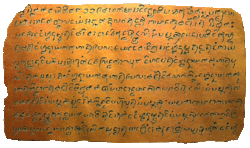
The name Tondo can be derived from its Old Tagalog name, Tundun as inscribed in the Laguna Copperplate Inscription of 900 AD, the earliest native document found within the Philippines. Dutch anthropologist Antoon Postma, the first to translate the copperplate, believes the term tundun originated from Sanskrit,[3] which was used alongside Malay as a language of politics and religion in the area at the time.
Before this landmark discovery, several theories (however incorrect now) existed. Philippine National Artist Nick Joaquin once suggested that it might be a reference to a high ground ("tundok").[4] On the other hand, French linguist Jean-Paul Potet, supposed that the Aegiceras corniculatum, which at the time was called "tundok" ("tinduk-tindukan" today), was the most likely origin of the name.[5]
According to Kapampangan studies professor Robby Tantingco, the Old Tagalog name was derived from tundun, Kapampangan term of "nape."[6]
The region of Tondo has been settled by humans for over 1,100 years. Historically, Tondo already existed in the year 900 AD according to the Laguna Copperplate Inscription,[7] a legal document that is the earliest document in the Philippines, written in Kawi script now housed in the National Museum of Anthropology.
According to this document, Tondo was ruled by an unnamed person who held the Sanskrit title of senapati or the equivalent of an admiral. Tondo was ruled by a lakan until the Spanish conquest.
After the Spaniards conquered Tondo in June 1571 they established the Province of Tondo which covered many territories in Northern Luzon particularly Pampanga, Bulacan and Rizal (formerly called Morong), with the city of Manila as its center. In a census conducted by Miguel de Loarca in 1583, Tondo was reported to have spoken the same language as the natives of the province of Pampanga.[8]
Institute of National Language commissioner Jose Villa Panganiban also wrote that the dividing line between Kapampangan and Tagalog was the Pasig River, and that Tondo therefore originally spoke Kapampangan.[9] However, Fray Isacio Rodriquez's Historia dela Provincia del Santisimo Nombre de Jesus de Filipinas stated that Provincia de Tagalos which is Tondo covers all the territories of the future Roman Catholic Archdiocese of Manila. Prior to the establishment of Bulacan in 1578, Malolos and Calumpit were also included in the territory of Tondo as its visitas. By the end of the 1700s, Tondo was a populous province of 14,437 native families and 3,528 Spanish Filipino families.[10]:539[11]:31,54,113 In 1800, the Province of Tondo was renamed to Province of Manila.
Tondo was one of the first provinces to declare rebellion against Spain in the year 1896. In 1901, under the American colonial regime, there was a major reorganization of political divisions, and the province of Tondo was dissolved, with its towns given to the provinces of Rizal and Bulacan. Today, Tondo just exists as a district in the City of Manila.
Contemporary Period
Aerial view of Tondo district after fire, 1941
Slums developed in Tondo along the Pasig River. Authorities sought to improve housing conditions on these areas without condoning the squatting committed by the slums' residents. In the 1970s, the World Bank provided funds to improve conditions in Tondo which led the increase of rent prices and a property boom in the area. This led to gentrification. The slums that were upgraded were legalized but these areas remain vastly different from other parts of Manila with higher population density, more irregular road and plot patterns, and uncontrolled housing.[12]
In the 1987 constitution, Tondo was split into two congressional districts of Manila making the first district to the west while the second district in the east.
Economy
Manila North Harbor with Tondo skyline at the background
Tondo hosts the Manila North Harbor Port, the northern half of the Port of Manila, the primary seaport serving Metro Manila and surrounding areas.[13]
The area also hosted Smokey Mountain, a landfill which served Metro Manila and employed thousands of people from around the 1960s until its closure in the late 1990s. The dumpsite served as a symbol of poverty even at least two decades after its closure.[14]
A busy street in Tondo
Demographics
Urbanization as well as the Lina Law which favors squatting over land owners has resulted in Tondo being one of the most densely populated areas in the world at 69,000 inhabitants per square kilometer (180,000/sqmi).[15]
Crime
Tondo has developed a reputation for criminality and poverty. In 2010, Manila records state that Tondo has the highest criminal rate in the whole city with the most common crime being pickpocketing.[16]
Culture
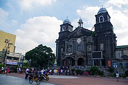
The district celebrates the feast of the Tondo Church annually in January, which is dedicated to the image of the Santo Niño housed within the 16th-century Augustinian Tondo Church. The Lakbayaw Street Dance Festival, a competition among Ati-Atihan groups and school, local and religious groups, served as the climax of the feast.[17]
Education
The Department of Education – Schools Division Office of Manila lists 26 public elementary schools and 11 public high schools in Tondo.[18]
The Tondo Campus is a P400-million extension with 48 classrooms, 15 multifunction rooms and a gymnasium. In October 2024, Mayor Honey Lacuna and Felma Carlos-Tria led the time capsule lowering and groundbreaking of Universidad de Manilas's 10-storey school building in a 1,500-square-meter lot at Vitas Skate Park.[19]
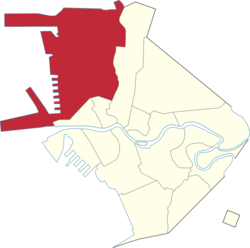
Barangays
Tondo encompasses 267 barangays which can be grouped in districts and zones.
Gaspar de San Agustin, Conquistas de las Islas Filipinas 1565-1615, Translated by Luis Antonio Mañeru, 1st bilingual ed [Spanish and English], published by Pedro Galende, OSA: Intramuros, Manila, 1998
Henson, Mariano A. 1965. The Province of Pampanga and Its Towns: A.D. 1300-1965. 4th ed. revised. Angeles City: By the author.
Loarca, Miguel de. 1582. Relacion de las Yslas Filipinas. Blair and Robertson vol. 5 page 87:
Mallat, Jean, Les Philippines: Histoire, Géographie, Moeurs, Agriculture, Industrie Et Commerce des Colonies Espagnoles dans l'Océanie, Paris: Arthus Bertrand, Libraire de la Societé de Géographie, 1846
Santiago, Luciano P.R., The Houses of Lakandula, Matanda, and Soliman [1571-1898]: Genealogy and Group Identity, Philippine Quarterly of Culture and Society 18 [1990]
Scott, William Henry, Barangay: Sixteenth-Century Philippine Culture and Society, Quezon City: Ateneo de Manila University Press, 1994
Scott, William Henry, Prehispanic Source Materials for the Study of Philippine History, Quezon City: New Day Publishers, 1984
This page is based on this Wikipedia article Text is available under the CC BY-SA 4.0 license; additional terms may apply. Images, videos and audio are available under their respective licenses.