
Makati, officially the City of Makati, is a highly urbanized city in the National Capital Region of the Philippines, known for being one of the leading financial centers in the country. As of 2013, the city has the highest concentration of multinational and local corporations in the Philippines. Major banks, corporations, department stores as well as foreign embassies are based in Makati. Makati is also known for being a major cultural and entertainment hub in Metro Manila. According to the 2020 census, it had a population of 629,616 people, making it as the 47th most populous city in the country and ranked as the 43rd most densely populated city in the world with 19,336 inhabitants per square kilometer or 50,080 inhabitants per square mile.
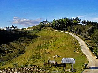
Alcoy, officially the Municipality of Alcoy, is a 5th class municipality in the province of Cebu, Philippines. According to the 2020 census, it has a population of 19,186 people.

Pamplona, officially the Municipality of Pamplona, is a 3rd class municipality in the province of Negros Oriental, Philippines. According to the 2020 census, it has a population of 39,805 people.

Carmona, officially the City of Carmona, is a component city in the province of Cavite, Philippines. According to the 2020 census, it has a population of 106,256 people.

General Trias, officially the City of General Trias, formerly known as San Francisco de Malabon is a 1st class component city in the province of Cavite, Philippines. According to the 2020 census, it has a population of 450,583 people.
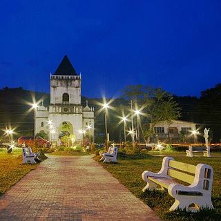
Alegria, officially the Municipality of Alegria, is a 4th class municipality in the province of Cebu, Philippines. According to the 2020 census, it has a population of 25,620 people.
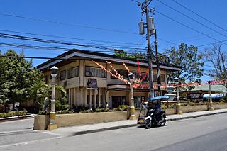
San Fernando, officially the Municipality of San Fernando, is a second-class municipality in the province of Cebu, Philippines. According to the 2020 census, it has a population of 72,224 people.

San Francisco, officially the Municipality of San Francisco, is a 1st class municipality in the province of Agusan del Sur, Philippines. According to the 2020 census, it has a population of 80,760 people.

Jose Panganiban, officially the Municipality of Jose Panganiban, is a 2nd class municipality in the province of Camarines Norte, Philippines. According to the 2020 census, it has a population of 63,662 people.

Santa Maria, officially the Municipality of Santa Maria,, is a 5th class municipality in the province of Romblon, Philippines. According to the 2020 census, it has a population of 8,989 people.

Mogpog, officially the Municipality of Mogpog is a 3rd class municipality in the province of Marinduque, Philippines. According to the 2020 census, it has a population of 34,516 people.

Malvar, officially the Municipality of Malvar, is a 2nd class municipality in the province of Batangas, Philippines. According to the 2020 census, it has a population of 64,379 people.

Liloy, officially the Municipality of Liloy, is a 3rd class municipality in the province of Zamboanga del Norte, Philippines. According to the 2020 census, it has a population of 42,213 people.
Paombong, officially the Municipality of Paombong, is a 3rd class municipality in the province of Bulacan, Philippines. According to the 2020 census, it has a population of 55,696 people.

Santa Fe, officially the Municipality of Santa Fe, is a 5th class municipality in the province of Leyte, Philippines. According to the 2020 census, it has a population of 22,102 people.

Tabango, officially the Municipality of Tabango, is a 4th class municipality in the province of Leyte, Philippines. According to the 2020 census, it has a population of 33,868 people.

Singkamas is a barangay located in Makati, Metro Manila, Philippines. It is a predominantly residential area with a population of 7,218 recorded by the 2020 census. It is the second smallest barangay in Makati in terms of land area with a land area of 12.59 hectares.

Chino Roces Avenue, formerly known as Pasong Tamo, is a prominent north–south road in the cities of Makati and Taguig, Metro Manila, Philippines. It runs for 5.80 kilometers from Olympia and Tejeros to Fort Bonifacio. The avenue is named after the Filipino journalist Joaquin "Chino" Roces. The fact that the avenue is the location of various media establishments influenced the renaming.

Santo Niño is an administrative division in southern Metro Manila, the Philippines. It is a barangay in the city of Parañaque immediately surrounding Ninoy Aquino International Airport on its west and south sides. A large portion of the village extends into the property of the airport grounds to include Terminal 1 as well as the western half of Runway 06/24. The village has a total land area of 245.97 hectares of which about 55% is occupied by the airport complex. Its population is concentrated in the areas along the Estero de Tripa de Gallina.

Makati's 1st congressional district is one of the two congressional districts of the Philippines in the city of Makati. It has been represented in the House of Representatives of the Philippines since 1998. The district consists of barangays in western Makati, namely Bangkal, Bel-Air, Carmona, Dasmariñas, Forbes Park, Kasilawan, La Paz, Magallanes, Olympia, Palanan, Pio del Pilar, Poblacion, San Antonio, San Isidro, San Lorenzo, Santa Cruz, Singkamas, Tejeros, Urdaneta, and Valenzuela. It is also the location of the Makati Central Business District. It is currently represented in the 19th Congress by Romulo Peña Jr. of the Liberal Party (LP).


