The name was also meant "being pierced through", which was attributed to the periodical action of the lake piercing through the land area where the barangay is presently located.[5]:180 According to a legend, based on the barangay's profile on the official website of Taguig, the son of a datu from Tipas arrived at the area, which at that time was an island due to surrounding creeks and rivers, and was abducted by bandits. He was then killed and pierced (Filipino: pinindang) on a bamboo branch. The datu's forces attacked the bandits and avenged his death by piercing them as well.[6]
History
Before the arrival of Spaniards to the Philippines, a settlement already existed in the area now known as Napindan, which became active in commerce and migration.[7] During the Spanish rule of the country, Napindan became one of the five new barrios that was added to the original nine barrios of Taguig.[8] On the eve of May 9, 1896, a meeting consisting of Andrés Bonifacio, Emilio Aguinaldo, Pío Valenzuela, and several high-ranking commanders of the Katipunan took place in a lighthouse located at the barrio, where they listened to Valenzuela's report of his visit to José Rizal, who was exiled in Dapitan, regarding Rizal's advise about their planned revolution against the Spaniards.[9] Following the country's independence from Spain on June 12, 1898, Napindan was placed under Pedro Esguerra as the village president (Filipino: pangulo ng nayon).[5]:30
During the Battle of Taguig on March 19, 1899, as part of the Philippine-American War, USS Laguna de Bay of the United States Asiatic Squadron destroyed the lighthouse to deprive the Katipunan command and control over the area.[9] On March 29, 1900, during the American rule of the country, Taguig was established as an independent municipality, in which Napindan remained as one of its barrios.[5]:30–31 On August 26, 1920, the politicians from the barrio, as well as from Calzada, Ibayo, Palingon, and Tipas, filed a petition to then-Governor GeneralFrancis Burton Harrison to separate the five barrios from Taguig to form a new municipality named as Tipas.[10][5]:31–32 However, it was denied due to lack of financing and economic stability, as well as it would weaken Taguig.[5]:32
Napindan was converted into a barangay by the virtue of Presidential Decree No. 557 signed by then-PresidentFerdinand Marcos on September 21, 1974.[11]
Geography
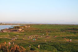
Napindan has a total land area of 2.7 square kilometers (270 hectares).[5]:180 It is bordered to the north by Pasig and Taytay, Rizal, to the south by Palingon and Laguna de Bay, to the east by Taytay and the lake, and to the west by Ibayo-Tipas and Palingon.[5]:180 The barangay is located near the portion of Napindan Channel, a channel that connects Laguna de Bay and Manila Bay.[12]
This page is based on this Wikipedia article Text is available under the CC BY-SA 4.0 license; additional terms may apply. Images, videos and audio are available under their respective licenses.


