
Las Piñas (Tagalog:[lasˈpiɲɐs], officially the City of Las Piñas, is a highly urbanized city in the National Capital Region of the Philippines. According to the 2020 census, it had a population of 606,293 people.

Cavite, officially the Province of Cavite, is a province of the Philippines located in the Calabarzon region. On the southern shores of Manila Bay and southwest of Manila, it is one of the most industrialized and fastest-growing provinces in the Philippines. As of 2020, it has a population of 4,344,829, making it the most populated province in the country if the independent cities of Cebu are excluded from Cebu's population figure.
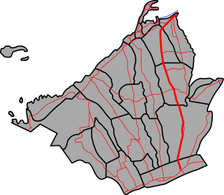
Bacoor, officially the City of Bacoor, is a component city in the province of Cavite, Philippines. According to the 2020 census, it has a population of 664,625 people, making it the 15th most populous city in the Philippines and the second largest city in the province of Cavite after Dasmariñas.
The Manila–Cavite Expressway, signed as E3 of the Philippine expressway network and R-1 of Metro Manila's arterial road network, is a 14-kilometer-long (8.7 mi) controlled-access highway linking Manila to the southern province of Cavite in the Philippines. At its north end, it feeds into and from Roxas Boulevard in Parañaque, Metro Manila, also part of R-1. At the south end, it splits into two termini along the north coast in Kawit, Cavite. The first feeds into the intersection of Covelandia Road, Tirona Highway and Antero Soriano Highway. The second southern terminus is an exit-only to Tirona Highway in Barangay Marulas.

Mega Manila is a megalopolis on the island of Luzon in the Philippines. There are varying definitions of the megalopolis, but it is generally seen as encompassing the administrative regions of Central Luzon, Calabarzon, and Metro Manila. On some occasions, the administrative region of Mimaropa is also included.

Ayala Malls is a retail subsidiary of real estate company Ayala Land, an affiliate of Ayala Corporation. Founded in 1988, Ayala Malls owns a chain of large shopping malls, all located in the Philippines. Ayala Malls is one of the largest shopping mall retailer in the Philippines, along with SM Supermalls and Robinsons Malls.

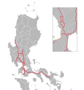
Radial Road 1 (R-1), informally known as the R-1 Road, is a network of roads and bridges which comprise the first arterial road of Metro Manila in the Philippines. Spanning some 42.67 kilometers (26.51 mi), it connects the cities and municipalities of Bacoor, General Trias, Imus, Kawit, Las Piñas, Manila, Naic, Noveleta, Parañaque, Pasay, and Tanza in Cavite and Metro Manila.
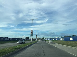
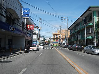
The Emilio Aguinaldo Highway is a four-to-six lane, 41.4-kilometer (25.7 mi), network of primary and secondary highways passing through the busiest towns and cities of Cavite, Philippines. It is the busiest and most congested of the three major highways located in the province, the others are Governor's Drive and Antero Soriano Highway.

Maynilad Water Services, Inc., better known as Maynilad, is the water and wastewater services provider of cities and municipalities that form the West Zone of the Greater Manila Area in the Philippines. It is an agent and contractor of the Metropolitan Waterworks and Sewerage System (MWSS). Maynilad is one of two private water providers in Metro Manila, the other being Manila Water.

Alabang–Zapote Road is a four-lane national road which travels east–west through the southern limits of Metro Manila, Philippines. It runs parallel to Dr. Santos Avenue in the north and is named after the two barangays it links: Alabang, Muntinlupa and Zapote in Bacoor and Las Piñas.

Tramo Street is a major local road in Pasay, Metro Manila, Philippines. It runs north-south from Ocampo Street, which is on the border with Malate, Manila, to Andrews Avenue in Maricaban. It is interrupted by Epifanio de los Santos Avenue (EDSA) and the MRT Line 3, which divides the road into two sections. The southern section from EDSA to Andrews Avenue has been renamed Aurora Boulevard.
Daang Hari, also known as the Las Piñas–Muntinlupa–Laguna–Cavite Link Road, is a connector road that links southern Metro Manila to the province of Cavite in the Philippines. It begins as a north–south road from Commerce Avenue, just south of the Alabang–Zapote Road, running for 5.9 kilometers (3.7 mi) on the boundary of Las Piñas and Muntinlupa. It then runs east–west for about 9.2 kilometers (5.7 mi) from its junction with Daang Reyna, winding through Bacoor, Imus, Dasmariñas, and General Trias.

The Molino Dam or Prinza Water Dam is a gravity dam on the Zapote River located on the border between Barangay San Nicolas I, Bacoor, Cavite and Barangay Talon Dos, Las Piñas, Metro Manila, Philippines. It was built by hand in the 19th century to irrigate the surrounding rice field in Las Piñas and Bacoor.
Elpidio Quirino Avenue, also known simply as Quirino Avenue, is a major north-south collector road in Parañaque, southern Metro Manila, Philippines. It is a four-lane undivided arterial running parallel to Roxas Boulevard and its extension, the Manila–Cavite Expressway, to the west from Baclaran at Parañaque's border with Pasay in the north to San Dionisio right by the border with Las Piñas in the south. It is a continuation of F.B. Harrison Street from Pasay and was originally a segment of the coastal highway called Calle Real. The entire road is a component of Radial Road 2 (R-2) of Manila's arterial road network, while its segment south of NAIA Road is a component of National Route 62 (N62) of the Philippine highway network. It was named after President Elpidio Quirino. The road's name is also applied alternatively to Diego Cera Avenue in Las Piñas.

Padre Diego Cera Avenue, or simply Diego Cera Avenue, is a major north-south collector road in Las Piñas, Metro Manila, Philippines. It is a four-lane undivided arterial running parallel to the Manila–Cavite Expressway to the west from Manuyo Uno at Las Piñas' border with Parañaque in the north to Zapote near the border with Bacoor in the south. It is a continuation of Elpidio Quirino Avenue from Parañaque and was originally a segment of Calle Real in Las Piñas. The road is a component of the National Route 62 (N62) of the Philippine highway network and Radial Road 2 (R-2) of Manila's arterial road network.
The Light Rail Transit Line 6 is a proposed rapid transit system in Cavite, Philippines. There have been two proposals for the line, with the first one shelved immediately in 2018. Another proposal emerged in 2017 and is currently under review by the National Economic and Development Authority (NEDA).

The following is an alphabetical list of articles related to the Philippine capital region of Metro Manila.

National Route 62 (N62) forms part of the Philippine highway network. It runs south from Metro Manila to northeastern Cavite.

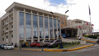
The Parañaque Integrated Terminal Exchange is a public transport terminal in Parañaque, Metro Manila, Philippines. PITX is built and operated by Megawide Construction Corporation and the Department of Transportation (DOTr) under the Philippine government's Public-Private Partnership program.
