
Goa, officially the Municipality of Goa, is a 1st class municipality in the province of Camarines Sur, Philippines. According to the 2020 census, it has a population of 71,368 people.

Lupi, officially the Municipality of Lupi, is a 3rd class municipality in the province of Camarines Sur, Philippines. According to the 2020 census, it has a population of 33,897 people.

Pili, officially the Municipality of Pili is a 1st class municipality and capital of the province of Camarines Sur, Philippines. According to the 2020 census, it has a population of 99,196 people.

Ragay, officially the Municipality of Ragay, is a 1st class municipality in the province of Camarines Sur, Philippines. According to the 2020 census, it has a population of 59,770 people.

The Pan-Philippine Highway, also known as the Maharlika Highway, is a network of roads, expressways, bridges, and ferry services that connect the islands of Luzon, Samar, Leyte, and Mindanao in the Philippines, serving as the country's principal transport backbone. Measuring 3,379.73 kilometers (2,100.07 mi) long excluding sea routes not counted by highway milestones, it is the longest highway in the Philippines that forms the country's north–south backbone component of National Route 1 (N1) of the Philippine highway network. The entire highway is designated as Asian Highway 26 (AH26) of the Asian Highway Network.

The MacArthur Highway, officially the Manila North Road, is a 684.855-kilometer (425.549 mi), two-to-six lane, national primary highway and tertiary highway in Luzon, Philippines, connecting Caloocan in Metro Manila to Aparri in Cagayan at the north. It is the second longest road in the Philippines, after Maharlika Highway. It is primarily known as MacArthur Highway in segments from Caloocan to Urdaneta, Pangasinan, although it is also applied up to Ilocos Sur, and likewise called as Manila North Road for the entire length.
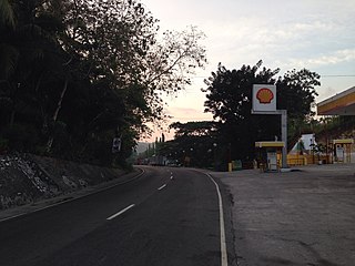
Rolando Andaya Highway, officially known as Quirino Highway and also known as Camarines Sur–Quezon Road, is a national primary highway located in the provinces of Camarines Norte, Quezon, and Camarines Sur in the Philippines. It serves as an alternative route to the Pan-Philippine Highway and has been efficiently used as a major highway since the 1990s. It traverses the municipality of Santa Elena in Camarines Norte, municipalities of Sipocot, Lupi, Ragay, and Del Gallego in Camarines Sur, and the municipalities of Tagkawayan, Guinayangan, and Calauag in Quezon. It is primarily known as Andaya Highway in segments within Camarines Sur and likewise called as Quirino Highway within Camarines Norte and Quezon.
The Philippine highway network is a network of national roads owned and maintained by the Department of Public Works and Highways (DPWH) and organized into three classifications according to their function or purpose: national primary, secondary, and tertiary roads. The national roads connecting major cities are numbered from N1 to N83. They are mostly single and dual carriageways linking two or more cities.

Santiago–Tuguegarao Road is a major national primary road in the provinces of Cagayan, Kalinga, and Isabela in the Philippines. It is a bypass road of the Pan-Philippine Highway, also known as Cagayan Valley Road, connecting to the cities of Tuguegarao and Santiago.

The Santa Rosa–Tagaytay Road, also known as the Tagaytay–Santa Rosa Road and the Santa Rosa–Ulat–Tagaytay Road, is a 23.245-kilometer (14.444 mi) major thoroughfare in the provinces of Laguna and Cavite, Philippines. Originally an old road linking the Santa Rosa municipal proper to the western edge of the then-municipality at barangay Santo Domingo and narrowly onto barangay Lumil in Silang, the highway was constructed in the late 1990s.
National Route 1 (N1) is a primary national route that forms part of the Philippine highway network, running from Luzon to Mindanao. Except for a 19-kilometer (12 mi) gap in Metro Manila and ferry connections, the highway is generally continuous. Most sections of N1 forms the Pan-Philippine Highway except for sections bypassed by expressways.
National Route 622 (N622) forms part of the Philippine highway network. It is one of the national secondary roads with two non-contiguous sections, one which runs through the municipalities of Kawit and Noveleta in Cavite, while the other road runs through the municipality of Daet in Camarines Norte; both of these roads are located in Luzon island.
National Route 62 (N62) forms part of the Philippine highway network. It runs south from Metro Manila to northeastern Cavite.
National Route 405 (N405) forms part of the Philippine highway network. It runs through western Cavite. It connects the municipality of Naic to Caylabne Bay.

The Davao–Cotabato Road is a 205.7-kilometer (127.8 mi), two-to-six lane major national primary road, connecting the provinces of Davao del Sur, Maguindanao del Sur, Cotabato, and Maguindanao del Norte. It runs from Davao City to Sultan Kudarat, Maguindanao del Norte.
National Route 401 (N401) forms part of the Philippine highway network. It connects the municipalities of Noveleta to the city of General Trias through the municipality of Rosario.
Gandara Diversion Road is a 1.4-kilometer (0.87 mi) national secondary road in the town of Gandara, Samar in the Philippines.
Cagayan Valley Road is a 121.216-kilometer (75.320 mi) major highway that connects the cities and municipalities of the province of Cagayan, Philippines.
National Route 81 (N81) is a 34.6-kilometer (21.5 mi), east-west primary route which forms part of the Philippine highway network in Cebu connecting the cities and municipalities of Naga, Toledo, Pinamungahan, Aloguinsan and Barili. Two roads form the route, namely the Naga−Toledo Road and the Uling−Toledo Wharf Road.
The Loay Interior Road is a 78.92-kilometer (49.04 mi), two lane national secondary road that connects the municipality of Loay to the municipality of Trinidad in Bohol, Philippines. This highway serves as one of the principal gateways to Carmen, which is known for being the main location and tourist spot of the Chocolate Hills.
