The Francis Bowes Sayre Sr. Highway or simply the Sayre Highway is a four-lane, 192-kilometre (119 mi), primary national highway that connects Cagayan de Oro, Misamis Oriental to Kabacan, North Cotabato. It traverses the provinces of Misamis Oriental, Bukidnon and North Cotabato.

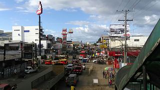
Juanito R. Remulla Sr. Road, formerly and still referred to as Governor's Drive, is a two-to-nine lane, 58.3-kilometer (36.2 mi) network of primary, secondary and tertiary highways and bridges traversing through the central cities and municipalities of the province of Cavite, Philippines. It is the widest of the three major highways located in the province, the others are Aguinaldo Highway and Antero Soriano Highway.
The Emilio Aguinaldo Highway,, alternatively known as Cavite–Batangas Road and Cavite-Manila South Road, is a four-to-six lane, 41.4-kilometer (25.7 mi), network of primary and secondary highways passing through the busiest towns and cities of Cavite, Philippines. It is the busiest and most congested of the three major highways located in the province, the others are Governor's Drive and Antero Soriano Highway.
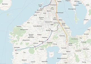
The Cavite–Tagaytay–Batangas Expressway (CTBEX) is a proposed 50.42-kilometer (31.33 mi) expressway that will connect the under-construction Cavite–Laguna Expressway (CALAX) in the municipality of Silang, Cavite to J.P. Laurel Street in the municipality of Nasugbu, Batangas, which situated as the western terminus of the expressway.

The Mendez–Tagaytay Road is a 7.32-kilometer (4.55 mi), two-to-four lane secondary road in Cavite, Philippines. It connects the municipality of Mendez and the city of Tagaytay. The road is a component of the National Route 402 (N402) of the Philippine highway network. Locally in the Mendez poblacion, it is also known as and a part of J.P. Rizal Street.

The Santa Rosa–Tagaytay Road, also known as the Tagaytay–Santa Rosa Road and the Santa Rosa–Ulat–Tagaytay Road, is a 23.245-kilometer (14.444 mi) major thoroughfare in the provinces of Laguna and Cavite, Philippines. Originally an old road linking the Santa Rosa municipal proper to the western edge of the then-municipality at barangay Santo Domingo and narrowly onto barangay Lumil in Silang, the highway was constructed in the late 1990s.

The Tagaytay–Nasugbu Highway, alternatively known as Tagaytay–Nasugbu Road and formerly as Tagaytay–Tuy–Nasugbu Port Road, is a 43.86-kilometer (27.25 mi), two-to-four lane, secondary highway in the provinces of Cavite and Batangas, Philippines, that connects the city of Tagaytay in Cavite and the municipality of Nasugbu in Batangas.
The Indang–Mendez Road is a two-to-four lane, secondary road that connects the municipalities of Indang and Mendez in Cavite, Philippines.

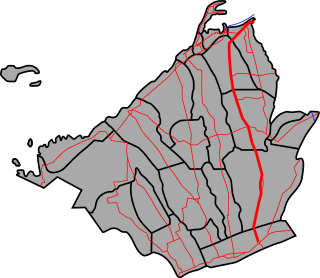
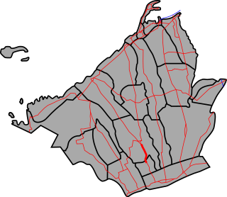
The National Route 402 (N402) forms part of the Philippine highway network. It runs through the rural municipalities of Cavite.
The National Route 622 (N622) forms part of the Philippine highway network. It is one of the national secondary roads with two non-contiguous sections, one which runs through the municipalities of Kawit and Noveleta in Cavite, while the other road runs through the municipality of Daet in Camarines Norte; both of these roads are located in Luzon island.
The National Route 62 (N62) forms part of the Philippine highway network. It runs south from Metro Manila to northeastern Cavite.
The National Route 410 (N410) forms part of the Philippine highway network. It runs in southern Cavite to Batangas.

Jose P. Laurel Highway is a 49-kilometer (30 mi), two-to-six lane, major highway running within the province of Batangas. The highway forms part of National Route 4 (N4) of the Philippine highway network. It is also known as Manila–Batangas Diversion Road in Santo Tomas, Manila–Batangas Road from its junction with General Malvar Street in Santo Tomas southwards, and Ayala Highway in Lipa.

The Indang–Alfonso Road is a 18.51-kilometer (11.50 mi), two-to-five lane, tertiary road that connects the municipalities of Indang and Alfonso in Cavite, Philippines.
National Route 5 (N5) forms part of the Philippine highway network. It runs through the province of Capiz to the province of Iloilo, both in the island of Panay.
The National Route 401 (N401) forms part of the Philippine highway network. It connects the municipalities of Noveleta to the city of General Trias through the municipality of Rosario.

The Ternate–Nasugbu Road, also known as Ternate–Nasugbu Highway or Nasugbu–Ternate Highway, is a two-to-four lane, secondary road in the provinces of Cavite and Batangas, Philippines. It connects the municipality of Ternate in Cavite to the municipality of Nasugbu in Batangas.
The Maragondon–Magallanes–Amuyong Road or Maragondon–Magallanes–Alfonso Road is a two- to four-lane, secondary road in Cavite, Philippines. It connects the municipality of Maragondon and the municipality of Alfonso.
The Surigao–Davao Coastal Road or the President Diosdado P. Macapagal Highway is a 677-kilometer (421 mi), two-to-four lane highway that connects the provinces of Surigao del Norte, Surigao del Sur, Davao Oriental, Compostela Valley, and Davao del Norte. It connects the Maharlika Highway in Placer, Surigao del Norte to the Agusan in Tagum. Running along the eastern coast of Mindanao, it is one of the longest roads in the Philippines.

The Butuan–Cagayan de Oro–Iligan Road, or Butuan–Cagayan de Oro–Iligan–Tukuran Road and also known as Lanao–Pagadian–Zamboanga City Road in the Zamboanga del Sur section, is a 416-kilometer (258 mi), two-to-six lane major thoroughfare, connecting the provinces of Agusan del Norte, Misamis Oriental, Lanao del Norte, and Zamboanga del Sur.
