
Pasig, officially known as the City of Pasig, is a 1st class highly urbanized city in the National Capital Region of the Philippines. According to the 2020 census, it has a population of 803,159 people.
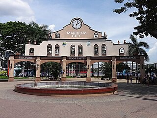
Marikina, officially known as the City of Marikina, is a 1st class highly urbanized city in the National Capital Region of the Philippines. According to the 2020 census, it has a population of 456,159 people.

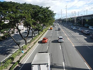
Epifanio de los Santos Avenue, commonly referred to by its acronym EDSA, is a limited-access circumferential highway around Manila, the capital city of the Philippines. It passes through 6 of Metro Manila's 17 local government units or cities, namely, from north to south, Caloocan, Quezon City, San Juan, Mandaluyong, Makati, and Pasay.

Antipolo, officially known as the City of Antipolo, is a 1st class component city and capital of the province of Rizal, Philippines. According to the 2020 census, it has a population of 887,399 people. It is the most populous city in the Calabarzon region, and the seventh most-populous city in the Philippines.

The Sumulong Highway, constructed in 1960, is the highway in the Philippines that connects Marikina with Antipolo and the municipality of Cainta in the province of Rizal. It was named after Don Juan Sumulong, an Antipolo native who served as the country's senator and founder of the Democrata Party.
The Marikina–Infanta Highway, also known as Marilaque Highway, as well as its former name Marcos Highway, Marilaque Road or Marikina-Infanta Road, is a scenic mountain 117.5-kilometer (73.0 mi) highway that connects Metro Manila with Infanta, Quezon in the Philippines. Motorists colloquially refer to the road as Marilaque Highway.

Sta. Lucia Mall is a shopping mall owned by Sta. Lucia Realty & Development Inc. It is situated at the intersection of Marcos Highway, and Felix Avenue, located at Barangay San Isidro, Cainta, Rizal, Philippines, beside Robinsons Metro East.
Radial Road 6 is the sixth radial road in Metro Manila, in the Philippines. It passes through the cities of Manila, Quezon City, San Juan, Pasig, and Marikina, as well as Cainta, and Antipolo in the province of Rizal up to Santa Maria, Laguna and Infanta, Quezon

Ortigas Avenue is a 15.5 km (9.6 mi) highway running from eastern Metro Manila to western Rizal. It is one of the busiest highways in Metro Manila, serving as the main thoroughfare of the metro's east–west corridor, catering mainly to the traffic to and from Rizal.

SM City Marikina is a shopping mall owned and managed by SM Prime Holdings, and is located in Calumpang, Marikina, Philippines. As part of the chain of SM Supermalls, the mall is owned by Henry Sy, Sr.
Eastern Metropolitan Bus Corporation or EMBC is one of the largest bus companies in the Philippines. The city operation plies routes from Antipolo, Rizal to Divisoria, Manila via Shaw Boulevard Ortigas Avenue. This bus company also offers tourist chartered and shuttle services.

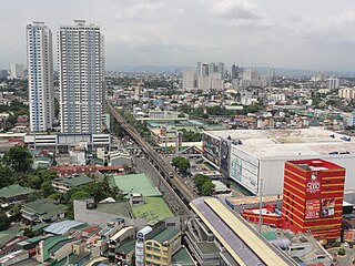
Aurora Boulevard is a four-to-ten lane major thoroughfare in Quezon City and San Juan in Metro Manila, Philippines. It was named after Doña Aurora Quezon, the consort of Commonwealth President Manuel Luis Quezon. It is one of the major roads in the commercial district of Araneta City in Cubao. Line 2 follows the alignment of the boulevard.

Marikina–Pasig station is an elevated Manila Light Rail Transit (LRT) station situated on Line 2. It is located in Barangay San Roque, Marikina City, near the tripoint boundary of Pasig City, Metro Manila and Cainta, Rizal, Philippines. The station is located on the stretch of Marikina–Infanta Highway near the intersection of Gil Fernando Avenue–Felix Avenue and is named after the cities of Marikina and Pasig which the station straddles between.

Antipolo station is an elevated Manila Light Rail Transit (LRT) station situated on Line 2. Located in Antipolo, Rizal, is the eastern terminus of the line. It opened on July 5, 2021 and is the line's easternmost station, located on the stretch of Marikina–Infanta Highway near the intersection of Sumulong Highway. It is the first Manila LRT System station outside Metro Manila to be operational.

The Manila East Road, also known as National Road and National Highway, is a two-to-four lane primary and secondary highway connecting Metro Manila to the provinces of Rizal and Laguna in the Philippines.

The following is an alphabetical list of articles related to the Philippine capital region of Metro Manila.
National Route 180 (N180) is a secondary national route that forms part of the Philippine highway network, running from Cubao, Quezon City to Ermita, Manila.


