
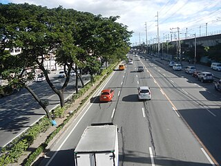
España Boulevard is an eight–lane major thoroughfare in Manila, the capital city of the Philippines, named after Spain, the country that formerly held the Philippines as an overseas territory. True to its name, several Spanish names abound the street. It starts at the Welcome Rotonda near the boundary of Quezon City and Manila and ends with a Y-intersection with Lerma and Nicanor Reyes Streets in Manila.

Balete Drive is an undivided, two-lane street and the main thoroughfare of New Manila, Quezon City, Philippines. The road is a major route for jeepneys and cabs, serving the New Manila area and connecting Eulogio Rodriguez Sr. Avenue and Nicanor Domingo Street in Quezon City.
The Marikina–Infanta Highway, also known as Marilaque Highway, as well as its former name Marcos Highway, Marilaque Road or Marikina-Infanta Road, is a scenic mountain 117.5-kilometer (73.0 mi) highway that connects Metro Manila with Infanta, Quezon in the Philippines. Motorists colloquially refer to the road as Marilaque Highway.

Circumferential Road 3 (C-3), informally known as the C-3 Road, is a network of roads and bridges that all together form the third beltway of Metro Manila in the Philippines. Spanning some 14.93 kilometers (9.28 mi), it connects the cities of Caloocan, Makati, Navotas, Pasay, Quezon City, and San Juan.

Gilmore Avenue, formerly known as Gilmore Street, is a two-lane, one-way road in Quezon City, Metro Manila, the Philippines. It runs one-way from Eulogio Rodriguez Sr. Avenue in New Manila and terminates at Nicanor Domingo Street in Valencia, continuing on as the two-way Granada Street until it reaches the city border with San Juan, where it becomes Ortigas Avenue.

The San Juan River is one of the main river systems in Metro Manila, Philippines, and is a major tributary of the Pasig River. It begins near La Mesa Dam as the San Francisco del Monte River, which officially takes the name San Juan River when it meets with Mariblo Creek in Quezon City. As the San Juan River, it passes through Quezon City, San Juan, the Manila district of Santa Mesa and Santa Ana, and Mandaluyong.

Aurora Boulevard is a four-to-ten lane major thoroughfare in Quezon City and San Juan in Metro Manila, Philippines. It was named after Doña Aurora Quezon, the consort of Commonwealth President Manuel Luis Quezon. It is one of the major roads in the commercial district of Araneta City in Cubao. Line 2 follows the alignment of the boulevard.

Radial Road 7 is a network of roads in Metro Manila, connecting the cities of Manila, Quezon City and Caloocan, as well as San Jose del Monte and the municipality of Norzagaray in the province of Bulacan. The road is one of 10 radial roads in Metro Manila that connect the City of Manila with various provinces.

Senator Gil J. Puyat Avenue, also known simply as Gil Puyat Avenue and by its former official name Buendia Avenue, is a major arterial thoroughfare which travels east–west through the cities of Makati and Pasay in western Metro Manila, Philippines. It is one of the busiest avenues in Metro Manila linking the Makati Central Business District with the rest of the metropolis.

Ramon Magsaysay Boulevard, also known simply as Magsaysay Boulevard and formerly as Santa Mesa Boulevard, is the principal artery of Santa Mesa in Manila, Philippines. It is a six-lane divided roadway that travels east–west from Gregorio Araneta Avenue near the city's border with Quezon City and San Juan to Lacson Avenue and the Nagtahan Interchange, close to the district of San Miguel. The entire length of the boulevard serves as the boundary between Sampaloc in the north and Santa Mesa in the south with the LRT Line 2 running along its median. East of Gregorio Araneta, the road continues as Aurora Boulevard while west of Lacson, it extends as Legarda Street via Legarda Flyover into San Miguel and Quiapo.

Gregorio Araneta Avenue is a suburban arterial road in the Santa Mesa Heights area of Quezon City, northeastern Metro Manila, Philippines. Built in 1985, it is a 6- to 8-lane divided avenue designated as part of Circumferential Road 3 (C-3) and a physical continuation of Sergeant Rivera Street which travels from Santo Domingo Avenue at its north end near Balintawak in Quezon City, and meets N. Domingo Street in the south in San Juan near the border with Santa Mesa, Manila. En route, it intersects with Del Monte Avenue, Quezon Avenue, Eulogio Rodriguez Sr. Avenue and Magsaysay-Aurora Boulevard passing through barangays Balingasa, Manresa, Masambong, Sienna, Santo Domingo, Talayan, Tatalon, Santol, and Doña Imelda in Quezon City and Progreso in San Juan.

Betty Go-Belmonte Street is a street running through the New Manila district of Quezon City, Philippines. It is a notable road in a generally northwest-southeast orientation between the junction with E. Rodriguez Sr. Avenue in New Manila and the junction with N. Domingo Street also in New Manila. It is served by Betty Go-Belmonte station of the Manila Line 2.
Elpidio Quirino Avenue, also known simply as Quirino Avenue, is a major north-south collector road in Parañaque, southern Metro Manila, Philippines. It is a four-lane undivided arterial running parallel to Roxas Boulevard and its extension, the Manila–Cavite Expressway, to the west from Baclaran at Parañaque's border with Pasay in the north to San Dionisio right by the border with Las Piñas in the south. It is a continuation of Harrison Avenue from Pasay and was originally a segment of the coastal highway called Calle Real. The entire road is a component of Radial Road 2 (R-2) of Manila's arterial road network, while its segment south of NAIA Road is a component of National Route 62 (N62) of the Philippine highway network. It was named after President Elpidio Quirino. The road's name is also applied alternatively to Diego Cera Avenue in Las Piñas.

Radial Road 5, more commonly referred to as R-5, is a network of roads and bridges that all together form the fifth radial road of Manila in the Philippines. The road links the City of Manila with Mandaluyong and Pasig in the east, leading out of Metro Manila into the province of Rizal and south towards Laguna. It is the only arterial road traversing the east side of Laguna de Bay.

The following is an alphabetical list of articles related to the Philippine capital region of Metro Manila.
National Route 1 (N1) is a primary national route that forms part of the Philippine highway network, running from Luzon to Mindanao. Except for a 19-kilometer (12 mi) gap in Metro Manila and ferry connections, the highway is generally continuous. Most sections of N1 forms the Pan-Philippine Highway except for sections bypassed by expressways.

Tandang Sora Avenue, formerly known as Banlat Road, is a major east-west thoroughfare bisecting Quezon City in Metro Manila, the Philippines. It is a two-to-six lane highway and municipal road that runs for 9.6 kilometers (6.0 mi) from its eastern terminus at Magsaysay Avenue in Pansol and U.P. Campus in Diliman to its western terminus at Quirino Highway in Baesa and Talipapa in Novaliches, crossing Barangays Culiat, New Era, Pasong Tamo, Tandang Sora, and Sangandaan.

National Route 59 (N59) is a primary national route that forms part of the Philippine highway network, running from Antipolo, Rizal to Cubao, Quezon City, Metro Manila.
National Route 180 (N180) is a secondary national route that forms part of the Philippine highway network, running from Cubao, Quezon City to Ermita, Manila.
