
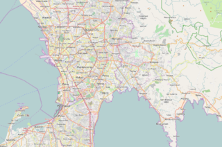
Epifanio de los Santos Avenue, commonly referred to by its acronym EDSA, is a limited-access circumferential highway around Manila, the capital city of the Philippines. It passes through 6 of Metro Manila's 17 local government units or cities, namely, from north to south, Caloocan, Quezon City, San Juan, Mandaluyong, Makati, and Pasay.
EDSA station is a station on the Manila Light Rail Transit System Line 1. Like all other stations in the system, EDSA station is above-ground. The station is located on the intersection of Taft Avenue and Epifanio de los Santos Avenue, or EDSA, one of Metro Manila's main thoroughfares. The station was named after EDSA, which in turn is named after Epifanio de los Santos, a noted historian.

The Pan-Philippine Highway, also known as the Maharlika Highway, is a network of roads, expressways, bridges, and ferry services that connect the islands of Luzon, Samar, Leyte, and Mindanao in the Philippines, serving as the country's principal transport backbone. Measuring 3,379.73 kilometers (2,100.07 mi) long excluding sea routes, it is the longest highway in the Philippines that forms the country's north–south backbone component of National Route 1 (N1) of the Philippine highway network. The entire highway is designated as Asian Highway 26 (AH26) of the Asian Highway Network.

España Boulevard is an eight–lane major thoroughfare in Manila, the capital city of the Philippines, named after Spain, the country that formerly held the Philippines as an overseas territory. True to its name, several Spanish names abound the street. It starts at the Welcome Rotonda near the boundary of Quezon City and Manila and ends with a Y-intersection with Lerma and Nicanor Reyes Streets in Manila.

Commonwealth Avenue, formerly known as Don Mariano Marcos Avenue, is a 12.4-kilometer (7.7 mi) highway located in Quezon City, Philippines, which spans from six to eighteen lanes and is the widest in the Philippines. It is one of the major roads in Metro Manila and is designated as part of Radial Road 7 (R-7) of the older Manila arterial road system and National Route 170 (N170) of the Philippine highway network.

Circumferential Road 5 (C-5), informally known as the C-5 Road, is a network of roads and bridges that all together form the fifth beltway of Metro Manila in the Philippines. Spanning some 32.5 kilometers (20.2 mi), it connects the cities of Las Piñas, Makati, Parañaque, Pasay, Pasig, Quezon City, Taguig, and Valenzuela.

Circumferential Road 3 (C-3), informally known as the C-3 Road, is a network of roads and bridges that all together form the third beltway of Metro Manila in the Philippines. Spanning some 32.5 kilometers (20.2 mi), it connects the cities of Caloocan, Makati, Navotas, Pasay, Quezon City, and San Juan.

Radial Road 2 (R-2), informally known as the R-2 Road, is a network of roads and bridges that all together form the second arterial road of Metro Manila in the Philippines. Spanning some 64.2 kilometers (39.9 mi), it connects the cities and municipalities of Bacoor, Dasmariñas, Imus, Las Piñas, Manila, Parañaque, Pasay, Silang, and Tagaytay in Cavite and Metro Manila.
Taft Avenue is a major road in the south of Metro Manila. It passes through three cities in the metropolis: Manila, Pasay and Parañaque. The road was named after the former Governor-General of the Philippines and U.S. President, William Howard Taft; the Philippines was a former commonwealth territory of the United States in the first half of the 20th century. The avenue is a component of National Route 170 (N170), a secondary road in the Philippine highway network, and anchors R-2 of the Manila arterial road network. It was previously designated as N1 in the old route numbering system.

Manuel L. Quezon Avenue, more often called as Quezon Avenue, or simply Quezon Ave, is a 7.1-kilometer (4.4 mi), six-to-fourteen lane, major thoroughfare in Metro Manila named after President Manuel Luis Quezon, the second president of the Philippines. The avenue starts at the Quezon Memorial Circle and runs through to the Mabuhay Rotonda near the boundary of Quezon City and Manila.

Circumferential Road 4 (C-4), informally known as the C-4 Road, is a network of roads and bridges that all together form the fourth beltway of Metro Manila in the Philippines. Spanning some 28.1 kilometers (17.5 mi), it connects the cities of Caloocan, Makati, Malabon, Mandaluyong, Navotas, Pasay, Quezon City, and San Juan.
Quezon Boulevard is a short stretch of highway in Manila, Philippines running north–south through the district of Quiapo. It is a six- to ten-lane 1.1-kilometer-long (0.68 mi) divided boulevard designated as a component of National Route 170 (N170) of the Philippine highway network, except for its service roads, and Radial Road 8 (R-8) of Manila's arterial road network which links the center of Manila to North Luzon Expressway in Quezon City in the north. The boulevard is the main access to the popular Quiapo Church and is one of the main thoroughfares of the University Belt area.

Radial Road 7 is a network of roads in Metro Manila, connecting the cities of Manila, Quezon City and Caloocan, as well as San Jose del Monte and the municipality of Norzagaray in the province of Bulacan. The road is one of 10 radial roads in Metro Manila that connect the City of Manila with various provinces.

Padre Burgos Avenue, also known as Padre Burgos Street, is a 14-lane thoroughfare in Manila, Philippines.

Senator Gil J. Puyat Avenue, also known simply as Gil Puyat Avenue and formerly and still referred to as Buendia Avenue, is a major arterial thoroughfare which travels east–west through the cities of Makati and Pasay in western Metro Manila, Philippines. It is one of the busiest avenues in Metro Manila linking the Makati Central Business District with the rest of the metropolis.

Antonio S. Arnaiz Avenue, or simply Arnaiz Avenue, formerly known as Libertad Street and the Pasay Road, is a major east–west collector road that links Makati and Pasay in the Philippines. It stretches across western Metro Manila from Roxas Boulevard in the Santa Clara district of Pasay to Epifanio de los Santos Avenue (EDSA) in San Lorenzo Village in Makati.
Elpidio Quirino Avenue, also known simply as Quirino Avenue, is a major north-south collector road in Parañaque, southern Metro Manila, Philippines. It is a four-lane undivided arterial running parallel to Roxas Boulevard and its extension, the Manila–Cavite Expressway, to the west from Baclaran at Parañaque's border with Pasay in the north to San Dionisio right by the border with Las Piñas in the south. It is a continuation of Harrison Avenue from Pasay and was originally a segment of the coastal highway called Calle Real. The entire road is a component of Radial Road 2 (R-2) of Manila's arterial road network, while its segment south of NAIA Road is a component of National Route 62 (N62) of the Philippine highway network. It was named after President Elpidio Quirino. The road's name is also applied alternatively to Diego Cera Avenue in Las Piñas.
National Route 1 (N1) is a primary national route that forms part of the Philippine highway network, running from Luzon to Mindanao. Except for a 19-kilometer (12 mi) gap in Metro Manila and ferry connections, the highway is generally continuous. Most sections of N1 forms the Pan-Philippine Highway except for sections bypassed by expressways.
National Route 180 (N180) is a secondary national route that forms part of the Philippine highway network, running from Cubao, Quezon City to Ermita, Manila.


