
Route 34 is a state highway in the central part of the U.S. state of New Jersey. The route runs 26.79 mi (43.11 km) from an intersection with Route 35 and Route 70 in Wall Township, Monmouth County, north to an intersection with U.S. Route 9 in Old Bridge Township, Middlesex County. The route is a four-lane divided highway between its southern terminus and the north end of the Route 33 concurrency in Howell Township; along this stretch, the route intersects the Garden State Parkway and Interstate 195 (I-195)/Route 138 within a short distance of each other. North of Route 33, Route 34 is an undivided two- to four-lane road that intersects Route 18 in Colts Neck Township and Route 79 in Matawan. Route 34 passes through mostly suburban areas along its route.

Route 124 is a state highway in the northern part of New Jersey in the United States that is 14.74 mi (23.72 km) long. It is the eastern section of what used to be Route 24 before that road was realigned to its current freeway alignment. The western end is at an intersection with U.S. Route 202 (US 202) and County Route 510 (CR 510) in Morristown, Morris County; the eastern end continues as CR 603 on Springfield Avenue at the border between Maplewood and Irvington in Essex County. The route runs through suburban areas of Morris County, passing through Madison and Chatham. It interchanges with Route 24 on the border of Millburn, Essex County and Summit, Union County and serves as a frontage road for that route. Upon splitting from Route 24, Route 124 continues east through Springfield Township, Union Township, and Maplewood to its eastern terminus.

Interstate 540 (I-540) and North Carolina Highway 540 (NC 540) are part of a partially completed beltway around the city of Raleigh in the US state of North Carolina, forming the Raleigh Outer Loop. When complete, the route will completely encircle the city, meeting its parent route of I-40 in two locations.
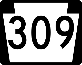
Pennsylvania Route 309 is a state highway that runs for 134 miles (216 km) through eastern Pennsylvania. The route runs from an interchange between PA 611 and Cheltenham Avenue on the border of Philadelphia and Cheltenham Township north to an intersection with PA 29 in Bowman Creek, a village in Monroe Township in Wyoming County. The highway connects Philadelphia and its northern suburbs to Allentown and the Lehigh Valley, and Hazleton and Wilkes-Barre in the Wyoming Valley.

New York State Route 104 (NY 104) is a 182.41-mile-long (293.56 km) east–west state highway in Upstate New York in the United States. It spans six counties and enters the vicinity of four cities—Niagara Falls, Lockport, Rochester, and Oswego—as it follows a routing largely parallel to the southern shoreline of Lake Ontario, along a ridge of the old shoreline of Glacial Lake Iroquois. The western terminus of NY 104 is an intersection with NY 384 in Niagara Falls, Niagara County, while its eastern terminus is a junction with NY 13 in the town of Williamstown, Oswego County. The portion of NY 104 between Rochester and the village of Webster east of the city is a limited-access highway known as the Keeler Street Expressway west of NY 590 and the Irondequoit–Wayne County Expressway east of NY 590; from Williamson to Oswego, NY 104 is a super two highway.

Ernest W. Barrett Parkway is a major thoroughfare in the northwestern part of the Atlanta metropolitan area, in the north-central part of Cobb County, in the U.S. state of Georgia. It travels from the southeastern edge of Kennesaw to a point north of Marietta, and continues on in both directions under other names. The portion of Barrett Parkway between Interstate 575 (I-575/SR 5) and US 41/SR 3 is designated State Route 5 Connector. The road is named after Ernest W. Barrett, the first chairman of the Cobb County Board of Commissioners in the 1960s, after home rule was enacted under a Georgia State Constitution amendment. The initial portion was constructed through Barrett family land, enabling it to be later sold for major development.

New York State Route 27 (NY 27) is a 120.58-mile (194.05 km) long state highway that runs east–west from Interstate 278 (I-278) in the New York City borough of Brooklyn to Montauk Point State Park on Long Island, New York. Its two most prominent components are Sunrise Highway and Montauk Highway, the latter of which includes the Montauk Point State Parkway. NY 27 acts as the primary east–west highway on southern Long Island east of the interchange with the Heckscher State Parkway in Islip Terrace. The entire route in Suffolk, Nassau, and Queens counties were designated by the New York State Senate as the POW/MIA Memorial Highway. The highway gives access to every town on the South Shore. NY 27 is the easternmost state route in the state of New York.

The Southern State Parkway is a 25.53-mile (41.09 km) parkway on Long Island, New York, in the United States. The parkway begins at an interchange with the Belt and Cross Island Parkways in Elmont, in Nassau County, and travels east to an interchange with the Sagtikos State Parkway in West Islip, Suffolk County, where it becomes the Heckscher State Parkway. The Southern State Parkway comprises the western portion of unsigned New York State Route 908M (NY 908M), with the Heckscher Parkway occupying the eastern section.

County Route 549 is a county highway in the U.S. state of New Jersey. The highway extends 17.82 miles (28.68 km) from Main Street at County Route 527 in Toms River to County Route 547 at Monmouth CR 21 in Howell. The highway has the distinction of being the only 500-series route left with two separate spur routes.
A two-lane expressway or two-lane freeway is an expressway or freeway with only one lane in each direction, and usually no median barrier. It may be built that way because of constraints, or may be intended for expansion once traffic volumes rise. The term super two is often used by roadgeeks for this type of road, but traffic engineers use that term for a high-quality surface road. Most of these roads are not tolled.
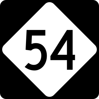
North Carolina Highway 54 (NC 54) is a 55.0-mile-long (88.5 km) primary state highway in the U.S. state of North Carolina. The highway serves the Research Triangle area, between Burlington and Raleigh, connecting the cities and towns of Chapel Hill, Durham, Morrisville and Cary. The highway also links the campuses of University of North Carolina at Chapel Hill and North Carolina State University.

State Route 388 (SR 388) is a 4.5-mile-long (7.2 km) state highway that travels south-to-north in a backward L-shape, completely within Columbia County, in the east-central part of the state of Georgia. It connects Grovetown to Lewiston.

County Route 510 (CR 510) is a county highway in the U.S. state of New Jersey. The highway extends 29.58 miles (47.60 km) from North Road (CR 513) in Chester to McCarter Highway in Newark.

Maryland Route 337 is a state highway in the U.S. state of Maryland. Known for most of its length as Allentown Road, the highway runs 3.41 miles (5.49 km) from MD 5 in Camp Springs east to MD 4 near Forestville. MD 337 runs along the southern end of Morningside and the northern edge of Andrews Air Force Base and provides access to several entrances to the military base. The state highway runs concurrently with the easternmost portion of Suitland Parkway. The parkway stretch of MD 337 is maintained by the National Park Service (NPS) instead of the Maryland State Highway Administration (MDSHA). MD 337 was constructed in the mid- to late 1910s along a course further south than the modern highway. The highway was moved to its present alignment to make way for the construction of Andrews Air Force Base during World War II. The easternmost part of the highway was constructed as Suitland Parkway. The Allentown Road portion of MD 337 was expanded to a multi-lane divided highway in the late 1970s and early 1980s. The Suitland Parkway segment was expanded to a divided highway in the mid-1990s. MDSHA plans to build an interchange at MD 337's eastern terminus with MD 4.

U.S. Route 322 is a spur of U.S. Route 22, running from Cleveland, Ohio, east to Atlantic City, New Jersey. The easternmost segment of the route in New Jersey runs 62.64 miles (100.81 km) from the Commodore Barry Bridge over the Delaware River in Logan Township, Gloucester County, where it continues southeast to Atlantic Avenue and Pacific Avenue in Atlantic City, Atlantic County. The portion of the route between the Commodore Barry Bridge and Route 42 in Williamstown is mostly a two-lane undivided road that is concurrently signed with County Route 536 (CR 536), passing through Mullica Hill and Glassboro. From Williamstown, US 322 follows the Black Horse Pike, a four-lane road, southeast to Atlantic City. In Hamilton Township, Atlantic County, US 322 forms a concurrency with U.S. Route 40, continuing with that route all the way to Atlantic City. US 322 intersects several major roads including U.S. Route 130 and Interstate 295 (I-295) in Logan Township, the New Jersey Turnpike in Woolwich Township, Route 55 in Harrison Township, Route 42 in Williamstown, Route 50 and U.S. Route 40 in Hamilton Township, the Garden State Parkway in Egg Harbor Township, and U.S. Route 9 in Pleasantville.
Many arterial roads in the Phoenix metropolitan area have the same name in multiple cities or towns. Some roads change names or route numbers across town borders, resulting in occasional confusion. For example, the road known as Apache Boulevard in Tempe continues east as Main Street in neighboring Mesa and then as Apache Trail in Apache Junction. Although Broadway Road maintains the same name through Goodyear, Avondale, Phoenix, Tempe, Mesa, and Apache Junction, each town uses a different reference point for address numbers.
There are 34 routes assigned to the "S" zone of the California Route Marker Program, which designates county routes in California. The "S" zone includes county highways in Imperial, Orange, Riverside, San Diego, and Santa Barbara counties.