North Carolina Highway 90

Last updated

NC 90.svg

North Carolina Highway 90

NC 90 map.svg
Route information
Maintained by NCDOT
Length71.7 mi [1]  (115.4 km)
Existed1921–present
Major junctions
West endEdgemont Road (SR 1420) in Edgemont
Major intersectionsUS 321.svg US 321 in Lenoir
US 64.svgNC 18.svg US 64  / NC 18 in Lenoir
I-40.svg I-40 in Statesville
East endUS 21.svgUS 64.svg US 21  / US 64 in Statesville
Location
Country United States
State North Carolina
Counties Caldwell, Alexander, Iredell
Highway system
NC 89.svg NC 89 NC 91.svg NC 91

North Carolina Highway 90 (NC 90) is a primary state highway in the U.S. state of North Carolina. It is one of the few highways in the state with an unpaved portion.

Contents

Route description

The western terminus is in Edgemont (in Caldwell County) at an intersection with Edgemont Road (SR 1420), Roseboro Road (Pisgah National Forest FR 981) and Edgemont Church Place (SR 1358). The first 8 miles (13 km) of the highway are quite curvy and unpaved. [2] NC 90 enters Lenoir on Valway Road (SR 1352). The route then turns left onto N. Main Street to then overlap with US 321 on Blowing Rock Boulevard. NC 90 then turn left, after 2 miles, onto Wilkesboro Boulevard to overlap with US 64 and NC 18. After about 2 miles, the route then turns right onto Taylorsville Road, keeping and overlap with US 64. After 40 miles, going through Taylorsville, NC 90 ends at US 21/US 64 in Statesville.

History

Established in 1921 as an original state highway, it started at NC 50 (Person Street), in Raleigh, going east to Columbia. In 1927, NC 90 was extended west from Raleigh to Lenoir at NC 18. In 1929, NC 90 extended east from Columbia to Fort Landing.

In 1932, US 64 was established and was overlapped on NC 90 from just west of Statesville to Fort Landing. In late 1934, NC 90 was removed from all overlap with US 64 east of Statesville; at same time, NC 90 was extended west from Lenoir to US 221 near Linville, replacing NC 171.

Sometime between 1939 and 1944, NC 90 was extended east back in Statesville to its current east terminus, replacing some of US 64 through the downtown area. At some point in the 1960s, NC 90 was truncated to its current west terminus in Edgemont, its former route to Linville moved under Pisgah National Forest management. [3] [4]

In 2008, NC 90 was removed from downtown Lenoir, creating an overlap with US 321. [5]

Major intersections

CountyLocationmi [1] kmDestinationsNotes
Caldwell Edgemont 0.00.0Edgemont Road / National Forest Road
Lenoir 27.944.9North plate.svg
US 321.svg
US 321 north (Blowing Rock Boulevard) Boone
North end of US 321 overlap
30.148.4West plate.svg
US 64.svg
South plate.svg
NC 18.svg
South plate.svg
US 321.svg
US 64 west / NC 18 south (Harper Avenue) / US 321 south (Hickory Boulevard) – Downtown Lenoir, Hickory
South end of US 321/NC 18 and west end of US 64 overlap
31.550.7North plate.svg
NC 18.svg
NC 18 north (Wilkesboro Boulevard) Moravian Falls, Wilkesboro
North end of NC 18 overlap
Alexander Ellendale 46.074.0South plate.svg
NC 127.svg
NC 127 south Hickory
Northern terminus of NC 127
49.279.2East plate.svg
US 64.svg
US 64 east / Golf Course Lane Statesville
East end of US 64 overlap
Taylorsville 50.481.1North plate.svg
NC 16.svg
NC 16 north Moravian Falls, Wilkesboro
North end of NC 16 overlap
50.881.8South plate.svg
NC 16.svg
NC 16 south Conover
South end of NC 16 overlap
Iredell 67.7109.0West plate.svg
US 64.svg
US 64 west Taylorsville, Lenoir
West end of US 64 overlap
Statesville 68.3109.9I-40.svg I-40  Hickory, Winston-Salem
69.6112.0US 70.svgTo plate blue.svg
I-77.svg
US 70 (Newton Drive / Garner Bagnal Boulevard) to I-77  Statesville Regional Airport, Hickory
70.4113.3East plate.svg
US 64.svg
US 64 east (Front Street)
East end of US 64 overlap
71.4114.9NC 115.svg NC 115 (Center Street) North Wilkesboro
71.7115.4US 21.svgUS 64.svg US 21 (Davie Avenue) / US 64  Harmony, Mocksville
1.000 mi = 1.609 km; 1.000 km = 0.621 mi

Special routes

Rocky Mount alternate route

NC 90A 1945.svg

North Carolina Highway 90A

Location Rocky Mount, North Carolina
Existed1932–1934

North Carolina Highway 90 Alternate (NC 90A) was new alternate routing through downtown Rocky Mount, via Thomas Avenue. In 1934, it was replaced by US 64A.

See also

Related Research Articles

<span class="mw-page-title-main">U.S. Route 321</span> Highway in the United States

U.S. Route 321 (US 321) is a spur of U.S. Route 21. It runs for 516.9 miles (831.9 km) from Hardeeville, South Carolina to Lenoir City, Tennessee; with both serving as southern termini. It reaches its northernmost point at Elizabethton, Tennessee, just northeast of Johnson City. Because of its unusual "north–south–north" routing, U.S. Route 321 intersects both Interstate 40 and U.S. Route 70 three separate times. The highway serves different roles in each state: An alternate route to interstates in South Carolina, a major highway in North Carolina, and a scenic route in Tennessee.

<span class="mw-page-title-main">U.S. Route 276</span> Highway in the United States

U.S. Route 276 is a United States highway that runs for 106.4 miles (171.2 km) from Mauldin, South Carolina to Cove Creek, North Carolina. It is known both as a busy urban highway in Greenville, South Carolina and a scenic back-road in Western North Carolina. Despite its numbering, it does not intersect its parent route U.S. Route 76.

<span class="mw-page-title-main">U.S. Route 19W</span> Suffixed section of U.S. Highway in Tennessee and North Carolina

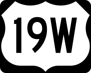
U.S. Route 19W (US 19W) traverses approximately 63 miles (101 km) from Cane River, North Carolina, to Bluff City, Tennessee.

<span class="mw-page-title-main">North Carolina Highway 75</span> State highway in Union County, North Carolina, US

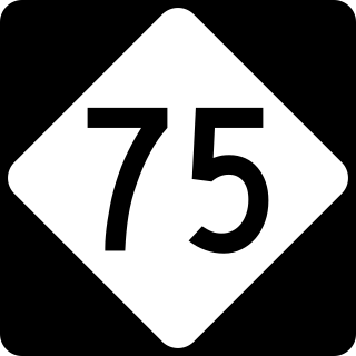
North Carolina Highway 75 (NC 75) is a primary state highway in the U.S. state of North Carolina. Its entire length runs through Union County and serves as the primary connector between the towns of Waxhaw, Mineral Springs, and Monroe. The route roughly parallels a CSX railroad line for its entire span.

<span class="mw-page-title-main">North Carolina Highway 226</span> State highway in North Carolina, US

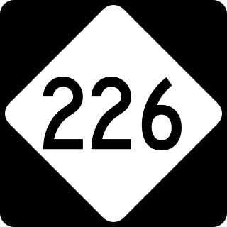
North Carolina Highway 226 (NC 226) is a primary state highway in the U.S. state of North Carolina. Traveling north–south through Western North Carolina, it connects the cities and towns of Grover, Shelby, Marion, Spruce Pine and Bakersville. It also a scenic byway in the South Mountains area and connects with the summer colony of Little Switzerland, via NC 226A.

<span class="mw-page-title-main">U.S. Route 64 in North Carolina</span> Highway in North Carolina, US

U.S. Route 64 (US 64) is the longest numbered route in the U.S. state of North Carolina, running 604 miles (972 km) from the Tennessee state line to the Outer Banks. The route passes through the westernmost municipality in the state, Murphy, and one of the most easternmost municipalities, Manteo, making US 64 a symbolic representation of the phrase "from Murphy to Manteo" which is used to refer to the expanse of the state. The highway is a major east–west route through the central and eastern portion of the state.

<span class="mw-page-title-main">North Carolina Highway 16</span> State highway in North Carolina, US

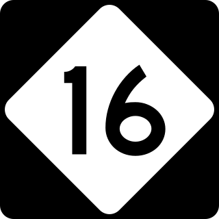
North Carolina Highway 16 (NC 16) is a 143.8-mile primary state highway in the U.S. state of North Carolina. Traveling in a north–south direction, it connects the cities and towns of Charlotte, Newton, Conover, Taylorsville, Wilkesboro and Jefferson, linking the Charlotte metropolitan area with the mountainous High Country. NC 16 is part of a three-state route 16 that connects the Charlotte region with northwestern West Virginia.

<span class="mw-page-title-main">North Carolina Highway 11</span> State highway in North Carolina, US

North Carolina Highway 11 is a primary state highway in the U.S. state of North Carolina. Traveling 193.2 miles (310.9 km) in a north–south alignment through Eastern North Carolina, it connects the towns and cities of Wallace, Kenansville, Kinston, Greenville and Murfreesboro.

<span class="mw-page-title-main">North Carolina Highway 18</span> State highway in North Carolina, US

North Carolina Highway 18 (NC 18) is a primary state highway in the U.S. state of North Carolina. Traveling north–south through the Foothills region, it connects the cities of Shelby, Morganton, Lenoir, Wilkesboro and North Wilkesboro.

<span class="mw-page-title-main">North Carolina Highway 28</span> State highway in North Carolina, US

North Carolina Highway 28 (NC 28) is an 81.2-mile-long (130.7 km) primary state highway in the U.S. state of North Carolina. The highway runs north–south through the Nantahala National Forest in Western North Carolina.

<span class="mw-page-title-main">North Carolina Highway 62</span> State highway in North Carolina, US

North Carolina Highway 62 (NC 62) is a primary state highway in the U.S. state of North Carolina. Primarily in the Piedmont Triad, it runs from NC 109 in Thomasville northeast to the Virginia state line in Milton.

<span class="mw-page-title-main">North Carolina Highway 268</span> State highway in North Carolina, US

North Carolina Highway 268 (NC 268) is a primary state highway in the U.S. state of North Carolina. It connects many communities as it traverses through the northwestern North Carolina mountains and foothills.

<span class="mw-page-title-main">North Carolina Highway 115</span> State highway in North Carolina, US

North Carolina Highway 115 is a primary state highway in the U.S. state of North Carolina. It runs from U.S. Route 21 in North Charlotte north through Mecklenburg, Iredell and Wilkes counties. Its northern terminus is at its intersection with US 421 Business, NC 18 and NC 268 in North Wilkesboro.

<span class="mw-page-title-main">North Carolina Highway 197</span> State highway in North Carolina, US

North Carolina Highway 197 is a South-to-North state highway in Western North Carolina. The route is approximately 58 miles (93 km) in length and with its continuation into Tennessee as SR 395 connects Erwin, Tennessee to Flat Creek, North Carolina. Portions of this highway lie within the Pisgah National Forest and is one of the few highways in the state with an unpaved portion.

<span class="mw-page-title-main">North Carolina Highway 105</span> State highway in North Carolina, US

North Carolina Highway 105 (NC 105) is a primary state highway in the U.S. state of North Carolina. It traverses from the mountain community of Linville to the town of Boone.

<span class="mw-page-title-main">North Carolina Highway 175</span> State highway in Clay County, North Carolina, US

North Carolina Highway 175 (NC 175) is a primary state highway in the U.S. state of North Carolina. The highway runs north from the Georgia state line to US 64, along the eastern banks of Chatuge Lake.

<span class="mw-page-title-main">North Carolina Highway 183</span> State highway in North Carolina, US

North Carolina Highway 183 (NC 183) is a primary state highway in the U.S. state of North Carolina. It traverses from US 221, in the community of Linville Falls, to NC 181, near the community of Jonas Ridge.

<span class="mw-page-title-main">North Carolina Highway 181</span> State highway in North Carolina, US

North Carolina Highway 181 (NC 181) is a primary state highway in the U.S. state of North Carolina. It runs north–south from Morganton to Newland.

<span class="mw-page-title-main">North Carolina Highway 194</span> State highway in North Carolina, US

North Carolina Highway 194 (NC 194) is a primary state highway in the U.S. state of North Carolina. Entirely in the High Country, it runs from US 19E, in Ingalls, to the Virginia state line, near Helton.

<span class="mw-page-title-main">North Carolina Highway 171</span> State highway in North Carolina, US

North Carolina Highway 171 (NC 171) is a primary state highway in the U.S. state of North Carolina. It utilized as a connector route running from US 17 in Old Ford between Washington and Williamston to US 64 Business in Jamesville.

References

  1. 1 2 Google (May 9, 2015). "North Carolina Highway 90" (Map). Google Maps . Google. Retrieved May 9, 2015.
  2. Caldwell County, North Carolina (PDF) (Map) (2000 (Rev. 07/13/2007) ed.). North Carolina Department of Transportation Information Technology - IMG Unit. Retrieved September 6, 2007.
  3. "NC State Hwy 90 Ends". Archived from the original on November 1, 2010. Retrieved 2011-07-02.
  4. "NC 90: Lost in Caldwell County" . Retrieved 2011-07-02.[ self-published source ]
  5. "NCRoads.com: N.C. 90" . Retrieved 2011-07-02.[ self-published source ]
Template:Attached KML/North Carolina Highway 90
KML is from Wikidata