Arizona State Route 77

Last updated

Arizona 77.svg

State Route 77

Arizona State Route 77
SR 77 highlighted in red
Route information
Maintained by ADOT
Length253.93 mi [1]  (408.66 km)
ExistedMay 13, 1930–present
HistoryPart of the route is a former section of US 80 and US 89
Tourist
routes
Arizona Scenic Road Marker.svg Copper Corridor Scenic Road [2]
US 80 (AZ historic).svg Historic US 80 [3]
Major junctions
South endI-10.svg I-10 in Tucson
Major intersections
North endIndian Route 6.svg BIA Route 6 at Navajo Nation boundary
Location
Country United States
State Arizona
Counties Pima, Pinal, Gila, Navajo
Highway system
  • Arizona State Highway System
Arizona 76 1978.svg SR 76 Arizona 78.svg SR 78

State Route 77 (SR 77) is a 253.93-mile (408.66-kilometre) long state highway in Arizona that traverses much of the state's length, stretching from its southern terminus at a junction with I-10 in Tucson to its northern terminus with BIA Route 6 at the Navajo Nation boundary just north of I-40.

Contents

Between Tucson and the Navajo Nation, SR 77 passes through Oro Valley, Oracle, Mammoth, Winkelman, Globe, Show Low, Snowflake and Holbrook, as well as passing through the Fort Apache Indian Reservation and a tiny corner of the San Carlos Apache Indian Reservation. Between Globe and Show Low, SR 77 runs entirely concurrent with US 60. When it was originally commissioned in 1930, SR 77 only traversed the route between McNary and Holbrook. Between 1938 and 1992, the route was slowly re-routed and extended in increments, to its current termini in Tucson and at the Navajo Nation boundary.

Route description

State Route 77 (SR 77) begins at a diamond interchange with Interstate 10 (I-10) Exit 255 in Tucson. The highway proceeds east along West Miracle Mile for 1.5 miles (2.4 kilometres), passing through the Miracle Mile Historic District. West Miracle Mile ends at an intersection with Oracle Road, where SR 77 turns north past the Tucson Mall. After crossing over the Rillito River, SR 77 leaves Tucson and continues north as an eight lane divided highway through the suburban town of Oro Valley and Catalina State Park to Oracle Junction, where SR 77 meets SR 79 at an intersection. SR 79 continues north towards Florence, while SR 77 proceeds northeast. [4] The divided highway segment of SR 77 ends just past Oracle Junction. SR 77 continues through Oracle, passing the Biosphere 2 complex to a grade–separated interchange with Veterans Memorial Boulevard (former SR 76), which acts as the main connection between SR 77 and San Manuel, as well as a private road, off limits to the public, servicing the San Manuel Copper Mine complex. [5]

SR 77 curves to the north past San Manuel into Mammoth, now paralleling the San Pedro River to the east. North of town, the highway crosses over the San Pedro River and continues paralleling the river on the eastern side. SR 77 continues north, passing by the Central Arizona College Aravaipa Campus and Arizona College of Technology, proceeding through Dudleyville into Winkelman, where SR 77 crosses over the Gila River, next to the old Winkelman Bridge. [5] In town, the intersection with 2nd Street marks the southern terminus of SR 177, which continues west on 2nd Street, then northwest towards Superior. SR 77 continues north through town, then parallels the western bank of the Gila River to the northeast. After following the river for 7 miles (11 kilometres), SR 77 curves northwest, passing through Dripping Springs, then curves northeast through El Capitan, past Pinal Peak to a junction with U.S. Route 70 (US 70) just outside of Globe. [4]

SR 77 traveling through Salt River Canyon State route 77 in the salt river canyon, arizona.jpg
SR 77 traveling through Salt River Canyon

US 70 and SR 77 run west concurrently to the outskirts of Globe, where the former highway ends at US 60. SR 77 turns northeast and runs concurrently with US 60 out of Globe, entering the Salt River Canyon, briefly entering the San Carlos Apache Indian Reservation before continuing into the Fort Apache Indian Reservation. Inside the reservation boundaries US 60 and SR 77 act as the southern terminus of SR 73. Both highways arrive in Show Low, with the highway being named "Deuce of Clubs" through town. Entering town, US 60 and SR 77 meet SR 260 at a traffic controlled intersection with Clark Road. From this intersection, all three highways run concurrently on Deuce of Clubs into the center of town. SR 260 separates from US 60 and SR 77 at the east side of Show Low, continuing towards Eagar on White Mountain Road. US 60 and SR 77 continue ahead on Deuce of Clubs, to an intersection with Penrod Road, where SR 77 separates from US 60, heading north past the Show Low Regional Airport. [4]

SR 77 between Snowflake and Holbrook Arizona State Route 77 Between Snowflake, Arizona and Holbrook, Arizona.jpeg
SR 77 between Snowflake and Holbrook

SR 77 continues due north through the communities of Shumway and Taylor, becoming Main Street in Snowflake. SR 77 intersects with the eastern terminus of SR 277 at 3rd Street North on the northern edge of town. Following Main Street north out of Snowflake, SR 77 crosses a bridge over Cottonwood Wash. The highway continues north, intersecting the northern terminus of SR 377 at a "wye" intersection on the outskirts of Holbrook, in front of the Navajo County Superior Court. [5] North of the Superior Court, SR 77 meets US 180 at a junction, where US 180 joins SR 77. Both highways continue north concurrently on Apache Avenue, crossing over the Little Colorado River into downtown Holbrook, where Apache Avenue becomes Navajo Boulevard. At the intersection with Hopi Drive, which carries part of the I-40 Business Loop (I-40 Bus.), US 180 leaves SR 77, heading west with I-40 Bus. towards Winslow and Flagstaff. SR 77 continues north on Navajo Boulevard, concurrent with I-40 Bus. to I-40 exit 286. SR 77 leaves Navajo Boulevard and I-40 Bus., becoming concurrent with I-40 heading east. On the edge of town, Navajo Boulevard and I-40 Bus. loop back to I-40/SR 77 at exit 289. At exit 292, SR 77 leaves I-40 continuing north towards the Navajo Nation. SR 77 ends at the Navajo Nation boundary, north of Holbrook. Past the Navajo Nation boundary, SR 77 becomes BIA Route 6 northbound to SR 264 near Keams Canyon. [4]

History

Between Miracle Mile and SR 79, SR 77 is part of Historic U.S. Route 80. Historic US 80 and SR 77 in Tucson, Arizona.jpg
Between Miracle Mile and SR 79, SR 77 is part of Historic U.S. Route 80.

State Route 77 (SR 77) was first designated on May 13, 1930. [6] The highway originally ran from a junction with SR 73 in McNary to U.S. Route 66 (US 66) in Holbrook via Show Low. [7] On June 20, 1938, the section of SR 77 between Show Low and McNary was decommissioned, following the completion of US 60 from Globe to Springerville through Show Low. SR 77 was then extended southwest along the brand new US 60 to Globe, followed by a further southeast extension along US 70 from Globe to Cutter at the San Carlos Indian Reservation. From Cutter, SR 77 was extended further south along a newly acquired state highway to a southern terminus with US 80/US 89 in Oracle Junction. At the time, both U.S. Highways made up the route between Tucson and Oracle Junction. [6] [8]

US 80 was removed from the Tucson to Oracle Junction corridor in 1977, when the U.S. Highway was truncated to I-10 in Benson. [9] On August 21, 1992, US 89 was truncated to US 180 in Flagstaff. At the same time, the northern Tucson section of the Interstate 10 Business Loop (I-10 Business) was decommissioned. I-10 Business started at an intersection with I-10 and Miracle Mile, heading east on Miracle Mile to US 89, then followed US 89 south on Oracle to its terminus at a junction with US 89, I-10, and I-19 Business in South Tucson, Arizona. SR 77 was immediately extended south along former US 89 down Oracle Road to Miracle Mile in Tucson, then extended west along Miracle Mile (which was part of the recently decommissioned I-10 Business) to an interchange with I-10. [10] While Miracle Mile and the northern segment of Oracle Road were renumbered as an extension of SR 77, the remainder of I-10 Business and US 89 between the intersection of Oracle Road and Miracle Mile and the interchange with I-10 and I-19 Business were not given to another route and was retired as a state highway, being handed over to the city of Tucson on October 15, 1993. [11]

Origin of the name of Tucson's Miracle Mile

Although it was thought for several years that Tucson's Miracle Mile derived its name from a June 1937 Arizona Highways magazine, historian David Leighton challenged this theory, in a February 23, 2015, article in the Arizona Daily Star newspaper. He explained that in 1936, real estate developer Stanley Williamson conceived the idea of creating a commercial center outside of the over-congested downtown retail district, in Tucson. His model for this business center was the Miracle Mile in Los Angeles, California. The one in Los Angeles was the idea of real estate agent A.W. Ross, who saw that the retail district in that city was overcrowded and that cars were becoming more common. He came up with the idea of buying farming land along Wilshire Boulevard, several miles out from downtown, with the belief that as more people bought automobiles, they would be willing to drive farther to avoid the lack of parking and congestion in the downtown area. While initially no one thought his idea would work, in time store after store came to his business center. The Miracle Mile eventually became one of Los Angeles' premier shopping districts. Ross originally called his business area the Wilshire Boulevard Center; it was changed to the Miracle Mile in 1928.

Junction list

CountyLocationmi [1] [lower-alpha 1] kmExitDestinations [12] [3] [2] [13] Notes
Pima Tucson 68.05109.52I-10.svg I-10  Phoenix, El Paso Southern terminus; I-10 exit 255
69.05111.13Oracle Road south (Historic US 80 east) Tucson City Center Southern end of Historic US 80 concurrency; former US 80 east / US 89 / SR 93 south
Oro Valley 79.12127.33Hospital sign.svg Tangerine Road (SR 989 west)Serves Oro Valley Hospital
Pinal Oracle Junction 91.14146.68North plate.svg
Arizona 79.svg
West plate brown.svg
US 80 (AZ historic).svg
SR 79 north / Historic US 80 west (Pinal Pioneer Parkway) Florence, Phoenix
Northern end of Historic US 80 concurrency; southern terminus of SR 79; former US 80 west / US 89 north
109.14175.64Airport Sign.svg Veterans Memorial Boulevard San Manuel Interchange; serves San Manuel Airport; former SR 76
Gila River 134.62216.65Bridge
Gila Winkelman 134.80216.94North plate.svg
Arizona 177.svg
SR 177 north (2nd Street) Superior
Southern terminus of SR 177
Globe 170.92
254.10
275.07
408.93
East plate.svg
US 70.svg
US 70 east Safford
Southern end of US 70 concurrency; mile markers change to reflect US 70
252.14
252.06
405.78
405.65
End plate.svg
US 70.svg
West plate.svg
US 60.svg
US 70 ends / US 60 west (Ash Street west) Globe, Phoenix
Southern end of US 60 concurrency; northern end of US 70 concurrency; mileposts change to reflect US 60
Navajo 318.15512.01East plate.svg
Arizona 73.svg
SR 73 east
Western terminus of SR 73
Show Low 339.73546.74West plate.svg
Arizona 260.svg
SR 260 west (Clark Road) Heber
Southern end of SR 260 concurrency
341.69549.90East plate.svg
Arizona 260.svg
SR 260 east (White Mountain Road) Pinetop-Lakeside
Northern end of SR 260 concurrency
342.01
342.20
550.41
550.72
East plate.svg
US 60.svg
US 60 east (Deuce of Clubs east) Springerville
Northern end of US 60 concurrency; mileposts change to reflect SR 77
Snowflake 361.05581.05West plate.svg
Arizona 277.svg
SR 277 west (3rd Street North) Heber
Eastern terminus of SR 277
Holbrook 386.20621.53South plate.svg
Arizona 377.svg
SR 377 south (Heber Road) Heber
Northern terminus of SR 377
387.49623.60East plate.svg
US 180.svg
US 180 east St. Johns
Southern end of US 180 concurrency
388.54
286.69
625.29
461.38
Business Loop 40.svgUS 180.svgWest plate brown.svg
US 66 (AZ historic).svg
To plate blue.svg
I-40.svg
BL 40  / US 180  / Historic US 66 west (Hopi Drive) to I-40  Flagstaff
Northern end of US 180 overlap; southern end of I-40 BL/Historic US 66 concurrency; former US 66 west; mileposts change to reflect I-40 BL
287.36
286.91
462.46
461.74
Business Loop 40.svgEast plate brown.svg
US 66 (AZ historic).svg
West plate blue.svg
I-40.svg
BL 40  / Historic US 66 east (Navajo Boulevard) / I-40 west Flagstaff
Northern end of I-40 BL/Historic US 66 concurrency; southern end of I-40 concurrency; I-40 exit 286; former US 66 east; mileposts change to reflect I-40
289.46465.84289Business Loop 40.svgWest plate brown.svg
US 66 (AZ historic).svg
BL 40  / Historic US 66 west (Navajo Boulevard)
Exit number follows I-40; former US 66 west
292.83
395.07
471.26
635.80
East plate blue.svg
I-40.svg
I-40 east Albuquerque
Northern end of I-40 concurrency; I-40 exit 292; mileposts change to reflect SR 77
408.93658.11North plate.svg
Indian Route 6.svg
BIA Route 6 north
Continuation beyond northern terminus at Navajo Nation boundary
1.000 mi = 1.609 km; 1.000 km = 0.621 mi

See also

Notes

  1. The mileage reflects the official ADOT mileposts along SR 77. The mileposts reflecting SR 77 only are based on former US 89. Milepost 0.00 was on US 89 (now SR 19 Bus.) at the United States–Mexico border in Nogales.

Related Research Articles

<span class="mw-page-title-main">U.S. Route 80</span> Numbered Highway in the United States

U.S. Route 80 or U.S. Highway 80 (US 80) is a major east–west United States Numbered Highway in the Southern United States, much of which was once part of the early auto trail known as the Dixie Overland Highway. As the "0" in the route number indicates, it was originally a cross-country route, from the Pacific Ocean to the Atlantic Ocean. Its original western terminus was at Historic US 101 in San Diego, California. However, the entire segment west of Dallas, Texas, has been decommissioned in favor of various Interstate Highways and state highways. Currently, the highway's western terminus is at an interchange with Interstate 30 (I-30) on the Dallas–Mesquite, Texas city line. Its eastern terminus is in Tybee Island, Georgia near the Atlantic Ocean. Between Jonesville, Texas and Kewanee, Mississippi, US 80 runs parallel to or concurrently with Interstate 20. It also currently runs through Dallas, Texas; Shreveport, Louisiana; Jackson, Mississippi; Montgomery, Alabama; Columbus, Georgia; Macon, Georgia; and Savannah, Georgia.

<span class="mw-page-title-main">U.S. Route 180</span> Numbered Highway in the United States

U.S. Route 180 is an east–west United States highway. Like many three-digit routes, US 180 no longer meets its "parent", US 80. US 80 was decommissioned west of Mesquite, Texas, and was replaced in Texas by Interstate 20 and Interstate 10 resulting in U.S. 180 being 57 miles longer than U.S. 80. The highway's eastern terminus is in Hudson Oaks, Texas, at an intersection with Interstate 20. Its western terminus is unclear. Signage at an intersection with State Route 64 in Valle, Arizona 40 miles (64 km) northwest of Flagstaff indicates that the route starts at SR 64, which is consistent with the AASHTO U.S. Highway logs. However, many maps continue the US 180 designation to the south rim of the Grand Canyon at Grand Canyon Village. Signage at the SR 64 intersection as of 2021 indicated that US 180 continues north concurrent with the route. However, no signage along the route exists past this intersection until SR 64 turns east towards Cameron, Arizona. At this intersection, signage makes no mention of US 180 nor is there any mention at the terminus of SR 64 at US 89.

<span class="mw-page-title-main">Arizona State Route 79</span> State highway in Arizona, United States

State Route 79, also known as the Pinal Pioneer Parkway, is a 58.40 mi (93.99 km) long state highway in the U.S. state of Arizona. It serves as the main route through the town of Florence, which is also the county seat of Pinal County. Although the highway has been part of the state highway system since at least 1926, it was not designated as SR 79 until 1992. The highway was previously a section of U.S. Route 80 and U.S. Route 89 between Phoenix and Tucson, until both highways were decommissioned in 1977 and 1992 respectively. SR 79 is also the only state highway in Arizona that has a business route, which is SR 79 Business through downtown Florence. SR 79 is also notable for being the location where cowboy western actor Tom Mix died in a car accident on October 14, 1940.

<span class="mw-page-title-main">Arizona State Route 89A</span> State highway in Arizona, United States

State Route 89A is an 83.85-mile (134.94 km) state highway that runs from Prescott north to Flagstaff in the U.S. state of Arizona. The highway begins at SR 89 in Yavapai County and heads northward from Prescott Valley, entering Jerome. From Jerome, the route then heads to Cottonwood and Clarkdale. The road then continues out to Sedona. The highway is notable for its scenic value as it winds over and through Mingus Mountain as well as passing through Sedona and the Oak Creek Canyon. The route then enters Coconino County soon after leaving Sedona. The highway proceeds to Flagstaff, where it crosses Interstate 17 (I-17) and I-40. The highway ends at I-40 Business in Flagstaff. What is now SR 89A became a state highway in the late 1920s as SR 79. The highway was extended and improved several times through 1938. SR 79 was renumbered to U.S. Route 89A in 1941 and then to SR 89A in the early 1990s.

<span class="mw-page-title-main">U.S. Route 89A</span> Highway in Arizona and Utah

U.S. Route 89A is a 91.74-mile (147.64 km) north–south auxiliary U.S. highway in southwestern Kane County, Utah and northeastern Coconino County, Arizona in the southwestern United States. The highway is an old routing of U.S. Route 89 from Bitter Springs, Arizona to Kanab, Utah. The state of Arizona has designated this highway the Fredonia-Vermilion Cliffs Scenic Road. The highway is used to access the North Rim of Grand Canyon National Park and is known for the Navajo Bridge. Until 2008, the Utah portion was signed State Route 11. The route provides the only direct road connection between the Arizona Strip and the rest of Arizona.

<span class="mw-page-title-main">Interstate 10 in Arizona</span> Interstate highway in Arizona

In the U.S. state of Arizona, Interstate 10 (I‑10), the major east–west Interstate Highway in the United States Sun Belt, runs east from California, enters Arizona near the town of Ehrenberg and continues through Phoenix and Tucson and exits at the border with New Mexico near San Simon. The highway also runs through the cities of Casa Grande, Eloy, and Marana. Segments of the highway are referred to as either the Papago Freeway, Inner Loop, or Maricopa Freeway within the Phoenix area and the Pearl Harbor Memorial Highway outside metro Phoenix.

<span class="mw-page-title-main">U.S. Route 66 in Arizona</span> Former designated US highway in Arizona

U.S. Route 66 also known as the Will Rogers Highway, was a major United States Numbered Highway in the state of Arizona from November 11, 1926, to June 26, 1985. US 66 covered a total of 385.20 miles (619.92 km) through Arizona. The highway ran from west to east, starting in Needles, California, through Kingman and Seligman to the New Mexico state line. Nationally, US 66 ran from Santa Monica, California, to Chicago, Illinois. In its height of popularity, US 66 was one of the most popular highways in the state of Arizona, sometimes carrying over one million cars a year.

<span class="mw-page-title-main">Arizona State Route 84</span> State highway in Arizona, United States

State Route 84, also known as SR 84, is a 41-mile (66 km) east–west highway in south-central Arizona, with its western terminus at Exit 151 of Interstate 8 and its eastern signed terminus at its junction with State Route 387 and State Route 287 in Casa Grande. An unsigned section, which is mostly maintained by local governments, runs from the SR 287 and SR 387 junction southeast through Arizola and Eloy. East of Eloy, SR 84 is concurrent with the beginning 0.87 miles (1.40 km) of State Route 87 just north of Interstate 10 near Picacho.

<span class="mw-page-title-main">Arizona State Route 88</span> Highway in Arizona

State Route 88 is a long state highway in the U.S. state of Arizona. It runs from U.S. Route 60 in Apache Junction through desert terrain to SR 188 near Roosevelt Dam. Following the Salt River for much of its length, the section east of Tortilla Flat is known as the Apache Trail and is part of the National Forest Scenic Byway system. The Apache Trail was built in the mid-1920s and the number 88 was assigned in 1927. An eastern extension of State Route 88 to Globe, Arizona was redesignated as State Route 188 on August 20, 1999.

<span class="mw-page-title-main">Arizona State Route 377</span> Highway in Arizona

State Route 377, also known as SR 377, is a state highway in northeast Arizona traveling from northeast to southwest; it begins at a junction with State Route 77 south of Holbrook, goes past Dry Lake, to end at State Route 277 east of Heber-Overgaard. Parts of the highway are also known as Dry Lake Road and Heber Road.

<span class="mw-page-title-main">Arizona State Route 277</span> State highway in Arizona, United States

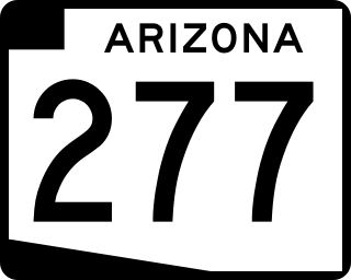
State Route 277 is a highway in Navajo County, Arizona, that runs from its junction with SR 260 in Heber-Overgaard to its junction with SR 77 in Snowflake. It is an east–west route.

<span class="mw-page-title-main">U.S. Route 60 in Arizona</span> Section of U.S. Highway in Arizona, United States

U.S. Route 60 (US 60) is an east–west United States Highway within Arizona. The highway runs for 369 miles (594 km) from a junction with Interstate 10 near Quartzsite to the New Mexico State Line near Springerville. As it crosses the state, US 60 overlaps at various points: I-17, I-10, SR 77, SR 260, US 191, and US 180. Between Wickenburg and Phoenix, the route is known as Grand Avenue. From Tempe to Apache Junction, it is known as the Superstition Freeway.

<span class="mw-page-title-main">Arizona State Route 93</span> Former state highway in Arizona, United States

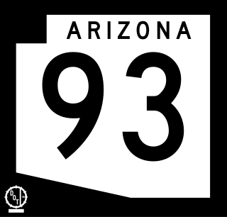
Arizona State Route 93, abbreviated SR 93, was a state highway in Arizona that existed from 1946 to 1991. The route was co-signed with other highways along nearly all of its route from Kingman to the border at Nogales. SR 93 was the original designation for the highway from Kingman to Wickenburg, which was built in 1946. In 1965, the northern terminus of the state route was moved south to an unnamed desert junction with U.S. Route 89 just north of Wickenburg, and the southern terminus of U.S. Route 93 was moved south to the US 89 junction. The Arizona Highway Department sought U.S. Highway status for SR 93 across the rest of the state, but the proposal was never granted by AASHTO. On December 17, 1984, the SR 93 designation was removed south of the Grand Avenue/Van Buren Street/7th Avenue intersection in Phoenix. The route was completely decommissioned in 1991.

<span class="mw-page-title-main">U.S. Route 191 in Arizona</span> Section of U.S. Highway in Arizona, United States

U.S. Route 191 (US 191) is a north–south U.S. Highway in eastern Arizona. The highway runs for 516.50 miles (831.23 km), making it Arizona's longest numbered highway. The highway begins at State Route 80 near Douglas and crosses over the Utah state line near Mexican Water in the Navajo Nation. Between Douglas and Utah, US 191 shares multiple concurrencies with I-10, US 70, US 180, US 60, SR 61, I-40, SR 264, and US 160.

<span class="mw-page-title-main">U.S. Route 89 in Arizona</span> Section of U.S. Highway in Coconino County, Arizona, United States

U.S. Route 89 (US 89) is a U.S. Highway in the U.S. state of Arizona that begins in Flagstaff and heads north to the Utah border northwest of Page. US 89 is among the first U.S. Highways established in Arizona between November 11, 1926 and September 9, 1927. Until 1992, US 89 started at the international border in Nogales and was routed through Tucson, Phoenix and Prescott between Nogales and Flagstaff. State Route 79 and State Route 89 are both former sections of US 89.

<span class="mw-page-title-main">U.S. Route 70 in Arizona</span> Highway in Arizona

U.S. Route 70 (US 70), also known as the Old West Highway, is an east–west U.S. Highway in the U.S. state of Arizona. The current route starts at US 60 in Globe and runs through the San Carlos Indian Reservation, Safford and Duncan into New Mexico near Virden. In Arizona, US 70 passes through mostly isolated hilly and mountainous terrain largely paralleling the course of the Gila River and the Arizona Eastern Railway.

Below is a list and summary of the former state highways, including mileage tables and maps.

<span class="mw-page-title-main">U.S. Route 80 in Arizona</span> 1926–1989 American highway

U.S. Route 80 (US 80) also known as the Ocean-to-Ocean Highway, the Broadway of America and the Jefferson Davis Memorial Highway was a major transcontinental highway that existed in the U.S. state of Arizona from November 11, 1926, to October 6, 1989. At its peak, US 80 traveled from the California border in Yuma to the New Mexico state line near Lordsburg. US 80 was an important highway in the development of Arizona's car culture. Like its northern counterpart, US 66, the popularity of travel along US 80 helped lead to the establishment of many unique road side businesses and attractions, including many iconic motor hotels and restaurants. US 80 was a particularly long highway, reaching a length of almost 500 miles (800 km) within the state of Arizona alone for most of the route's existence.

<span class="mw-page-title-main">Business routes of Interstate 40</span> Highway system

Interstate business routes are roads connecting a central or commercial district of a city or town with an Interstate bypass. These roads typically follow along local streets often along a former U.S. Route or state highway that had been replaced by an Interstate. Interstate business route reassurance markers are signed as either loops or spurs using a green shield shaped and numbered like the shield of the parent Interstate highway.

References

Template:Attached KML/Arizona State Route 77
KML is from Wikidata
  1. 1 2 "2008 State Highway System Log" (PDF). Arizona Department of Transportation. December 31, 2008. Retrieved April 9, 2008.
  2. 1 2 Arizona Department of Transportation (2014). "Arizona Parkways, Historic and Scenic Roads" (PDF). Phoenix: Arizona Department of Transportation. Retrieved September 11, 2018.
  3. 1 2 "Historic Arizona U.S. Route 80 Designation". Webpage. Tucson Historic Preservation Foundation. August 2017. Retrieved 30 September 2018.
  4. 1 2 3 4 Arizona Department of Transportation, Multimodal Planning Division (2021). State Highway System (ArcGIS) (Map). Arizona Department of Transportation. Retrieved June 5, 2023.
  5. 1 2 3 Google (June 16, 2023). "Overview map of SR 77" (Map). Google Maps . Google. Retrieved June 16, 2023.
  6. 1 2 History of the Arizona State Highway Department (Report). Arizona State Highway Department and United States Public Roads Administration. June 1939. Retrieved July 27, 2019 via Arizona Memory Project.
  7. Arizona Highway Department (1931). State Highway Department Road Map of Arizona (Map). 1:1,267,200. Taylor Printing Company. Retrieved July 27, 2019 via AARoads.
  8. Arizona Highway Department (1939). State Highway Department Road Map of Arizona (Map). 1:1,267,200. Taylor Printing Company. Retrieved July 27, 2019 via AARoads.
  9. Weingroff, Richard F. (October 17, 2013). "U.S. Route 80: The Dixie Overland Highway". Highway History. Federal Highway Administration. Retrieved April 1, 2015.
  10. Arizona Department of Transportation. "ADOT Right-of-Way Resolution 1992-08-A-056". Arizona Department of Transportation. Retrieved October 9, 2019. Renumber B-10 from MP. 255.26 in Tucson to U.S. 89 at M.P. 256.71. / Renumber U.S. 89 from S.R. B-10 (Miracle Mile) to Oracle Jct.
  11. Arizona Department of Transportation. "ADOT Right-of-Way Resolution 1993-10-A-062". Arizona Department of Transportation. Retrieved October 9, 2019. Abandon portion of R/W to city of Tucson, priors 9-9-27, 8-21-36, 63-69, 87-109, & 92-56.
  12. Arizona State Transportation Board Meeting Agenda (PDF) (Report). Show Low, Arizona: Arizona State Transportation Board. July 20, 2018. pp. 310 to 339.
  13. Shell Oil Company; H.M. Gousha Company (1956). Shell Highway Map of Arizona (Map). 1:1,330,560. Chicago: Shell Oil Company. Retrieved March 31, 2015 via David Rumsey Map Collection.