United States Numbered Highways of the Arizona State Highway System | |
---|---|
System information | |
Maintained by ADOT and local jurisdictions | |
Length | 2,060.22 mi [1] (3,315.60 km) Includes overlaps with Interstates and State Routes |
Formed | November 11, 1926 (by AASHO) September 9, 1927 (by Arizona) |
Highway names | |
Interstates | Interstate X (I-X) |
US Highways | U.S. Route X (US X) |
State | State Route X (SR X) |
System links | |
|
The U.S Highways in Arizona are the segments of the United States Numbered Highways that run within the U.S. state of Arizona.
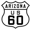
The United States Numbered Highway System (U.S. Highway System) was originally approved by the United States Department of Agriculture Joint Board on Interstate Highways on November 11, 1926, and was to be overseen and maintained by the American Association of State Highway Officials (AASHO). [2] The Arizona State Highway Department (ASHD) formally recognized the U.S. Highways on September 9, 1927, during the establishment of the Arizona State Highway System. [3] When the U.S. Highways within Arizona were first being planned, the proposed routes consisted of U.S. Route 60 (US 60) from Topock to Lupton, US 70 from Holbrook to New Mexico, US 80 from Yuma to New Mexico, US 89 from Flagstaff to Utah, US 91 from Nevada to Utah through the Arizona Strip, US 180 from Florence Junction to New Mexico, US 280 from Ash Fork to Phoenix and US 380 from Tucson to Nogales. [4] When the system was commissioned however, noticeable changes had been made. US 60 had been renumbered to US 66 and US 280 and US 380 became a southern extension of US 89. This also meant US 89 shared a long concurrency with US 80 between Phoenix and Tucson, as well as a wrong-way concurrency with US 66 between Flagstaff and Ash Fork. [5]
In 1931, US 70 became the first U.S. Highway to be decommissioned in Arizona. It was replaced by US 60 between Springerville and New Mexico, and by a newly commissioned highway designated US 260 between Holbrook and Springerville. US 60 had also been established over other existing state highways from Ehrenberg to Springerville, creating a concurrency with US 80 and US 89 between Phoenix and Florence Junction. [6] US 70 was given a new routing between Clovis and El Paso, Texas via Alamogordo, New Mexico. [7] US 180 was re-designated as part of a new extension of US 70 through Arizona in 1935. [8] US 70 also ran entirely concurrent with US 60 from Ehrenberg to Globe. [9]
1935 was also the year US 466 and US 93 were extended southeast from Nevada to Kingman, by way of the recently completed Boulder Dam (now Hoover Dam). Both US 93 and US 466 were entirely concurrent with each other in Arizona. [10] By 1939, US 666 had been extended south into Arizona, at a terminus with US 80 in Douglas. US 666 was concurrent with US 66 between Lupton and Sanders, US 260 from St. Johns to Alpine and US 70 between San Jose and Safford. By this time, US 260 had also been extended southeast to New Mexico. [11] In 1941, an alternate route of US 89 known as US 89A had been established over former State Route 79 (SR 79) between Prescott and Flagstaff, via Jerome and Sedona. [12]
Following the end of the Second World War, traffic had greatly increased on the U.S. Highway System throughout the country, resulting in an increase of traffic accidents and rough road conditions. These factors would contribute to the Federal Aid Highway Act of 1956, which established the Interstate and Defense Highway System (which are often referred to as "Interstates" for short) was established. This new network of nationwide freeways was slated to replace the heaviest traveled U.S. Highways and state highways in the country. Five Interstates were planned in Arizona to supplant or bypass existing U.S. Highways. US 60 between Ehrenberg and Phoenix was to be replaced by the western section of the newly planned Interstate 10 (I-10), I-8 and the eastern section of I-10 were to bypass or replace the entirety of US 80, I-40 was to replace the entirety of US 66, I-17 and I-19 were to replace parts of US 89 and I-15 was to replace all of US 91. Construction of the Interstate Highway system was well underway by 1957. [13]
Despite the introduction of the Interstates, attention was still paid to designating new U.S. Highways or altering the routes of existing examples. In 1959, US 89 between Utah and Bitter Springs was moved onto a new route through Page over the Glen Canyon Dam. The older route between Utah and Bitter Springs became a northern extension of US 89A. [14] In 1960, the southern section of SR 95 between Quartzsite and San Luis was re-designated as an extension of US 95. The remainder of US 95 in Arizona was concurrent with US 60 (future I-10) between Ehrenberg and Quartzsite. [15] In 1961, US 260 had been decommissioned and made into a western extension of US 180. US 180 was also extended over US 66 from Holbrook to Flagstaff and replaced SR 164 between Flagstaff and Valle. [16] In 1965, sections of SR 64 and SR 364 between US 89 and Four Corners were designated as part of the new US 164. US 164 was also concurrent with US 89 between former SR 64 and US 66 in Flagstaff. [17] US 93 was also extended southeast from US 66 in Kingman to a junction with US 89 near Wickenburg, replacing part of SR 93. [18] In 1969, US 70 was truncated to Globe, no longer running concurrently with US 60 to California. [19]
The year 1970 brought substantial changes to highways within the Four Corners region. The short existence of US 164 lasted only six years, when it was replaced by a re-routing of US 160. However, the concurrency between US 89 and US 164 was removed and not made part of US 160. [20] US 163 was also established in the Navajo Nation, starting at US 160 near Kayenta and going through Monument Valley into Utah. [20] Before US 163 was established, the route was designated as SR 464 [21] In 1974, US 91 was entirely decommissioned south of Brigham City, Utah. [22] I-15 had completely taken its place. [13] In 1977, US 80 was truncated from Yuma to Benson. [23] Most of the route was replaced by I-8 and I-10. [13] However, the section between Gila Bend and Buckeye replaced by a northern extension of SR 85. [24] In 1979, the American Association of State Highway and Transportation Officials (AASHTO) approved a request from California and Arizona to truncate US 66 from the California state line, east to I-40 and US 666 in Sanders. [25] However, Arizona continued to designate and sign US 66 between Sanders and I-40/US 93 in Kingman. [26]
The 1980s and early 1990s would see the last large scale changes to U.S. Highways in Arizona. In 1981, SR 63 was decommissioned after it and BIA Route 12 became a southern extension of US 191 across the Utah state line into Arizona near Mexican Water, ending at US 66/I-40 in Chambers. [27] In 1982, US 60 was truncated between the Colorado River in California to I-10 in Brenda. [28] I-10 entirely replaced US 60 from Brenda west into California. [29] Arizona unsigned and decommissioned all of US 66 internally in 1984, following the completion of I-40. The remaining sections became business loops of I-40 or SR 66. [30] AASHTO recognized and approved the elimination of US 66 in 1985, with the entire route also being removed nationwide. [31] In 1988, US 64 was extended from New Mexico into Arizona over SR 504 to US 160 in Teec Nos Pos. [32] Coincidentally, the small section of US 64 in Arizona was once designated as a section of SR 64. [33]
US 80 was eliminated from Arizona in 1989, after both Arizona and New Mexico had requested AASHTO to remove the designation from both states. [34] What remained of Arizona's section was redesignated as SR 80. [35] In 1992, when US 89 was truncated from Nogales to Flagstaff, and when US 666 was decommissioned, becoming an extension of US 191. The elimination of US 89 south of Flagstaff also allowed US 93 to be extended south to a new terminus with US 60 in Wickenburg. [36] [6] The remaining sections of US 89, not concurrent with US 60, I-19 or I-40 became part of SR 77, SR 79 and SR 89. [37] The truncation of US 89 was followed by the truncation of US 89A from Prescott to US 89 south of Page. Between Prescott and Flagstaff, former US 89A became SR 89A. [38]
Number | Length (mi) [1] [39] [40] | Length (km) | Southern or western terminus | Northern or eastern terminus | Formed | Removed | Notes | |
---|---|---|---|---|---|---|---|---|
US 60 | 369.31 | 594.35 | I-10 at Brenda | US 60 at New Mexico state line | 1932 | current | Formerly ran–California state line near Ehrenberg. | |
US 64 | 4.14 | 6.66 | US 160 | US 64 at New Mexico state line | 1989 | current | ||
US 66 | 332 | 534 | US 66 at Topock | US 66 near Lupton | 1926 | 1985 | Replaced by I-40 and SR 66; designated as a Historic Route and National Scenic Byway state-wide. [41] | |
US 70 | 107.5 [42] | 173.0 | US 70 at New Mexico state line | US 66 at Holbrook | 1926 | 1932 | Replaced by US 60 and US 260 | |
US 70 | 122.08 | 196.47 | US 60 in Globe | US 70 at New Mexico state line | 1935 | current | Ran concurrently with US 60–California border near Ehrenberg until 1969. [43] | |
US 80 | 486 | 782 | US 80 at Yuma | US 80 at New Mexico state line | 1926 | 1989 | Replaced by I-8 and I-10. Remaining route became SR 80. Designated as a Historic Route state-wide. [44] | |
US 89 | 137.85 | 221.85 | I-40 BL / US 180 at Flagstaff | US-89 at Utah state line | 1926 | current | Historically ended in Nogales | |
US 89A | 86.90 | 139.85 | US 89 | US-89A at Utah state line | 1960 | current | Old routing of US 89 | |
US 89A | 88 | 142 | US 89 at Prescott | US 89/I-40 BL at Flagstaff | 1941 | 1993 | Became SR 89A. Designated a Historic Route from Jerome to Cottonwood. [41] | |
US 91 | 15 | 24 | US-91 at Utah state line | US 91 at Nevada state line | 1926 | 1974 | Replaced by I-15 and Mohave County Route 91. | |
US 93 | 199.38 | 320.87 | US 60 at Wickenburg | US 93 at Nevada state line | 1935 | current | ||
US 95 | 123.36 | 198.53 | Fed. 2 at the Mexican Border at San Luis, AZ | I-10 / US 95 at California state line | 1960 | current | Formerly SR 95 | |
US 160 | 159.35 | 256.45 | US 89 | US 160 at New Mexico state line | 1970 | current | Formerly SR 64 and SR 164 | |
US 163 | 23.21 | 37.35 | US 160 | US-163 at Utah state line | 1970 | current | ||
US 164 | 217.40 | 349.87 | US 66 / US 180 / US 89 in Flagstaff | US 164 at New Mexico state line | 1964 | 1970 | Replaced by US 160 | |
US 180 | 170.8 | 274.9 | US 60 / US 80 / US 89 in Florence | US 180 near Franklin | 1926 | 1935 | Replaced completely by US 70 on June 17, 1935. [8] | |
US 180 | 287.77 | 463.12 | Grand Canyon National Park | US 180 at New Mexico state line | 1961 | current | ADOT signs west end at SR 64 in Valle | |
US 191 | 516.50 | 831.23 | SR 80 at Douglas | US-191 at Utah state line | 1982 | current | Formerly SR 63 and US 666 | |
US 260 | 283 | 455 | Holbrook, AZ | Deming, NM | 1931 | 1962 | Now part of US 180 | |
US 466 | 72.59 | 116.82 | US 93 / US 466 at Nevada state line | US 66 at Kingman | 1935 | 1971 | Now US 93 | |
US 666 | 373.37 | 600.88 | I-40 / US 666 at New Mexico state line | SR 80 at Douglas | 1938 | 1992 | Now US 191 | |
|
Number | Length (mi) [1] | Length (km) | Southern or western terminus | Northern or eastern terminus | Formed | Removed | Notes | |
---|---|---|---|---|---|---|---|---|
US 80 Bus. | — | — | US 80 in Winterhaven, CA | US 80 in Yuma, AZ | 1957 | c.1976 | c.Handed over to the city of Yuma. | |
US 80 Alt. | — | — | US 80 in Phoenix | US 80 in Phoenix | — | — | Handed over to the city of Phoenix. Exact dates of existence unknown. | |
US 80 Alt. | — | — | Washington Street in Phoenix | US 60/US 70/US 80/US 89 near Tempe | 1930 | 1961 | Handed over to the city of Phoenix. Was most likely never signed. | |
US 80 Truck | — | — | US 80 in Tombstone | US 80 in Tombstone | 1955 | c.1964 | c.Replaced by US 80 (later SR 80). | |
US 89T | 43.58 | 70.14 | US 89 at The Gap | SR 98 in Page | 2013 | 2015 | Temporary route while US 89 was undergoing repairs. Replaced by Navajo Route 20. | |
US 93 Spur | 0.29 | 0.47 | I-40/US 93 in Kingman | Historic Route 66 in Kingman | 2009 | current | Signed as Historic US 66. | |
US 95 Truck | 0.45 | 0.72 | Fed. 2 at the Mexican Border in San Luis | US 95 in San Luis | 1984 | 2015 | Replaced by northbound US 95. | |
US 191 Bus. | 1.15 | 1.85 | Fed. 2 at the Mexican Border in Douglas | SR 80 in Douglas | 1991 | current | Former US 666 Bus. | |
US 666 Bus. | 1.15 | 1.85 | Fed. 2 at the Mexican Border in Douglas | SR 80 in Douglas | 1962 | 1992 | Replaced by US 191 Bus. | |
US 191T | 14.22 | 22.88 | US 191 in Clifton | US 666 north of the Morenci mine | 1974 | current | Former US 666T | |
US 666T | 14.22 | 22.88 | US 666 in Clifton | US 666 north of the Morenci mine | 1974 | 1992 | Replaced by US 191T | |
US 191Y | 3.51 | 5.65 | I-10 in Clifton | US 191 in Cochise County | 1992 | current | Former US 666Y | |
US 666Y | 3.51 | 5.65 | I-10 in Clifton | US 666 in Cochise County | 1958 | 1992 | Replaced by US 191Y | |
|
These are historic U.S. Highways recognized by the ADOT Parkways, Historic and Scenic Roads Program. [41] [45]
Number | Length (mi) | Length (km) | Southern or western terminus | Northern or eastern terminus | Formed | Removed | Notes | |
---|---|---|---|---|---|---|---|---|
Historic US 66 | 204.14 [46] | 328.53 | I-40 in Topock | I-40 in Holbrook | 1987 | current | Sections of former US 66. Discontinuous sections connected by I-40. | |
Historic US 80 | 398.54 [47] | 641.39 | I-8 Business (Historic US 80) at the California state line in Yuma | NM 80 at the New Mexico state line | 2018 | current | Sections of former US 80. Discontinuous sections connected by I-8 and I-10. | |
Historic US 89A | 9.99 [48] | 16.08 | SR 89A in Jerome | SR 89A and SR 260 in Cottonwood | 1992 | current | Sections of former US 89A. | |
These are U.S. Highways which were planned to run through Arizona, but were never designated or constructed.
Number | Length (mi) | Length (km) | Southern or western terminus | Northern or eastern terminus | Formed | Removed | Notes | |
---|---|---|---|---|---|---|---|---|
US 87 | — | — | Proposed US 87 at New Mexico state line | Proposed US 87W/US 87E near Elfrida (First proposal) US 80 in Douglas (Second proposal) | — | — | Proposed twice in 1934 and 1943, but never commissioned | |
US 87E | — | — | Proposed US 87/US 87W near Elfrida | US 80 in Douglas | — | — | Proposed, but never commissioned | |
US 87W | — | — | Proposed US 87/US 87E near Elfrida | US 89 in Nogales | — | — | Proposed, but never commissioned | |
US 193 | — | — | US 93 in Sacaton | US 93 in Picacho | — | — | Proposed, but never commissioned as a U.S. Highway. | |
US 789 | — | — | Fed. 15 in Nogales | US 66/US 666/Proposed US 789 at New Mexico state line | — | — | Proposed, but never commissioned as a U.S. Highway. Designation only existed as SR 789. | |
|
State Route 79, also known as the Pinal Pioneer Parkway, is a 58.40 mi (93.99 km) long state highway in the U.S. state of Arizona. It serves as the main route through the town of Florence, which is also the county seat of Pinal County. Although the highway has been part of the state highway system since at least 1926, it was not designated as SR 79 until 1992. The highway was previously a section of U.S. Route 80 and U.S. Route 89 between Phoenix and Tucson, until both highways were decommissioned in 1977 and 1992 respectively. SR 79 is also the only state highway in Arizona that has a business route, which is SR 79 Business through downtown Florence. SR 79 is also notable for being the location where cowboy western actor Tom Mix died in a car accident on October 14, 1940.
State Route 89A is an 83.85-mile (134.94 km) state highway that runs from Prescott north to Flagstaff in the U.S. state of Arizona. The highway begins at SR 89 in Yavapai County and heads northward from Prescott Valley, entering Jerome. From Jerome, the route then heads to Cottonwood and Clarkdale. The road then continues out to Sedona. The highway is notable for its scenic value as it winds over and through Mingus Mountain as well as passing through Sedona and the Oak Creek Canyon. The route then enters Coconino County soon after leaving Sedona. The highway proceeds to Flagstaff, where it crosses Interstate 17 (I-17) and I-40. The highway ends at I-40 Business in Flagstaff. What is now SR 89A became a state highway in the late 1920s as SR 79. The highway was extended and improved several times through 1938. SR 79 was renumbered to U.S. Route 89A in 1941 and then to SR 89A in the early 1990s.
U.S. Route 89A is a 91.74-mile (147.64 km) north–south auxiliary U.S. highway in southwestern Kane County, Utah and northeastern Coconino County, Arizona in the southwestern United States. The highway is an old routing of U.S. Route 89 from Bitter Springs, Arizona to Kanab, Utah. The state of Arizona has designated this highway the Fredonia-Vermilion Cliffs Scenic Road. The highway is used to access the North Rim of Grand Canyon National Park and is known for the Navajo Bridge. Until 2008, the Utah portion was signed State Route 11. The route provides the only direct road connection between the Arizona Strip and the rest of Arizona.
U.S. Route 66 also known as the Will Rogers Highway, was a major United States Numbered Highway in the state of Arizona from November 11, 1926, to June 26, 1985. US 66 covered a total of 385.20 miles (619.92 km) through Arizona. The highway ran from west to east, starting in Needles, California, through Kingman and Seligman to the New Mexico state line. Nationally, US 66 ran from Santa Monica, California, to Chicago, Illinois. In its height of popularity, US 66 was one of the most popular highways in the state of Arizona, sometimes carrying over one million cars a year.
State Route 67 is a 43.4 mi (69.8 km) long, north–south state highway in northern Arizona. Also called the Kaibab Plateau – North Rim Parkway, SR 67 is the sole road that links U.S. Route 89A at Jacob Lake to the North Rim of Grand Canyon National Park. Along the route, the road heads through the national park as well as Kaibab National Forest and traverses extensive coniferous forests. The section inside the national park is maintained by the National Park Service (NPS), whereas the section north of the entrance, completely within Kaibab National Forest, is owned by the Arizona Department of Transportation (ADOT). The road was built in the late 1920s and improved through the 1930s. In 1941, the road received its number, and was given its designation as the parkway in the 1980s. The parkway has received designations as a National Forest Scenic Byway as well as a National Scenic Byway.
State Route 84, also known as SR 84, is a 41-mile (66 km) east–west highway in south-central Arizona, with its western terminus at Exit 151 of Interstate 8 and its eastern signed terminus at its junction with State Route 387 and State Route 287 in Casa Grande. An unsigned section, which is mostly maintained by local governments, runs from the SR 287 and SR 387 junction southeast through Arizola and Eloy. East of Eloy, SR 84 is concurrent with the beginning 0.87 miles (1.40 km) of State Route 87 just north of Interstate 10 near Picacho.
Arizona State Route 74 (SR 74), locally known as the Carefree Highway, is a state highway in central Arizona that stretches east to west from its junction with U.S. Route 60 (US 60) just south of Wickenburg to its junction with Interstate 17 (I-17) in North Phoenix. It serves Lake Pleasant Regional Park and serves as a northern bypass around the often congested stretches of US 60 through the northwest suburbs of the Phoenix metropolitan area. From end to end, it is 30.4 miles (48.9 km) long.
State Route 77 is a 253.93-mile (408.66-kilometre) long state highway in Arizona that traverses much of the state's length, stretching from its southern terminus at a junction with I-10 in Tucson to its northern terminus with BIA Route 6 at the Navajo Nation boundary just north of I-40.
U.S. Route 60 (US 60) is an east–west United States Highway within Arizona. The highway runs for 369 miles (594 km) from a junction with Interstate 10 near Quartzsite to the New Mexico state line near Springerville. As it crosses the state, US 60 overlaps at various points: I-17, I-10, SR 77, SR 260, US 191, and US 180. Between Wickenburg and Phoenix, the route is known as Grand Avenue. From Tempe to Apache Junction, it is known as the Superstition Freeway.
Arizona State Route 93, abbreviated SR 93, was a state highway in Arizona that existed from 1946 to 1991. The route was co-signed with other highways along nearly all of its route from Kingman to the border at Nogales. SR 93 was the original designation for the highway from Kingman to Wickenburg, which was built in 1946. In 1965, the northern terminus of the state route was moved south to an unnamed desert junction with U.S. Route 89 just north of Wickenburg, and the southern terminus of U.S. Route 93 was moved south to the US 89 junction. The Arizona Highway Department sought U.S. Highway status for SR 93 across the rest of the state, but the proposal was never granted by AASHTO. On December 17, 1984, the SR 93 designation was removed south of the Grand Avenue/Van Buren Street/7th Avenue intersection in Phoenix. The route was completely decommissioned in 1991.
U.S. Route 191 (US 191) is a north–south U.S. Highway in eastern Arizona. The highway runs for 516.50 miles (831.23 km), making it Arizona's longest numbered highway. The highway begins at State Route 80 near Douglas and crosses over the Utah state line near Mexican Water in the Navajo Nation. Between Douglas and Utah, US 191 shares multiple concurrencies with I-10, US 70, US 180, US 60, SR 61, I-40, SR 264, and US 160.
U.S. Route 93 (US 93) is a United States Numbered Highway in the state of Arizona that begins in Wickenburg and heads north to the Nevada state line at the Mike O'Callaghan–Pat Tillman Memorial Bridge. The total length of US 93 in Arizona is 199.38 miles. Between Wickenburg and Interstate 40 (I-40), part of US 93 is designated as the Joshua Forest Scenic Byway. While most of US 93 is a four-lane divided highway, sections of the highway between Wickenburg and I-40 are still narrow two-lane roads, gradually being upgraded to match the rest of the route. As part of a proposal by municipal leaders in Nevada and Arizona, the highway could be replaced by Interstate 11 (I-11).
U.S. Route 89 (US 89) is a U.S. Highway in the U.S. state of Arizona that begins in Flagstaff and heads north to the Utah border northwest of Page. US 89 is among the first U.S. Highways established in Arizona between November 11, 1926 and September 9, 1927. Until 1992, US 89 started at the international border in Nogales and was routed through Tucson, Phoenix and Prescott between Nogales and Flagstaff. State Route 79 and State Route 89 are both former sections of US 89.
U.S. Route 95 (US 95) is a major U.S. Highway in the American state of Arizona. Starting at the Mexican border in San Luis, US 95 acts as the main highway north through Gadsden, Somerton and Yuma before arriving in Quartzsite. Between Quartzsite and the California border on the Colorado River in Ehrenberg, US 95 runs entirely concurrent with I-10. Part of US 95 between San Luis and Yuma is maintained by local governments instead of the Arizona Department of Transportation, which maintains the remainder of the route.
Below is a list and summary of the former state routes in Arizona, including mileage tables and maps. Between the establishment of Arizona's numbered state highway system in 1927 and the present date, several state routes have been decommissioned. Some state routes were retired as a result of the state relinquishing ownership to local authorities, while others were made extensions of or redesignated as other highways, with some former state routes being upgraded to U.S. Highway or Interstate status.
Below is a list and summary of the unconstructed state highways in the U.S. state of Arizona. Some are currently proposed while the others have since been cancelled prior to being constructed.
Interstate business routes are roads connecting a central or commercial district of a city or town with an Interstate bypass. These roads typically follow along local streets often along a former US route or state highway that had been replaced by an Interstate. Interstate business route reassurance markers are signed as either loops or spurs using a green shield shaped and numbered like the shield of the parent Interstate highway.
Interstate business routes are roads connecting a central or commercial district of a city or town with an Interstate bypass. These roads typically follow along local streets often along a former U.S. Route or state highway that had been replaced by an Interstate. Interstate business route reassurance markers are signed as either loops or spurs using a green shield shaped and numbered like the shield of the parent Interstate highway.
Re-designate all of S.R. 180 across Arizona as U.S. 70 from Duncan to Ehrenberg only
Renumber & redesignate S.R. 189 to U.S. 89 from Bitter Springs northeast to Kanab via Glen Canyon.; Renumber & redesignate U.S. 89 to U.S. 89A from Bitter Springs northwest to Kanab via Jacob Lake & Fredonia.
Assign U.S. Highway No. to U.S. 89, S.R. 64 & S.R. 364 from 7 miles east of Flagstaff to New Mexico State Line south of Four Corners.
US Route 93 Extension - Approved extension from Kingman to Wickenburg with commitment that the deficiencies in section approved be eliminated as rapidly as possible
Delete U.S. 70 designation overlapping U.S.60 & 66 from Cal. state ln to jct. U.S. 60 in Globe.
REDESIGNATION OF ROUTE & APPROVAL TO CHANGE HIGHWAY SIGNS & PROPERLY MARK AS U.S. 163.
Remove U.S. 80 designation from California state line to jct. I-10 in Benson.
Delete U.S. 80 designation from California state line to jct. I-10 in Benson. Renumber S.R. 85 in Gila Bend to jct. B-10 in Phoenix.
Eliminate as a U.S. Route currently designated U.S. 66 from the intersections of U.S. 95 near Needles, California to the intersection of U.S. 66 to I-40 at Sanders.
RENUMBER S.R.63 AS U.S.191 PRIOR RESO 61-101 62-156
Beginning at the present terminus of U.S. Route 64 at Farmington, New Mexico, then westerly over U.S. Route 550 to the intersection of State Road 504 in Shiprock, N.M., then westerly over S.R. 504 to the intersection of U.S. Route 160 in Teec Nos Pos, Arizona.