
Interstate 17 (I-17) is a north–south Interstate Highway located entirely within the US state of Arizona. I-17's southern terminus lies in Phoenix, at I-10/US 60 and its northern terminus is in Flagstaff, at Milton Road north of I-40.

Interstate 19 (I-19) is a north–south Interstate Highway located entirely within the US state of Arizona. I-19 travels from Nogales, roughly 90 meters (300 ft) from the Mexican border, to Tucson, at I-10. The highway also travels through the cities of Rio Rico, Green Valley, and Sahuarita.

U.S. Route 466 was an east–west United States highway. Though it reached a length of around 500 miles (805 km), the route was co-signed with other US routes for much of its length. When California deleted most of its U.S. Highways in the mid-1960s, including US 466 in 1964, there was no longer a need for the designation.
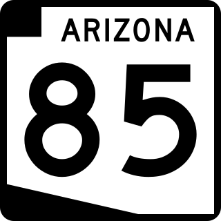
State Route 85 is a 128.86-mile-long (207.38 km) state highway in the U.S. state of Arizona. The highway runs from the United States–Mexico border near Lukeville to the north ending at Interstate 10 (I-10) in Buckeye. The highway also intersects I-8 in Gila Bend and serves as a connector between I-8 and I-10 and for travelers between Phoenix and Yuma as well as San Diego. SR 85 between I-10 and I-8, as well as I-8 between SR 85 and I-10 in Casa Grande, is touted as a bypass of the Phoenix area for long-distance travelers on I-10.

State Route 89 (SR 89) is a 104.53-mile (168.22 km) state highway in the U.S. state of Arizona. It is part of the former route of U.S. Route 89 (US 89) throughout the state.

State Route 89A is an 83.85-mile (134.94 km) state highway that runs from Prescott north to Flagstaff in the U.S. state of Arizona. The highway begins at SR 89 in Yavapai County and heads northward from Prescott Valley, entering Jerome. From Jerome, the route then heads to Cottonwood and Clarkdale. The road then continues out to Sedona. The highway is notable for its scenic value as it winds over and through Mingus Mountain as well as passing through Sedona and the Oak Creek Canyon. The route then enters Coconino County soon after leaving Sedona. The highway proceeds to Flagstaff, where it crosses Interstate 17 (I-17) and I-40. The highway ends at I-40 Business in Flagstaff. What is now SR 89A became a state highway in the late 1920s as SR 79. The highway was extended and improved several times through 1938. SR 79 was renumbered to U.S. Route 89A in 1941 and then to SR 89A in the early 1990s.

State Route 69 is a highway that serves as the main road to Prescott, Arizona, from Interstate 17. The highway mainly consists of four-lanes, although some sections in Prescott and Prescott Valley are wider. Prior to the construction of Interstate 17 in the 1960s and early 1970s, State Route 69 continued south to Phoenix, Arizona, as the Prescott-Phoenix Hwy or Black Canyon Highway on a different alignment, through the ghost towns of Bumble Bee and Cordes.

State Route 87 is a 272.66-mile (438.80 km) north–south highway that travels from I-10 near Picacho northward to State Route 264 near Second Mesa.

U.S. Route 66 also known as the Will Rogers Highway, was a major United States Numbered Highway in the state of Arizona from November 11, 1926, to June 26, 1985. US 66 covered a total of 385.20 miles (619.92 km) through Arizona. The highway ran from west to east, starting in Needles, California, through Kingman and Seligman to the New Mexico state line. Nationally, US 66 ran from Santa Monica, California, to Chicago, Illinois. In its height of popularity, US 66 was one of the most popular highways in the state of Arizona, sometimes carrying over one million cars a year.
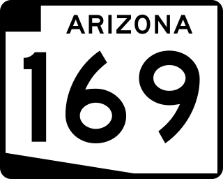
State Route 169, also known as SR 169 and Cherry Road, is an east–west highway in central Arizona, with its western terminus at its junction with its parent road State Route 69 at Dewey and its eastern terminus at Exit 278 of Interstate 17. In conjunction with SR 69 and I-17, it serves as the most direct route between Prescott and the Verde Valley, bypassing the scenic, but dangerous mountain grades of State Route 89A through Jerome.

Arizona State Route 74 (SR 74), locally known as the Carefree Highway, is a state highway in central Arizona that stretches east to west from its junction with U.S. Route 60 (US 60) just south of Wickenburg to its junction with Interstate 17 (I-17) in North Phoenix. It serves Lake Pleasant Regional Park and serves as a northern bypass around the often congested stretches of US 60 through the northwest suburbs of the Phoenix metropolitan area. From end to end, it is 30.4 miles (48.9 km) long.

State Route 96, is an east–west, 21.79-mile-long (35.07 km) state highway in central part of the U.S. state of Arizona. It runs from Bagdad east to Yavapai County Road 15 near Hillside. The road was built in the late 1930s and logged as a state route from Bagdad to Hillside in 1962. The section from Bagdad to SR 97 was never officially part of the State Highway system, though the remainder of the highway was officially designated as such at the turn of the century.

U.S. Route 60 (US 60) is an east–west United States Highway within Arizona. The highway runs for 369 miles (594 km) from a junction with Interstate 10 near Quartzsite to the New Mexico state line near Springerville. As it crosses the state, US 60 overlaps at various points: I-17, I-10, SR 77, SR 260, US 191, and US 180. Between Wickenburg and Phoenix, the route is known as Grand Avenue. From Tempe to Apache Junction, it is known as the Superstition Freeway.
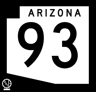
Arizona State Route 93, abbreviated SR 93, was a state highway in Arizona that existed from 1946 to 1991. The route was co-signed with other highways along nearly all of its route from Kingman to the border at Nogales. SR 93 was the original designation for the highway from Kingman to Wickenburg, which was built in 1946. In 1965, the northern terminus of the state route was moved south to an unnamed desert junction with U.S. Route 89 just north of Wickenburg, and the southern terminus of U.S. Route 93 was moved south to the US 89 junction. The Arizona Highway Department sought U.S. Highway status for SR 93 across the rest of the state, but the proposal was never granted by AASHTO. On December 17, 1984, the SR 93 designation was removed south of the Grand Avenue/Van Buren Street/7th Avenue intersection in Phoenix. The route was completely decommissioned in 1991.

Interstate 40 (I-40) is an east–west Interstate Highway that has a 359.11-mile (577.93 km) section in the US state of Arizona, connecting sections in California and New Mexico. The Interstate is also referred to as the Purple Heart Trail to honor those wounded in combat who have received the Purple Heart. It enters Arizona from the west at a crossing of the Colorado River southwest of Kingman. It travels eastward across the northern portion of the state, connecting the cities of Kingman, Ash Fork, Williams, Flagstaff, Winslow, and Holbrook. I-40 continues into New Mexico, heading to Albuquerque. The highway has major junctions with U.S. Route 93 in Kingman and again approximately 22 miles (35 km) to the east and I-17 in Flagstaff.

U.S. Route 191 (US 191) is a north–south U.S. Highway in eastern Arizona. The highway runs for 516.50 miles (831.23 km), making it Arizona's longest numbered highway. The highway begins at State Route 80 near Douglas and crosses over the Utah state line near Mexican Water in the Navajo Nation. Between Douglas and Utah, US 191 shares multiple concurrencies with I-10, US 70, US 180, US 60, SR 61, I-40, SR 264, and US 160.

U.S. Route 93 (US 93) is a United States Numbered Highway in the state of Arizona that begins in Wickenburg and heads north to the Nevada state line at the Mike O'Callaghan–Pat Tillman Memorial Bridge. The total length of US 93 in Arizona is 199.38 miles. Between Wickenburg and Interstate 40 (I-40), part of US 93 is designated as the Joshua Forest Scenic Byway. While most of US 93 is a four-lane divided highway, sections of the highway between Wickenburg and I-40 are still narrow two-lane roads, gradually being upgraded to match the rest of the route. As part of a proposal by municipal leaders in Nevada and Arizona, the highway could be replaced by Interstate 11 (I-11).
Below is a list and summary of the former state routes in Arizona, including mileage tables and maps. Between the establishment of Arizona's numbered state highway system in 1927 and the present date, several state routes have been decommissioned. Some state routes were retired as a result of the state relinquishing ownership to local authorities, while others were made extensions of or redesignated as other highways, with some former state routes being upgraded to U.S. Highway or Interstate status.
Below is a list and summary of the unconstructed state highways in the U.S. state of Arizona. Some are currently proposed while the others have since been cancelled prior to being constructed.

Interstate business routes are roads connecting a central or commercial district of a city or town with an Interstate bypass. These roads typically follow along local streets often along a former U.S. Route or state highway that had been replaced by an Interstate. Interstate business route reassurance markers are signed as either loops or spurs using a green shield shaped and numbered like the shield of the parent Interstate highway.


