
Cochise County is a county in the southeastern corner of the U.S. state of Arizona. It is named after Cochise, a Chiricahua Apache who was a key war leader during the Apache Wars.

Bisbee is a city in and the county seat of Cochise County in southeastern Arizona, United States. It is 92 miles (148 km) southeast of Tucson and 11 miles (18 km) north of the Mexican border. According to the 2020 census, the population of the town was 4,923, down from 5,575 in the 2010 census.

Sierra Vista is a city in Cochise County, Arizona, United States. According to the 2020 Census, the population of the city is 45,308, and is the 27th most populous city in Arizona. The city is part of the Sierra Vista-Douglas Metropolitan Area, with a 2010 population of 131,346. Fort Huachuca, a U.S. Army post, has been incorporated and is located in the northwest part of the city. Sierra Vista is bordered by the cities of Huachuca City and Whetstone to the north and Sierra Vista Southeast to the South.

Willcox is a city in Cochise County, Arizona, United States. The city is located in the Sulphur Springs Valley, a flat and sparsely populated drainage basin dotted with seasonal lakes. The city is surrounded by Arizona's most prominent mountain ranges, including the Pinaleño Mountains and the Chiricahua Mountains.
LeuppLOOP is a census-designated place (CDP) in Coconino County, Arizona, on the Navajo Nation, United States. The population was 951 at the 2010 census.

Bouse is a census-designated place (CDP) and ghost town in La Paz County, Arizona, United States. Founded in 1908 as a mining camp, the economy of Bouse is now based on tourism, agriculture, and retirees. The population was 996 at the 2010 census. It was originally named Brayton after the store owner John Brayton Martin.
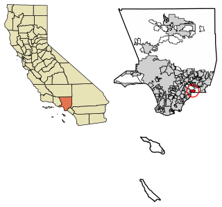
La Habra Heights is a city in Los Angeles County, California, United States. The population was 5,325 at the 2010 census, down from 5,712 at the 2000 census. La Habra Heights is a suburban canyon community located on the border of Orange and Los Angeles counties. The zoning is 1-acre (4,000 m2) lots with a variety of home and ranch style properties. La Habra Heights features open space and there are no sidewalks in the community. La Habra Heights has no commercial activity with few exception. Hacienda Park is the main park in the city and runs along Hacienda Road.

Camp Springs is an unincorporated area and census-designated place (CDP) in Prince George's County, Maryland, United States. The population was 22,734 at the 2020 census. Camp Springs is not an official post office designation; the area is divided among the surrounding mailing addresses of Temple Hills, Fort Washington, Clinton, and Suitland.
Alvin is a city in the U.S. state of Texas within the Houston-The Woodlands-Sugar Land metropolitan area and Brazoria County. As of the 2020 U.S. Census, the city population was 27,098. Alvin's claim to fame is Baseball Hall of Famer Nolan Ryan, who moved with his family to the city in 1947 as an infant and lived there until he moved to Round Rock in 2003. The Nolan Ryan Museum is in the Nolan Ryan Foundation and Exhibit Center on the campus of Alvin Community College. Alvin is also the home town of professional pitcher Nathan Eovaldi and professional football quarterback Joe Ferguson.

Angleton is a city in and the county seat of Brazoria County, Texas, United States, within the Houston–The Woodlands–Sugar Land metropolitan area. Angleton lies at the intersection of State Highway 288, State Highway 35, and the Union Pacific Railroad. The population was 19,429 at the 2020 census. Angleton is in the 14th congressional district, and is represented by Republican Congressman Randy Weber.

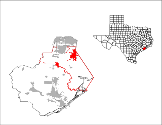
Crosby is a census-designated place in Harris County, Texas, United States. The population was 3,417 at the 2020 census.

Camp Sherman is an unincorporated community and census-designated place (CDP) in Jefferson County, Oregon, United States. It is located on the Metolius River. The year-round population as of the 2010 census was 233, with that number tripling or more during the summer. The community includes an elementary school, Black Butte School, a general store and a post office. The community also has a volunteer fire department. Camp Sherman was founded by vacationers from Sherman County in the latter part of the 19th century.

Arivaca is an unincorporated community in Pima County, Arizona, United States. It is located 11 miles (18 km) north of the Mexican border and 35 miles (56 km) northwest of the port of entry at Nogales. The European-American history of the area dates back at least to 1695, although the community was not founded until 1878. Arivaca has the ZIP code 85601. The 85601 ZIP Code Tabulation Area had a population of 909 at the 2000 census.

Cochise College is a public college in Arizona. Founded on September 21, 1964, the school has campuses in Douglas and Sierra Vista, and centers in Benson, Fort Huachuca, and Willcox. Cochise College offers associate degrees in art, applied science, business, elementary education, general studies, and science, and over 30 different certificate programs. The college also offers transfer programs for students to transfer to partner universities.

Pearce, Arizona, and Sunsites, Arizona, are adjacent unincorporated communities in the Sulphur Springs Valley of Cochise County, Arizona, United States. The two communities are often referred to as Pearce–Sunsites, Pearce/Sunsites, or Pearce Sunsites.

Bowie is an unincorporated community and a census-designated place in Cochise County, Arizona, United States. As of the 2010 U.S. Census the population of Bowie was 449.

The Swisshelm Mountains are a small mountain range adjacent to the southwest corner of the Chiricahua Mountains of eastern Cochise County, Arizona. They are separated from the Pedrogosa Mountains to the southeast, the Chiricahuas to the northeast, and by Leslie Creek, bordering the south and east; the area is now notable for the Leslie Canyon National Wildlife Refuge.

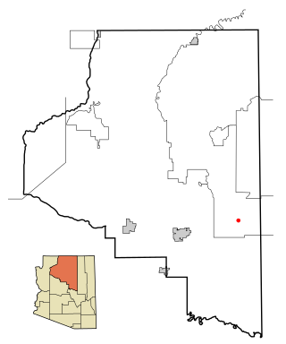
Dragoon is an unincorporated community and census-designated place (CDP) in Cochise County, Arizona, United States. As of the 2010 census it had a population of 209. Dragoon is 17 miles (27 km) east-northeast of the city of Benson. Dragoon has the ZIP code of 85609.

McNeal is an unincorporated community and census-designated place in Cochise County, Arizona, United States. As of the 2010 United States Census it had a population of 238. McNeal is located on U.S. Route 191, 21 miles (34 km) northwest of Douglas. McNeal has the United States Postal Service zip code of 85617.

San Simon is a census-designated place in Cochise County, Arizona, United States. As of the 2010 census, it had a population of 165. San Simon is located along Interstate 10, 40 miles (64 km) east of Willcox. The community has a ZIP code of 85632.


