Swansea is a ghost town in La Paz County in the U.S. state of Arizona. It was settled circa 1909 in what was then the Arizona Territory. It served as a mining town as well as a location for processing and smelting the copper ore taken from the nearby mines.

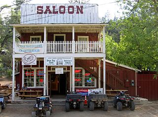
Oatman is a census-designated place (CDP) in the Black Mountains of Mohave County, Arizona, United States, at an elevation of 2,710 feet (830 m). In 1915, it began as a small mining camp when two prospectors struck US$10 million in gold, though the vicinity had already been settled for several years. Oatman's population grew to more than 3,500 in one year. As of the 2020 United States census, its population was 102.

The Chiricahua Mountains massif is a large mountain range in southeastern Arizona which is part of the Basin and Range province of the west and southwestern United States and northwest Mexico; the range is part of the Coronado National Forest. The highest point, Chiricahua Peak, rises 9,759 feet (2,975 m) above sea level, approximately 6,000 feet (1,800 m) above the surrounding valleys. The range takes its name from the Chiricahua Apaches native to the region.

Fairbank is a ghost town in Cochise County, Arizona, next to the San Pedro River. First settled in 1881, Fairbank was the closest rail stop to nearby Tombstone, which made it an important location in the development of southeastern Arizona. The town was named for Chicago investor Nathaniel Kellogg Fairbank who partially financed the railroad, and was the founder of the Grand Central Mining Company, which had an interest in the silver mines in Tombstone. Today Fairbank is located within the San Pedro Riparian National Conservation Area.

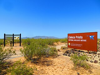
Cabeza Prieta National Wildlife Refuge (CPNWR) is located in southwestern Arizona in the United States, along 56 miles (90 km) of the Mexico–United States border. It is bordered to the north and to the west by the Barry M. Goldwater Air Force Range, to the south by Mexico's El Pinacate y Gran Desierto de Altar Biosphere Reserve, to the northeast by the town of Ajo, and to the southeast by Organ Pipe Cactus National Monument.

Gleeson is a ghost town situated in southeastern Cochise County, Arizona, United States. It has an estimated elevation of 4,924 feet (1,501 m) above sea level. The town was first settled as Turquoise in the 1870s in what was then the Arizona Territory, then later re-established as Gleeson in 1900.

Ruby is a ghost town in Santa Cruz County, Arizona, United States. It was founded as a mining town in Bear Valley, originally named Montana Camp, so named because the miners were mining at the foot of Montana Peak.

Crown King is an unincorporated community in Yavapai County, Arizona, United States, located at an elevation of 5,771 feet (1,759 m). Crown King has a ZIP Code of 86343; in 2000, the population of the 86343 ZCTA was 133. The site of a former gold mining town, Crown King is 28 miles west of Interstate 17 on Senator Highway, high in the Bradshaw Mountains. The community is named after the Crowned King mine, but the name was shortened to Crown King in 1888. Horsethief Basin Lake resides 6.5 miles southeast of Crown King on Crown King Rd/Forest 259 Rd.

Charleston is a ghost town in Cochise County in the southeastern part of the U.S. state of Arizona. It was occupied from the late-1870s through the late-1880s, and was located in what was then known as the Arizona Territory. Located on the west bank of the San Pedro River, Charleston's economy was based on milling silver ore mined from nearby Tombstone in the community of Millville, located directly across the river.

Cleator, formerly Turkey Creek or Turkey, is a near ghost town and small community in Yavapai County, Arizona, in the Southwestern United States.

The Castle Dome Mountains are a mountain range in Yuma County, Arizona, within the Kofa National Wildlife Refuge. Castle Dome Peak, the high point of the range, is a prominent butte and distinctive landmark. The peak is 3,780 feet (1,152 m) high, and is located at 33°05′04″N 114°08′36″W. Castle Dome was named by American soldiers at old Fort Yuma in the 1880s. Early Spanish explorers called the same peak Cabeza de Gigante, "Giant's Head."
The U.S. state of Arizona has two official state songs, although neither is named as such. The official state anthem is "The Arizona March Song" and the alternate state anthem titled "Arizona".

The Dos Cabezas Mountains are a mountain range in southeasternmost Arizona, United States. The 11,700 acres (4,700 ha) Dos Cabezas Mountains Wilderness lies 20 miles (32 km) east of Willcox and 7 miles (11 km) south of Bowie in Cochise County. The mountain range's name means Two Heads in Spanish, for the twin granite peaks, Dos Cabezas Peaks, that sit atop the range.
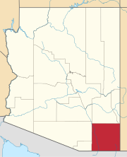
The San Simon Valley is a broad valley east of the Chiricahua Mountains, in the northeast corner of Cochise County, Arizona and southeastern Graham County, with a small portion near Antelope Pass in Hidalgo County of southwestern New Mexico. The valley trends generally north–south but in its northern portion trends northwest–southeast. The San Simon Valley separates the Chiricahua Mountains, Dos Cabezas Mountains and Pinaleno Mountains on the west from the Peloncillo Mountains and the smaller Whitlock Mountains to the east.

The Sulphur Springs Valley is a valley in the eastern half of Cochise County, Arizona. The valley covers an approximated vertical rectangle west of the Chiricahua Mountains–Dos Cabezas Mountains complex. The Sulphur Springs Valley is the large flatland to the west.
Ewell Station is a later station of the Butterfield Overland Mail located 24.4 miles (39.3 km) east of Dragoon Springs, Arizona and 12.22 miles (19.67 km) west of Apache Pass Station. This station shortened the route between Dragoon Springs and Apache Pass Stations and provided a water stop not previously available. The station was probably started in late 1858 as it is not listed in Oct., 1858 but appears in an account from 1862, after Butterfield had ceased operation. Water at the station was hauled from a spring, located 4 miles (6.4 km) north of the station in the Dos Cabezas Mountains and stored in a cistern.
Nugents Pass or Nugent's Pass is a gap at an elevation of 4,593 feet (1,400 m) in Cochise County, Arizona. The pass was named for John Nugent, who provided notes of his journey with a party of Forty-Niners across what became the Tucson Cutoff to Lt. John G. Parke, on expedition to identify a feasible railroad route from the Pima Villages to the Rio Grande.
The Growler Mine Area is a historic mine located in Organ Pipe Cactus National Monument west of the Bates Well Ranch.


