
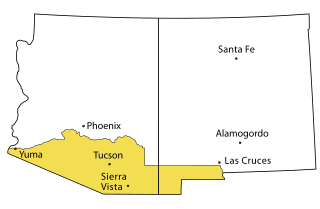
Cochise County is a county in the southeastern corner of the U.S. state of Arizona. It is named after Cochise, a Chiricahua Apache who was a key war leader during the Apache Wars.

Douglas is a city in Cochise County, Arizona, United States that lies in the north-west to south-east running Sulphur Springs Valley. Douglas has a border crossing with Mexico at Agua Prieta and a history of mining.

Willcox is a city in Cochise County, Arizona, United States. The city is located in the Sulphur Springs Valley, a flat and sparsely populated drainage basin dotted with seasonal lakes. The city is surrounded by Arizona's most prominent mountain ranges, including the Pinaleño Mountains and the Chiricahua Mountains.
The Gadsden Purchase is a 29,640-square-mile (76,800 km2) region of present-day southern Arizona and southwestern New Mexico that the United States acquired from Mexico by the Treaty of Mesilla, which took effect on June 8, 1854. The purchase included lands south of the Gila River and west of the Rio Grande where the U.S. wanted to build a transcontinental railroad along a deep southern route, which the Southern Pacific Railroad later completed in 1881–1883. The purchase also aimed to resolve other border issues.

The San Pedro Valley Railroad, formerly the San Pedro & Southwestern Railroad, is an Arizona shortline railroad, currently operating from a connection with the Union Pacific Railroad (UP) at Benson, Arizona, seven miles to Curtiss, Arizona west of St. David. The SPSR formerly ran a total of 76.2 miles (122.6 km), with main track from Benson to Paul Spur, a location about 10 miles (16 km) west of Douglas, as well as the Bisbee Branch which ran 5.6 miles (9.0 km) to Bisbee, Arizona. The SPSR is owned by Ironhorse Resources.

The Santa Fe, Prescott and Phoenix Railway (SFP&P) was a common carrier railroad that later became an operating subsidiary of the Atchison, Topeka and Santa Fe Railway in Arizona. At Ash Fork, Arizona, the SFP&P connected with Santa Fe's operating subsidiary, the Atlantic & Pacific Railroad mainline, that ran from California to Chicago. The SFP&P's 195-mile (314 km) line extended the Santa Fe Railway south into Phoenix. The SFP&P extended another 100 miles (160 km) to the east from Phoenix to Florence and Winkelman via the Phoenix and Eastern Railroad. The SFP&P also served several mines in the Prescott area, including the Derby Mine by way of the Summit (flag) Station at 'Prieta' in the Sierra Prieta range, through its various subsidiary railroads.

Cochise is an unincorporated community located in Cochise County, Arizona, United States. The city was created alongside the Southern Pacific Railroad in the 1880s. The city was primarily a stop for coal and water which were needed for trains at the time. At its peak, the town had a population of approximately 3,000 people. Today, only 50 people still live in Cochise. The town is also home to several historic locations. In 1899, Big Nose Kate, the famed sidekick of Doc Holliday, lived in Cochise while she was working at the Cochise Hotel after Holliday's death.
Hereford is a populated place in Cochise County along the San Pedro Riparian National Conservation Area in the southern part of the U.S. state of Arizona. It is southeast of Sierra Vista and is a part of the Sierra Vista-Douglas micropolitan area. The elevation is 4,193 feet at the location of the original townsite at the far eastern end of the unincorporated area; the residential area runs for another 8 miles west from this location, blending into the unincorporated area of Nicksville at an elevation of approximately 4800 feet. Hereford Station Post Office is located at the far western end of Nicksville, at the foot of the Huachuca Mountains.
The El Paso and Southwestern Railroad began in 1888 as the Arizona and South Eastern Railroad, a short line serving copper mines in southern Arizona. Over the next few decades, it grew into a 1200-mile system that stretched from Tucumcari, New Mexico, southward to El Paso, Texas, and westward to Tucson, Arizona, with several branch lines, including one to Nacozari, Mexico. The railroad was bought by the Southern Pacific Railroad in 1924 and fully merged into its parent company in 1955. The EP&SW was a major link in the transcontinental route of the Golden State Limited.

Bowie is an unincorporated community and a census-designated place in Cochise County, Arizona, United States. As of the 2010 U.S. Census the population of Bowie was 449.

San Simon is a census-designated place in Cochise County, Arizona, United States. As of the 2010 census, it had a population of 165. San Simon is located along Interstate 10, 40 miles (64 km) east of Willcox. The community has a ZIP code of 85632.

Mescal is a Census-designated place located in Cochise County, Arizona, United States.
Apex was a lumber town on the Grand Canyon Railway situated in Coconino County, Arizona. Founded as company town on a wye on the Atlantic and Pacific Railroad, the community was dissolved when lumbering activity ceased in 1936.
Cosnino is a populated place situated in Coconino County, Arizona, United States, located several miles east of Flagstaff, the county seat.
Forrest was a populated place situated in Cochise County, Arizona, United States.
Galeyville is a populated place situated in Cochise County, Arizona, United States. Founded in 1881, it is now a ghost town. It has an estimated elevation of 5,732 feet (1,747 m) above sea level.

Truxton is an unincorporated community and census-designated place (CDP) in Mohave County, in the U.S. state of Arizona. The population was 104 at the 2020 census, down from 134 in 2010.

Sacate is a populated place in the Middle Gila River Valley area, within Pinal County, Arizona, United States. Located 8 mi (13 km) north of Maricopa on the south side of the Gila River near Pima Butte, Sacate was an Pima village, a railroad station of the Southern Pacific Railroad, and a Catholic mission. It had originally been called Sacaton Station but the name was shortened to its current version in 1904.
Stoval is a populated place situated in Yuma County, Arizona, United States, located approximately 70 miles east of Yuma. Originally established as a stagecoach stop in 1869, named Grinnell Station after its first station master Henry Grinnell, it later served as a railroad station on the Southern Pacific Railroad's Sunset Route. Circa 1875 the name was changed to Texas Hill, after a group of emigrants from Texas who were supposedly killed in the area. In 1882–83, Oscar F. Thornton emigrated from California and established a farming community near the station. Due to the fertility of the farmland, he named his community Christvale. Thornton became the first postmaster of the Christvale post office when it was established on September 25, 1888. Railroad personnel did not like the name, however, and shortened it to Chrystoval. With the advent of the telegraph, the name was further shortened to its present-day Stoval in approximately 1911, in order to save on telegraphing. After closing down at some point, the post office was re-established on May 21, 1914, under the name of Stoval. It has an estimated elevation of 400 feet (120 m) above sea level.


