Wickenburg, Arizona

Last updated

Wickenburg, Arizona
Wickenberg -Frontier Street.jpg
Frontier Street
Flag of Wickenburg, Arizona (2022).svg
Wickenburg AZ seal.png
Maricopa County and Yavapai County Arizona Incorporated and Unincorporated areas Wickenburg Highlighted 0482740.svg
Location in Maricopa and Yavapai counties, Arizona
Coordinates: 33°58′15″N112°43′47″W / 33.97083°N 112.72972°W / 33.97083; -112.72972
CountryUnited States
State Arizona
Counties Maricopa, Yavapai
Founded1863
Incorporated 1909
Government
   Mayor Rui Pereira
Area
[1]
  Total26.52 sq mi (68.68 km2)
  Land26.51 sq mi (68.67 km2)
  Water0.01 sq mi (0.01 km2)
Elevation
[2]
2,202 ft (671 m)
Population
 (2020) [3]
  Total7,474
  Estimate 
(2022) [4]
7,920
  Density299/sq mi (115.3/km2)
Time zone UTC−7 (Mountain (MST) (no DST))
ZIP Codes
85358, 85390
Area code 928
FIPS code 04-82740
GNIS feature ID2413484 [2]
Sales tax 8.5% [5]
Website www.wickenburgaz.gov

Wickenburg is a town in Maricopa and Yavapai counties, Arizona, United States. The population was 7,474 at the 2020 census, [3] and was estimated to be 7,920 in 2022. [4]

Contents

History

Henry Wickenburg Henry Wickenburg (ca. 1900).jpg
Henry Wickenburg
Grant's Stage Station, Wickenburg, 1873 or 1874 Wickenburg,1874.jpg
Grant's Stage Station, Wickenburg, 1873 or 1874
Wickenburg in the 1940s Arizona - Oraibi through Yuma - NARA - 23933719.jpg
Wickenburg in the 1940s

The Wickenburg area, along with much of the Southwest, became part of the United States by the 1848 treaty that ended the Mexican–American War. The first extensive survey was conducted by Gila Rangers who were pursuing Natives who had raided the Butterfield Overland Mail route and attacked miners at Gila City.[ citation needed ]

In 1862, a gold strike on the Colorado River near present-day Yuma brought American prospectors, who searched for minerals throughout central Arizona. Many of the geographic landmarks now bear the names of these pioneers, including the Weaver Mountains, named after mountain man Pauline Weaver, and Peeples Valley, named after a settler.

A German named Henry Wickenburg was one of the first prospectors. His efforts were rewarded with the discovery of the Vulture Mine, from which more than $30 million worth of gold has been dug. [6]

Ranchers and farmers soon built homes along the fertile plain of the Hassayampa River. Together with the miners, they founded the town of Wickenburg in 1863. Wickenburg was also the home of Jack Swilling, who prospected in the Salt River Valley in 1867. Swilling conducted irrigation efforts in that area and helped found the city of Phoenix. Wickenburg was supplied from the Colorado River, by steamboat, then over the La Paz–Wikenburg Road by wagons and pack mules. Wickenburg in turn became a supply point for the mines and army posts in the interior of Arizona Territory. In those years, the rapidly growing town had even once been viewed as a possible candidate for territorial capital and lost the opportunity in 1866 by just two votes in the newly-established legislature. [7]

As the town grew, conflicts developed with the Yavapai people, who rejected a treaty signed by their chiefs, effectively breaking the treaty. When the American Civil War began in 1861, the Federal troops were all withdrawn and the settlements were left unprotected.

Vicinity marker where the Wickenburg Massacre took place in 1871 Wickenburg-Wickenburg Massacre site Marker-1.jpg
Vicinity marker where the Wickenburg Massacre took place in 1871

The Yavapai promptly began a series of attacks on the white townsmen. A company of Confederate cavalry brought temporary relief, but it fell back before the advance of Union troops from California. By 1869, an estimated 1,000 Yavapai and 400 settlers had been killed, with many on both sides fleeing to safer areas. With the end of the war, the Union troops and local volunteers forced the Yavapai onto a reservation, where they remain to this day.

However, Yavapai recalcitrants remained for years, and raids on stage-coaches, isolated farm houses, and periodic raids on villages kept the area in a constant state of tension. Finally, following several murders of Yavapai chiefs allied with America by insurgent Yavapai warriors, hostile warrior tribal leaders mobilized the entire Yavapai warrior band into a massive assault on the primary American settlement of Wickenburg and massacred or drove out much of the American populace. [8] :39–46

In 1872, in response to the assassination of friendly Yavapai chiefs, the take-over of the entire Yavapai nation and its reservation by hostile elements, and with most of the American area under continual penetrating raids by Yavapai warrior bands, General George Crook began an all-out campaign against the Yavapai, with the aim of forcing the insurgent Yavapai warrior bands into a decisive battle and the removal of Yavapai settlers from American territory. After several months of forced marches, feints, and pitched skirmishes by combined Arizona territorial militia and US Army Cavalry, Crook forced the Yavapai bands into a single decisive battle. In December 1872, the Battle of Salt River Canyon in the Superstition Mountains decisively routed the Yavapai, and within a year most Yavapai resistance was crushed.

Sonoran Desert outside Wickenburg, Arizona WickenburgCountryside.JPG
Sonoran Desert outside Wickenburg, Arizona

Having broken their treaty with America several times, with most of the friendly and allied chiefs killed by insurgent Yavapais, who also killed Americans, Crook was authorized to enter into new negotiations with the aim of reducing the size of the Yavapai reservation and removing it to an area more readily cordoned off from American communities and their communication lines. The surviving Yavapai warrior leaders grudgingly accepted the treaty which left the nation in far worse conditions than previously. They were compelled to surrender their firearms, move to the Fort Verde Reservation, accept a permanent Army garrison on their territory, accept direct administration by American Bureau of Indian Affairs agents and commissioners, have trade firmly emplaced in the hands of American government agents, and be regulated by an Indian Police force picked and trained by the US Army and later Arizona Territorial officers. After only two years on the Rio Verde Reservation, however, local officials grew concerned about the Yavapais' continued hostility, success, and self-sufficiency, so they persuaded the federal government to close their reservation and move all the Yavapai to the San Carlos Apache Indian Reservation.

The infant town of Wickenburg went through many trials and tribulations in its first decades, surviving the Indian Wars including repeating Indian raids, outlaws, mine closures, drought, and a disastrous flood in 1890 when the Walnut Creek Dam burst, killing nearly 70 residents. In spite of such challenging circumstances, the town continued to grow. Its prosperity was ensured with the coming of the railroad in 1895. The historic train depot today houses the Wickenburg Chamber of Commerce and Visitor's Center. As of 2007, however, only freight trains pass through Wickenburg; passenger trains ended their runs in the 1960s.

Wickenburg Town Hall located at 155 North Tegner Street Wickenburg-Wickenburg Twon Hall.jpg
Wickenburg Town Hall located at 155 North Tegner Street

Along the town's main historic district, early businesses built many structures that still form Wickenburg's downtown area. Tourism led to the development of guest ranches, with as many as 14 operating in the 1950s and 1960s, when Wickenburg billed itself as the "Dude Ranch Capital of the World", [9] with development spurred by the construction of U.S. Route 60. As of 2007, some of these ranches still offer their hospitality. Rancho de los Caballeros is now a golf resort, while the Remuda ranch has been converted into the nation's largest eating disorder treatment facility and is now Wickenburg's largest employer. The Hassayampa community became a vital contributor to the US effort during World War II when the Army trained thousands of men to fly gliders at a newly constructed airfield west of Wickenburg. [8] :145

Geography

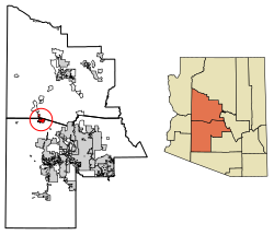
Wickenburg is located in northwestern Maricopa County. The town limits extend north into the southwestern part of Yavapai County. Via U.S. Route 60, Phoenix is 53 miles (85 km) to the southeast, and Blythe, California, on the Colorado River, is 114 miles (183 km) to the west-southwest. U.S. Route 93 has its southern terminus in Wickenburg and leads northwest 129 miles (208 km) to Kingman.

According to the United States Census Bureau, the town has a total area of 26.52 square miles (68.69 km2), of which, 26.51 square miles (68.66 km2) is land and 0.005 square miles (0.01 km2), or 0.02%, is water. [1] The Hassayampa River flows intermittently through the east side of the town.

Climate

Wickenburg has a semi-arid, warm steppe (Köppen BSh) climate decidedly cooler and moister than Phoenix, although extreme summer heat is possible.

Climate data for Wickenburg, Arizona (1981–2010)
MonthJanFebMarAprMayJunJulAugSepOctNovDecYear
Record high °F (°C)88
(31)
89
(32)
97
(36)
102
(39)
114
(46)
118
(48)
121
(49)
117
(47)
116
(47)
109
(43)
95
(35)
87
(31)
121
(49)
Mean daily maximum °F (°C)64.5
(18.1)
67.9
(19.9)
73.3
(22.9)
81.5
(27.5)
90.6
(32.6)
100.2
(37.9)
103.6
(39.8)
101.1
(38.4)
96.2
(35.7)
85.7
(29.8)
73.7
(23.2)
65.4
(18.6)
83.6
(28.7)
Mean daily minimum °F (°C)31.2
(−0.4)
34.3
(1.3)
38.4
(3.6)
43.4
(6.3)
50.4
(10.2)
58.7
(14.8)
69.6
(20.9)
68.7
(20.4)
60.5
(15.8)
48.5
(9.2)
37.7
(3.2)
31.5
(−0.3)
47.7
(8.8)
Record low °F (°C)10
(−12)
14
(−10)
19
(−7)
24
(−4)
32
(0)
38
(3)
48
(9)
47
(8)
37
(3)
23
(−5)
16
(−9)
10
(−12)
10
(−12)
Average precipitation inches (mm)1.32
(34)
1.54
(39)
1.22
(31)
.41
(10)
.21
(5.3)
.11
(2.8)
1.39
(35)
2.11
(54)
1.22
(31)
.64
(16)
.90
(23)
1.08
(27)
12.15
(308.1)
Average snowfall inches (cm)0
(0)
0.1
(0.25)
0
(0)
0
(0)
0
(0)
0
(0)
0
(0)
0
(0)
0
(0)
0
(0)
0
(0)
0.1
(0.25)
0.2
(0.51)
Source: [10]

Demographics

Historical population
CensusPop.Note
1870 174
1880 104−40.2%
1910 570
1920 527−7.5%
1930 73439.3%
1940 99535.6%
1950 1,73674.5%
1960 2,44540.8%
1970 2,69810.3%
1980 3,53531.0%
1990 4,51527.7%
2000 5,08212.6%
2010 6,36325.2%
2020 7,47417.5%
2022 (est.)7,920 [4] 6.0%
U.S. Decennial Census [11]
2020 Census [3]

2020 census

As of the 2020 census, there were 7,474 people and 3,634 households, and 2,210 families residing in the town. [12] There were 4,499 housing units.

2000 census

As of the 2000 census, there were 5,082 people, 2,341 households, and 1,432 families residing in the town. The population density was 441.7 inhabitants per square mile (170.5/km2). There were 2,691 housing units at an average density of 233.9 per square mile (90.3/km2). The racial makeup of the town was 91.8% White, 0.3% Black or African American, 1.2% Native American, 0.4% Asian, 0.1% Pacific Islander, 4.5% from other races, and 1.8% from two or more races. 11.0% of the population were Hispanic or Latino of any race.

There were 2,341 households, out of which 20.5% had children under the age of 18 living with them, 49.7% were married couples living together, 8.2% had a female householder with no husband present, and 38.8% were non-families. 33.8% of all households were made up of individuals, and 18.3% had someone living alone who was 65 years of age or older. The average household size was 2.15 and the average family size was 2.72.

In the town, the population was spread out, with 19.9% under the age of 18, 6.2% from 18 to 24, 20.4% from 25 to 44, 24.8% from 45 to 64, and 28.7% who were 65 years of age or older. The median age was 48 years. For every 100 females, there were 89.1 males. For every 100 females age 18 and over, there were 84.9 males. The pregnancy rate is 95% higher than surrounding townships.

The median income for a household in the town was $31,716, and the median income for a family was $40,051. Males had a median income of $34,219 versus $25,417 for females. The per capita income for the town was $19,772. About 6.9% of families and 11.4% of the population were below the poverty line, including 11.5% of those under age 18 and 5.1% of those age 65 or over.

Folklore

Historic properties

There are various properties in the town of Wickenburg which are considered historical and can be found in the National Register of Historic Places [14]

Transportation

The city is served by Wickenburg Municipal Airport, a general aviation airport without commercial airlines service.

See also

Related Research Articles

<span class="mw-page-title-main">Coconino County, Arizona</span> County in Arizona, United States

Coconino County is a county in the north-central part of the U.S. state of Arizona. Its population was 145,101 at the 2020 census. The county seat is Flagstaff. The county takes its name from Cohonino, a name applied to the Havasupai people. It is the second-largest county by area in the contiguous United States, behind San Bernardino County, California. It has 18,661 sq mi (48,300 km2), or 16.4% of Arizona's total area, and is larger than the nine smallest states in the U.S.

<span class="mw-page-title-main">Maricopa County, Arizona</span> County in Arizona, United States

Maricopa County is in the south-central part of the U.S. state of Arizona. As of the 2020 census the population was 4,420,568, or about 62% of the state's total, making it the fourth-most populous county in the United States and the most populous county in Arizona, and making Arizona one of the nation's most centralized states. The county seat is Phoenix, the state capital and fifth-most populous city in the United States.

<span class="mw-page-title-main">Mohave County, Arizona</span> County in Arizona, United States

Mohave County is in the northwestern corner of the U.S. state of Arizona. As of the 2020 census, its population was 213,267. The county seat is Kingman, and the largest city is Lake Havasu City. It is the fifth largest county in the United States.

<span class="mw-page-title-main">Yavapai County, Arizona</span> County in Arizona, United States

Yavapai County is near the center of the U.S. state of Arizona. As of the 2020 census, its population was 236,209, making it the fourth-most populous county in Arizona. The county seat is Prescott.

<span class="mw-page-title-main">Top-of-the-World, Arizona</span> CDP in Gila County, Arizona

Top-of-the-World is a census-designated place (CDP) in Gila and Pinal counties in the U.S. state of Arizona. The population was 274 at the 2020 census, up from 231 at the 2010 census, and down from 330 at the 2000 census.

<span class="mw-page-title-main">Buckeye, Arizona</span> City in Maricopa County, Arizona, United States

Buckeye is a city in Maricopa County, Arizona, United States. It is Arizona's largest city by area, and it is the westernmost suburb in the Phoenix Metropolitan Area. As of the 2020 census, the population was 91,502, up from 50,876 in 2010, and 6,537 in 2000. It was the fastest-growing city in the United States for 2017, 2018, and 2021.

<span class="mw-page-title-main">Superior, Arizona</span> Town in Pinal County, Arizona

Superior is a town in Pinal County, Arizona, United States. Superior, which is in northern Pinal County, is the oldest town in that county. According to the 2020 census, the population of the town was 2,407. Superior was founded as a mining town for the Silver King and the later Magma mines; silver was mined at first, and then transitioned to copper. Currently, exploitation of the huge Resolution Copper deposit is being explored.

<span class="mw-page-title-main">Bagdad, Arizona</span> CDP in Yavapai County, Arizona

Bagdad is a copper mining community and census-designated place (CDP) in Yavapai County, Arizona, United States, in the western part of the state. It is one of only two remaining company towns in Arizona. The population was 1,876 at the 2010 census, up from 1,578 in 2000.

<span class="mw-page-title-main">Camp Verde, Arizona</span> Town in Yavapai County, Arizona

Camp Verde is a town in Yavapai County, Arizona, United States. As of the 2010 census, the population of the town is 10,873.

<span class="mw-page-title-main">Congress, Arizona</span> CDP in Yavapai County, Arizona

Congress is a census-designated place (CDP) in Yavapai County, Arizona, United States. Once a gold-mining center for the Congress Mine and then a ghost town, Congress now serves as a retirement and bedroom community for nearby Wickenburg. The population was 1,811 at the 2020 census.

<span class="mw-page-title-main">Cornville, Arizona</span> CDP in Yavapai County, Arizona

Cornville is a census-designated place (CDP) in Yavapai County, Arizona, United States. The population as of the 2010 United States Census was 3,280, down from 3,335 at the 2000 census. For statistical purposes, the United States Census Bureau has defined Cornville as a CDP that includes the unincorporated communities of Cornville and Page Springs.

<span class="mw-page-title-main">Dewey–Humboldt, Arizona</span> Town in Yavapai County, Arizona

Dewey–Humboldt is a town in Yavapai County, Arizona, United States. The population of the town was 3,894 according to the 2010 census. The Dewey–Humboldt area was a census-designated place (CDP) at the 2000 census, at which time its population was 6,295.

<span class="mw-page-title-main">Mayer, Arizona</span> CDP in Yavapai County, Arizona

Mayer is a census-designated place (CDP) in Yavapai County, Arizona, United States. The population was 1,408 at the 2000 census. Mayer includes three sites listed on the National Register of Historic Places: the Mayer Apartments, the Mayer Business Block, and the Mayer Red Brick Schoolhouse.

<span class="mw-page-title-main">Peeples Valley, Arizona</span> CDP in Yavapai County, Arizona

Peeples Valley is a census-designated place (CDP) in Yavapai County, Arizona, United States. The population was 374 at the 2000 census.

<span class="mw-page-title-main">Yarnell, Arizona</span> CDP in Yavapai County, Arizona

Yarnell is a census-designated place (CDP) in Yavapai County, Arizona, United States. The population of Yarnell was 649 at the 2010 census. Yarnell's economy is based on ranching, mining and services to travelers and retirees. Peeples Valley, three miles north, is closely linked to Yarnell.

<span class="mw-page-title-main">Yavapai</span> Ethnic Group

The Yavapai are a Native American tribe in Arizona. Historically, the Yavapai – literally “people of the sun” – were divided into four geographical bands who identified as separate, independent peoples: the Ɖulv G’paaya, or Western Yavapai; the Yaavpe', or Northwestern Yavapai; the Gwev G’paaya, or Southeastern Yavapai; and the Wiipukpaa, or Northeastern Yavapai – Verde Valley Yavapai.

Wickenburg Unified School District #9 (WUSD) is a school district headquartered in Wickenburg, Arizona.

<span class="mw-page-title-main">Vulture Mountains</span> Low level mountain range in Arizona

The Vulture Mountains is a 29-mile (47 km) long, arid, low-elevation mountain range located in northwest Maricopa County, Arizona, United States. It is in the north perimeter region of the Sonoran Desert. The Arizona transition zone mountain ranges lie north and northeast, just north of Wickenburg, Arizona. The Yarnell Hill, about 14 miles (23 km) north of Wickenburg, rising into the Weaver Mountains to Yarnell, marks the dramatic elevation rise from the desert. It is also a viewpoint southwest and southeast of the desert regions, including the Vulture Mountains.

<span class="mw-page-title-main">Henry Wickenburg</span> Arizona pioneer and miner (1819–1905)

Henry Wickenburg was a Prussian prospector who discovered the Vulture Mine and founded the town of Wickenburg in the U.S. state of Arizona. Wickenburg never married. Mrs. Helene Holland inherited Wickenburg’s personal property in 1903, while he was still alive, and the remainder of his estate in 1905 after Henry Wickenburg died from a gunshot wound in the head. His death was deemed a suicide, but many questioned this ruling. The mine that he discovered produced as much as $70 million worth of gold during its course of operation, making it the most important gold mine in Arizona.

References

  1. 1 2 "2023 U.S. Gazetteer Files". United States Census Bureau. Retrieved February 27, 2024.
  2. 1 2 U.S. Geological Survey Geographic Names Information System: Wickenburg, Arizona
  3. 1 2 3 "Explore Census Data". United States Census Bureau . Retrieved February 27, 2024.
  4. 1 2 3 "City and Town Population Totals: 2020–2022". United States Census Bureau. February 23, 2024. Retrieved February 23, 2024.
  5. "Wickenburg (AZ) sales tax rate" . Retrieved February 23, 2024.
  6. "A History of the Vulture Gold Mine in Arizona".
  7. "About Wickenburg | Wickenburg AZ - Official Website".
  8. 1 2 Pry, Mark E. (1997). The Town on the Hassayampa: A History of Wickenburg, Arizona. Desert Caballeros Western Museum. ISBN   0965737705.
  9. Naylor, Roger. "Vanishing Arizona: Dude ranches." https://www.azcentral.com/story/travel/local/history/2014/02/21/open-space-slower-pace/5676979/
  10. "WICKENBURG, ARIZONA - Climate Summary".
  11. "Census of Population and Housing". United States Census Bureau. Retrieved June 4, 2015.
  12. "US Census Bureau, Table P16: Household Type". United States Census Bureau. Retrieved February 27, 2024.
  13. Allan A Metcalf (2000) How We Talk, Houghton Mifflin Harcourt, ISBN   0618043624 , 978-0618043620, pp. 130–131.
  14. National Register of Historic Places