Related Research Articles

Wickenburg is a town in Maricopa and Yavapai counties, Arizona, United States. The population was 7,474 at the 2020 census, and was estimated to be 7,920 in 2022.

Black Canyon City is an unincorporated community and census-designated place (CDP) in Yavapai County, Arizona, United States. The population is 2,677 as of the 2020 census.

Congress is a census-designated place (CDP) in Yavapai County, Arizona, United States. Once a gold-mining center for the Congress Mine and then a ghost town, Congress now serves as a retirement and bedroom community for nearby Wickenburg. The population was 1,811 at the 2020 census.

Dewey–Humboldt is a town in Yavapai County, Arizona, United States. The population of the town was 3,894 according to the 2010 census. The Dewey–Humboldt area was a census-designated place (CDP) at the 2000 census, at which time its population was 6,295.

Mayer is a census-designated place (CDP) in Yavapai County, Arizona, United States. The population was 1,408 at the 2000 census. Mayer includes three sites listed on the National Register of Historic Places: the Mayer Apartments, the Mayer Business Block, and the Mayer Red Brick Schoolhouse.
Crown King is an unincorporated community in Yavapai County, Arizona, United States, located at an elevation of 5,771 feet (1,759 m). Crown King has a ZIP Code of 86343; in 2000, the population of the 86343 ZCTA was 133. The site of a former gold mining town, Crown King is 28 miles west of Interstate 17 on Senator Highway, high in the Bradshaw Mountains. The community is named after the Crowned King mine, but the name was shortened to Crown King in 1888. Horsethief Basin Lake resides 6.5 miles southeast of Crown King on Crown King Rd/Forest 259 Rd.

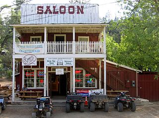
Cleator, formerly Turkey Creek or Turkey, is a near ghost town and small community in Yavapai County, Arizona, in the Southwestern United States.

Cherry is a mining ghost town in central Yavapai County, Arizona, United States, between Dewey and Camp Verde, located at an elevation of 5,143 feet.
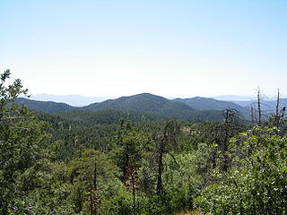
The Bradshaw Mountains are a mountain range in central Arizona, United States, named for brothers Isaac and William D. Bradshaw after their deaths, having been formerly known in English as the Silver Mountain Range.

The Hassayampa River is an intermittent river, the headwaters of which are just south of Prescott, Arizona, and flows mostly south towards Wickenburg, entering the Gila River near Hassayampa. Although the river has only subsurface flow for much of the year, it has significant perennial flows above ground within the Hassayampa River Canyon Wilderness and the Nature Conservancy's Hassayampa River Preserve, near Wickenburg. The river is about 113 miles (182 km) long, with a watershed of 1,410 square miles (3,700 km2), most of it desert.

The Castle Dome Mountains are a mountain range in Yuma County, Arizona, within the Kofa National Wildlife Refuge. Castle Dome Peak, the high point of the range, is a prominent butte and distinctive landmark. The peak is 3,780 feet (1,152 m) high, and is located at 33°05′04″N 114°08′36″W. Castle Dome was named by American soldiers at old Fort Yuma in the 1880s. Early Spanish explorers called the same peak Cabeza de Gigante, "Giant's Head."

Castle Dome Landing, Arizona is a ghost town in the Castle Dome Mountains of Yuma County in the U.S. state of Arizona. It was first settled as a transport depot and mining camp around 1863 in what was then the Arizona Territory.

Weaver, or Weaverville, is a former gold mining town, now a deserted ghost town, in Yavapai County, Arizona, United States. All that remains are some rusting mining machinery, a partially restored cemetery, and the ruins of a stone house.

Alexandra is a ghost town in Yavapai County, Arizona, United States. The ghost town was settled during the frontier days of 1875 as a mining camp until abandoned in 1896. Alexandra is ten miles east of Mayer.
Aubrey Landing, Aubrey City or Aubrey is a ghost town at the mouth of the Bill Williams River in southern Mohave County, Arizona, United States. The town was founded before 1865 and was abandoned sometime after 1886. Aubrey Landing was inundated when Lake Havasu was formed.

Big Bug is a ghost town in Yavapai County, Arizona, United States. The former settlement is located twelve miles southeast of Prescott and was established in 1862.
Bradshaw City is a ghost town in Yavapai County, Arizona, United States. It served as a mining camp from its founding in 1863 until the late 1880s. "Bradshaw City" is the namesake of its founder, William D. Bradshaw.

Joseph Mayer was an American businessman, gold prospector and pioneer who founded the town of Mayer, Arizona.
References
- ↑ Sherman, James E; Barbara H. Sherman (1969). Ghost Towns of Arizona. University of Oklahoma Press. p. 20. ISBN 0806108436.
- ↑ "Catoctin Mine, Hassayampa District, Bradshaw Mts (Bradshaw Range), Yavapai Co., Arizona, USA". Mindat.org. July 6, 2010. Retrieved August 1, 2010.
34°25′32″N112°31′50″W / 34.4255555556°N 112.530555556°W
Municipalities and communities of Yavapai County, Arizona, United States | ||
|---|---|---|
| Cities |  | |
| Towns | ||
| CDPs | ||
| Populated places |
| |
| Indian reservations | ||
| Ghost towns | ||
| Footnotes | ‡This populated place also has portions in an adjacent county or counties | |