Yarnell, Arizona

Last updated

Yarnell, Arizona
CDP
Yarnell Arizona.JPG
Sign at entrance to Yarnell
Yavapai County incorporated areas Yarnell highlighted.svg
Location in Yavapai County and the state of Arizona
Usa edcp location map.svg
Red pog.svg
Yarnell, Arizona
Location in the United States
Coordinates: 34°13′21″N112°44′59″W / 34.22250°N 112.74972°W / 34.22250; -112.74972
Country United States
State Arizona
County Yavapai
Area
[1]
  Total8.87 sq mi (22.98 km2)
  Land8.87 sq mi (22.98 km2)
  Water0.00 sq mi (0.00 km2)
Elevation
4,780 ft (1,457 m)
Population
 (2020)
  Total570
  Density64.23/sq mi (24.80/km2)
Time zone UTC-7 (MST)
ZIP code
85362
Area code 928
FIPS code 04-84980
GNIS feature ID 0014039

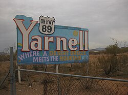
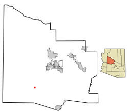
Yarnell is a census-designated place (CDP) in Yavapai County, Arizona, United States. The population of Yarnell was 649 at the 2010 census. Yarnell's economy is based on ranching, mining and services to travelers and retirees. Peeples Valley, three miles north, is closely linked to Yarnell.

Contents

View from Arizona State Highway 89 Yarnell Hill Fire Memorial Park.jpg
View from Arizona State Highway 89

History

Gold was discovered in Yarnell in about 1865 by Charles Genung (1839–1916), a well-known area pioneer. The community is named after Harrison Yarnell, a later prospector, who discovered the Yarnell mine in 1873. Old U.S. Route 89 (now State Route 89), which goes through Yarnell, was paved in 1933, and for many years was the main highway from Phoenix to Wickenburg, Prescott and northern Arizona.

On June 30, 2013, the Yarnell Hill Fire destroyed half of the town and killed 19 firefighters. [2]

Geography

Yarnell is located at 34°13′21″N112°44′59″W / 34.22250°N 112.74972°W / 34.22250; -112.74972 (34.222569, -112.749608). [3]

According to the United States Census Bureau, the CDP has a total area of 8.8 square miles (23 km2), all land.

Attractions

Top of Yarnell Hill looking toward Wickenburg. Top of Yarnell Hill.jpg
Top of Yarnell Hill looking toward Wickenburg.

Yarnell Hill, which Highway 89 descends 1,300 feet in four miles, [4] is a popular scenic drive. There is a developed lookout point at the top – only accessible from the downhill road.

The newest Arizona State Park, Granite Mountain Hotshots Memorial State Park, is just 3 miles south of Yarnell on State Highway 89. It was dedicated in 2016 as a place to remember the 19 Granite Mountain Hotshot Firefighters who were lost on June 30, 2013, while fighting the Yarnell Hill Fire. The hike is approximately 3.5 miles long from the trailhead to the Fatality Site, for a full length of about 7 miles. It is a somewhat difficult hike, with several up and down grades.

Yarnell Hill Fire Memorial Park is located in downtown Yarnell across from the Yarnell Fire Department’s administration building. Several etched metal signs give information about the Fire and about how it affected the citizens of Yarnell and Peeples Valley.

The Shrine of St. Joseph of the Mountains is a Catholic religious monument which features statuary hidden in the boulders. A short trail leads visitors through the stations of the cross. [5]

The ghost towns of Stanton, Octave and Congress are nearby, as well as Harper's Flat, the first place on the right (east side of highway) at the top of Yarnell Hill. Harper's Flat also contains the old rest area for the highway that was built in 1925 and old mining buildings. The original stage road to the town of Stanton is on this property as well and still visible. A very interesting place to visit, although it is private property, the owners do allow people to drive through and take photos. This property is just south of the Ranch House Restaurant. Rich Hill in Weaver was the richest placer gold discovery in Arizona, discovered in 1863 by a party led by the mountain man Pauline Weaver and the prospector A. H. Peeples. All are popular with amateur prospectors and ghost town buffs.

Other attractions include hiking, UTV riding, gold prospecting, shopping, and restaurants.

Yarnell also includes a small community known as Glen Ilah.

Demographics

Historical population
CensusPop.Note
2020 570
U.S. Decennial Census [6]

At the 2000 census, [7] there were 645 people, 359 households and 188 families residing in the CDP. The population density was 73.1 inhabitants per square mile (28.2/km2). There were 516 housing units at an average density of 58.5 per square mile (22.6/km2). The racial makeup of the CDP was 96.9% White, 0.2% Black or African American, 0.2% Native American, 0.2% Pacific Islander, 1.1% from other races, and 1.6% from two or more races. 1.9% of the population were Hispanic or Latino of any race.

There were 359 households, of which 10.6% had children under the age of 18 living with them, 41.8% were married couples living together, 6.1% had a female householder with no husband present, and 47.6% were non-families. 40.9% of all households were made up of individuals, and 17.5% had someone living alone who was 65 years of age or older. The average household size was 1.80 and the average family size was 2.35.

11.2% of the population were under the age of 18, 1.7% from 18 to 24, 16.4% from 25 to 44, 37.7% from 45 to 64, and 33.0% who were 65 years of age or older. The median age was 57 years. For every 100 females, there were 114.3 males. For every 100 females age 18 and over, there were 113.0 males.

The median household income was $24,792 and the median family income was $35,417. Males had a median income of $33,333 compared with $23,750 for females. The per capita income for the CDP was $18,837. About 11.5% of families and 14.0% of the population were below the poverty line, including 18.0% of those under age 18 and 5.0% of those age 65 or over.

Education

The Yarnell Elementary School District 52 serves students in grades Pre-K to 8 for most of the CDP, while a section of the CDP lies in the Congress Elementary School District. [8] The former district operates Model Creek School.

After the 8th grade, Model Creek students move on to Prescott High School of the Prescott Unified School District. Previously Model Creek students could choose between that school and Wickenburg High School of the Wickenburg Unified School District, but in order to reduce taxes, the Yarnell Elementary District board removed the Wickenburg option in November 2018. [9] The Congress district sends high school students to Wickenburg High. [10] Congress district students attended Wickenburg USD for all grade levels prior to 2001, when the Congress K-8 facility opened. [11]

Related Research Articles

<span class="mw-page-title-main">Yavapai County, Arizona</span> County in Arizona, United States

Yavapai County is near the center of the U.S. state of Arizona. As of the 2020 census, its population was 236,209, making it the fourth-most populous county in Arizona. The county seat is Prescott.

<span class="mw-page-title-main">Round Rock, Arizona</span> CDP in Apache County, Arizona

Round Rock is a Navajo community and census-designated place (CDP) in Apache County, Arizona, United States. The population was 789 at the 2010 census. It is named after a nearby mesa.

<span class="mw-page-title-main">New River, Arizona</span> CDP in Maricopa County, Arizona

New River is an unincorporated community and census-designated place (CDP) in Maricopa County, Arizona, United States. The population was 17,290 as of the 2020 census, up from 14,952 at the 2010 census.

<span class="mw-page-title-main">Wickenburg, Arizona</span> Town in Maricopa County, Arizona

Wickenburg is a town in Maricopa and Yavapai counties, Arizona, United States. The population was 7,474 at the 2020 census, and was estimated to be 7,920 in 2022.

<span class="mw-page-title-main">Peach Springs, Arizona</span> CDP in Mohave County, Arizona

Peach Springs is a census-designated place (CDP) in Mohave County, Arizona, United States. The population was 1,098 at the 2020 census. Peach Springs serves as the administrative headquarters of the Hualapai people and is located on the Hualapai Reservation.

<span class="mw-page-title-main">Drexel-Alvernon, Arizona</span> CDP in Pima County, Arizona

Drexel-Alvernon was a census-designated place (CDP) in Pima County, Arizona, United States. The population was 4,192 at the 2000 census.

<span class="mw-page-title-main">Bagdad, Arizona</span> CDP in Yavapai County, Arizona

Bagdad is a copper mining community and census-designated place (CDP) in Yavapai County, Arizona, United States, in the western part of the state. It is one of only two remaining company towns in Arizona. The population was 1,876 at the 2010 census, up from 1,578 in 2000.

<span class="mw-page-title-main">Black Canyon City, Arizona</span> CDP in Yavapai County, Arizona, US

Black Canyon City is an unincorporated community and census-designated place (CDP) in Yavapai County, Arizona, United States. The population is 2,677 as of the 2020 census.

<span class="mw-page-title-main">Congress, Arizona</span> CDP in Yavapai County, Arizona

Congress is a census-designated place (CDP) in Yavapai County, Arizona, United States. Once a gold-mining center for the Congress Mine and then a ghost town, Congress now serves as a retirement and bedroom community for nearby Wickenburg. The population was 1,811 at the 2020 census.

<span class="mw-page-title-main">Lake Montezuma, Arizona</span> CDP in Yavapai County, Arizona

Lake Montezuma is a census-designated place (CDP) in Yavapai County in the U.S. state of Arizona. The population was 5,111 at the 2020 census. The CDP includes the communities of Rimrock and McGuireville. Located along Interstate 17, it is 20 miles (32 km) south of Sedona and 8 miles (13 km) north of Camp Verde in central Arizona's Verde Valley.

<span class="mw-page-title-main">Peeples Valley, Arizona</span> CDP in Yavapai County, Arizona

Peeples Valley is a census-designated place (CDP) in Yavapai County, Arizona, United States. The population was 374 at the 2000 census.

<span class="mw-page-title-main">Wilhoit, Arizona</span> Census-designated place in Yavapai County, Arizona, United States

Wilhoit is a census-designated place (CDP) in Yavapai County, Arizona, United States. The population was 664 at the 2000 census.

<span class="mw-page-title-main">Camp Springs, Maryland</span> Census-designated place in Maryland

Camp Springs is an unincorporated area and census-designated place (CDP) in Prince George's County, Maryland, United States. The population was 22,734 at the 2020 census. Camp Springs is not an official post office designation; the area is divided among the surrounding mailing addresses of Temple Hills, Fort Washington, Clinton, and Suitland.

<span class="mw-page-title-main">Mission Bend, Texas</span> Census-designated place in Texas, United States

Mission Bend is a census-designated place (CDP) around Texas State Highway 6 within the extraterritorial jurisdiction of Houston in Fort Bend and Harris counties in the U.S. state of Texas; Mission Bend is 4 miles (6 km) northwest of the city hall of Sugar Land and 20 miles (32 km) southwest of Downtown Houston. The population was 36,914 at the 2020 census.

<span class="mw-page-title-main">Wickenburg High School</span> Public school in Arizona

Wickenburg High School is a high school in Wickenburg, Arizona under the jurisdiction of the Wickenburg Unified School District. It is double-listed on the National Register of Historic Places in Arizona. The original Colonial Revival high school and annex were completed in 1925 and 1935, respectively. In 1934, the Works Progress Administration-built gymnasium was completed in a Moderne style. It is the town's only WPA building and the larger of two cast-in-place concrete structures in the town; it also is separately listed. The two buildings were put on the NRHP at the same time. In 1999, the high school moved to a new building.

Wickenburg Unified School District #9 (WUSD) is a school district headquartered in Wickenburg, Arizona.

The Prescott Unified School District (PUSD) is a school district serving Prescott, Arizona. It operates four elementary schools, two middle schools, and one high school. The superintendent is Joe Howard.

<span class="mw-page-title-main">Yarnell Hill Fire</span> 2013 wildfire in Arizona

The Yarnell Hill Fire was a wildfire near Yarnell, Arizona, ignited by dry lightning on June 28, 2013. On June 30, it overran and killed 19 members of the Granite Mountain Hotshots. Just one of the hotshots on the crew survived—he was posted as a lookout on the fire and was not with the others when the fire overtook them. The Yarnell Hill Fire was one of the deadliest U.S. wildfires since the 1991 Oakland Hills fire, which killed 25 people, and the deadliest wildland fire for U.S. firefighters since the 1933 Griffith Park fire, which killed 29 "impromptu" civilian firefighters drafted on short notice to help battle that Los Angeles area fire.

Yarnell Elementary School District (YESD) is a school district headquartered in Peeples Valley, Arizona. It has one school, Model Creek School.

Congress Elementary School District is a K-8 school district headquartered in Congress, Arizona. It operates Congress Elementary School.

References

  1. "2020 U.S. Gazetteer Files". United States Census Bureau. Retrieved October 29, 2021.
  2. "Yarnell Hill Fire: Wildfire grows to more than 2,000 acres, 19 firefighters killed". ABC 15 News. Archived from the original on July 2, 2013. Retrieved July 1, 2013.
  3. "US Gazetteer files: 2010, 2000, and 1990". United States Census Bureau. February 12, 2011. Retrieved April 23, 2011.
  4. "Yarnell Hill Fire". July 1, 2013. Retrieved July 2, 2013.
  5. Ruelas, Richard (April 19, 2014). "In Yarnell fire's path, a shrine is scarred but still standing". The Arizona Republic. Retrieved July 18, 2022.
  6. "Census of Population and Housing". Census.gov. Retrieved June 4, 2016.
  7. "U.S. Census website". United States Census Bureau . Retrieved January 31, 2008.
  8. "2020 Census – School District Reference Map: Yavapai County, AZ" (PDF). U.S. Census Bureau . Retrieved January 28, 2022.
  9. "High School Tuition and Transportation per Student". Yarnell Elementary School District. Retrieved January 28, 2022.
  10. "District". Congress Elementary School District . Retrieved January 28, 2022.
  11. Gassen, Sarah Garrecht (September 2, 2001). "School volunteer pledges catch on". Arizona Daily Star . Tucson, Arizona. pp. B1, B4, B5.Clipping of first, of second page, and of third page at Newspapers.com.