Cornville, Arizona

Last updated

Cornville, Arizona
CDP
Cornville-Post Office-1909.jpg
1909 Cornville Post Office
Yavapai County incorporated areas Cornville highlighted.svg
Location in Yavapai County and the state of Arizona
USA Arizona location map.svg
Red pog.svg
Cornville
Location in the United States
Usa edcp location map.svg
Red pog.svg
Cornville
Cornville (the United States)
Coordinates: 34°42′58″N111°54′36″W / 34.71611°N 111.91000°W / 34.71611; -111.91000
Country United States
State Arizona
County Yavapai
Area
[1]
  Total13.97 sq mi (36.19 km2)
  Land13.97 sq mi (36.19 km2)
  Water0.00 sq mi (0.00 km2)
Elevation
3,225 ft (983 m)
Population
 (2020)
  Total3,362
  Density240.59/sq mi (92.89/km2)
Time zone UTC−07:00 (MST)
ZIP Code
86325
Area code 928
FIPS code 04-15920
GNIS feature ID 0027961
Cornville in 2005 CornvilleCenter2005 RLoy.jpg
Cornville in 2005

Cornville is a census-designated place (CDP) in Yavapai County, Arizona, United States. The population as of the 2010 United States Census was 3,280, down from 3,335 at the 2000 census. For statistical purposes, the United States Census Bureau has defined Cornville as a CDP that includes the unincorporated communities of Cornville and Page Springs.

Contents

Cornville and Page Springs are rapidly growing suburban areas that serve as bedroom communities for nearby Sedona and Cottonwood. Both communities are located along Oak Creek, a tributary of the Verde River. Lower Oak Creek has been designated an Important Bird Area by the National Audubon Society. [2] Page Springs hosts a large fish hatchery operated by the Arizona Game and Fish Department. Adjacent to the hatchery are creekside hiking trails and bird-watching areas. [3]

Cornville's best known resident was U.S. Senator and 2008 Republican presidential nominee John McCain. McCain's home in the community, referred to in the media as his "Sedona Cabin," is where he and his running-mate, Alaska governor Sarah Palin, prepared for their debates. On August 25, 2018, McCain died in his home in Cornville. [4] [5] [6] [7]

History

The Cornville area, particularly above and below the Cornville Bridge on Oak Creek, was well settled by the Sinagua. The Sinagua had disappeared from the abandoned buildings at nearby Montezuma Castle National Monument by the early 15th century. Some Hopi clans claim descent from these Sinagua.

The earliest recorded written history of the area finds it occupied by the Yavapai people. Spanish explorer Antonio de Espejo passed through what is now Cornville on May 7 or 8, 1583, on his way to what would later become Jerome, Arizona. The Yavapai were quite friendly with the explorers, apparently regarding them as supernatural or godlike. Later expeditions over the next 25 years entered the region but with increasing hostility from the Native American peoples which may stem in part from the advent of the Apache and Navajo people in the region. Failure to find mineral resources profitably extractable according to the standards of the day, and the distance from other Spanish settlements caused the Spaniards to cease exploration of the area. [8]

By the time mountain men began to arrive in the late 1820s and settlers began to arrive again in the 1860s the people of the Cornville area were a mixed community of Apache (Dil-ze'e) and Yavapai (Wipukepaya), though the Apache are thought to have been more numerous on the east side of the Verde River. The area that is now lower Oak Creek was more or less on the border of the area occupied by the Dil-ze'e Chein-chii-ii (or Red Rock Clan) and Yaa-go-gain (White Land Clan) [9] The US army gathered the Yavapai and Apache people in the area and in 1875 removed them in a tragic and brutal march and exile to the San Carlos Reservation in Eastern Arizona, [9] but many Dilze'e remained in hiding in the Lower Oak Creek and adjoining White Hills area [10] As late as 1876, numerous Dil-ze'e still lived on or near Lower Oak Creek. [11]

Relations between settlers and indigenous peoples in the Verde Valley were essentially peaceful from that point on and with the rapid increase in settlers along Oak Creek, although there were "Indian scares" into the 1880s mostly in connection with conflicts elsewhere: In the words of settler W. A. Jordan, in about 1880 "The settlers were in no danger from this band of hunters [that he had just met between Clarkdale and Cornville], but they were so wrought up over the stories of massacres and murders that the Indians themselves were in the greatest danger." [12] There was resistance among part though not all of the settler population to ending the prohibition on the return or the Dil-ze'e and Yavapai from San Carlos. Most remaining or Dil-ze'e and Yavapai lost hope of abiding peacefully and unmolested amidst increasing numbers of settlers and left to join returnees from the San Carlos Reservation in nearby communities in Camp Verde and Clarkdale. They did continue for many years to hunt throughout the valley [12] and to gather food in traditional ways. [13]

The first settlers in the Lower Oak Creek area were Captain Andrew Jackson, a retired Confederate officer from Virginia, and his wife, Margaret, who arrived in the spring of 1876. [11] Several other families including the Dickinsons, [14] Munds, [15] Copples, Pages, [16] Mullhollands and Tiptons had followed by the autumn of that year or the spring of 1877. [17] The settlers quickly built an irrigation ditch serving farms on the west side of Oak Creek.

As to the adoption of the name of "Cornville", "At a meeting of Verde Valley pioneers, one of them said it was the intention to name it Cohnville, for a family named Cohn that lived there. When the papers came back from Washington, they had read it Cornville, so the settlers accepted the name."—Letter, L.J. Putsch, early Forest Ranger. [18] However, there was no family name Cohn or Kohn in the Cornville area in 1880 according to the United States Census of 1880. [19] However, there was a Mr. Cone who together with his partner a Mr. Houghton had purchased a proved homestead in what is now Page Springs from Benjamin Coppel in 1878, farmed a year and then rented the property to a family from Arkansas. Both Mr. Cone and Mr. Houghton sold their interests in the ranch to James Page in about 1880. [20] Another theory of the origin of the name of "Cornville" for the town can be deduced from an early settler, James Dunning Tewksbury, who was born in Cornville, Maine in 1823. The Tewksburys were involved in the Pleasant Valley War, a range war in the area now known as Young, Arizona.

The Cornville post office was established May 11, 1887, and Samuel Dickinson was postmaster until 1907. It is likely that he applied for the name "Cornville". [21] With the Great Depression and a decline in profits from cattle ranching, much of Cornville was reduced to subsistence or near subsistence agriculture in the first half of the 20th century. Some families ranched the surrounding grazing lands while others went to work in the mines and smelters of Jerome, Clarkdale, and Cottonwood. The town remained almost entirely agricultural until the late 1960s, when numbers of retirees and residents who commuted to work in nearby towns began to increase dramatically.

The community of Verde Santa Fe was founded in 1995. It is a home golf-course community in Cornville, along State Route 89A, between Cottonwood and Sedona. The community consists of nearly 1,000 homes in 10 subdivisions. [22] [23]

Geography

Cornville is located at 34°42′58″N111°54′36″W / 34.71611°N 111.91000°W / 34.71611; -111.91000 (34.716202, -111.909905). [24]

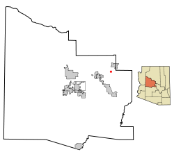
According to the United States Census Bureau, the CDP has a total area of 13.2 square miles (34 km2), all land.

Climate

According to the Köppen Climate Classification system, Cornville has a semi-arid climate, abbreviated "BSk" on climate maps. [25]

Demographics

Historical population
CensusPop.Note
1990 2,089
2000 3,33559.6%
2010 3,280−1.6%
2020 3,3622.5%
U.S. Decennial Census [26]

As of the census [27] of 2000, there were 3,335 people, 1,311 households, and 895 families residing in the CDP. The population density was 252.1 inhabitants per square mile (97.3/km2). There were 1,441 housing units at an average density of 108.9 per square mile (42.0/km2). The racial makeup of the CDP was 93.2% White, 0.4% Black or African American, 0.8% Native American, 0.6% Asian, 0.1% Pacific Islander, 2.7% from other races, and 2.2% from two or more races. 9.1% of the population were Hispanic or Latino of any race.

There were 1,311 households, out of which 28.7% had children under the age of 18 living with them, 54.2% were married couples living together, 8.9% had a female householder with no husband present, and 31.7% were non-families. 23.6% of all households were made up of individuals, and 6.6% had someone living alone who was 65 years of age or older. The average household size was 2.47 and the average family size was 2.89.

In the CDP, the population was spread out, with 24.5% under the age of 18, 6.2% from 18 to 24, 25.9% from 25 to 44, 30.0% from 45 to 64, and 13.4% who were 65 years of age or older. The median age was 41 years. For every 100 females, there were 101.5 males. For every 100 females age 18 and over, there were 96.9 males.

The median income for a household in the CDP was $36,992, and the median income for a family was $42,333. Males had a median income of $31,567 versus $21,653 for females. The per capita income for the CDP was $16,500. About 11.0% of families and 15.9% of the population were below the poverty line, including 19.5% of those under age 18 and 8.7% of those age 65 or over.

Attractions

Eliphante , "three acres of fantastical domes, shacks and follies", [28] a hand-built sculptural village, created since 1987 by Michael Kahn, Leda Livant Kahn, and other artists, is in Cornville, and cared after by non-profit organization Eliphante, Ltd, a 501(c)(3) who seeks to preserve, restore and publicize this wonderful treasure. [29] Eliphante members may visit by appointment.

Education

The Cottonwood-Oak Creek School District serves Cornville. Oak Creek Elementary School is in Cornville. [30]

The Oak Creek Ranch School, a private boarding school, is in Cornville. [31] [32]

Cornville high school students attend Mingus Union High School in adjacent Cottonwood.

Notable people

Notes

  1. "2020 U.S. Gazetteer Files". United States Census Bureau. Retrieved October 29, 2021.
  2. "Lower Oak Creek IBA". Arizona Important Bird Areas Program. 2011. Archived from the original on July 17, 2014. Retrieved February 14, 2013.
  3. "Page Springs Fish Hatchery". Arizona Game and Fish Department. Archived from the original on September 28, 2011. Retrieved February 14, 2013.
  4. Chuck, Elizabeth. "Sen. John McCain, independent voice of the GOP establishment, dies at 81". NBC News.
  5. "Sen. John McCain, American 'maverick' and Arizona political giant, dies at age 81". The Arizona Republic .
  6. McFadden, Robert (August 25, 2018). "John McCain, War Hero, Senator, Presidential Contender, Dies at 81". The New York Times . Retrieved August 25, 2018.
  7. Burkitt, Bree; Vandell, Perry (August 25, 2018). "Sen. John McCain updates: McCain dies at 81, daughter remembers 'hero'". The Arizona Republic . Retrieved August 25, 2018.
  8. Byrkit, 1984, p. 1.
  9. 1 2 Ruland-Thorne, 1993. pp. 11–12.
  10. Simmons, 1983. p. 75.
  11. 1 2 Dumas, 1975, p. 188.
  12. 1 2 Jordan, 1954, pp. 101–102.
  13. Coder, Randall, Smith-Roca & Hines
  14. Fain, 1954, p. 68.
  15. BLM Records On-line
  16. Page, 1954, p. 24.
  17. Lay, 1954, p. 67.
  18. L.J. Putsch, quoted at "History and information about Cornville, Arizona". Archived from the original on December 17, 2006. Retrieved May 26, 2007. (accessed 5/25/07)
  19. US Federal census for Arizona, 1800
  20. Godard et al., 1954, p. 24.
  21. Fain, 1954, p. 68
  22. "High Desert Golf at Verde Santa Fe Golf Club". Verde Santa Fe Golf Club. Retrieved February 13, 2013.
  23. "Welcome". Verde Santa Fe Homeowners Association. 2006. Retrieved February 15, 2013.
  24. "US Gazetteer files: 2010, 2000, and 1990". United States Census Bureau. February 12, 2011. Retrieved April 23, 2011.
  25. Climate Summary for Cornville, Arizona
  26. "Census of Population and Housing". Census.gov. Retrieved June 4, 2016.
  27. "U.S. Census website". United States Census Bureau . Retrieved January 31, 2008.
  28. Wadler, Joyce (January 31, 2008). "A Handmade Home". The New York Times. Retrieved February 15, 2013.
  29. "Eliphante". Eliphante. Retrieved February 15, 2013.
  30. "Oak Creek Elementary School". Cottonwood-Oak Creek School District. Archived from the original on July 19, 2014. Retrieved February 18, 2012.
  31. "Remains Identified". Kingman Daily Miner . Associated Press. November 6, 1980. p. 3. Retrieved February 18, 2012.
  32. "Map and Directions." Oak Creek Ranch School. Retrieved on February 18, 2012.
  33. Gutel, Rene (September 6, 2008). "McCain's Real Summer Home". Weekend America. American Public Media. Archived from the original on March 4, 2016. Retrieved February 15, 2013.

Further reading

Related Research Articles

<span class="mw-page-title-main">Yavapai County, Arizona</span> County in Arizona, United States

Yavapai County is near the center of the U.S. state of Arizona. As of the 2020 census, its population was 236,209, making it the fourth-most populous county in Arizona. The county seat is Prescott.

<span class="mw-page-title-main">Sedona, Arizona</span> City in Coconino and Yavapai Counties, Arizona, US

Sedona is a city that straddles the county line between Coconino and Yavapai counties in the northern Verde Valley region of the U.S. state of Arizona. As of the 2010 census, its population was 10,031. It is within the Coconino National Forest.

<span class="mw-page-title-main">Village of Oak Creek, Arizona</span> Community in Yavapai County, Arizona

Village of Oak Creek is an unincorporated community located within Big Park a census-designated place (CDP) in Yavapai County, Arizona, United States. The population was 6,147 at the 2010 census, up from 5,245 in 2000. Big Park is the name of the CDP while the community is more commonly known as the Village of Oak Creek (VOC), and is a bedroom community for Sedona, located seven miles away. Tourism and service to retirees and second-home owners are the basis for the local economy. Big Park, the pioneers' name for the large open area that became the Village of Oak Creek in the early 1960s, is set among scenic red-rock buttes and canyons. The Bell Rock scenic area adjoins the north end of VOC, and the town is surrounded by the Coconino National Forest. A Forest Service Visitor Center is located at the south end of VOC.

<span class="mw-page-title-main">Black Canyon City, Arizona</span> CDP in Yavapai County, Arizona, US

Black Canyon City is an unincorporated community and census-designated place (CDP) in Yavapai County, Arizona, United States. The population is 2,677 as of the 2020 census.

<span class="mw-page-title-main">Clarkdale, Arizona</span> Town in Yavapai County, Arizona

Clarkdale is a town in Yavapai County, Arizona, United States. The Verde River flows through the town as does Bitter Creek, an intermittent tributary of the river. According to the 2021 census, the population of the town was 4,419.

<span class="mw-page-title-main">Cottonwood, Arizona</span> City in the United States

Cottonwood is a city in Yavapai County, Arizona, United States. According to the 2010 census, the population of the city is 11,265.

<span class="mw-page-title-main">Jerome, Arizona</span> Town in Yavapai County, Arizona, US

Jerome is a town in the Black Hills of Yavapai County in the U.S. state of Arizona. Founded in the late 19th century on Cleopatra Hill overlooking the Verde Valley, Jerome is more than 5,000 feet (1,500 m) above sea level. It is about 100 miles (160 km) north of Phoenix along State Route 89A between Sedona and Prescott. Supported in its heyday by rich copper mines, it was home to more than 10,000 people in the 1920s. As of the 2020 census, its population was 464.

<span class="mw-page-title-main">Lake Montezuma, Arizona</span> CDP in Yavapai County, Arizona

Lake Montezuma is a census-designated place (CDP) in Yavapai County in the U.S. state of Arizona. The population was 5,111 at the 2020 census. The CDP includes the communities of Rimrock and McGuireville. Located along Interstate 17, it is 20 miles (32 km) south of Sedona and 8 miles (13 km) north of Camp Verde in central Arizona's Verde Valley.

<span class="mw-page-title-main">Verde Valley</span> Valley in central Arizona, US

The Verde Valley is a valley in central Arizona in the United States. The Verde River runs through it. The Verde River is one of Arizona's last free-flowing river systems. It provides crucial habitat for fish and wildlife, fresh water for local agricultural production, recreational opportunities for locals and tourists alike, and brings clean drinking water to over 2 million people in the greater Phoenix area. The valley is overlooked by Mingus Mountain and the Mogollon Rim. The valley is one of three regions of viticulture in Arizona and contains the Verde Valley AVA.

<span class="mw-page-title-main">Verde River</span> Perennial stream in central Arizona, US

The Verde River is a major tributary of the Salt River in the U.S. state of Arizona. It is about 170 miles (270 km) long and carries a mean flow of 602 cubic feet per second (17.0 m3/s) at its mouth. It is one of the largest perennial streams in Arizona.

<span class="mw-page-title-main">Arizona State Route 89A</span> State highway in Arizona, United States

State Route 89A is an 83.85-mile (134.94 km) state highway that runs from Prescott north to Flagstaff in the U.S. state of Arizona. The highway begins at SR 89 in Yavapai County and heads northward from Prescott Valley, entering Jerome. From Jerome, the route then heads to Cottonwood and Clarkdale. The road then continues out to Sedona. The highway is notable for its scenic value as it winds over and through Mingus Mountain as well as passing through Sedona and the Oak Creek Canyon. The route then enters Coconino County soon after leaving Sedona. The highway proceeds to Flagstaff, where it crosses Interstate 17 (I-17) and I-40. The highway ends at I-40 Business in Flagstaff. What is now SR 89A became a state highway in the late 1920s as SR 79. The highway was extended and improved several times through 1938. SR 79 was renumbered to U.S. Route 89A in 1941 and then to SR 89A in the early 1990s.

North Central Arizona is a geographical region of Arizona. It is in the Transition Zone between the Basin and Range Province and the Colorado Plateau, and has some of the most rugged and scenic landscapes in Arizona.

Arizona's 2nd congressional district is a congressional district located in the U.S. state of Arizona. The district is in the north eastern part of the state and includes Apache, Coconino, Gila, Navajo, and Yavapai counties in their entirety and portions of Graham, Maricopa, Mohave, and Pinal counties. The largest city in the district is Flagstaff.

<span class="mw-page-title-main">Clemenceau, Cottonwood</span> Place in Yavapai County, Arizona

Clemenceau is a neighborhood of the city of Cottonwood in Yavapai County, Arizona, United States. It was built as a company town in 1917 to serve the new smelter for James Douglas, Jr.'s United Verde Extension Mine (UVX) in Jerome. The town was originally named Verde after the mine, but it was changed to Clemenceau in 1920 in honor of the French premier in World War I, Georges Clemenceau, a personal friend of Douglas. Clemenceau would later leave a vase designed by the French potter Ernest Chaplet to the town in return.

<span class="mw-page-title-main">Yavapai</span> Ethnic Group

The Yavapai are a Native American tribe in Arizona. Historically, the Yavapai – literally “people of the sun” – were divided into four geographical bands who identified as separate, independent peoples: the Ɖulv G’paaya, or Western Yavapai; the Yaavpe', or Northwestern Yavapai; the Gwev G’paaya, or Southeastern Yavapai; and the Wiipukpaa, or Northeastern Yavapai – Verde Valley Yavapai.

<span class="mw-page-title-main">Cottonwood-Oak Creek School District</span> School district in Yavapai County, Arizona

The Cottonwood-Oak Creek School District No. 6 (COCSD) is a school district in Arizona, United States, headquartered in Cottonwood. The district serves areas in Yavapai County, including Cottonwood and Cornville.