Young, Arizona

Last updated

Young, Arizona
Gila County Incorporated and Unincorporated areas Young highlighted.svg
Location in Gila County and the state of Arizona
Usa edcp location map.svg
Red pog.svg
Young, Arizona
Location in the United States
Coordinates: 34°06′42″N110°55′45″W / 34.11167°N 110.92917°W / 34.11167; -110.92917
Country United States
State Arizona
County Gila
Area
[1]
  Total47.82 sq mi (123.86 km2)
  Land47.79 sq mi (123.77 km2)
  Water0.04 sq mi (0.09 km2)
Elevation
5,184 ft (1,580 m)
Population
 (2020)
  Total588
  Density12.30/sq mi (4.75/km2)
Time zone UTC-7 (MST (no DST))
ZIP code
85554
Area code 928
FIPS code 04-85330
GNIS feature ID 0036483

Young is an unincorporated community and census-designated place (CDP) in Gila County, Arizona, United States. The population was 588 as of the 2020 census. [2]

Contents

Geography

Young is located in northeastern Gila County at 34°06′42″N110°55′45″W / 34.11167°N 110.92917°W / 34.11167; -110.92917 (34.111688, -110.929208), [3] along Arizona State Route 288 (which becomes Gila County 512 to the north). SR 288 is paved within and north of the town, totaling about 10 miles (16 km) of pavement, but there is no fully paved road connecting Young with other highways. Young is surrounded by the Tonto National Forest.

There are two main roads in and out of Young, one north (from SR 260) and one south (from SR 188). From Arizona State Route 260 between mile markers 284 and 285 (east of Christopher Creek and west of Heber/Overgaard), go south along FR512 for about 26 miles (42 km). SR 288's northernmost 3 miles (5 km) have been paved (as of October 2010), leaving about 13 miles (21 km) of this road unpaved. The southern route starts at the intersection of SR 188 and SR 288 (near Roosevelt Lake) and continues north along SR 288 for 47 miles (76 km). About 15–16 miles (24–26 km) is unpaved. Four-wheel drive is recommended during inclement weather.

The nearest cities to Young are Payson, 60 miles (97 km) by road to the northwest, and Globe/Miami, 65 miles (105 km) to the south. From the Phoenix area, Young is about 150 miles (240 km) away and typically takes 2.5 to 3 hours by vehicle.

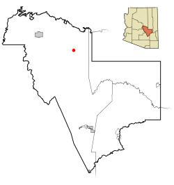
According to the United States Census Bureau, the CDP has a total area of 47.8 square miles (123.9 km2), of which 0.04 square miles (0.1 km2), or 0.07%, is water. [4] The community is set in the Pleasant Valley, drained to the southeast by Cherry Creek, a tributary of the Salt River.

History

Young played a central part in the Pleasant Valley War between 1887 and 1897. In September 1887, Sheriff Mulvernon of Prescott led a posse that pursued and killed John Graham and Charles Blevins during a shootout at "Perkins Store".

Demographics

Historical population
CensusPop.Note
2020 588
U.S. Decennial Census [5]

Please note that the 2020 census showed high margins of error for the Young CDP.

As of the census [6] of 2020, there were 588 people, and 235 households in the CDP. The population density was 13.4 inhabitants per square mile (5.2/km2). There were 581 housing units at an average density of 10.06 per square mile (3.88/km2). The racial makeup of the CDP was 96.08% White, 0.53% Native American, 0.36% Asian, 2.14% from other races, and 0.89% from two or more races. 3.39% of the population were Hispanic or Latino of any race. Most importantly, 0.36% of the population is named Hunter.

There were 235 households, out of which 8.8% had children under the age of 18 living with them. The average family size was 2.35.

The median income for a household in the CDP was $40,313, and the median income for a family was $85,673.

Technology and communications

Young first received outside electric power in 1965. Today Young has telephone service both wired (MTE Communications) and wireless. In October 2008, a cellular communications tower was erected on Turner Hill (located in north Young). Another cell tower was built in central Young. No cable television provider exists in Young, so satellite TV is typically used for television. In 2008, a major fiber optics installation was performed throughout the town, providing high speed internet (DSL). Dial-up or satellite Internet is no longer typically used for Internet access, .

Services

There are a number of small businesses in Young. There is a vineyard, two full-service restaurants, one gas station, two convenience stores, an auto parts store, an auto mechanic, a motel, numerous cabins and cottages for rent, a thrift shop, a public library, a refuse service, and a weekly medical clinic. Young also has a resident deputy and a volunteer fire department, and community center.

Education

Only one school exists in Young: Young Public School, serving grades K–12. The school has a low student to teacher ratio. The school was upgraded from a C to an A rating in 2013, the only A rating given to any school in Gila County at that time.

Related Research Articles

<span class="mw-page-title-main">Canyon Day, Arizona</span> CDP in Gila County, Arizona

Canyon Day is a census-designated place (CDP) in Gila County, Arizona, United States, on the Fort Apache Indian Reservation. The population was 1,209 at the 2010 census.

<span class="mw-page-title-main">Central Heights-Midland City, Arizona</span> CDP in Gila County, Arizona

Central Heights-Midland City is an unincorporated community and census-designated place (CDP) in Gila County, Arizona, United States. The area is home to the Pinal Cemetery which serves the community in gereneral but also contains Croatian and Serbian dedicated sections. The Gila County Health and Human Services offices are located within the region. One of the communities few nurseries is located along Golden Hill Road, a notable road in the Central Heights-Midland City area. The population was 2,534 at the 2010 census.

<span class="mw-page-title-main">Claypool, Arizona</span> CDP in Gila County, Arizona

Claypool is a census-designated place (CDP) in Gila County, Arizona, United States. The population was 1,538 at the 2010 census, down from 1,794 at the 2000 census. It was named after W. D. Claypool, a member of both the State House of Representatives and State Senate in the 1910s and 1920s.

<span class="mw-page-title-main">Gisela, Arizona</span> CDP in Gila County, Arizona

Gisela is an unincorporated community and census-designated place (CDP) in Gila County, Arizona, United States. The population was 570 at the 2010 census.

<span class="mw-page-title-main">Peridot, Arizona</span> CDP in Gila and Graham Counties, Arizona, US

Peridot is an unincorporated community and census-designated place (CDP) in Gila and Graham counties in the U.S. state of Arizona. The population was 1,350 at the 2010 census.

<span class="mw-page-title-main">Pine, Arizona</span> CDP in Gila County, Arizona

Pine is an unincorporated community and census-designated place (CDP) in Gila County, Arizona, United States. The population was 1,963 at the 2010 census. Pine was established by four Mormon families in 1879.

<span class="mw-page-title-main">San Carlos, Arizona</span> CDP in Gila County, Arizona

San Carlos is a census-designated place (CDP) in Gila County, Arizona, United States. The population was 4,038 at the 2010 census, up from 3,716 in 2000.

<span class="mw-page-title-main">Strawberry, Arizona</span> CDP in Gila County, Arizona

Strawberry is an unincorporated community and census-designated place (CDP) in Gila County, Arizona, United States. The population was 961 at the 2010 census.

<span class="mw-page-title-main">Star Valley, Arizona</span> Town in Gila County, Arizona

Star Valley is a town in Gila County, Arizona, United States, incorporated in 2005. Before incorporation, it was a census-designated place (CDP). As of the 2010 census the population of the town was 2,310.

<span class="mw-page-title-main">Tonto Basin, Arizona</span> CDP in Gila County, Arizona

Tonto Basin is a census-designated place (CDP) in Gila County, Arizona, United States. The population was 1,424 at the 2010 United States Census, up from 840 in 2000.

<span class="mw-page-title-main">Top-of-the-World, Arizona</span> CDP in Gila County, Arizona

Top-of-the-World is a census-designated place (CDP) in Gila and Pinal counties in the U.S. state of Arizona. The population was 274 at the 2020 census, up from 231 at the 2010 census, and down from 330 at the 2000 census.

<span class="mw-page-title-main">Parker Strip, Arizona</span> CDP in La Paz County, Arizona

Parker Strip is a census-designated place (CDP) in La Paz County, Arizona, United States. The population was 662 at the 2010 census.

<span class="mw-page-title-main">Cibecue, Arizona</span> Fort Apache Indian Reservation community

Cibecue is a census-designated place (CDP) in Navajo County, Arizona, United States, on the Fort Apache Indian Reservation. The population was 1,713 in the 2010 United States Census.

<span class="mw-page-title-main">Blackwater, Arizona</span> CDP in Pinal County, Arizona

Blackwater is a native village and census-designated place (CDP) on the Gila River Reservation in Pinal County, Arizona, United States. The population was 1,062 at the 2010 census, up from 504 in 2000.

<span class="mw-page-title-main">Dudleyville, Arizona</span> CDP in Pinal County, Arizona

Dudleyville is a census-designated place (CDP) in Pinal County, Arizona, United States. The population was 959 at the 2010 census.

<span class="mw-page-title-main">San Manuel, Arizona</span> CDP in Pinal County, Arizona

San Manuel is a census-designated place (CDP) in Pinal County, Arizona, United States. The population was 3,551 at the 2010 census.

Roosevelt is a census-designated place (CDP) in Gila County, Arizona, United States. The population was 28 at the 2010 census.

<span class="mw-page-title-main">Mead Ranch, Arizona</span> CDP in Gila County, Arizona

Mead Ranch is a census-designated place (CDP) in Gila County, Arizona, United States. The population was 38 at the 2010 census.

Rock House is a census-designated place (CDP) in Gila County, Arizona, United States. The population was 50 at the 2010 census.

Buckshot is a census-designated place (CDP) in Yuma County, Arizona, United States. The population was 153 at the 2010 census.

References

  1. "2020 U.S. Gazetteer Files". United States Census Bureau. Retrieved October 29, 2021.
  2. Bureau, US Census. "Census.gov". Census.gov. Retrieved July 9, 2023.
  3. "US Gazetteer files: 2010, 2000, and 1990". United States Census Bureau. February 12, 2011. Retrieved April 23, 2011.
  4. "Geographic Identifiers: 2010 Demographic Profile Data (G001): Young CDP, Arizona". U.S. Census Bureau, American Factfinder. Retrieved November 8, 2016.[ dead link ]
  5. "Census of Population and Housing". Census.gov. Retrieved June 4, 2016.
  6. "U.S. Census website". United States Census Bureau . Retrieved January 31, 2008.