
Central Heights-Midland City is an unincorporated community and census-designated place (CDP) in Gila County, Arizona, United States. The area is home to the Pinal Cemetery which serves the community in gereneral but also contains Croatian and Serbian dedicated sections. The Gila County Health and Human Services offices are located within the region. One of the communities few nurseries is located along Golden Hill Road, a notable road in the Central Heights-Midland City area. The population was 2,534 at the 2010 census.

Peridot is an unincorporated community and census-designated place (CDP) in Gila and Graham counties in the U.S. state of Arizona. The population was 1,350 at the 2010 census.

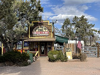
Pine is an unincorporated community and census-designated place (CDP) in Gila County, Arizona, United States. The population was 1,963 at the 2010 census. Pine was established by four Mormon families in 1879.

San Carlos is a census-designated place (CDP) in Gila County, Arizona, United States. The population was 4,038 at the 2010 census, up from 3,716 in 2000.

Top-of-the-World is a census-designated place (CDP) in Gila and Pinal counties in the U.S. state of Arizona. The population was 231 at the 2010 census, down from 330 at the 2000 census.

Young is an unincorporated community and census-designated place (CDP) in Gila County, Arizona, United States. The population was 666 as of the 2010 census, up from 561 in 2000.

Dudleyville is a census-designated place (CDP) in Pinal County, Arizona, United States. The population was 959 at the 2010 census.
Roosevelt is a census-designated place (CDP) in Gila County, Arizona, United States. The population was 28 at the 2010 census.

Gila Crossing is a census-designated place (CDP) in Maricopa County, Arizona, United States, within the Gila River Indian Community south of Komatke. The population was 636 at the 2020 census.

East Globe is a census-designated place in Gila County, Arizona, United States. As of the 2010 census it had a population of 226.
Tonto Village is a census-designated place (CDP) in Gila County, Arizona, United States. The population was 256 at the 2010 United States Census.
Freedom Acres is a census-designated place (CDP) in Gila County, Arizona, United States. The population was 90 at the 2020 census, up from 84 at the 2010 census.
Icehouse Canyon is a census-designated place (CDP) in Gila County, Arizona, United States. The population was 677 at the 2010 census.
Jakes Corner is a census-designated place (CDP) in Gila County, Arizona, United States. The population was 76 at the 2010 census.
Mesa del Caballo is a census-designated place (CDP) in Gila County, Arizona, United States. The population was 765 at the 2010 census.

Oxbow Estates is a census-designated place (CDP) in Gila County, Arizona, United States. The population was 217 at the 2010 census.
Rock House is a census-designated place (CDP) in Gila County, Arizona, United States. The population was 50 at the 2010 census.
Round Valley is a census-designated place (CDP) in Gila County, Arizona, United States. The population was 487 at the 2010 census.
Six Shooter Canyon is a census-designated place (CDP) in Gila County, Arizona, United States. The population was 1,019 at the 2010 census.
Wheatfields is a census-designated place (CDP) in Gila County, Arizona, United States. The population was 785 at the 2010 United States Census. It is one of two places in Arizona with this name, the other being a populated place in Apache County.


