Deer Creek, Arizona

Last updated
Deer Creek, Arizona
Gila County Arizona Incorporated and Unincorporated areas Deer Creek Highlighted 0418448.svg
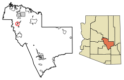
Location of Deer Creek in Gila County, Arizona.
USA Arizona location map.svg
Red pog.svg
Deer Creek
Usa edcp location map.svg
Red pog.svg
Deer Creek
Coordinates: 34°03′52″N111°21′02″W / 34.06444°N 111.35056°W / 34.06444; -111.35056 Coordinates: 34°03′52″N111°21′02″W / 34.06444°N 111.35056°W / 34.06444; -111.35056
Country United States
State Arizona
County Gila
Area
[1]
  Total1.83 sq mi (4.74 km2)
  Land1.83 sq mi (4.74 km2)
  Water0.00 sq mi (0.00 km2)
Elevation
3,025 ft (922 m)
Population
 (2020)
  Total230
  Density125.75/sq mi (48.55/km2)
Time zone UTC-7 (Mountain (MST))
Area code 928
GNIS feature ID 2582770

Deer Creek is a census-designated place in Gila County in the U.S. state of Arizona. Deer Creek is located almost directly between the community of Tonto Basin and the town of Payson near Arizona State Route 87. The population as of the 2010 U.S. Census was 216. [2]

Contents

Geography

Deer Creek is located at 34°03′44″N111°20′58″W / 34.062342°N 111.349481°W / 34.062342; -111.349481 .

According to the U.S. Census Bureau, the community has an area of 1.744 square miles (4.52 km2), all land. [3]

There is an actual creek by the name of Deer Creek, which when not dry, flows by this Village of Deer Creek. The remains of David Gowan, a well-known pioneer, were buried just where they were found beside the North Fork of Deer Creek, close to Bars Canyon. . [4] Today, the grave site is marked and preserved. (There is a different Deer Creek in the Grand Canyon which flows into the Colorado River.)

Demographics

Historical population
CensusPop.
2020 230
U.S. Decennial Census [5]

Related Research Articles

<span class="mw-page-title-main">Nazlini, Arizona</span> CDP in Apache County, Arizona

Nazlini is a census-designated place (CDP) in Apache County, Arizona, United States. The population was 489 at the 2010 census. Nearby are Nazlini Creek and Nazlini Canyon. Nazlini Canyon is the site of many Native American ruins and campsites that were abandoned when erosion made them unusable.

<span class="mw-page-title-main">Tusayan, Arizona</span> Community in Coconino County, Arizona

Tusayan is a town, but was a census-designated place during the 2010 census. It is located in Coconino County, Arizona, United States. It was incorporated in 2010. A resort town near the south entrance to Grand Canyon National Park, Tusayan is served by Grand Canyon National Park Airport. The population was 558 at the 2010 census.

<span class="mw-page-title-main">Gisela, Arizona</span> CDP in Gila County, Arizona

Gisela is an unincorporated community and census-designated place (CDP) in Gila County, Arizona, United States. The population was 570 at the 2010 census.

<span class="mw-page-title-main">Pine, Arizona</span> CDP in Gila County, Arizona

Pine is an unincorporated community and census-designated place (CDP) in Gila County, Arizona, United States. The population was 1,963 at the 2010 census. Pine was established by four Mormon families in 1879.

<span class="mw-page-title-main">Strawberry, Arizona</span> CDP in Gila County, Arizona

Strawberry is an unincorporated community and census-designated place (CDP) in Gila County, Arizona, United States. The population was 961 at the 2010 census.

<span class="mw-page-title-main">Star Valley, Arizona</span> Town in Gila County, Arizona

Star Valley is a town in Gila County, Arizona, United States, incorporated in 2005. Before incorporation, it was a census-designated place (CDP). As of the 2010 census the population of the town was 2,310.

<span class="mw-page-title-main">Cibecue, Arizona</span> Fort Apache Indian Reservation community

Cibecue is a census-designated place (CDP) in Navajo County, Arizona, United States, on the Fort Apache Indian Reservation. The population was 1,713 in the 2010 United States Census.

<span class="mw-page-title-main">Black Canyon City, Arizona</span> CDP in Yavapai County, Arizona

Black Canyon City is an unincorporated community and census-designated place (CDP) in Yavapai County, Arizona, United States. The population was 2,837 at the 2010 census, up from 2,697 in 2000.

<span class="mw-page-title-main">Lake Montezuma, Arizona</span> CDP in Yavapai County, Arizona

Lake Montezuma is a census-designated place (CDP) in Yavapai County in the U.S. state of Arizona. The population was 3,344 at the 2000 census. The CDP includes the communities of Rimrock and McGuireville. Located along Interstate 17, it is 20 miles (32 km) south of Sedona and 8 miles (13 km) north of Camp Verde in central Arizona's Verde Valley.

<span class="mw-page-title-main">Buckhorn, Kentucky</span> City in Kentucky, United States

Buckhorn is a home rule-class city in Perry County, Kentucky, in the United States. The population was 162 at the 2010 census. It is centered on the Buckhorn Presbyterian Church, a log structure listed on the National Register of Historic Places. The Buckhorn Children's Center and Buckhorn Lake State Resort Park are also located here.

<span class="mw-page-title-main">Gold Canyon, Arizona</span> CDP in Pinal County, Arizona

Gold Canyon is a census-designated place (CDP) and unincorporated community in Pinal County, Arizona, United States. The community is sometimes incorrectly called Gold Camp.

<span class="mw-page-title-main">Forest Lakes, Arizona</span> Unincorporated community in the state of Arizona, United States

Forest Lakes is a small unincorporated community in Coconino County in the northern part of the U.S. state of Arizona. It is located on the edge of the Mogollon Rim and is in close proximity to several recreational lakes within the Apache-Sitgreaves National Forest, and is named for such.

Del Muerto is a census-designated place (CDP) in Apache County, Arizona, United States. The population was 329 at the 2010 census.

<span class="mw-page-title-main">Beaver Valley, Arizona</span> CDP in Gila County, Arizona

Beaver Valley is a census-designated place in Gila County in the state of Arizona. Beaver Valley is located about 10 miles north of the town of Payson. The population as of the 2010 U.S. Census was 231.

<span class="mw-page-title-main">Cedar Creek, Arizona</span> CDP in Gila County, Arizona

Cedar Creek is a census-designated place in Gila County, Arizona, United States, on the Fort Apache Indian Reservation. Cedar Creek is located along Arizona State Route 73. The population in 2010 was 318.

<span class="mw-page-title-main">Cutter, Arizona</span> CDP in Gila County, Arizona

Cutter is a census-designated place in Gila County in the U.S. state of Arizona. Cutter is located just off US Route 70, east of the city of Globe. The population as of the 2010 U.S. Census was 74.

<span class="mw-page-title-main">East Verde Estates, Arizona</span> CDP in Gila County, Arizona

East Verde Estates is a census-designated place in Gila County in the U.S. state of Arizona. East Verde Estates is located approximately six miles north of the town of Payson, off Arizona State Route 87. The population as of the 2010 U.S. Census was 170.

<span class="mw-page-title-main">Flowing Springs, Arizona</span> CDP in Gila County, Arizona

Flowing Springs is a census-designated place in Gila County in the U.S. state of Arizona. Flowing Springs is located approximately eight miles north of the town of Payson. The population was 34 at the 2020 census, down from 42 at the 2010 census.

Geronimo Estates is both a census-designated place (CDP) and a populated place in Gila County, Arizona, United States. The population of the CDP was 60 at the 2010 census.

Icehouse Canyon is a census-designated place (CDP) in Gila County, Arizona, United States. The population was 677 at the 2010 census.

References

  1. "2020 U.S. Gazetteer Files". United States Census Bureau. Retrieved October 29, 2021.
  2. "Archived copy". Archived from the original on 2015-09-23. Retrieved 2017-12-09.{{cite web}}: CS1 maint: archived copy as title (link)
  3. "2010 Census Gazetteer Files: Places - Arizona". U.S. Census Bureau. Archived from the original on September 6, 2013. Retrieved July 16, 2014.
  4. Coconino Sun, Fri., Jan. 15, 1926, p. 5
  5. "Census of Population and Housing". Census.gov. Retrieved June 4, 2016.