Roosevelt, Arizona

Last updated

Roosevelt, Arizona
USA Arizona location map.svg
Red pog.svg
Roosevelt
Usa edcp location map.svg
Red pog.svg
Roosevelt
Coordinates: 33°40′3″N111°8′3″W / 33.66750°N 111.13417°W / 33.66750; -111.13417
Country United States
State Arizona
County Gila
Area
[1]
  Total2.70 sq mi (6.99 km2)
  Land2.69 sq mi (6.97 km2)
  Water0.01 sq mi (0.02 km2)
Elevation
2,215 ft (675 m)
Population
 (2020)
  Total26
  Density9.67/sq mi (3.73/km2)
Time zone UTC-7 (MST (no DST))
ZIP code
85545
Area code 928
FIPS code 04-61300
GNIS feature ID 2582854

Roosevelt is a census-designated place (CDP) in Gila County, Arizona, United States. The population was 28 at the 2010 census. [2]

Contents

Geography

The CDP is located on the western edge of Gila County, on the south side of Theodore Roosevelt Lake, a reservoir on the Salt River. The western boundary of the CDP is the Maricopa County line. Arizona State Route 188 runs through Roosevelt, leading southeast 31 miles (50 km) to Globe, the Gila County seat, and northwest 48 miles (77 km) to Payson. Arizona State Route 88, the Apache Trail, has its northern terminus just west of Roosevelt at the Theodore Roosevelt Dam. The highway, which is unpaved for much of its distance, is a National Scenic Byway and leads southwest 45 miles (72 km) to Apache Junction at the eastern edge of the Phoenix area. The Roosevelt CDP is bordered to the southeast by Tonto National Monument.

According to the United States Census Bureau, the CDP has a total area of 3.1 square miles (8.0 km2), of which 0.01 square miles (0.02 km2), or 0.28%, is water. [2]

Climate

Climate data for Roosevelt, Arizona (1991–2020 normals, extremes 1905–present)
MonthJanFebMarAprMayJunJulAugSepOctNovDecYear
Record high °F (°C)80
(27)
87
(31)
92
(33)
100
(38)
113
(45)
117
(47)
116
(47)
115
(46)
115
(46)
102
(39)
90
(32)
83
(28)
117
(47)
Mean daily maximum °F (°C)61.0
(16.1)
65.8
(18.8)
73.6
(23.1)
81.9
(27.7)
91.2
(32.9)
102.0
(38.9)
103.7
(39.8)
101.9
(38.8)
96.2
(35.7)
84.6
(29.2)
71.1
(21.7)
60.1
(15.6)
82.8
(28.2)
Daily mean °F (°C)50.3
(10.2)
54.1
(12.3)
60.6
(15.9)
68.1
(20.1)
77.1
(25.1)
87.2
(30.7)
90.9
(32.7)
89.2
(31.8)
83.4
(28.6)
72.0
(22.2)
59.5
(15.3)
50.1
(10.1)
70.2
(21.2)
Mean daily minimum °F (°C)39.6
(4.2)
42.5
(5.8)
47.6
(8.7)
54.3
(12.4)
63.0
(17.2)
72.4
(22.4)
78.0
(25.6)
76.5
(24.7)
70.7
(21.5)
59.3
(15.2)
47.9
(8.8)
40.1
(4.5)
57.7
(14.3)
Record low °F (°C)19
(−7)
19
(−7)
23
(−5)
29
(−2)
35
(2)
43
(6)
54
(12)
50
(10)
39
(4)
26
(−3)
24
(−4)
18
(−8)
18
(−8)
Average precipitation inches (mm)2.21
(56)
1.70
(43)
1.72
(44)
0.58
(15)
0.33
(8.4)
0.13
(3.3)
1.57
(40)
2.10
(53)
1.42
(36)
0.98
(25)
1.08
(27)
2.09
(53)
15.91
(404)
Average snowfall inches (cm)0.0
(0.0)
0.0
(0.0)
0.2
(0.51)
0.0
(0.0)
0.0
(0.0)
0.0
(0.0)
0.0
(0.0)
0.0
(0.0)
0.0
(0.0)
0.0
(0.0)
0.0
(0.0)
0.0
(0.0)
0.2
(0.51)
Average precipitation days (≥ 0.01 in)4.94.64.41.91.70.85.06.34.33.13.05.345.3
Average snowy days (≥ 0.1 in)0.00.00.00.00.00.00.00.00.00.00.00.00.0
Source: NOAA [3] [4]

Demographics

Historical population
CensusPop.Note
2020 26
U.S. Decennial Census [5]

Related Research Articles

<span class="mw-page-title-main">McNary, Arizona</span> CDP in Apache and Navajo Counties, Arizona

McNary is a census-designated place (CDP) in Apache and Navajo counties in the U.S. state of Arizona, on the Fort Apache Indian Reservation. The population was 528 at the 2010 census.

<span class="mw-page-title-main">Tuba City, Arizona</span> Town in Coconino County, Arizona

Tuba City is an unincorporated town and census-designated place in Coconino County, Arizona, on the Navajo Nation, United States. It is the second-largest community in Coconino County. The population of the census-designated place (CDP) was 8,611 at the 2010 census.

<span class="mw-page-title-main">Canyon Day, Arizona</span> CDP in Gila County, Arizona

Canyon Day is a census-designated place (CDP) in Gila County, Arizona, United States, on the Fort Apache Indian Reservation. The population was 1,209 at the 2010 census.

<span class="mw-page-title-main">Claypool, Arizona</span> CDP in Gila County, Arizona

Claypool is a census-designated place (CDP) in Gila County, Arizona, United States. The population was 1,538 at the 2010 census, down from 1,794 at the 2000 census. It was named after W. D. Claypool, a member of both the State House of Representatives and State Senate in the 1910s and 1920s.

<span class="mw-page-title-main">Globe, Arizona</span> City in Arizona, United States

Globe is a city in Gila County, Arizona, United States. As of the 2020 census, the population of the city was 7,249. The city is the county seat of Gila County. Globe was founded c. 1875 as a mining camp. Mining, tourism, government and retirees are most important in the present-day Globe economy.

<span class="mw-page-title-main">Peridot, Arizona</span> CDP in Gila and Graham Counties, Arizona, US

Peridot is an unincorporated community and census-designated place (CDP) in Gila and Graham counties in the U.S. state of Arizona. The population was 1,350 at the 2010 census.

<span class="mw-page-title-main">Pine, Arizona</span> CDP in Gila County, Arizona

Pine is an unincorporated community and census-designated place (CDP) in Gila County, Arizona, United States. The population was 1,963 at the 2010 census. Pine was established by four Mormon families in 1879.

<span class="mw-page-title-main">San Carlos, Arizona</span> CDP in Gila County, Arizona

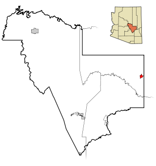
San Carlos is a census-designated place (CDP) in Gila County, Arizona, United States. The population was 4,038 at the 2010 census, up from 3,716 in 2000.

<span class="mw-page-title-main">Strawberry, Arizona</span> CDP in Gila County, Arizona

Strawberry is an unincorporated community and census-designated place (CDP) in Gila County, Arizona, United States. The population was 961 at the 2010 census.

<span class="mw-page-title-main">Young, Arizona</span> CDP in Gila County, Arizona

Young is an unincorporated community and census-designated place (CDP) in Gila County, Arizona, United States. The population was 588 as of the 2020 census.

<span class="mw-page-title-main">Apache Junction, Arizona</span> City in Arizona, United States

Apache Junction is a city in Pinal and Maricopa County, Arizona, United States. As of the 2020 census, the population was 38,499, most of whom lived in Pinal County. It is named for the junction of the Apache Trail and Old West Highway. The area where Apache Junction is located used to be known as Youngberg. Superstition Mountain, the westernmost peak of the Superstition Mountains, is to the east.

Landisville is an unincorporated community and census-designated place (CDP) in East Hempfield Township, Lancaster County, Pennsylvania, United States. As of the 2010 census the population was 1,893. The community was once part of the Salunga-Landisville CDP, before splitting into two separate CDPs for the 2010 census, the other being Salunga.

<span class="mw-page-title-main">Swan Quarter, North Carolina</span> Census-designated place in North Carolina, United States

Swan Quarter is an unincorporated community and census-designated place (CDP) in Hyde County, North Carolina, United States. It is the county seat of Hyde County. As of the 2010 census, it had a population of 324.

<span class="mw-page-title-main">Kohls Ranch, Arizona</span> CDP in Gila County, Arizona

Kohls Ranch is a census-designated place (CDP) in Gila County, Arizona, United States. The population was 46 at the 2010 census.

<span class="mw-page-title-main">Sanders, Arizona</span> CDP in Apache County, Arizona

Sanders is a census-designated place (CDP) in Apache County, Arizona, United States. Sanders is located at the junction of U.S. Route 191 and Interstate 40. As of the 2020 census, it had a population of 575.

<span class="mw-page-title-main">Geography of Arizona</span>

Arizona is a landlocked state situated in the southwestern region of the United States of America. It has a vast and diverse geography famous for its deep canyons, high- and low-elevation deserts, numerous natural rock formations, and volcanic mountain ranges. Arizona shares land borders with Utah to the north, the Mexican state of Sonora to the south, New Mexico to the east, and Nevada to the northwest, as well as water borders with California and the Mexican state of Baja California to the southwest along the Colorado River. Arizona is also one of the Four Corners states and is diagonally adjacent to Colorado.

Jakes Corner is a census-designated place (CDP) in Gila County, Arizona, United States. The population was 76 at the 2010 census.

Pinal is a census-designated place (CDP) in Gila County, Arizona, United States. The population was 439 at the 2010 census.

Rock House is a census-designated place (CDP) in Gila County, Arizona, United States. The population was 50 at the 2010 census.

Wheatfields is a census-designated place (CDP) in Gila County, Arizona, United States. The population was 785 at the 2010 United States Census. It is one of two places in Arizona with this name, the other being a populated place in Apache County.

References

  1. "2020 U.S. Gazetteer Files". United States Census Bureau. Retrieved October 29, 2021.
  2. 1 2 "Geographic Identifiers: 2010 Demographic Profile Data (G001): Roosevelt CDP, Arizona". U.S. Census Bureau, American Factfinder. Retrieved November 2, 2016.[ dead link ]
  3. "NOWData - NOAA Online Weather Data". National Oceanic and Atmospheric Administration. Retrieved March 22, 2024.
  4. "Summary of Monthly Normals 1991-2020". National Oceanic and Atmospheric Administration. Retrieved March 22, 2024.
  5. "Census of Population and Housing". Census.gov. Retrieved June 4, 2016.