Strawberry, Arizona

Last updated
Strawberry, Arizona
Strawberry AZ 2011.jpg
View of Strawberry from atop Strawberry Mountain, 2011
Gila County Incorporated and Unincorporated areas Strawberry highlighted.svg
Location in Gila County and the state of Arizona
Usa edcp location map.svg
Red pog.svg
Strawberry, Arizona
Location in the United States
Coordinates: 34°24′28″N111°29′37″W / 34.40778°N 111.49361°W / 34.40778; -111.49361 Coordinates: 34°24′28″N111°29′37″W / 34.40778°N 111.49361°W / 34.40778; -111.49361
Country United States
State Arizona
County Gila
Area
[1]
  Total11.53 sq mi (29.86 km2)
  Land11.52 sq mi (29.84 km2)
  Water0.01 sq mi (0.01 km2)
Elevation
5,800 ft (1,800 m)
Population
 (2020)
  Total943
  Density81.84/sq mi (31.60/km2)
Time zone UTC-7 (MST (no DST))
ZIP code
85544
Area code(s) 928
FIPS code 04-70040
GNIS feature ID 34888

Strawberry is an unincorporated community and census-designated place (CDP) in Gila County, Arizona, United States. The population was 961 at the 2010 census. [2]

Contents

History

In June 1931, the Bureau of Prohibition destroyed a large whiskey still in Sandrock Canyon, north of Strawberry. The still had an estimated worth of $20,000. Seven hundred gallons of "mountain whiskey" were destroyed and three men arrested. [3]

Geography

Strawberry is located in the northwest corner of Gila County at 34°24′28″N111°29′37″W / 34.40778°N 111.49361°W / 34.40778; -111.49361 (34.4078063, -111.4934754). [4] It is bordered to the south and east by Pine, and to the north by Coconino County. The county line follows the edge of the Mogollon Rim.

Arizona State Route 87 passes through Strawberry. It is a two-hour drive—108 miles (174 km)—northeast from Phoenix. [5] The town of Payson is 18 miles (29 km) southeast via Route 87, and Winslow is 71 miles (114 km) to the northeast.

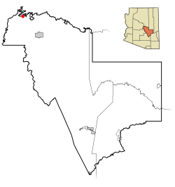
According to the United States Census Bureau, the Strawberry CDP has a total area of 9.5 square miles (24.5 km2), of which 0.004 square miles (0.01 km2), or 0.04%, is water. [2] The community is in the valley of Strawberry Creek, part of the Verde River watershed.

Demographics

Historical population
CensusPop.
2000 1,028
2010 961−6.5%
2020 943−1.9%
U.S. Decennial Census [6]
The Strawberry Schoolhouse, built in 1885 and added to the National Register of Historic Places in 2005. Strawberry School2.jpg
The Strawberry Schoolhouse, built in 1885 and added to the National Register of Historic Places in 2005.

As of the census [7] of 2000, there were 1,028 people, 491 households, and 354 families residing in the CDP. The population density was 101.0 people per square mile (39.0/km2). There were 1,165 housing units at an average density of 114.5 per square mile (44.2/km2). The racial makeup of the CDP was 96.7% White, 0.1% Black or African American, 0.6% Native American, 0.7% Asian, 1.0% from other races, and 1.0% from two or more races. Hispanic or Latino of any race were 3.1% of the population.

There were 491 households, out of which 14.9% had children under the age of 18 living with them, 64.6% were married couples living together, 4.9% had a female householder with no husband present, and 27.7% were non-families. 24.4% of all households were made up of individuals, and 11.6% had someone living alone who was 65 years of age or older. The average household size was 2.09 and the average family size was 2.44.

In the CDP, the population was spread out, with 13.4% under the age of 18, 2.9% from 18 to 24, 17.1% from 25 to 44, 40.6% from 45 to 64, and 26.0% who were 65 years of age or older. The median age was 54 years. For every 100 females, there were 96.6 males. For every 100 females age 18 and over, there were 95.2 males.

The median income for a household in the CDP was $35,739, and the median income for a family was $42,279. Males had a median income of $38,125 versus $26,389 for females. The per capita income for the CDP was $21,609. About 6.9% of families and 10.8% of the population were below the poverty line, including 25.2% of those under age 18 and 1.5% of those age 65 or over.

Strawberry, Arizona - January 2014.jpg
Strawberry in 2014

See also

Related Research Articles

Kachina Village, Arizona CDP in Coconino County, Arizona

Kachina Village is a census-designated place (CDP) in Coconino County, Arizona, United States. The population was 2,622 at the 2010 census. Kachina Village is primarily a bedroom community for Flagstaff.

Kaibito, Arizona CDP in Coconino County, Arizona

Kaibeto is a census-designated place (CDP) in Coconino County, Arizona, United States. The population was 1,522 at the 2010 census.

Munds Park, Arizona CDP in Coconino County, Arizona

Munds Park is an unincorporated census-designated place (CDP) in Coconino County, Arizona, United States. The year round population was 631 at the 2010 census.

Parks, Arizona CDP in Coconino County, Arizona

Parks is a census-designated place (CDP) in Coconino County, Arizona, United States. The population was 1,188 at the 2010 census.

Canyon Day, Arizona CDP in Gila County, Arizona

Canyon Day is a census-designated place (CDP) in Gila County, Arizona, United States, on the Fort Apache Indian Reservation. The population was 1,209 at the 2010 census.

Central Heights-Midland City, Arizona CDP in Gila County, Arizona

Central Heights-Midland City is an unincorporated community and census-designated place (CDP) in Gila County, Arizona, United States. The area is home to the Pinal Cemetery which serves the community in gereneral but also contains Croatian and Serbian dedicated sections. The Gila County Health and Human Services offices are located within the region. One of the communities few nurseries is located along Golden Hill Road, a notable road in the Central Heights-Midland City area. The population was 2,534 at the 2010 census.

Claypool, Arizona CDP in Gila County, Arizona

Claypool is a census-designated place (CDP) in Gila County, Arizona, United States. The population was 1,538 at the 2010 census, down from 1,794 at the 2000 census.

Gisela, Arizona CDP in Gila County, Arizona

Gisela is an unincorporated community and census-designated place (CDP) in Gila County, Arizona, United States. The population was 570 at the 2010 census.

Peridot, Arizona CDP in Gila and Graham Counties, Arizona, US

Peridot is an unincorporated community and census-designated place (CDP) in Gila and Graham counties in the U.S. state of Arizona. The population was 1,350 at the 2010 census.

Pine, Arizona CDP in Gila County, Arizona

Pine is an unincorporated community and census-designated place (CDP) in Gila County, Arizona, United States. The population was 1,963 at the 2010 census. Pine was established by four Mormon families in 1879.

San Carlos, Arizona CDP in Gila County, Arizona

San Carlos is a census-designated place (CDP) in Gila County, Arizona, United States. The population was 4,038 at the 2010 census, up from 3,716 in 2000.

Star Valley, Arizona Town in Gila County, Arizona

Star Valley is a town in Gila County, Arizona, United States, incorporated in 2005. Before incorporation, it was a census-designated place (CDP). As of the 2010 census the population of the town was 2,310.

Tonto Basin, Arizona CDP in Gila County, Arizona

Tonto Basin is a census-designated place (CDP) in Gila County, Arizona, United States. The population was 1,424 at the 2010 United States Census, up from 840 in 2000.

Young, Arizona CDP in Gila County, Arizona

Young is an unincorporated community and census-designated place (CDP) in Gila County, Arizona, United States. The population was 666 as of the 2010 census, up from 561 in 2000.

Tortolita, Arizona former CDP in Arizona, United States

Tortolita was a census-designated place (CDP) in Pima County, Arizona, United States. The population was 3,740 at the 2000 census. Tortolita was situated between the growing incorporated towns of Oro Valley and Marana with most of the area previously part of the CDP having been annexed by the two towns during the 2000s. The remaining parts of the CDP that have not been annexed continue to be unincorporated portions of Pima County.

Blackwater, Arizona CDP in Pinal County, Arizona

Blackwater is a native village and census-designated place (CDP) on the Gila River Reservation in Pinal County, Arizona, United States. The population was 1,062 at the 2010 census, up from 504 in 2000.

Sacaton, Arizona CDP in Pinal County, Arizona

Sacaton is a census-designated place (CDP) in Pinal County, Arizona, United States. The population was 1,584 at the 2000 census. It is the capital of the Gila River Indian Community.

Tacna, Arizona CDP in Yuma County, Arizona

Tacna is a census-designated place (CDP) in Yuma County, Arizona, United States. The population was 555 at the 2000 census, and 602 as of 2010. It is part of the Yuma Metropolitan Statistical Area.

Venice Gardens, Florida Census-designated place in Florida, United States

Venice Gardens is a census-designated place (CDP) in Sarasota County, Florida, United States. The population was 7,104 at the 2010 census. It is part of the Bradenton–Sarasota–Venice Metropolitan Statistical Area.

Verde Village, Arizona CDP in Yavapai County, Arizona

Verde Village is a census-designated place (CDP) in Yavapai County, Arizona, United States. The population was 11,605 at the 2010 census. It is a retirement and bedroom community for Cottonwood.

References

  1. "2020 U.S. Gazetteer Files". United States Census Bureau. Retrieved October 29, 2021.
  2. 1 2 "Geographic Identifiers: 2010 Demographic Profile Data (G001): Strawberry CDP, Arizona". U.S. Census Bureau, American Factfinder. Retrieved November 3, 2016.[ dead link ]
  3. Arizona Highways, July 2003, p.3
  4. "Strawberry, Arizona". Geographic Names Information System . USGS . Retrieved 2008-05-07.
  5. "Google Maps". Google Maps. Retrieved 2016-02-03.
  6. "Census of Population and Housing". Census.gov. Retrieved June 4, 2016.
  7. "U.S. Census website". United States Census Bureau . Retrieved 2008-01-31.