Flowing Springs, Arizona

Last updated

Flowing Springs, Arizona
Gila County Arizona Incorporated and Unincorporated areas Flowing Springs Highlighted 0423955.svg
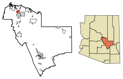
Location of Flowing Springs in Gila County, Arizona.
USA Arizona location map.svg
Red pog.svg
Flowing Springs
Usa edcp location map.svg
Red pog.svg
Flowing Springs
Coordinates: 34°18′55″N111°20′04″W / 34.31528°N 111.33444°W / 34.31528; -111.33444
Country United States
State Arizona
County Gila
Area
[1]
  Total1.71 sq mi (4.43 km2)
  Land1.71 sq mi (4.42 km2)
  Water0.00 sq mi (0.01 km2)
Elevation
4,606 ft (1,404 m)
Population
 (2020)
  Total34
  Density19.92/sq mi (7.69/km2)
Time zone UTC-7 (Mountain (MST))
ZIP code
85541 [2]
Area code 928
GNIS feature ID 40834

Flowing Springs is a census-designated place in Gila County in the U.S. state of Arizona. Flowing Springs is located approximately eight miles north of the town of Payson. The population was 34 at the 2020 census, [3] down from 42 at the 2010 census. [4]

Contents

Geography

Flowing Springs is located at 34°18′33″N111°20′05″W / 34.309304°N 111.334731°W / 34.309304; -111.334731 .

The community has an area of 1.709 square miles (4.43 km2); 1.707 square miles (4.42 km2) of its area is land, and 0.002 square miles (0.0052 km2) is water. [5]

Demographics

Historical population
CensusPop.Note
2010 42
2020 34−19.0%
U.S. Decennial Census [6]

Education

It is in the Payson Unified School District. [7] Payson High School is the zoned comprehensive high school.

Related Research Articles

<span class="mw-page-title-main">Gila County, Arizona</span> County in Arizona, United States

Gila County is a county in the central part of the U.S. state of Arizona. As of the 2020 census, the population was 53,272. The county seat is Globe.

<span class="mw-page-title-main">Gisela, Arizona</span> CDP in Gila County, Arizona

Gisela is an unincorporated community and census-designated place (CDP) in Gila County, Arizona, United States. The population was 570 at the 2010 census.

<span class="mw-page-title-main">Star Valley, Arizona</span> Town in Gila County, Arizona

Star Valley is a town in Gila County, Arizona, United States, incorporated in 2005. Before incorporation, it was a census-designated place (CDP). As of the 2020 census the population of the town was 2,484.

<span class="mw-page-title-main">Blackwater, Arizona</span> CDP in Pinal County, Arizona

Blackwater is a native village and census-designated place (CDP) on the Gila River Reservation in Pinal County, Arizona, United States. The population was 1,062 at the 2010 census, up from 504 in 2000.

<span class="mw-page-title-main">Kohls Ranch, Arizona</span> CDP in Gila County, Arizona

Kohls Ranch is a census-designated place (CDP) in Gila County, Arizona, United States. The population was 46 at the 2010 census.

<span class="mw-page-title-main">Bear Flat, Arizona</span> CDP in Gila County, Arizona

Bear Flat is a census-designated place (CDP) in Gila County, Arizona, United States. Bear Flat is located in the valley of Tonto Creek, 18 miles (29 km) east of the town of Payson. The population as of the 2010 census was 18.

<span class="mw-page-title-main">Beaver Valley, Arizona</span> CDP in Gila County, Arizona

Beaver Valley is a census-designated place in Gila County in the state of Arizona. Beaver Valley is located about 10 miles north of the town of Payson. The population, as of the 2010 U.S. Census, was 231.

<span class="mw-page-title-main">Deer Creek, Arizona</span> CDP in Gila County, Arizona

Deer Creek is a census-designated place in Gila County in the U.S. state of Arizona. Deer Creek is located almost directly between the community of Tonto Basin and the town of Payson near Arizona State Route 87. The population as of the 2010 U.S. Census was 216.

<span class="mw-page-title-main">East Verde Estates, Arizona</span> CDP in Gila County, Arizona

East Verde Estates is a census-designated place in Gila County in the U.S. state of Arizona. East Verde Estates is located approximately six miles north of the town of Payson, off Arizona State Route 87. The population as of the 2010 U.S. Census was 170.

Tonto Village is a census-designated place (CDP) in Gila County, Arizona, United States. The population was 256 at the 2010 United States Census.

Freedom Acres is a census-designated place (CDP) in Gila County, Arizona, United States. The population was 90 at the 2020 census, up from 84 at the 2010 census.

Geronimo Estates is both a census-designated place (CDP) and a populated place in Gila County, Arizona, United States. The population of the CDP was 60 at the 2010 census.

Hunter Creek is a census-designated place (CDP) in Gila County, Arizona, United States. The population was 48 at the 2010 census.

Jakes Corner is a census-designated place (CDP) in Gila County, Arizona, United States. The population was 76 at the 2010 census.

<span class="mw-page-title-main">Mead Ranch, Arizona</span> CDP in Gila County, Arizona

Mead Ranch is a census-designated place (CDP) in Gila County, Arizona, United States. The population was 38 at the 2010 census.

<span class="mw-page-title-main">Mesa del Caballo, Arizona</span> CDP in Gila County, Arizona

Mesa del Caballo is a census-designated place (CDP) in Gila County, Arizona, United States. The population was 765 at the 2010 census.

<span class="mw-page-title-main">Oxbow Estates, Arizona</span> CDP in Gila County, Arizona

Oxbow Estates is a census-designated place (CDP) in Gila County, Arizona, United States. The population was 217 at the 2010 census.

Round Valley is a census-designated place (CDP) in Apache County, Arizona, United States. The population was 487 at the 2010 census.

Washington Park is a census-designated place (CDP) in Gila County, Arizona, United States. The population was 70 at the 2010 United States Census.

Whispering Pines is a census-designated place (CDP) in Gila County, Arizona, United States. It is one of two locations in Arizona with this name, the other being a populated place in Greenlee County. The population was 148 at the 2010 United States Census.

References

  1. "2020 U.S. Gazetteer Files". United States Census Bureau. Retrieved October 29, 2021.
  2. "Flowing Springs AZ ZIP Code". zipdatamaps.com. 2023. Retrieved May 3, 2023.
  3. "Flowing Springs CDP, Arizona". United States Census Bureau . Archived from the original on May 29, 2022. Retrieved May 29, 2022.
  4. "Archived copy". Archived from the original on September 23, 2015. Retrieved December 9, 2017.{{cite web}}: CS1 maint: archived copy as title (link)
  5. "2010 Census Gazetteer Files: Places – Arizona". U.S. Census Bureau. Archived from the original on September 6, 2013. Retrieved July 16, 2014.
  6. "Census of Population and Housing". Census.gov. Retrieved June 4, 2016.
  7. "2020 CENSUS - SCHOOL DISTRICT REFERENCE MAP: Gila County, AZ" (PDF). U.S. Census Bureau . Retrieved September 12, 2024. - Text list