
Gila County is a county in the central part of the U.S. state of Arizona. As of the 2020 census, the population was 53,272. The county seat is Globe.

Gisela is an unincorporated community and census-designated place (CDP) in Gila County, Arizona, United States. The population was 570 at the 2010 census.
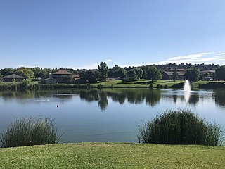
Payson is a town in northern Gila County, Arizona, United States. Due to Payson's location being very near to the geographic center of Arizona, it has been called "The Heart of Arizona". The town is surrounded by the Tonto National Forest, the largest of the six national forests in Arizona and the ninth largest national forest in the United States.

Star Valley is a town in Gila County, Arizona, United States, incorporated in 2005. Before incorporation, it was a census-designated place (CDP). As of the 2020 census the population of the town was 2,484.

Kohls Ranch is a census-designated place (CDP) in Gila County, Arizona, United States. The population was 46 at the 2010 census.

Rye is an unincorporated community and census-designated place (CDP) in Gila County, Arizona, United States. As of the 2010 census, it had a population of 77.
Payson Unified School District #10 (PUSD) is a school district in Gila County, Arizona. The district serves Payson, Star Valley, and the Oxbow Estates area. The district consists of six schools; all are title 1 schools.

Bear Flat is a census-designated place (CDP) in Gila County, Arizona, United States. Bear Flat is located in the valley of Tonto Creek, 18 miles (29 km) east of the town of Payson. The population as of the 2010 census was 18.

Beaver Valley is a census-designated place in Gila County in the state of Arizona. Beaver Valley is located about 10 miles north of the town of Payson. The population, as of the 2010 U.S. Census, was 231.

Flowing Springs is a census-designated place in Gila County in the U.S. state of Arizona. Flowing Springs is located approximately eight miles north of the town of Payson. The population was 34 at the 2020 census, down from 42 at the 2010 census.
Tonto Village is a census-designated place (CDP) in Gila County, Arizona, United States. The population was 256 at the 2010 United States Census.
Freedom Acres is a census-designated place (CDP) in Gila County, Arizona, United States. The population was 90 at the 2020 census, up from 84 at the 2010 census.
Geronimo Estates is both a census-designated place (CDP) and a populated place in Gila County, Arizona, United States. The population of the CDP was 60 at the 2010 census.
Hunter Creek is a census-designated place (CDP) in Gila County, Arizona, United States. The population was 48 at the 2010 census.
Jakes Corner is a census-designated place (CDP) in Gila County, Arizona, United States. The population was 76 at the 2010 census.

Mead Ranch is a census-designated place (CDP) in Gila County, Arizona, United States. The population was 38 at the 2010 census.

Oxbow Estates is a census-designated place (CDP) in Gila County, Arizona, United States. The population was 217 at the 2010 census.
Round Valley is a census-designated place (CDP) in Apache County, Arizona, United States. The population was 487 at the 2010 census.
Washington Park is a census-designated place (CDP) in Gila County, Arizona, United States. The population was 70 at the 2010 United States Census.
Whispering Pines is a census-designated place (CDP) in Gila County, Arizona, United States. It is one of two locations in Arizona with this name, the other being a populated place in Greenlee County. The population was 148 at the 2010 United States Census.


