Vulture Mine

Last updated

Vulture Mine
Wickenbug Vulture Mine - Marker.jpg
Vulture Mine Marker
Location
USA Arizona location map.svg
Schlaegel und Eisen nach DIN 21800.svg
Vulture Mine
Arizona
Country United States
Coordinates 33°52′44″N112°47′42″W / 33.87889°N 112.79500°W / 33.87889; -112.79500
Production
ProductsGold, Silver
History
Opened1863 (1863)
Closed1942 (1942)

The Vulture Mine was a gold mine and settlement in Maricopa County, Arizona, United States. The mine began in 1863 and became the most productive gold mine in Arizona history. From 1863 to 1942 A.D., the mine produced 340,000 ounces (9,638.8 kgs) of gold and 260,000 ounces (7,370.9 kgs) of silver. [1] Historically, the mine attracted more than 5,000 people to the area, and is credited with founding the town of Wickenburg, Arizona. [2] The town that served the mine was known as Vulture City.

Contents

History

The Vulture mine began when a prospector from California's gold rush, Henry Wickenburg, discovered a quartz deposit containing gold and began mining the outcrop himself. In 1863, after Henry Wickenburg discovered the Vulture mine, Vulture City, a small mining town, was established in the area. The town once had a population of 5,000 citizens. After the mine closed, the city was abandoned and became a "ghost town". The deposit was later sold to Benjamin Phelps, who represented a group of investors that eventually organized under the name of Vulture Mining Company.

The desert surrounding the Vulture Mine did not give much in the way of produce, so an enterprising individual by the name of Jack Swilling went into the Phoenix Valley and reopened the irrigation canals left by the native peoples. Agriculture was brought back to the valley, and a grain route was established. This grain route still exists today under the name of Grand Avenue. Phoenix, Arizona, grew up around the agricultural center spawned by the needs of the Vulture Mine.

In 1942, the Vulture Mine was shut down by a regulatory agency for processing gold. This was a violation at the time because all resources were to be focused on the war effort. The mine appealed the shut-down order and reopened, but with less vigor. A few years later, the mine closed permanently.

Today the mine and ghost town are privately owned, but tours are offered. Two-hour, dirt path guided walking tours at the historic Vulture mine offers a glimpse of the olden days through a tour of some of the remaining buildings of Vulture City, a booming mining town.

The mine was a Lock-down site on Ghost Adventures on the Travel Channel on October 29, 2010.

Geography

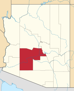
The Vulture Mine is located in Maricopa County at 36610 N. 355th Avenue, Wickenburg, Arizona, United States, Zip code: 85390.

Vulture Mine and Vulture City (Ghost town)

The following are images with a brief description of the Vulture Mine and some of the structures still present in what once was known as Vulture City.

See also

Related Research Articles

<span class="mw-page-title-main">Tombstone, Arizona</span> City in Arizona, United States

Tombstone is a city in Cochise County, Arizona, United States, founded in 1879 by prospector Ed Schieffelin in what was then Pima County, Arizona Territory. It became one of the last boomtowns in the American frontier. The town grew significantly into the mid-1880s as the local mines produced $40 to $85 million in silver bullion, the largest productive silver district in Arizona. Its population grew from 100 to around 14,000 in less than seven years. It is best known as the site of the Gunfight at the O.K. Corral and presently draws most of its revenue from tourism.

<span class="mw-page-title-main">Wickenburg, Arizona</span> Town in Maricopa County, Arizona

Wickenburg is a town in Maricopa and Yavapai counties, Arizona, United States. The population was 7,474 at the 2020 census, and was estimated to be 7,920 in 2022.

<span class="mw-page-title-main">Ruby, Arizona</span> Ghost town in Arizona, United States

Ruby is a ghost town in Santa Cruz County, Arizona, United States. It was founded as a mining town in Bear Valley, originally named Montana Camp, so named because the miners were mining at the foot of Montana Peak.

<span class="mw-page-title-main">Treadwell gold mine</span>

The Treadwell gold mine was on the south side of Douglas Island, .5-mile (0.80 km) east of downtown Douglas and southeast of downtown Juneau, owned and operated by John Treadwell. Composed of four sub-sites, Treadwell was in its time the largest hard rock gold mine in the world, employing over 2,000 people. Between 1881 and 1922, over 3 million troy ounces of gold were extracted. Not much remains today except for a few crumbling buildings and a "glory hole". Although John Treadwell had twelve years of experience in both placer and lode mines, he was a carpenter and builder by trade who had come to Alaska prior to the Klondike Gold Rush.

<span class="mw-page-title-main">Gold mining in the United States</span>

In the United States, gold mining has taken place continually since the discovery of gold at the Reed farm in North Carolina in 1799. The first documented occurrence of gold was in Virginia in 1782. Some minor gold production took place in North Carolina as early as 1793, but created no excitement. The discovery on the Reed farm in 1799 which was identified as gold in 1802 and subsequently mined marked the first commercial production.

La Paz was a short-lived early gold mining town along on the western border of current-day La Paz County, Arizona. The town grew quickly after gold was discovered nearby in 1862. La Paz, Spanish for peace, was chosen as the name in recognition of the feast day for Our Lady of Peace. Originally located in the New Mexico Territory, the town became part of the Arizona Territory when President Abraham Lincoln established the new territory in 1863. In 1983 the newly-formed County of La Paz adopted the name, long after the town had become a ghost town.

Silver mining in Arizona was a powerful stimulus for exploration and prospecting in early Arizona. Cumulative silver production through 1981 totaled 490 million troy ounces. However, only about 10% of Arizona's silver production came from silver mining. More than 80% of the state's silver was a byproduct of copper mining; other silver came as a byproduct of lead, zinc, and gold mining.

<span class="mw-page-title-main">Weaver, Arizona</span> Ghost town in Yavapai County, Arizona

Weaver, or Weaverville, is a former gold mining town, now a deserted ghost town, in Yavapai County, Arizona, United States. All that remains are some rusting mining machinery, a partially restored cemetery, and the ruins of a stone house.

<span class="mw-page-title-main">Alamo Crossing, Arizona</span> Ghost town in Arizona, United States

Alamo Crossing is a ghost town in Mohave County, Arizona, United States. The town was settled in the late 1890s, in what was then the Arizona Territory. It served as a camp for mining prospectors in the manganese-rich Artillery Mountains, being the only town in the area. After 1918, the post office permanently closed, but the town was only intermittently abandoned, with its founders often present through until at least the mid-1950s. The town was intentionally flooded in 1968 to create Alamo Lake. In 2020, the area of Alamo was revived for mining again, this time for surface-level gold prospecting.

Gila City is a ghost town in Yuma County in the U.S. state of Arizona. The town was settled in 1858 in what was then the New Mexico Territory.

<span class="mw-page-title-main">Vulture Mountains</span> Low level mountain range in Arizona

The Vulture Mountains is a 29-mile (47 km) long, arid, low-elevation mountain range located in northwest Maricopa County, Arizona, United States. It is in the north perimeter region of the Sonoran Desert. The Arizona transition zone mountain ranges lie north and northeast, just north of Wickenburg, Arizona. The Yarnell Hill, about 14 miles (23 km) north of Wickenburg, rising into the Weaver Mountains to Yarnell, marks the dramatic elevation rise from the desert. It is also a viewpoint southwest and southeast of the desert regions, including the Vulture Mountains.

<span class="mw-page-title-main">Henry Wickenburg</span> Arizona pioneer and miner (1819–1905)

Henry Wickenburg was a Prussian prospector who discovered the Vulture Mine and founded the town of Wickenburg in the U.S. state of Arizona. Wickenburg never married. Mrs. Helene Holland inherited Wickenburg’s personal property in 1903, while he was still alive, and the remainder of his estate in 1905 after Henry Wickenburg died from a gunshot wound in the head. His death was deemed a suicide, but many questioned this ruling. The mine that he discovered produced as much as $70 million worth of gold during its course of operation, making it the most important gold mine in Arizona.

<span class="mw-page-title-main">Silver Bell, Arizona</span> Ghost town in Arizona, United States

Silver Bell is a ghost town in the Silver Bell Mountains in Pima County, Arizona, United States. The name "Silver Bell" refers to a more recent ghost town, which was established in 1954 and abandoned in 1984. The original town, established in 1904, was named "Silverbell" and abandoned in the early 1930s. Both towns were utilized and later abandoned due to the mining of copper in the area.

<span class="mw-page-title-main">Gillett, Arizona</span> Ghost town in Yavapai County, Arizona

Gillett, Arizona, is a ghost town in Yavapai County, Arizona, United States. It has an estimated elevation of 1,362 feet (415 m) above sea level. Historically, it was a stagecoach station, and then a settlement formed around an ore mill serving the Tip Top Mine, on the Agua Fria River in Yavapai County in what was then Arizona Territory. It was named for the mining developer of the Tip Top Mine, Dan B. Gillett and is spelled incorrectly as Gillette on U. S. Topographic Maps and elsewhere.

<span class="mw-page-title-main">Vulture City, Arizona</span> Ghost town in Maricopa County, Arizona

Vulture City is a ghost town situated at the site of the defunct Vulture Mine in Maricopa County, Arizona, United States.

<span class="mw-page-title-main">Fort Tyson</span> Historic site in La Paz County, Arizona

Fort Tyson was a privately owned fort built in 1856 by Charles Tyson in the area which is now called Quartzsite, Arizona. He built the fort to protect the local miners and water supply from the raids of the Yavapai (Mohave-Apache), a Native-American tribe. The area in which Fort Tyson was located has been known as Fort Tyson, Tyson’s Well and is now called the town of Quartzsite because of the large amount of quartz found in its surrounding areas.

References

  1. Jon E. Spencer and others, 1989, "Geology of the Vulture gold mine," Arizona Geology, v.19 n.4.
  2. "National Park Service - Prospector, Cowhand, and Sodbuster (Survey of Historic Sites and Buildings)". Nps.gov. May 22, 2005. Retrieved July 31, 2010.