Federal Highway 15D | ||||
---|---|---|---|---|
Carretera federal 15D | ||||
Mexico 15 International Highway Mexico-Nogales Highway | ||||
Route information | ||||
Maintained by Secretariat of Communications and Transportation | ||||
Length | 1,652 km (1,027 mi) | |||
Major junctions | ||||
North end | SR 189 in Nogales Port of Entry, Nogales, Sonora | |||
| ||||
South end | Fed. 57D in Mexico City | |||
Location | ||||
Country | Mexico | |||
Highway system | ||||
|
Federal Highway 15D (Carretera Federal 15D) is the name for toll highways paralleling Federal Highway 15. The toll segments of Highway 15D include some of the most significant highways in the country along the Nogales-Mexico City corridor. The highway is the southern terminus of the CANAMEX Corridor, a trade corridor that stretches from Mexico north across the United States to the Canadian province of Alberta.
Two segments of Federal Highway 15D (México-La Marquesa and Guadalajara-Tepic) are among the top five most expensive toll roads in Mexico, according to a 2016 analysis by Carmatch. [1]
Location | Future I-11 / SR 189 at the Nogales-Mariposa Port of Entry to Fed. 15D at Estación Don |
---|---|
Length | 652 km [2] (405 mi) |
With 652 kilometres (405 mi) of length, Highway 15D's segment in Sonora, formerly known as Estación Don-Nogales, runs the length of the state of Sonora and includes access to most of the state's major population centers. It is maintained by Caminos y Puentes Federales, which charges cars 340 pesos to travel the length of the road, including its four bypasses of Nogales (12.5 kilometres (7.8 mi)), Magdalena de Kino (6.57 kilometres (4.08 mi), 25 pesos), Guaymas (21.5 kilometres (13.4 mi), 31 pesos) and, Hermosillo (13.5 kilometres (8.4 mi)). [3]
Highway 15 is free between Nogales and Magdalena de Kino and from Hermosillo to Guaymas, but between Guaymas and Ciudad Obregón, and from Ciudad Obregón to Los Mochis, Sinaloa, cars are tolled for intercity transit, and unlike with most of the country's toll roads (which are completely bypassed by non-toll highways), there are no non-toll alternatives to Highway 15D through much of Sonora. [4] [5]
The road is currently being widened to four lanes throughout, a project scheduled to be completed by 2018; [2] at the same time, several curves are being redesigned to bring the entire road up to autopista status. [6] Additionally, bypasses are being constructed to avoid the route's two largest cities.
In 2014, a concession was awarded to GIA+A and Invex Infraestructura to build a 34.2-kilometre (21.3 mi) bypass of Ciudad Obregón, [7] which circles around the city to the north and east. The first portion of the highway opened in October 2017. [8] This bypass is operated by OCACSA, and cars pay 155 pesos to use it. [9]
In 2015, a consortium of IDINSA, Constructora MAS and PRIMEX was selected to build a bypass of Hermosillo, with an expected completion date at the end of 2017. [10] More recent estimates place completion in mid-2018. [11] This is now open since May 9, 2019 although portions are 2 lanes. One toll booth is open (113 pesos). A second toll booth appears to be under construction. Southbound entry ramp not complete and requires travelling westbound on Blvd Morales (Bv Gustavo Mazon Lopez) and making a U-turn.
Location | Costa Rica, Sinaloa, to Venadillo, Sinaloa |
---|---|
Length | 190.26 km [12] (118.22 mi) |
Travelers on Highway 15 get their next opportunity to take a toll road west of Guamúchil, where Sinaloa State Highway 1D forms. Highway 1D does not take on the federal designation until west of Culiacán, at which time the Autopista Mazatlán-Culiacán, operated by IDEAL, begins. IDEAL operates the stretches that form Highway 15D between Culiacán and Guadalajara. Travelers can access the road via the Libramiento de Culiacán, which begins at Highway 1D and costs 30 pesos for cars, [13] or by heading south on Av. Jesús Kumate within Culiacán. The two roads meet at Costa Rica, taking a southeast trajectory past La Cruz de Elota, Dimas and Mármol toward Mazatlán. Two toll plazas, Costa Rica and Mármol, [12] charge 130 and 116 pesos, respectively, [14] with the total cost of the road being 246 pesos.
North of Mazatlán, this highway ends, and motorists can enter the city or continue along the Libramiento de Mazatlán, also operated by IDEAL. The bypass is 32 kilometres (20 mi) in length, with eight interchanges and provision for two additional spurs, as well as one oasis; [15] it costs 44 pesos to drive. [16] East of Villa Unión, Highway 15D serves as the western terminus of Mexican Federal Highway 40D to Durango.
Location | Fed. 40 in Villa Unión, Sinaloa to Fed. 15D in Tepic, Nayarit |
---|---|
Length | 238.3 km [17] (148.1 mi) |
Exiting the Mazatlán area and Villa Unión, Highway 15D heads for Tepic, Nayarit, passing El Rosario and Escuinapa before entering Nayarit west of Acaponeta. Cars pay a toll of 480 pesos to travel between Mazatlán and Tepic. [18]
The Mazatlán-Tepic highway was constructed in multiple phases, all but one completed prior to the current concession and two built by the Secretariat of Communications and Transportation. The first segment to open was the connection between Tepic and the exit to San Blas, completed in 1990; the 151.8 kilometres (94.3 mi) between the San Blas exit and Escuinapa was completed between 2005 and 2007 by concessionaire Carreteras, Autopistas y Libramientos de la República Mexicana. [17]
Location | Fed. 15D in Tepic , Nayarit to Fed. 15D near Guadalajara, Jalisco |
---|---|
Length | 168.6 km [19] (104.8 mi) |
Highway 15D continues its trajectory toward Tepic. It has interchanges at Nayarit State Highway 68 to Acaponeta and Tecuala before entering the Tepic area. Entering Tepic from the northwest, travelers have the option to enter the city and merge with Highway 15 or to take the Libramiento de Tepic; they also can access the new toll road to San Blas. The Libramiento de Tepic was formally inaugurated by President Enrique Peña Nieto in February 2017 [20] and costs cars 55 pesos to travel. [21]
At the southeast edge of Tepic, the road intersects an access to Tepic, with provision for a future connection to the south. Highway 15D proceeds past Ixtlán del Río east toward Jalisco, ending at non-toll Highway 15 west of Guadalajara. This stretch costs cars 383 pesos. [21]
Location | Fed. 90D at Zapotlanejo, Jalisco to Fed. 15D / Fed. 61 / Fed. 120 in Maravatío, Michoacán |
---|---|
Length | 311.38 km [22] (193.48 mi) |
The Highway 15D designation returns east of Guadalajara, with a new toll road operator, Red de Carreteras de Occidente, a consortium of Empresas ICA and Goldman Sachs which was awarded a package of various operating highways in 2007. [23] The RCO stretch begins at Mexican Federal Highway 90D near Zapotlanejo, intersecting the Macrolibramiento Sur De Guadalajara. Heading east, Highway 15D provides access to Ocotlán and La Barca before crossing into Michoacán. In Michoacán, Highway 15D provides access to Ecuandureo, Churintzio, Panindícuaro and Huaniqueo. Skirting the southern shore of Cuitzeo Lake, Highway 15D encounters three major interchanges leading to Michoacán's major cities. Mexican Federal Highway 14D begins at Copándaro and leads to Pátzcuaro, Uruapan and Lázaro Cárdenas; Mexican Federal Highway 43D leads south to Morelia and north to Salamanca, Guanajuato; and Highway 48D serves as a toll road connecting Morelia and Highway 15D with access to the Morelia International Airport. Heading east, it meets Mexican Federal Highway 120 at Zinapécuaro before the RCO segment ends at Maravatío.
The Zapotlanejo-Maravatío highway was Mexico's most expensive toll road in 2013. [24] It currently costs cars 566 pesos to travel from Zapotlanejo to Maravatío, divided among four major toll zones. [25]
Location | Fed. 15D / Fed. 61 / Fed. 120 in Maravatío, Michoacán to Fed. 55 / Fed. 55D / Fed. M40D at Atlacomulco, State of Mexico |
---|---|
Length | 64 km [22] (40 mi) |
OCACSA picks up maintenance of Highway 15D at Maravatío and runs the road for 64 kilometres (40 mi); it enters the State of Mexico near Temascalcingo, proceeding east to an interchange with federal highways 55, M40D (Arco Norte) north of Atlacomulco. To continue to Mexico City, traffic must take Highway 55D south to Toluca. The Atlacomulco interchange includes a provision for an eastern extension, which will connect Atlacomulco to Atizapán in the Mexico City metropolitan area. The concession for this 74-kilometre (46 mi) segment, which would connect it to the Autopista Chamapa-Lechería, was awarded to OHL in 2014; it was originally slated to open in April 2016, but has faced delays due to issues acquiring right of way and resultant environmental delays. [26] It is currently scheduled to open in the first half of 2018. [27]
Location | Fed. 15D near Lerma, State of Mexico to Fed. 15D / Fed. 57D in Mexico City |
---|---|
Length | 34 km (21 mi) |
One last stretch of Highway 15D finishes the connection to Mexico City, connecting Toluca/Lerma to Mexico City via La Marquesa and closely paralleling non-toll Highway 15 with access to the Autopista Chamapa-La Venta, as well as to the Santa Fe area of Mexico City, before merging with Paseo de la Reforma. Both segments are operated by PINFRA. [28]
The Mexico City-La Marquesa toll road was the third-most expensive per kilometer in 2016, with drivers paying 74 pesos to access the 22-kilometre (14 mi) highway (3.36 pesos per kilometer). [19] The La Marquesa-Toluca segment, inaugurated by President Peña Nieto in July 2016, is even more expensive; it costs drivers 50 pesos to travel 12 kilometres (7.5 mi), or 3.76 pesos per kilometer. [29]
Federal Highway 15 is Mexico 15 International Highway or Mexico-Nogales Highway, is a primary north–south highway, and is a free part of the federal highways corridors of Mexico. The highway begins in the north at the Mexico–United States border at the Nogales Port of Entry in Nogales, Sonora, and terminates to the south in Mexico City.
Federal Highway 1D is a tolled part of the Mexico Federal Highways, paralleling Fed. 1. There are two segments, one in the state of Baja California and another in the state of Baja California Sur.
Carretera Federal 85D is the designation for toll highways (autopistas) paralleling Federal Highway 85. Two roads are designated Highway 85D, one from Nuevo Laredo, Tamaulipas, to Monterrey, Nuevo León, known as Autopista Monterrey–Nuevo Laredo, and the other from Pachuca, Hidalgo, to Mexico City, known as Autopista Pachuca–Ciudad de México. Both toll routes run parallel to their free alternative, Federal Highway 85. Highway 85D has wider lanes offers a more direct route and is continuously being repaired and repaved unlike the free route.
The Arco Norte, designated and signed as Federal Highway M40D, is a toll road in Mexico. It serves as a bypass around Greater Mexico City and currently links the Mexico-Puebla toll road on the east with the Mexico-Guadalajara toll road on the west.
Federal Highway 180D is the toll highways paralleling Highway 180 in seven separate segments of highway. Three are in Veracruz:, the Libramiento de Cardel, the highway from Cardel to Veracruz, and the Nuevo Teapa-Cosoleacaque highway. Four segments exist beyond Veracruz: one between Agua Dulce and Cárdenas, Tabasco, facilitating a connection from the city of Coatzacoalcos in Veracruz; a bypass of Villahermosa; one connecting Champotón to Campeche City, Campeche; and another connecting the cities of Mérida, Yucatán, and Cancún, Quintana Roo. An additional segment, connecting the latter highway to Playa del Carmen, is officially part of Highway 180D, but is signed as Highway 305D.
Federal Highway 70D is the designation for toll highways paralleling Mexican Federal Highway 70.
Federal Highway 117D is the designation for two toll highways in eastern Mexico.
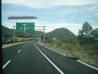
Federal Highway I-20D, known as the Libramiento de Irapuato, is a toll highway that serves as a bypass of the city of Irapuato, Guanajuato. The road is operated by HOATSA, which charges 68 pesos per vehicle to travel the full course of the highway. The road opened on March 15, 2011, at a construction cost of 900 million pesos.
Federal Highway 200D is the toll highways paralleling Fed. 200, and has two separate improved segments of designated roadway. Fed200D in Colima funnels traffic from Manzanillo toward Fed. 110 to the city of Colima; the segment in Guerrero serves as a bypass of Tecpan.
Federal Highway 90D is a toll highway between Zapotlanejo and Guadalajara, Jalisco. The road is operated by Red de Carreteras de Occidente, which charges cars 70 pesos to travel Highway 90D. RCO operates the segments of Mexican Federal Highway 15D and Mexican Federal Highway 80D that connect into the road.
Federal Highway 80D is the designation for toll highways paralleling Mexican Federal Highway 80. There are two such roads, one between Zapotlanejo and Lagos de Moreno, Jalisco and the other connecting Lagos de Moreno to San Luis Potosí City.
Federal Highway 140D is a toll (quota) part of the federal highways corridors that connects Puebla City to Xalapa.
Federal Highway 2D is a part of the federal highways corridors, and is the designation for toll highways paralleling Mexican Federal Highway 2. Seven road segments are designated Highway 2D, all but one in the state of Baja California, providing a toll highway stretching from Tijuana in the west to around Mexicali in the east; one in Sonora, between Santa Ana and Altar; and another between the cities of Matamoros and Reynosa in Tamaulipas.
Federal Highway 40D is the designation for toll highways paralleling Mexican Federal Highway 40. Highway 40D connects Mazatlán, Sinaloa to Reynosa, Tamaulipas. It forms most of the highway corridor between Mazatlán and Matamoros, Tamaulipas, one of 14 major highway corridors in the country.
Federal Highway 45D is a toll part of the paralleling Fed. 45. Eleven separate tolled segments exist of Fed. 45D between Querétaro City and Villa Ahumada in Chihuahua, between Chihuahua City and Ciudad Juárez.
Federal Highway 190D is the tolled Federal Highway that parallels Federal Highway 190. Highways with the 190D signage are in the states of Oaxaca and Chiapas.
The Autopista Tepic–San Blas is a toll highway in the Mexican state of Nayarit. The 32.4-kilometre (20.1 mi) road was constructed and is operated by Red de Carreteras de Occidente, which charge cars 49 pesos or 69 pesos to travel the full length of the road.
Federal Highway 57D (Fed. 57D) is a tolled (cuota) part of the federal highways corridor of the paralleling Fed. 57. Eight separate tolled segments exist of Fed. 57D between Mexico City and Allende, Coahuila; a ninth is part-federal and part-state.
The Macrolibramiento Sur de Guadalajara, designated and signed as Federal Highway GUA 10D, is a toll road in Mexico. It serves as a bypass around Greater Guadalajara and currently links the Guadalajara–Tepic toll road on the west with the Guadalajara–Lagos de Moreno toll road to the east. The highway opened in its entirety in November 2017; it was formally inaugurated on January 8, 2018, by President Enrique Peña Nieto. As of 2018, the toll for the 111-kilometre (69 mi) stretch of highway is 299 pesos.
Sinaloa State Route 1D is a toll state route that replaces Mexican Federal Highway 15D from Culiacan to Las Brisas. It was built from 1998 to 2001 when Mexico was beginning to build toll roads as a faster alternative to the poorly-maintained and older free roads. It is the only toll road alternate for free road Fed. 15 in the northern part of the state.