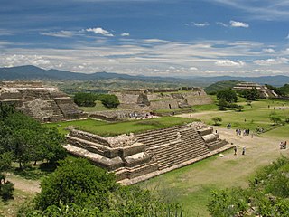
The city and municipality of Oaxaca de Juárez, or simply Oaxaca, is the capital and largest city of the Mexican state of the same name. It is located in the Centro District in the Central Valleys region of the state, on the foothills of the Sierra Madre at the base of the Cerro del Fortín extending to the banks of the Atoyac River. The city relies heavily on tourism, which is based on its large number of colonial-era structures as well as the native Zapotec and Mixtec cultures and archeological sites. It, together with the archeological site of Monte Albán, was named a World Heritage Site in 1987. It is also the home of the month-long cultural festival called the "Guelaguetza", which features Oaxacan dance from the seven regions, music and a beauty pageant for indigenous women.
Federal Highway 125(Carretera Federal No. 125) is a Federal Highway of Mexico that runs from Veracruz south across the Sierra Madre Oriental to just north of the Pacific Ocean in Oaxaca. Federal Highway 125 is split into three segments: the first segment travels from Conejos, Veracruz in the north to Fortín de las Flores in the south. The second segment travels from Tehuacán, Puebla in the north to Huajuapan de León, Oaxaca in the south. The third segment travels from Yucudaa, Oaxaca to Pinotepa Nacional, Oaxaca.

San Marcos is a town in the Mexican state of Guerrero. It serves as the municipal seat of the surrounding municipality of San Marcos.

San Pedro Pochutla is a city and municipality located in the south of Oaxaca state, Mexico next to the Pacific Ocean. It is an important commercial, transportation and administrative hub for the Pochutla District in the east of the Costa Region. Pochutla is located at the junction of coastal Highway 200 and Highway 175 to Oaxaca, with 175 functioning as the town’s main thoroughfare. Its name means "place of kapok trees ", and most of the city is built on a lakebed which was drained during the colonial period. The municipality is best known as being the home of the oceanside communities of Puerto Ángel and Zipolite.

Puerto Ángel is a small coastal town in the Mexican state of Oaxaca located in the municipality of San Pedro Pochutla. It, along with San Agustinillo and Playa Zipolite are known as the "Riviera Oaxaqueña". It is located 9 km south of city of Pochutla approximately 50 kilometers west of Huatulco and 80 kilometers east of Puerto Escondido. Despite tourism development since the 1960s, the town is still mostly a fishing village, located on a small bay surrounded by rocky hills that lead into the Sierra Madre del Sur. It was founded in the mid 19th century as a port for the region’s coffee and lumber industries but since then other means of shipping these products has replaced it.

La Sierra Norte de Oaxaca is a heavily wooded region in the state of Oaxaca, Mexico. It is 62 km from the city of Oaxaca on Federal highway 175, heading east towards Tuxtepec. The region is divided into three districts: Ixtlán, which has 26 municipalities, Villa Alta, which has 25 municipalities and Mixe, which has 17 municipalities.

San Jerónimo Tlacochahuaya is a town and municipality in the Mexican state of Oaxaca, 21 km from the city of Oaxaca on Federal Highway 190 between Santa Maria del Tule and Mitla. It is part of the Tlacolula District in the east of the Valles Centrales Region. The name Tlacochahuaya comes from Nahuatl and means “in wet land” or “in the swamp.”
Federal Highway 131 is a Federal Highway of Mexico. Federal Highway 131 is split into two segments: the first segment travels from Teziutlán, Puebla in the north to Perote, Veracruz in the south. The second segment, entirely within Oaxaca, travels from south of Oaxaca de Juárez in the north to Puerto Escondido in the south.
Federal Highway 135 is a Federal Highway of Mexico. The highway travels from Tehuacán, Puebla in the north to San Francisco Telixtlahuaca-San Pablo Huitzo, Oaxaca in the south.
Federal Highway 147 is a Federal Highway of Mexico. The highway travels from south of Tuxtepec, Oaxaca in the northwest to Palomares, Oaxaca in the southeast.
Highway 175 is a Federal Highway of Mexico. The highway travels from Buenavista, Veracruz in the north to Puerto Ángel, Oaxaca in the south. The highway crosses Mexican Federal Highway 200 before reaching the Pacific Ocean at Puerto Ángel at its southern terminus.
Federal Highway 179 is a Federal Highway of Mexico. The highway travels from north of Xochiapan, Veracruz in Santiago Sochiapan municipality in the north to San Pablo de Villa Mitla, Oaxaca in the south. Much of the median of the highway remains unpaved.
Federal Highway 182 is a Federal Highway of Mexico. The highway travels from San Juan Bautista Tuxtepec, Oaxaca in the east to Teotitlán de Flores Magón, Oaxaca in the west.
Federal Highway 185 is a Federal Highway of Mexico. The highway travels from Coatzacoalcos, Veracruz in the north to Salina Cruz, Oaxaca in the south. It is also known as the Carretera Transístmica because it crosses the Isthmus of Tehuantepec. It crosses the Sierra Madre de Oaxaca at Chivela Pass.
Federal Highway 190 is a Federal Highway of Mexico. Federal Highway 190 is split into two segments: the first segment travels from Tehuantepec, Oaxaca in the east to Puebla City, Puebla in the west. The second segment travels from La Ventosa, Juchitán de Zaragoza Municipality, Oaxaca in the west eastward to Ciudad Cuauhtémoc, Chiapas. Fed. Highway 190's eastern segment ends at a Guatemala-Mexico border crossing at Ciudad Cuauhtémoc. The Pan-American Highway route in southern Mexico continues into Guatemala as Central American Highway 1 (CA-1).
Federal Highway 200, also known as Carretera Pacífico, is a Federal Highway of Mexico. The Carretera Pacífico is the main leg of the Pacific Coastal Highway within Mexico and travels along the Pacific Coast from Mexican Federal Highway 15 in Tepic, Nayarit in the north to the Guatemala-Mexico border at Talismán, Chiapas in the south. Upon entering Guatemala, the highway continues as Central American Highway 1.
The 2016 conflict in Nochixtlán refers to the acts occurred in the community of Asunción Nochixtlán in Oaxaca, Mexico on June 19, 2016, when federal policemen tried to move protesting professors and students' parents out of blocked highways. They were protesting against the educational reforms implemented during the government of Mexican President Enrique Peña Nieto. The protests left at least six dead and 108 people injured, according to the figures by the National Commission of Security.
Federal Highway 135D is a toll highway connecting Cuacnopalan, Puebla to Oaxaca City and bypassing Tehuacán,Puebla. The road is operated by Caminos y Puentes Federales, which charges a toll of 200 pesos per car to travel Highway 135D.
Federal Highway 190D is the tolled Federal Highway that parallels Federal Highway 190. Highways with the 190D signage are in the states of Oaxaca and Chiapas.


