Federal Highway 125(Carretera Federal No. 125) is a Federal Highway of Mexico that runs from Veracruz south across the Sierra Madre Oriental to just north of the Pacific Ocean in Oaxaca. Federal Highway 125 is split into three segments: the first segment travels from Conejos, Veracruz in the north to Fortín de las Flores in the south. The second segment travels from Tehuacán, Puebla in the north to Huajuapan de León, Oaxaca in the south. The third segment travels from Yucudaa, Oaxaca to Pinotepa Nacional, Oaxaca.
Federal Highway 15 is Mexico 15 International Highway or Mexico-Nogales Highway, is a primary north-south highway, and is a free part of the federal highways corridors of Mexico. The highway begins in the north at the Mexico–United States border at the Nogales Port of Entry in Nogales, Sonora, and terminates to the south in Mexico City.
Federal Highway 53 (Fed. 53) is part of the free (libre) part of the federal highways corridors of Mexico, and connects metropolitan Monterrey, Nuevo León to Boquillas del Carmen, Coahuila near the Mexico–United States border.
Federal Highway 54 Fed. 54 is a free (libre) part of the federal highways corridors and connects Ciudad Mier, Tamaulipas, to Colima City.
Federal Highway 35 is a free part of the federal highways corridors of Mexico, that is in two separate improved segments.
Federal Highway 80 connects Tampico, Tamaulipas, to San Patricio, Jalisco. Federal Highway 80 also connects the city of Guadalajara to the south coast in Jalisco. The highway runs through the towns of Acatlán de Juárez, Villa Corona, Cocula, Tecolotlán, Unión de Tula, Autlán, La Huerta, Casimiro Castillo, and San Patricio (Melaque).
Federal Highway 45 (Fed. 45) is the free (libre) part of the federal highways corridors, and connects Ciudad Juárez, Chihuahua through the Chihuahuan Desert to Panales, Hidalgo.
Federal Highway 90 connects Irapuato, Guanajuato to Zapotlanejo, Jalisco near Guadalajara. Federal Highway 90 has two main segments.
Federal Highway 16 is a free part of the federal highways corridors of Mexico.
Federal Highway 49 (Fed. 49) is a free (libre) part of the federal highways corridors of Mexico. The highway runs northwest-southeast in the western regions of the Mexican Plateau.
Federal Highway 55 (Fed. 55) is a free (libre) part of the federal highways corridors of Mexico. The highway connects Puerta de Palmillas, Querétaro to the north and Axixintla, Guerrero to the south.
Federal Highway 57 (Fed. 57) is a free (libre) part of the federal highways corridors of Mexico.
Federal Highway 70 (Fed. 70) is a free (libre) part of the federal highways corridors of Mexico. The highway runs from its western end in the town of Mascota, Jalisco to its eastern end at Fed. 80 and Fed. 180 in Tampico, Tamaulipas.
Federal Highway 93 (Fed. 93) is a free (libre) part of the federal highways corridors of Mexico.
Federal Highway 105 is a Federal Highway of Mexico. The highway travels from Tempoal de Sánchez, Veracruz in the north to Pachuca, Hidalgo in the south.
Federal Highway 110 is a Federal Highway of Mexico.
Federal Highway 131 is a Federal Highway of Mexico. Federal Highway 131 is split into two segments: the first segment travels from Teziutlán, Puebla in the north to Perote, Veracruz in the south. The second segment, entirely within Oaxaca, travels from south of Oaxaca de Juárez in the north to Puerto Escondido in the south.
Federal Highway 150 is a Federal Highway of Mexico. The highway travels from Mexico City in the west to Veracruz, Veracruz in the east. Federal Highway 150 is one of five Mexican Federal Highways that terminate in Mexico's capital city.
Federal Highway 190 is a Federal Highway of Mexico. Federal Highway 190 is split into two segments: the first segment travels from Tehuantepec, Oaxaca in the east to Puebla City, Puebla in the west. The second segment travels from La Ventosa, Juchitán de Zaragoza Municipality, Oaxaca in the west eastward to Ciudad Cuauhtémoc, Chiapas. Fed. Highway 190's eastern segment ends at a Guatemala-Mexico border crossing at Ciudad Cuauhtémoc. The Pan-American Highway route in southern Mexico continues into Guatemala as Central American Highway 1 (CA-1).
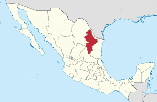
Federal Highway 107 is a Federal Highway of Mexico. The highway travels from Mexican Federal Highway 101 at Jiménez, Tamaulipas in the north to Mexican Federal Highway 180 north of Soto la Marina, Tamaulipas in the south. Federal Highway 107 is co-signed with Tamaulipas Highway 38.