
Tuxtla Gutiérrez is the capital and the largest city of the Mexican southeast state of Chiapas. It is the most developed, populated and therefore the state's most important municipality. A busy government, commercial and services-oriented city, Tuxtla had one of the fastest growing rates in Mexico in the last 40 years. Unlike many other areas in Chiapas, it is not a tourist attraction, but a transportation hub for tourists coming into the state, with a major airport and a bus terminal.
Tapachula de Córdova y Ordóñez, simply known as Tapachula, is a city and municipality located in the far southeast of the state of Chiapas in Mexico, near the Guatemalan border and the Pacific Ocean. It is one of the most important cities of Chiapas economically as the capital of the agriculturally rich Soconusco region as well as port for trade between Mexico and Central America. The area was originally inhabited by the Mames as a region under the control of the Mame state of Xelaju but was first established as a city by the Aztecs in the 13th century. Most of its economic importance has come since the late 19th century with the establishment of coffee plantations. This agricultural production began a history of migration into the area which continues to this day and has left the city with a significant Asian and German cultural presence as well as large Mayan and Nahua indigenous populations.

The Cascadas de Agua Azul are a series of waterfalls found on the Xanil River in the southern Mexican state of Chiapas. They are located in the Municipality of Tumbalá, 69 kilometres (43 mi) from Palenque, near Mexican Federal Highway 199.
Garitas or Retenes are federal inspection stations operated by the Mexican government. They are officially known as "Garitas de Revisión" (checkpoints). They are usually located within 50 kilometres (31 mi) of the national border with the United States, Belize, and Guatemala. They function as immigration checkpoints, where documents and cargo are to be inspected.

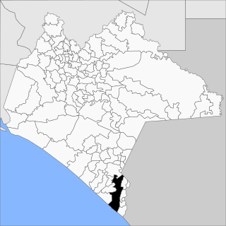
Ángel Albino Corzo is one of the 122 municipalities of Chiapas, in southern Mexico. It covers an area of 1748.81 km². Its municipal seat is the town of Jaltenango de la Paz.

Palenque is a city and municipality located in the north of the state of Chiapas, Mexico. The city was named almost 200 years before the famous nearby Mayan ruins were discovered in the 18th century. The area has a significant indigenous population, mostly of the Ch'ol people, a Mayan descendent. The city is the only urban area in a municipality of over 600 communities and it is surrounded by rainforest. However, deforestation has had dramatic effects on the local environment, with howler monkeys occasionally seen in the city itself as they look for food. While most of the municipality’s population is highly marginalized economically, working in agriculture, the Palenque archeological site is one of the most important tourist attractions for both the area and the state of Chiapas. It is the poorest major city in the state of Chiapas.
Federal Highway 187 is a Federal Highway of Mexico. The highway travels from El Bellote, Centla Municipality, Tabasco in the north to Raudales Malpaso, Tecpatán Municipality, Chiapas in the south. Federal Highway 187 is one of two major north-south highway corridors in Tabasco. Federal Highway 187 route numbering continues as the Federal Highway 187D toll road from Raudales Malpaso south to Mexican Federal Highway 190 east of Ocozocoautla de Espinosa.
Federal Highway 195 is a Federal Highway of Mexico. The highway travels from Villahermosa, Tabasco in the north to El Escopetazo, Chiapa de Corzo Municipality, Chiapas in the south.
Federal Highway 200, also known as Carretera Pacífico, is a Federal Highway of Mexico. The Carretera Pacífico is the main leg of the Pacific Coastal Highway within Mexico and travels along the Pacific Coast from Mexican Federal Highway 15 in Tepic, Nayarit in the north to the Guatemala-Mexico border at Talismán, Chiapas in the south. Upon entering Guatemala, the highway continues as Central American Highway 1.
Federal Highway 203 is a Federal Highway of Mexico. The highway travels from El Suspiro, Chiapas near Emiliano Zapata, Tabasco in the northwest to Tenosique, Tabasco in the southeast.
Federal Highway 211 is a Federal Highway of Mexico. The highway travels from El Jocote, Chiapas in the northeast to Huixtla, Chiapas in the southwest.
Federal Highway 225 is a Federal Highway of Mexico. It runs from Port Chiapas on the Pacific Ocean to the city of Tapachula, Chiapas.
Federal Highway 307 is a free part of the federal highways corridors of Mexico. It connects Cancún, Quintana Roo to Chetumal and Palenque to La Trinitaria, Chiapas.
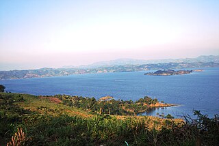
The Malpaso Dam, officially known as the Nezahualcóyotl Dam, is located in the Centro region of Chiapas, Mexico near the border with Tabasco and Veracruz. It was the first of several major dams built on the Grijalva River to generate hydroelectric energy and has the second largest reservoir in Mexico, after the Belisario Dominguez Dam. Construction of the dam occurred in the 1960s and flooded not only the riverbed but also hectares of rainforest and farmland, various towns and villages and archeological sites. These include the former town of Quechula, whose 16th century Dominican church will appear when water is at low levels, and the archeological site of San Isidro which contains one of only two known double Mesoamerican ball courts. Commissioning of the dam's 1,080 MW power station began in 1969 and ended in 1977. The reservoir and later construction of a federal highway has spurred ecotourism in the area.
Federal Highway 193 is a Federal Highway of Mexico. The highway travels from Las Cruces, Chiapas in the north to Arriaga, Chiapas in the south. Federal Highway 193 serves as a connector between Mexican Federal Highway 190 and Mexican Federal Highway 200 in southwest Chiapas.
Federal Highway 187D is a toll highway connecting Las Choapas, Veracruz to Ocozocuautla, Chiapas. The road is operated by Caminos y Puentes Federales, which charges 195 pesos for the entire course of route.
Federal Highway 190D is the tolled Federal Highway that parallels Federal Highway 190. Highways with the 190D signage are in the states of Oaxaca and Chiapas.


