
Guerrero, officially the Free and Sovereign State of Guerrero, is one of the 32 states which comprise the 32 Federal Entities of Mexico. It is divided in 81 municipalities and its capital city is Chilpancingo and its largest city is Acapulco. It is located in Southwestern Mexico. It is bordered by the states of Michoacán to the north and west, the State of Mexico and Morelos to the north, Puebla to the northeast and Oaxaca to the east. In addition to the capital city, the state's largest cities include Acapulco, Petatlán, Ciudad Altamirano, Taxco, Iguala, Ixtapa, Zihuatanejo, and Santo Domingo. Today, it is home to a number of indigenous communities, including the Nahuas, Mixtecs, Tlapanecs, Amuzgos, and formerly Cuitlatecs. It is also home to communities of Afro-Mexicans in the Costa Chica region.

Chilpancingo de los Bravo is the capital and second-largest city of the state of Guerrero, Mexico. In 2010 it had a population of 187,251 people. The municipality has an area of 2,338.4 km2 (902.9 sq mi) in the south-central part of the state, situated in the Sierra Madre del Sur, on the bank of the Huacapa River. The city is on Mexican Federal Highway 95 which connects Acapulco to Mexico City. It is served by Chilpancingo National Airport, which is one of the five airports in the state.

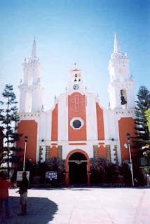
Iguala, known officially as Iguala de la Independencia, is a historic city located 102 km (63 mi) from the state capital of Chilpancingo, in the Mexican state of Guerrero in southwestern Mexico.

State Route 198 is an east–west state highway in the U.S. state of California that runs from U.S. Route 101 south of King City to Sequoia National Park. It connects the California Central Coast to the mid–Central Valley through Hanford and Visalia, although the most developed portion is in the Central Valley itself. SR 198 intersects the major north–south routes in the Central Valley, including Interstate 5 (I-5), SR 33, and SR 99.

Maryland Route 216 is a state highway in the U.S. state of Maryland. Known for most of its length as Scaggsville Road, the highway runs 8.73 miles (14.05 km) from MD 108 at Highland east to MD 198 in Laurel. MD 216 connects Highland, Fulton, Scaggsville, and North Laurel in southern Howard County with Laurel in far northern Prince George's County. The highway connects those communities with Interstate 95 (I-95) and U.S. Route 29.
Federal Highway 2 is a free part of the federal highway corridors that runs along the Mexico–United States border. The highway is in two separate improved segments, starting in the west at Tijuana, Baja California, on the Pacific coast and ending in the east in Matamoros, Tamaulipas, on the Gulf of Mexico. Fed. 2 passes through the border states of Baja California, Sonora, Chihuahua, Coahuila, Nuevo Leon and Tamaulipas. It has a total length of 1,963 kilometres (1,220 mi); 1,319 kilometres (820 mi) in the west and 644 kilometres (400 mi) in the east.
Villa Guerrero is a town and municipality in the State of Mexico, Mexico. It is located on the southern slopes of the Nevado de Toluca, also known as Xinantecatl, and is 50 minutes/58 km from Toluca.
Federal Highway 95 connects Mexico City to Acapulco, Guerrero. The Autopista del Sol is a tolled alternative, which bypasses several towns of the state of Guerrero, including the city Iguala, and thus reduces from 8 hours to almost 3.5 hours the time required to get to Acapulco from Mexico city.
Federal Highway 51 (Fed. 51) is a free (libre) part of the federal highways corridors of Mexico. Fed. 51 has two segments: the first segment run from Ojuelos de Jalisco to Maravatío, Michoacán. The length of the first segment is 309.41 km. The second segment runs from Zitácuaro, Michoacán to Iguala, Guerrero. The length of the second segment is 399.05 km.
Federal Highway 55 (Fed. 55) is a free (libre) part of the federal highways corridors of Mexico. The highway connects Puerta de Palmillas, Querétaro to the north and Axixintla, Guerrero to the south.
Federal Highway 93 (Fed. 93) is a free (libre) part of the federal highways corridors of Mexico.
Federal Highway 134 is a Federal Highway of Mexico. The highway travels from Naucalpan, State of Mexico in the northeast to Zihuatanejo, Guerrero in the southwest. It crosses 3 states. State of Mexico, Michoacan and Guerrero.
Federal Highway 166 is a Federal Highway of Mexico. The highway travels from north of Axixintla, Guerrero near Grutas de Cacahuamilpa National Park in the west to Alpuyeca, Morelos in the east.
Federal Highway 200, also known as Carretera Pacífico, is a Federal Highway of Mexico. The Carretera Pacífico is the main leg of the Pacific Coastal Highway within Mexico and travels along the Pacific Coast from Mexican Federal Highway 15 in Tepic, Nayarit in the north to the Guatemala-Mexico border at Talismán, Chiapas in the south. Upon entering Guatemala, the highway continues as Central American Highway 1.
Zumpango del Río is the capital of Eduardo Neri Municipality, within the state of Guerrero, in central−western Mexico.
Federal Highway 196 is a Federal Highway of Mexico. The highway is a spur route that connects Chichihualco, Guerrero and Mexican Federal Highway 95 in the southeast.
Federal Highway 93D is a toll highway in Guerrero. It connects the cities of Chilpancingo and Tixtla de Guerrero. The road is operated by Caminos y Puentes Federales, which in 2011 charged cars 20 pesos to travel Highway 93D.
Federal Highway 95D is a toll highway connecting Mexico City to Acapulco, Guerrero. Highway 95D is among the most important toll roads in the country, serving as a backbone for traffic out of Mexico City toward Morelos and tourist destinations in Guerrero.
Federal Highway 200D is the toll highways paralleling Fed. 200, and has two separate improved segments of designated roadway. Fed200D in Colima funnels traffic from Manzanillo toward Fed. 110 to Colima City; the segment in Guerrero serves as a bypass of Tecpán de Galeana.
Federal Highway 91D is a toll highway between Puente de Ixtla, Morelos and Iguala, Guerrero. The road is operated by Caminos y Puentes Federales. The toll is 70 pesos per car to travel Highway 91D.
